Team-BHP > Travelogues
Register New Topics New Posts Top Thanked Team-BHP FAQ


Reply
  Search this Thread
190,976 views
Old 18th April 2010, 05:40   #76
Senior - BHPian
 
laluks's Avatar
 
Join Date: Sep 2008
Location: Bangalore
Posts: 6,552
Thanked: 16,443 Times

Quote:
Originally Posted by ampere View Post
Laluks,

Can you please post a Google Map snapshot of the route you took? Thats is because in google maps, I see the road from Pollachi to Valparai town shown as incomplete. In fact it shows the other road through Parambikolam going to Chalakudy.
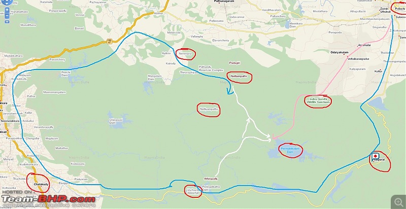
The road from Pollachi till Parambikulam is through Sethumadai Checkpost and it ends at Parambikulam dam inside the Parambikulam WLS. After this there exists some Jeep Trails. The attached map will show the details. The pink line is for the roads till the dam and white ones the jeep trails.

Quote:
Originally Posted by hvkumar View Post
Typically, Google Maps is wrong. As in many instances. The incomplete road that you mention is the same Chalakudy-Valparai road.
The attached map shows this clearly. In this case mapmyindia maps seems to be believable.

Both Google and Satguide maps are wrong.


Quote:
Originally Posted by ampere View Post
Thanks sir! I also got confused because of this other SH (SH21), as shown in Google maps which hits Neliampathy first before its hits Chalakuddy. Then I started wondering why one should then go to Chalakuddy if he has to go to Neliampathy.
Google maps is grossly wrong here. Nelliampathy is not near Chalakudy but near Nemmara in Palghat. The motorable access road to Nelliyampathy is from Nemmara. The blue line indicates the route.

But again there are Jeep trails - shown in white from vazhachal to Nelliyampathy through the forest. Some jeeps with the permission from DFO plies here.

Swifted : Nelliyampathy via Valparai-map.jpg
laluks is offline  
Old 18th April 2010, 06:01   #77
Senior - BHPian
 
laluks's Avatar
 
Join Date: Sep 2008
Location: Bangalore
Posts: 6,552
Thanked: 16,443 Times

Quote:
Originally Posted by NutsNBolts View Post
I am planning a trip from kochi-wayand-kodaikanal. Your travelogue has made me think about my return leg from Kodai. Earlier, I had plans to take NH49 from kodai and get back to Kochi. Now I feel it will be worthwhile to return via Kodai-Palani-Pollachi-Valparai-Athirampally-Kochi.
I suddenly realised that your drive includes Wayanad too. Man this is one serious trip. Wayanad is way up in the North and you have a lot of possibilities like Nagarahole, Kabini, Bandipur, Ooty - all near your routes.

While Kodai / Munnar is very much below Wayanad.

Waiting for a detailed log from you.

Only one thing you must note is the closure time of the forest roads that you intend to take.
laluks is offline  
Old 18th April 2010, 07:08   #78
Team-BHP Support
 
ampere's Avatar
 
Join Date: Sep 2009
Location: Bangalore
Posts: 18,260
Thanked: 13,500 Times

Laluks,

Thanks for that pointer. Oh yes, Google maps seems to be grossly wrong there. I never expected MMI/Satguide to be correct compared to Google. Always used to take Google as the benchmark.


Need to be more careful now onwards !

Also in these areas, do cell phone connections last (esp. Airtel)?
Asked that because, if yes, we can access GPRS.
ampere is offline  
Old 18th April 2010, 09:20   #79
Senior - BHPian
 
laluks's Avatar
 
Join Date: Sep 2008
Location: Bangalore
Posts: 6,552
Thanked: 16,443 Times

Quote:
Originally Posted by ampere View Post
Laluks,

Thanks for that pointer. Oh yes, Google maps seems to be grossly wrong there. I never expected MMI/Satguide to be correct compared to Google. Always used to take Google as the benchmark.


Need to be more careful now onwards !

Also in these areas, do cell phone connections last (esp. Airtel)?
Asked that because, if yes, we can access GPRS.
BSNL was working mostly.
Airtel I do not know :(
laluks is offline  
Old 18th April 2010, 09:34   #80
BHPian
 
NutsNBolts's Avatar
 
Join Date: Jul 2009
Location: Jammu
Posts: 817
Thanked: 41 Times

This thing about maps is quite funny actually. At some places, I found Google to be accurate and at others, Map My India was good. For example, while trying to find ingress routes to Kodai, Google always shows only one route; from Munnar. As knowledgeable people know, this is not a motorable road. Map MyIndia in this case shows entry through Batlagundu, which is correct.

While confirming ingress routes from north side (Palani), MapMyIndia shows only Batlagundu road, whereas Google shows correctly a route running south from Palani via Villapatti.

Thanks to guys like Lalu, Ampere and but of course hvkumar, I have a little better knowledge of these routes.

I will be using open street maps for this entire journey and will upload the .gpx files so that in future this confusion can be avoided by TBHPians.

Request to Mods: Open a sticky thread for uploading gpx files where members can upload the requisite ones.

@Lalu. I will be in Sultan Battery for one day and then starting south via Palakkad. So I will see how much I can squeeze into this itinerary.

Last edited by NutsNBolts : 18th April 2010 at 09:35.
NutsNBolts is offline  
Old 18th April 2010, 10:37   #81
Senior - BHPian
 
jacs's Avatar
 
Join Date: Nov 2007
Location: Kochi
Posts: 1,499
Thanked: 1,047 Times

Quote:
Originally Posted by laluks View Post
BSNL was working mostly.
Airtel I do not know :(
BSNL rules Kerala especially in rural sides. Now Airtel is also doing good in most places. I never had an issue using Airtel in any of the common routes (especially NH/SH) in Kerala.

BTW wrong maps from Google scares me a lot. I planned my trip via Nilambur next week based on GMAP. But anyhow Ampere, Raj and others gave me clear instructions to live without a map
jacs is offline  
Old 18th April 2010, 11:13   #82
Team-BHP Support
 
ampere's Avatar
 
Join Date: Sep 2009
Location: Bangalore
Posts: 18,260
Thanked: 13,500 Times

Although off-topic. How good is BSNL GPRS?
Any feedbacks during travels? Esp. Kerala/TN/Karnataka/AP?
ampere is offline  
Old 18th April 2010, 12:29   #83
J.Ravi
 
Posts: n/a

Quote:
Originally Posted by laluks View Post
In another 6 kilometers we reached the Sholayar Dam.
I remembered my school days. My father was working there as AEE during the construction of Sholayar Dam. We used to spend our vacation at Sholayar Nagar. Tamil superhit Kaadalikka Neramillai was shot extensively in the project guest house of Aaliyar Dam and Aanamalai ghat sections. He used to drive us in our Standard Herald from Madras to Sholayar Nagar, via Pollachi.

Last edited by J.Ravi : 18th April 2010 at 12:33.
 
Old 18th April 2010, 12:45   #84
Senior - BHPian
 
laluks's Avatar
 
Join Date: Sep 2008
Location: Bangalore
Posts: 6,552
Thanked: 16,443 Times

Quote:
Originally Posted by ampere View Post
Although off-topic. How good is BSNL GPRS?
Any feedbacks during travels? Esp. Kerala/TN/Karnataka/AP?
BSNL was ok from experiences in Karnataka, TN and Kerala, was available when needed though slow. I wouldn't fully depend on it.

Though off topic, I just realised that I never drove to AP Should plan something soon.

Quote:
Originally Posted by J.Ravi View Post
I remembered my school days. My father was working there as AEE during the construction of Sholayar Dam. We used to spend our vacation at Sholayar Nagar. Tamil superhit Kaadalikka Neramillai was shot extensively in the project guest house of Aaliyar Dam and Aanamalai ghat sections. He used to drive us in our Standard Herald from Madras to Sholayar Nagar, via Pollachi.
hey, that's very nostalgic moments from your childhood.
laluks is offline  
Old 18th April 2010, 13:36   #85
Senior - BHPian
 
trrk's Avatar
 
Join Date: Feb 2004
Location: Alleppey, Kerala
Posts: 2,114
Thanked: 34 Times

Hi,

Quote:
Originally Posted by NutsNBolts View Post
So as I understand, from valparai to vazhachal, the roads are not in great condition but can be easily negotiated by a sedan.

As ramzys said, yes gc can be an issue, but I guess if the road is not hit by rains, it should be do-able.
In end Oct (29 Oct 2008), I went up and down the Vazhachal Valparai road on the same day. My NHC CVT did not have any problem negotiating the roads and whatever bad stretches there were.
trrk is offline  
Old 18th April 2010, 13:48   #86
Senior - BHPian
 
laluks's Avatar
 
Join Date: Sep 2008
Location: Bangalore
Posts: 6,552
Thanked: 16,443 Times

Quote:
Originally Posted by trrk View Post
Hi,
In end Oct (29 Oct 2008), I went up and down the Vazhachal Valparai road on the same day. My NHC CVT did not have any problem negotiating the roads and whatever bad stretches there were.
It still stays the same Nothing to be unduly worried about.
laluks is offline  
Old 18th April 2010, 14:01   #87
Senior - BHPian
 
Join Date: Apr 2007
Location: Chennai
Posts: 1,149
Thanked: 346 Times

I have done the route in my Wagon R. I don't think there is anything to worry about, it is in much better condition than the road that was after Murkal in Nagarhole all the way upto Kutta a couple of years back.

The thing with this road is its too lonely, very narrow with thick undergrowth on the sides, add to it is the scary thought that if god forbid you get stuck there is no way to call anyone for almost half of the stretch. Not to forget the possibility of bumping into a mad tusker with absolutely zero possibility of taking a U turn, leaving us with the only option of driving the cars in reverse through the twists and turns.

Last edited by pypkmsrikanth : 18th April 2010 at 14:04.
pypkmsrikanth is online now  
Old 18th April 2010, 14:12   #88
Team-BHP Support
 
ampere's Avatar
 
Join Date: Sep 2009
Location: Bangalore
Posts: 18,260
Thanked: 13,500 Times

Quote:
Originally Posted by laluks View Post
BSNL was ok from experiences in Karnataka, TN and Kerala, was available when needed though slow. I wouldn't fully depend on it.
Though off topic, I just realised that I never drove to AP Should plan something soon.
My only AP road show was Puttaparthy.
Though I have done many on buses and trains!


Quote:
Originally Posted by J.Ravi View Post
I remembered my school days. My father was working there as AEE during the construction of Sholayar Dam. We used to spend our vacation at Sholayar Nagar. Tamil superhit Kaadalikka Neramillai was shot extensively in the project guest house of Aaliyar Dam and Aanamalai ghat sections. He used to drive us in our Standard Herald from Madras to Sholayar Nagar, via Pollachi.

Great to hear that Ravi ! I remember watching that movie 20 years back in a community hall and a VCR !
ampere is offline  
Old 18th April 2010, 14:34   #89
Senior - BHPian
 
laluks's Avatar
 
Join Date: Sep 2008
Location: Bangalore
Posts: 6,552
Thanked: 16,443 Times

Quote:
Originally Posted by pypkmsrikanth View Post
I have done the route in my Wagon R. I don't think there is anything to worry about, it is in much better condition than the road that was after Murkal in Nagarhole all the way upto Kutta a couple of years back.
Man, don't remind me of that road.
I was forced to take the Mananthavady - Kutta - Gonikoppal road in the midnight on my Civic last October. Compared to that this route is only small patches here there.
Quote:
Originally Posted by pypkmsrikanth View Post
The thing with this road is its too lonely, very narrow with thick undergrowth on the sides, add to it is the scary thought that if god forbid you get stuck there is no way to call anyone for almost half of the stretch. Not to forget the possibility of bumping into a mad tusker with absolutely zero possibility of taking a U turn, leaving us with the only option of driving the cars in reverse through the twists and turns.
Very true. And the fact is it is 50 Km CP to CP, that's a long way.

Quote:
Originally Posted by ampere View Post
Great to hear that Ravi ! I remember watching that movie 20 years back in a community hall and a VCR !
Another nostalgic moment for ampere
laluks is offline  
Old 18th April 2010, 21:58   #90
Senior - BHPian
 
laluks's Avatar
 
Join Date: Sep 2008
Location: Bangalore
Posts: 6,552
Thanked: 16,443 Times

Day 1, April 2nd 2010 continued

Malakkapara CP - Vazhachal CP (50 Kms)

We entered the Forest limits by 17:35Pm and drove on. The roads are narrow and curves around most of the time.

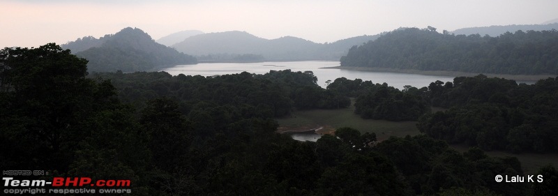
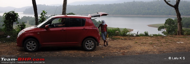
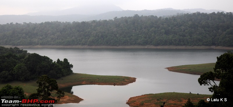
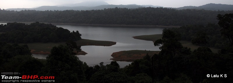
Around half an hour later we saw a lake view and stopped there for some time.
Swifted : Nelliyampathy via Valparai-20100402_0254.jpg
Swifted : Nelliyampathy via Valparai-20100402_0256.jpg
Swifted : Nelliyampathy via Valparai-20100402_0269.jpg
Swifted : Nelliyampathy via Valparai-20100402_0274.jpg

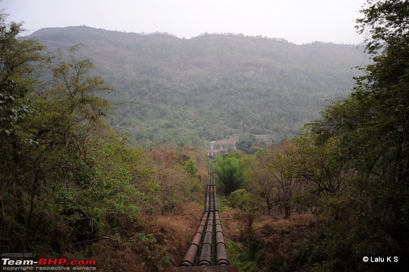
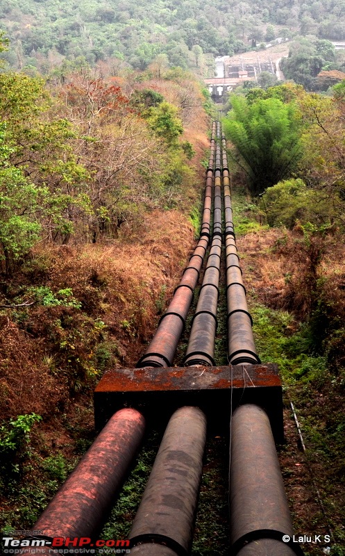
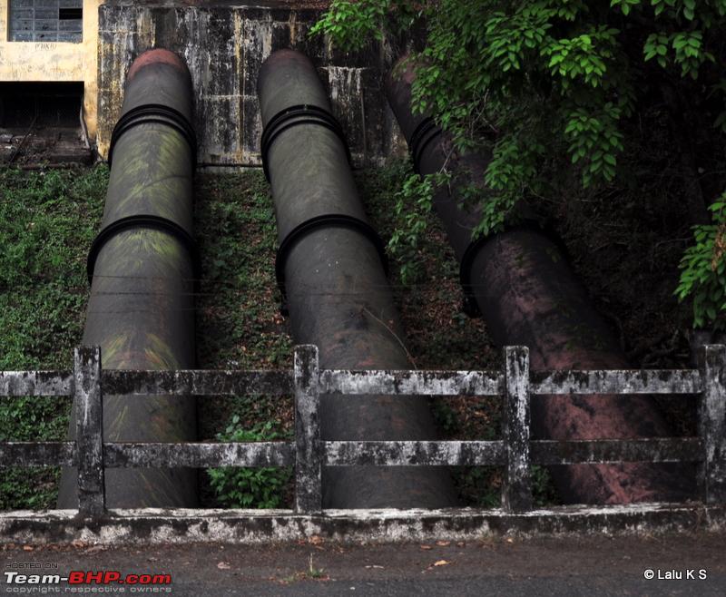
Around 18:15PM we reached the pipelines, which our travelogues have made famous

Swifted : Nelliyampathy via Valparai-20100402_0283.jpg
Swifted : Nelliyampathy via Valparai-20100402_0284.jpg
Name:  20100402_0286.JPG
Views: 5910
Size:  358.0 KB

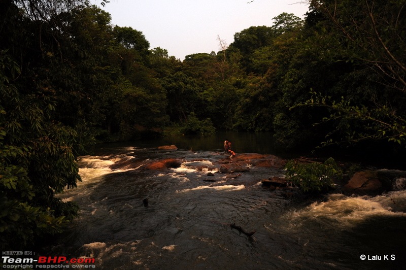
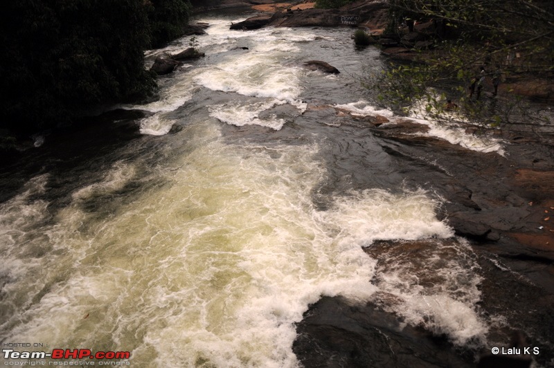
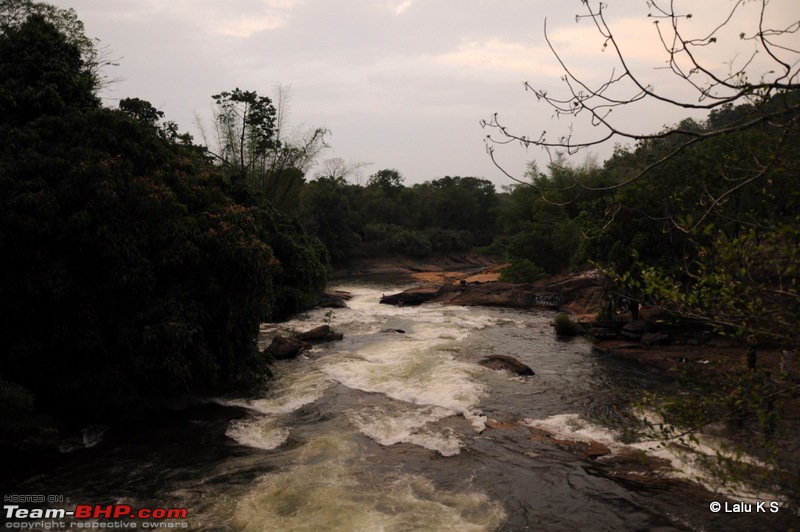
Another few minutes we saw this stream, and stopped to enjoy for a while. Many people were there cooling in the streams already. But we moved on.
Swifted : Nelliyampathy via Valparai-20100402_0291.jpg
Swifted : Nelliyampathy via Valparai-20100402_0295.jpg
Swifted : Nelliyampathy via Valparai-20100402_0296.jpg

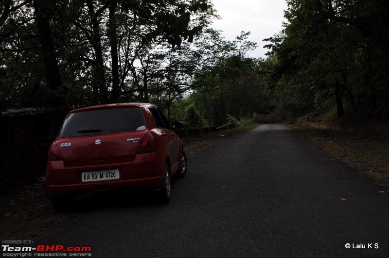
A sneak peak to the road conditions. Mostly it was like this, except for the occasional patches at the thickly vegetated and curvy areas.
Swifted : Nelliyampathy via Valparai-20100402_0287.jpg

The most funny part was we never saw any animals, but we saw a lot of homo sapiens enroute blasting loud music and consuming their poison in the wild, and jumping into almost all forms of water bodies available. Guess the crocodiles were on holidays!

We reached vazhachal CP by 19:10PM. Signed the register and we moved on.

Time --- KM ----- Place
17:35 -- 642.0 -- Malakkapara CP, entry to Kerala. Forest Starts.
19:10 -- 692.0 -- Vazhachal CP, Forest limit ends.

Here again the officer asked where to, and the girls looked at me - Where to?


Continued...
laluks is offline  
Reply

Most Viewed


Copyright ©2000 - 2025, Team-BHP.com
Proudly powered by E2E Networks