Day 3, Sunday, 4 Oct
Got up late on sunday morning, thinking 'why do holidays get over so early?? It seems that I have to wait for ages for the weekend and when it comes it is over in a split second'. So, what to do now?? Hmmm. After much thinking, I decide to take my grandfather for a drive out in the country and visit our farm.
We drive around for a while, visit the farm and come back talking about the bad roads and local politics etc etc.
We come back at 1.30 pm when I received a call from my friends. They want me to take them to a place called Kaginahare (called Kagneri in Survey of India Maps). Let me tell you something about Kaginahare.
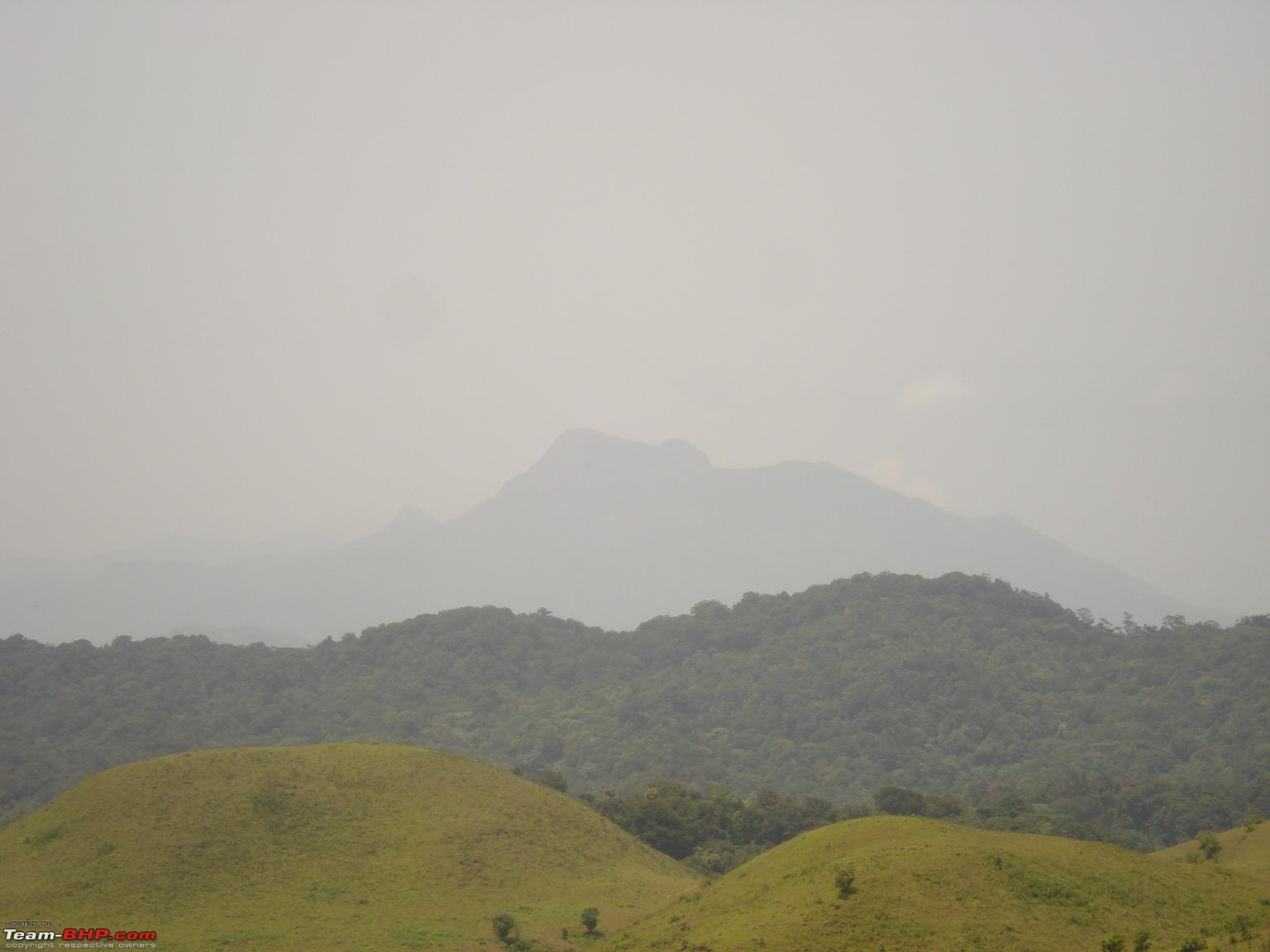
Kaginahare is a village located in between the Shiradi and Bisle ghats after Sakleshpur. There is a small fort next to the village supposedly built by Tipu Sultan with the other forts in the region, the Manjarabad fort (on NH48 after Sakleshpur) and the Jamalabad Fort (near Belthangadi). This is not exactly a fort, all you can see is a small boundary wall surrounded by a moat. I guess this was a small outpost to warn the larger Majarabad Fort in case of any danger. Nowadays there is nothing but ruins there. But it has an excellent view of the surrounding region.
It is 7-8kms from Hongadahalla by road. Btw, Hongadahalla is supposed to receive the second highest rainfall in Karnataka after Agumbe.
I had trekked to this place in May this year. This was part of a larger trek plan starting from Donigal-Yedakumari-Kaginahare-Hongadahalla-Sakleshpur.
For those who know Yedakumari Railway station, Kaginahare is 5 kms from that place.
Coming back to Sunday, since I was free the whole afternoon, I said 'Lets go'. So, we packed lunch deciding to have a small picnic on the way and finally left Hassan at 2.30 pm with a slight drizzle falling upon us. We were five of us in a friend's white 1998 Zen. He calls it 'The Landcruiser'. From Hassan we took the following route
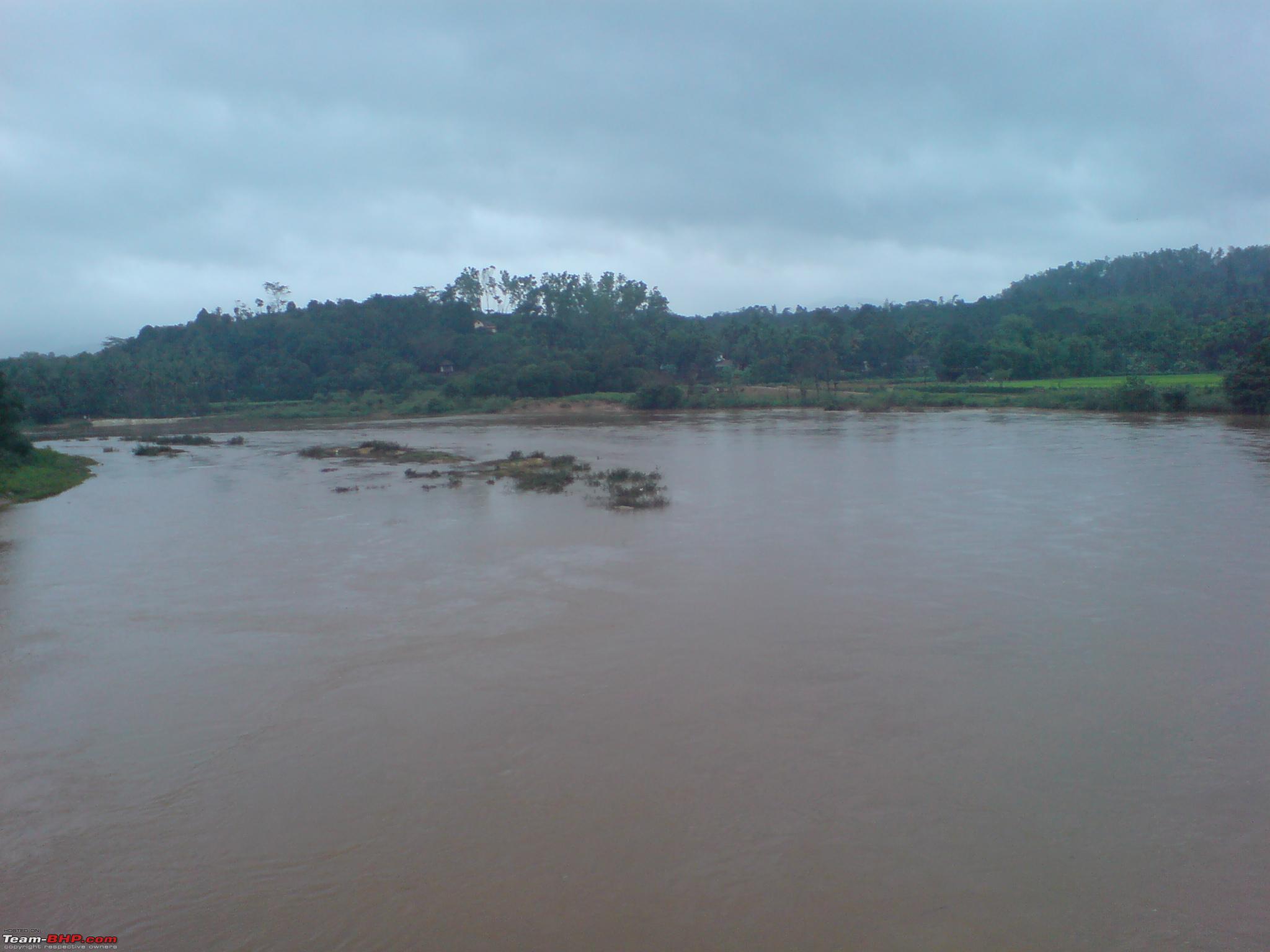
Hassan-Sakleshpur-Donigal-Byakaravalli-Hethur-Baachihalli-Hongadahalla-Kaginahare. The total distance from Hassan is 90 kms one way.
Hassan to Sakleshpur, the route is straightforward. From Sakleshpur drive on towards Shiradi ghat till you reach Donigal. Here you have to take the road towards Bisle ghat. Upto Baachihalli, the road is the same as to Bisle ghat. At Baachihalli take a right towards Hongadahalla (pronounced as Hongarahalla locally). After you reach Hongadahalla, keep going straight for around 7-8 kms and you will reach Kaginahare. You can also visit Mookana Mane Abbi Falls on the way.
There are no signboards to Kaginahare or Hongadahalla. You have to ask for directions. The roads are nothing to write about. I will not comment on the NH48 upto Donigal since it has been discussed very frequently.
From Donigal to Byakaravalli junction, the road is good and smooth except for a few big potholes. From Byakaravalli, a couple of kilometers of rough roads with potholes and again good roads till Hethur. After Hethur, the road is very very rough couple with potholes. You also get a couple of steep inclines/declines between Baachihalli-Hongadahalla & Hongadahalla-Kaginahare.
The road ends at Kaginahare. If you trek about 10-12 kms due west from the ruins, you can reach Shribagilu railway station (on the Hassan-Mangalore line) and from there to the Gundya-Subramanya road.
We had a nice picnic lunch on a small grassland near Hethur. By the time we finished, it was already late. So, we scrambled our things and started moving. We finally reached Kaginahare at 5.45pm.
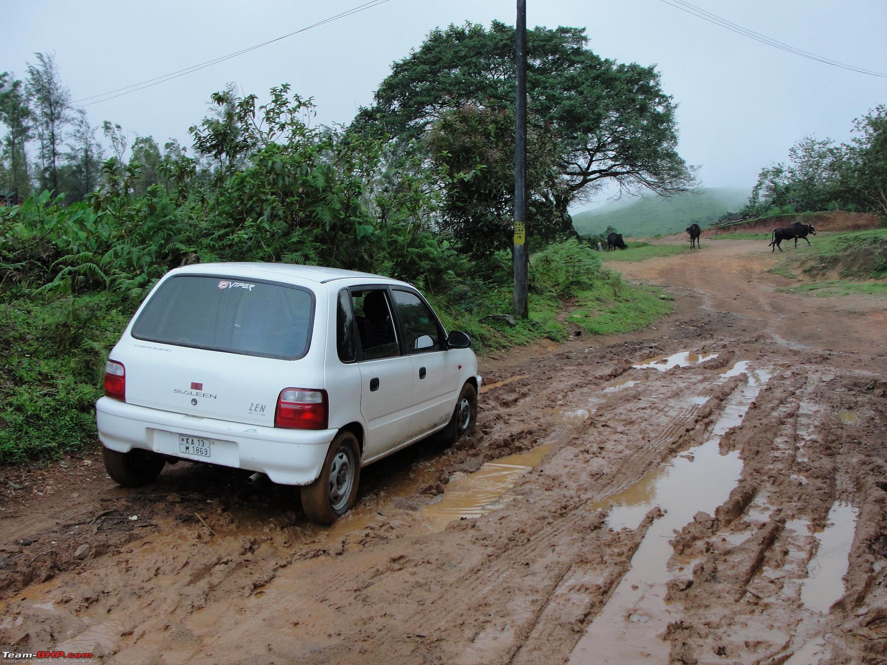
The ruins are about 2-3 kms from the actual village. We had to pass large grassland. From there, there is a dirt road leading all the way to the ruins. But, since we were in a Zen, we could not take it all the way up. The track was covered in moss due to the incessant rains. The zen used to slide around the track when we tried to take it up. So, we stopped it and walked the remaining distance to the ruins.
As we were walking up the track, I felt something wet below my foot. Upon investigation, I found that there were 4 leeches clinging on to my foot

. But luckily, they still had not started feeding, so removed them with ease.
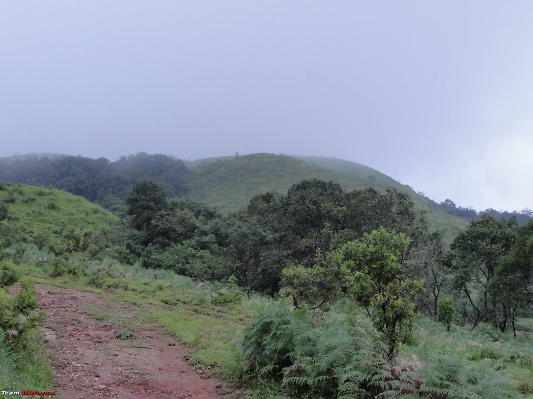
We reached the ruins and spent a few minutes on top. But due to the fog, we could not get good views of the surroundings. It was already getting dark and the fog was setting in. It was a wonderful and eerie experience walking in the fading light with no torches and fog all around us. We came back to the car and started on the return journey and finally reached Hassan at 9.30pm
This was a lovely way to finish off an unplanned weekend, wasn't it??
The winding road after Sakleshpur. Notice the surface of the road. It is like this upto Byakaravalli junction

Lush green paddy fields with coffee estates in the background


The place where we had our small picnic


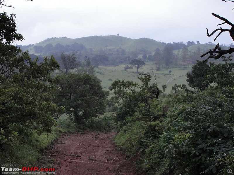
Somewhere near Hongadahalla

Between Hongadahalla and Kaginahare. There was a steep decline just after this place


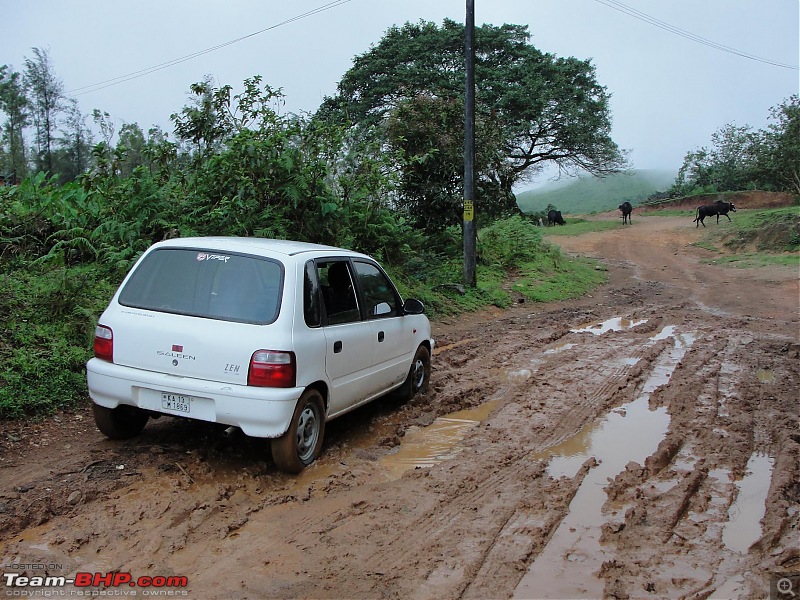
The Zen negotiating some slush in Kaginahare village. It is truly a Landcruiser

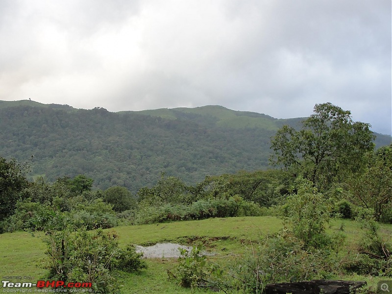
The grassland on the way to the dirt road. a small depression has created a rainwater pond. It looked lovely

Tyre tracks of the Zen next to the pond. The whole grassland was under a bit of water

The Zen could go no further from here. Notice the green moss covering the track. the car almost slipped into the ditch

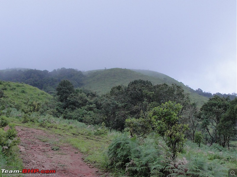
Views on the way to the ruins


More pics to continue.....


 6th October 2009, 13:21

 (1)
Thanks
(1)
Thanks
 . Somehow parked the vehicle and made it to the temple. By the time we reached Sringeri, it was already 2 pm. The temple had just closed at 2 pm and would open only at 5 pm.