| |||||||
| Search Forums |
| Advanced Search |
| Go to Page... |
 |
| Search this Thread |  37,331 views |
| | #1 |
| BHPian Join Date: Nov 2015 Location: Mumbai/Pune
Posts: 114
Thanked: 442 Times
| Kashmir Great Lakes Trek - My 1st raw experience in the mighty Himalayas The year 2019 had been quite eventful, for many reasons. Well to start with, it had been an extremely demanding year at work, but at the same time on the personal front, did manage to accomplish a few personal goals. If anybody asks me, ‘what was so special about the previous year?’ My answer to them remains the same, nothing but my ‘1st ever Himalayan trek’ in the mountains & ‘valleys of Kashmir'. That means 7 days of witnessing beautiful ‘Alpine lakes’ deep down in the valleys (where true hidden beauty of Kashmir exists), with zero mobile connectivity, bare minimum civilization & minimalistic luxuries. Prelude: Going back to March 2019, it's been only 5 months since I was back from the travel expedition of several days (i.e Bhutan & Sikkim), and silently I started planning for the next one. Well to make it interesting, did manage to hike 3-4 forts around Pune city, post-monsoon. A lush green 'Sahyadri's' especially during monsoon has its own charm, folks from Maharashtra would certainly relate to my thoughts. That aside, in order to stay motivated throughout the year, personally look forward to travel someplace, where I haven't been before. Nearly 4 years ago (Nov 2016), along with my friends, drove down to South India with the intention to explore Kerala and a bit of Karnataka, along with Tamilnadu, managed to cover nearly 4,000 km in our Swift Zdi. 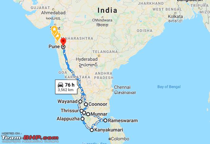 Post that in August 2017, did a first-ever solo road trip again to south India, on my Enfield Bullet 500 to 'Hyderabad', then 'Tadipatri' to attend a friend’s wedding and returning back to 'Pune', after riding to 'Hampi & Goa'. Rode 2,200 km, while on this trip. 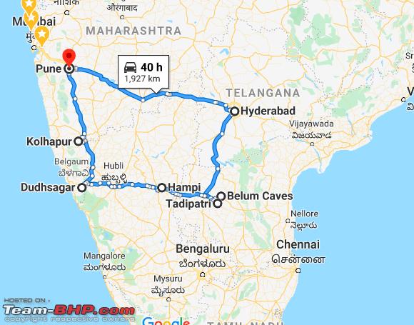 Moving to October 2018, along with my 3 best friends, I’ve undertaken a road trip to ‘Bhutan & Sikkim’ in our 2nd gen Swift Zdi. We drove through ‘11 states of India, 2 countries’ covering around ‘6500 km’ over ‘16 days’ and had one crazy experience, which was an eye-opener in many ways and also the longest time, I've been behind the steering wheel. We returned with a sense of positivity and stories to cherish for a lifetime. 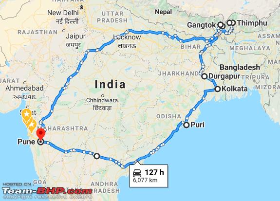 This past travel experiences been quite a confidence-inspiring for me, in many ways and did help me to change my perspective, towards the way I look at any situation. It did give me immense confidence to plan and execute various itineraries with respect to scaling India by road. And witnessed, the most important change within me, something that I wasn't capable of and never ever imagined doing it i.e. today, it has provoked me to tell my travel stories. Following is the one quote, which really touched my heart and can totally relate myself to it, so thought of sharing it in the opening post.  How it all started: Trekking in the Himalayan mountain range was always on the cards, ever since I started exploring mountains of Sahyadri’s. For 2019, I was very clear about one thing, that I'd avoid road-trip and instead go for a Himalayan trek, which I was delaying since past few years, for several reasons. I wanted to do this trek with like-minded people, though I have a couple of my colleagues, who were willing to join, but was strictly against that idea. Somewhere in March 2019, I recollect having a house party along with my friends, out of nowhere late in the night, I messaged one of my cousin 'Siddhesh', and our conversation went like this:-
Note:
Details of the trek:
Itinerary:  Mountain training & preparation: Trekking in the Himalayas is one experience to have, which is unparalleled to any object/feeling in the world. Whether one would be able to enjoy it or not, that totally depends upon the fitness level of that individual. Training yourself before the trek i.e a month or 2, prior to actual trek does make a hell lot of difference. Moreover, it’s important to do an exercise you enjoy. I have trained myself before the trek in different ways and also adapted my routine as well as a lifestyle:
Trekking Checklist: A trek of several days in the Himalayas comes along with a long list of equipments to be carried. The golden rule always remains the same i.e ‘pack light’. This might seem easier said than done; One should carry only essentials, which are necessary to survive on the trek. Ideally, the backpack should weigh less than 15 kgs, as you’re the one who’s gonna carry on your respective back’s. That means equipment should be lightweight & compact. Following list is prepared on the basis of my personal experience of trekking in western ghats and with the help of certain articles (credits due, where it's needed). That said you may add/ remove things which you feel and share the same: TREKKING GEAR
FOOTWEAR
CLOTHING
TOILETRIES
UTENSILS (To be checked with trek organizer)
MISCELLANEOUS
 All you need to survive, over a week-long trek. 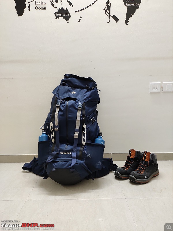 Once everything went in, it weighed around 14.5 kgs(including the weight of backpack). Last edited by Aditya : 14th April 2020 at 06:28. Reason: As requested |
| |  (18)
Thanks (18)
Thanks
|
| The following 18 BHPians Thank Aniruddha_Ch for this useful post: | CrAzY dRiVeR, dailydriver, GTO, haisaikat, ketantendulkar, Leoshashi, Meer, mh09ad5578, moralfibre, Red Liner, Rudra Sen, sachinayak, Sheel, swiftnfurious, Thermodynamics, Turbanator, vb-saan, wolg |
| |
| | #2 |
| BHPian Join Date: Nov 2015 Location: Mumbai/Pune
Posts: 114
Thanked: 442 Times
| Kashmir Great Lakes Trek- My 1st raw experience in the mighty Himalayas Day 0: Mumbai, MH to Pune, MH (Bus journey), As I’ve already taken half a day at work, I came back home by afternoon. Before leaving home, I did one last-minute final check of my backpack and house, few friends were there to see me off. While leaving, I had a word with my school friend 'Puneet' who resides in Mumbai, regarding staying at his place for a night, which he accepted wholeheartedly. After a quick bite, I boarded a late evening state transport bus (Shivneri), for Mumbai from Pune station. Also managed to get my favourite seat (i.e front seat opposite to driver), and the journey started. Another 30 minutes, and the bus was already on the Mumbai Pune expressway. I've always admired night drives on this particular stretch, and throughout the journey, I was busy replying to all the well wishes for the forthcoming expedition. Also, the web check inn was done after confirming with 'Ankita', it was quite hard to believe that this was actually happening. Within myself, I was a little nervous & anxious with several ‘If’s and but’s’ in my mind. With all those thoughts, I didn't realise when the bus reached Mumbai. My friend and I had some good conversation for a while and called it a day, as the next day my flight was scheduled at 1015 hrs. Day 1: Mumbai, MH to Srinagar, J&K (flight journey), Location: Srinagar, J&K, Elevation: 5300 ft, After having breakfast, I made my move towards the Mumbai airport, reaching at 0900 hrs. After a series of consecutive road trips over the years, it was the 1st time that I was taking a flight for my personal travel. A quick phone call to 'Ankita' and she was already on her way, stuck in slow-moving traffic. Meanwhile, I took details from her, in order to collect our respective boarding passes and there she arrived 5 minutes before the boarding time. Baggage was checked in, we were all set and flight left on time. It was a comfortable 4 hours flight with a technical halt at Jammu airport.  Arriving at Srinagar by 1430 hrs, it was quite unlikely to be greeted by sunny weather. Don’t get me wrong, the climate was absolutely pleasant but quite hot as per standards of Kashmir. Collected our respective check-in baggage and met Shubhangi, who was gonna stay along with us at Zostel. We waited for another 2 hours at the airport itself, Siddhesh’s flight from Hyderabad arrived after an hour and then Prasad arrived. We booked a prepaid taxi for 5 of us till Zostel, which was 20 km from the airport. Before arriving at the destination, we made a stop at 'Dal Lake' to click some photographs & to enjoy the view. 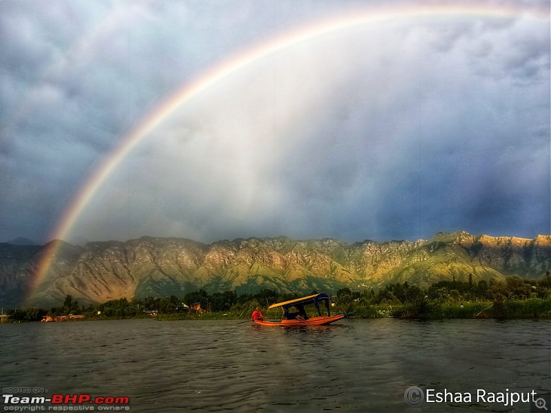   We had a booking of 5 beds in a mixed dorm at 'Zostel, and the tariff was Rs.699/ night for a single bed. I was experiencing 'Zostel' for the 1st time, the one amongst popular backpacker's hostel. Well, it happens to be a peaceful place, away from the crowd and hosts were quite welcoming. It's located at a walkable distance from 'Dal lake' & additionally provides some nice views of surrounding mountains.  View from the balcony of our dorm.  One can witness, beautiful evening skyline from the terrace of the property.  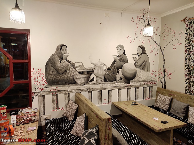 The common room of this place is nicely done with some interesting bits all around, does enhances the overall experience.   The dinner was quite delicious, though it was ordered from outside with the help of our host. (L to R;- Myself, Siddhesh, Prasad, Ankita, Shubhangi). Last edited by khan_sultan : 13th April 2020 at 09:16. Reason: as requested |
| |  (12)
Thanks (12)
Thanks
|
| The following 12 BHPians Thank Aniruddha_Ch for this useful post: | CrAzY dRiVeR, GTO, haisaikat, Leoshashi, mh09ad5578, Red Liner, sachinayak, Sheel, swiftnfurious, Thermodynamics, Turbanator, vb-saan |
| | #3 |
| BHPian Join Date: Nov 2015 Location: Mumbai/Pune
Posts: 114
Thanked: 442 Times
| re: Kashmir Great Lakes Trek - My 1st raw experience in the mighty Himalayas Day 2: Srinagar to Sonmarg (Bus journey from Srinagar) Location:'Sonmarg', J&K, Highest elevation for the day: 9200 ft, After getting up in the morning, we spent some time arranging our belongings, as we wanted to checkout. Been to Nishat garden, which was walking distance from Zostel. Post lunch, we made our move towards the city, in order to join the rest of the group. It was a 2 hrs bus journey to reach 'Sonmarg' in the evening which happens to be our base camp before we began the actual trek. The campsite was beautifully located on the small hill parallel to the bank of the 'Sind' river. As one would expect, the place is surrounded by some mountains, that includes lush green mountains as well as Snow Capped peaks. As expected, mobile connectivity went off while we were on our way, so I kept the cellphone in flight mode. That means getting disconnected from the rest of the world for the next couple of days and I was desperately looking forward to doing the same.  Morning view from our dorm's balcony.      One group picture outside in the garden, while departing from 'Zostel'  The bus journey from Srinagar to Sonmarg  A quick stopover for tea, at this view  (Picture courtesy- Prasad Guram)  The road further continues till Kargil, then 'Leh' and happens to be part of the famous NH-1  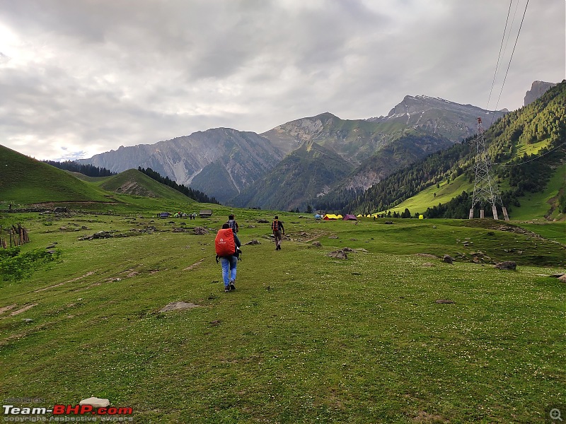 As we approach the campsite of Sonmarg valley    An icebreaker session with these wonderful bunch of people.  (Picture courtesy- Mario Mascarenhas) The day had been more about getting acclimatized to the altitude and also getting to know fellow trekkers, with whom I'd share the trail for the next 6 days. Also, a briefing was done by a local trek leader, regarding 'Dos & Don'ts'. Last edited by Aniruddha_Ch : 11th April 2020 at 19:52. Reason: Alignment |
| |  (13)
Thanks (13)
Thanks
|
| The following 13 BHPians Thank Aniruddha_Ch for this useful post: | ast.ggn, CrAzY dRiVeR, GTO, haisaikat, Meer, mh09ad5578, Red Liner, sachinayak, Samba, Sheel, swiftnfurious, Thermodynamics, vb-saan |
| | #4 |
| BHPian Join Date: Nov 2015 Location: Mumbai/Pune
Posts: 114
Thanked: 442 Times
| DAY 1 of the trek (Nichnai campsite) Day 3: 1st day of the trek (Sonmarg to Nichnai campsite), Location: Nichnai valley, Highest elevation for the day: 11,500 ft, Trail distance: 13 km, The day started early, it was sunny at the start, but not something that was hitting us. Before starting off, I was in two minds whether to carry a backpack on my back or offload it to mules/porters. But then, I was determined to carry on my back, with some push from ‘Siddhesh’, I’ve decided to take the plunge. 1st day of a trek, quite a long day for all and for a few of us it had been the first taste of the Himalayas. After initial hiccups, kept a gradual pace throughout the trail, as enjoying the beauty is also equally important. The trail passes through long pine trees, some steep ascents, snow patches as well as flat ground and some rocks, also one would witness streams which are originating from glaciers that would run all the way along the trail. I managed to reach 'Nichnai' campsite by an evening around 1700 hrs. As it was the 1st day at altitude, a headache was common for most of us, for a short duration. I was happy and content with the fact that I managed to complete 1st day with a loaded backpack. Post dinner, with some chit-chat we called it a day.  A pleasant morning to begin the day with.  Morning sun rays on the peak of surrounding mountains.  Home of Shephards on an adjoining hill. (Picture courtesy- Mr Venugopal)  The trail begins with a gradual ascent.  The group waiting for verification at Army check post.  After clearance from the army, the trail which paves the way towards 'Nichnai valley'.  (Picture courtesy- Prasad Guram)  The view of the beautiful Sonmarg valley.  (Picture courtesy- Prasad Guram)  Last visible civilisation & roadway, until the next couple of days  (Picture courtesy- Prasad Guram)  Some little innocent faces which came across our way.  Their happiness lies in receiving some sweets and chocolates.  Soon we approach the section of trail, which was surrounded by long Pine trees.  A part of my body frame for the next couple of days. 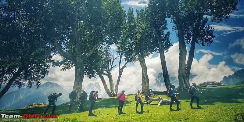 A quick hydration break at this view & we are ready to leave. (Picture courtesy- Mario Mascarenhas)   A constant uphill climb since the past 2 hours. 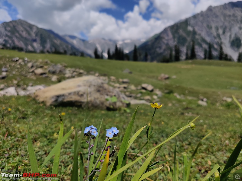  And as we complained of ascent, soon we see down the hill slope.  Soon, the topography changes with the trail which navigates through stones.  The streams which originate from the glacier. 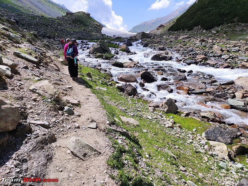 The trail next to flowing stream & sound of it is nothing less than a melody.  As we approached some short some snow-covered trails.  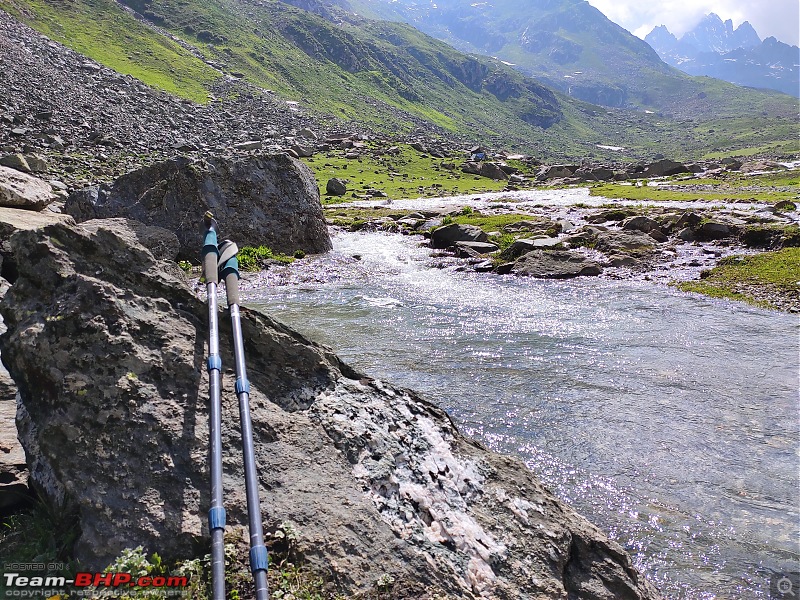 Using 2 poles instead of 1 does make a whole lot of difference, helps to share a load of our weight evenly on the body.   A destination for the day i.e Nichnai campsite  Last edited by ampere : 13th April 2020 at 08:21. Reason: Alignment; typo fixed |
| |  (14)
Thanks (14)
Thanks
|
| The following 14 BHPians Thank Aniruddha_Ch for this useful post: | ast.ggn, CrAzY dRiVeR, GTO, haisaikat, Meer, mh09ad5578, Red Liner, sachinayak, Samba, Sheel, swiftnfurious, Thermodynamics, Turbanator, vb-saan |
| | #5 |
| BHPian Join Date: Nov 2015 Location: Mumbai/Pune
Posts: 114
Thanked: 442 Times
| Day 2 of the trek- 'Vishansar' lake campsite Day 4: Nichnai valley to Vishansar lake, Location: Vishansar lake Highest elevation for the day: 13,100 ft (Nichnai pass) Trail distance: 12 Km, 2nd day of the trek, the trail begins from Nichnai valley all the way up till Nichnai pass at 13,100 ft high, which appeared to be a steep never-ending climb. All the trekkers successfully managed to climb the pass without much difficulty. We took a tea break at the pass and admired the surrounding beauty. While descending from Nichnai top, we encountered snow trail for a considerable amount of time, which for me was 1st of a kind experience to trek on snow, along with varied species of wildflowers. Post lunch, the path turned out to be flat over the meadows, between the two mountain ranges and equally monotonous, also the day had been quite tiring for few trekkers. The day ended at Vishansar lake, which is first Alpine lake in Kashmir Great Lakes. Pictures won't really do the justice to the sheer beauty of this landscape. Vishansar lake houses many types of fishes especially the famous 'Trout. Late in the evening, few of us have been to Vishansar lake, which is hidden within a periphery of hills and not visible from the campsite. Spent some time, silently admiring the natural beauty of the lake and enjoying the silence, something which is quite extinct in crowded cities. Alpine lakes- All the lakes at high altitude above 5000 ft and often froze for the maximum duration of the year.  The steep ascent of Nichnai pass, which lasted for more than an hour. 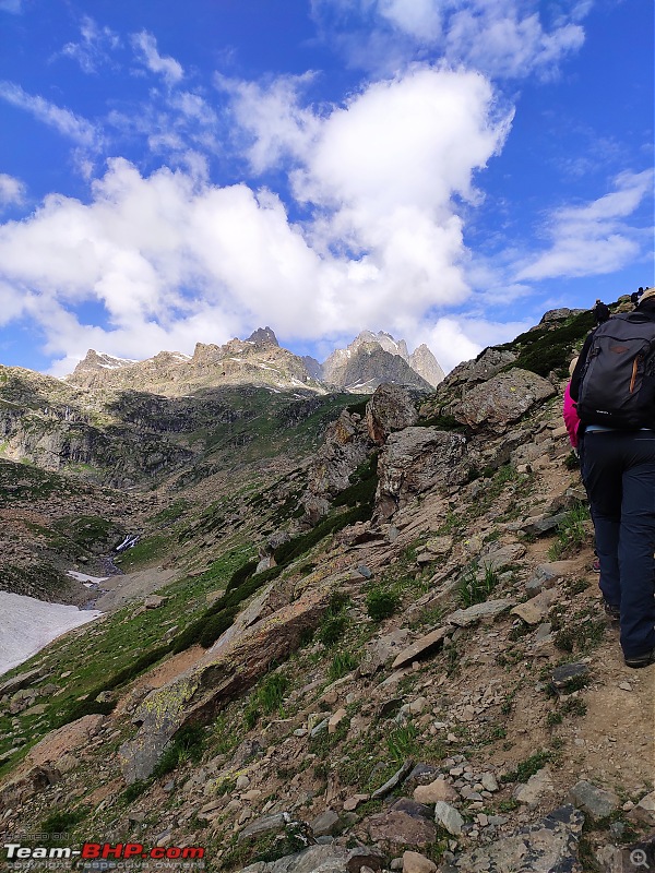  Small water crossing can be seen, as we reach closer to pass.   Every mountain that you see has some unique pattern, which is hard to repeat.  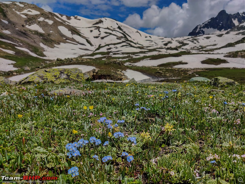 Wildflowers are present in many places.    As we were descending from Nichnai pass, we encountered snow trail for a longer duration.    The downhill from Nichnai pass felt like a never-ending thing.  If used correctly, trekking poles could be a blessing on long downhill trails, in order to avoid sore knees. 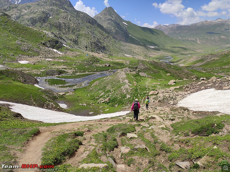  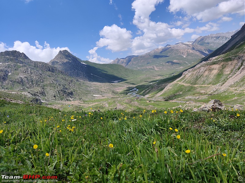  As we approach the flat trail and one can see 2 different types of the mountain range.  (Pic courtesy- Prasad Guram)  The flat trail seemed to be quite long & later on, it got little monotonous.  Soon, we were able to sight 'Vishansar lake' campsite, must say one beautiful of all campsites of this trek.  After reaching a campsite on a regular basis, this had been a treat. 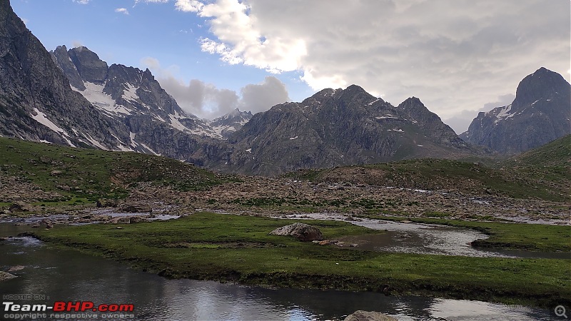 The periphery of mountains in which 'Vishansar lake' is present.  Vishansar lake- 1st lake of the trek. Due to the dull evening, the true colours of the lake is not visible.  It's nothing less than a luxury to get birthday cake in the mountains, thanks to the support team.  This was regular activity on most of the days. That's 'Esha' setting up the camera.  And this was a result, i.e the beautiful capture of Milky way galaxy. Post dinner, few group members identified stars and the Milky Way galaxy, also photographed the same, the activity which had been constant throughout the trek. Prasad did teach us how to click the same in our respective cell phones, a new skill which I learnt. Last edited by Aniruddha_Ch : 11th April 2020 at 19:42. |
| |  (14)
Thanks (14)
Thanks
|
| The following 14 BHPians Thank Aniruddha_Ch for this useful post: | Ashutosh, ast.ggn, CrAzY dRiVeR, GTO, haisaikat, Meer, mh09ad5578, sachinayak, Samba, Sheel, swiftnfurious, Thermodynamics, Turbanator, vb-saan |
| | #6 |
| BHPian Join Date: Nov 2015 Location: Mumbai/Pune
Posts: 114
Thanked: 442 Times
| Day 3 of the trek- Gadsar pass (highest elevation of the trek) Day 5: Vishansar lake to Gadsar campsite, Places visited: Kishansar lake, Gadsar pass & Gadsar lake Highest elevation for the day: 13,750 ft (Gadsar pass- highest elevated point of the trek) Trail distance: 18 km, As per local trek leader, 3rd day of the trek seemed to be most difficult, as we were supposed to cross 'Gadsar' pass ('highest elevated point' for the complete trek). Dry weather is prefered to cross the same. The Trail starts from 'Vishansar' lake with a gradual climb till 'Krishansar' lake (2nd lake). From 'Krishansar' lake, a very steep 3 km long ascend begins up to Gadsar pass at 13750 ft, it takes minimum 2-3 hrs depending on endurance. As you move up, both the lakes would start appearing even prettier. The trail on the climb is Zigzag and once you reach on the top, both 'Vishansar' and 'Krishansar' lakes are visible together. The view from Gadsar pass on either of the sides is spectacular and appears to be like a painting. Post this, it's complete descend till Gadsar, also 'Gadsar' lake will fall on the way, which by far had been most beautiful lake out of all. Gadsar lake, like all other lakes, formed due to melting of glaciers and surrounded by snow-clad mountains. One needs to be careful while descending snow patches. Enroute, one would also see certain wild animals (Eg. Mormot) and their burrows. Also, the trail till 'Gadsar' campsite is beautifully surrounded by flowers, which appears nothing less than a carpet. Post that, it was a straight walk towards a campsite, though this time around all the campsite's were closer to each other.  The true beauty of 'Vishansar lake' in broad daylight.  [ [The trail alongside 'Vishansar lake' which goes till Kishansar lake  It's recommended to fill up the bottles, prior to moving towards the pass, as there's hardly any stream water available, till Gadsar pass. The sweetness of stream water is still fresh in my taste buds.  After moving a few metres, 'Kishansar lake' is just ahead of Vishansar lake & just before starting point of Gadsar trail.  This had been, one of the most challenging uphill climbs of the trek, nearly 3 km long.  As we got closer to the pass, both 'Vishansar' and 'Kishansar' lakes were visible together. 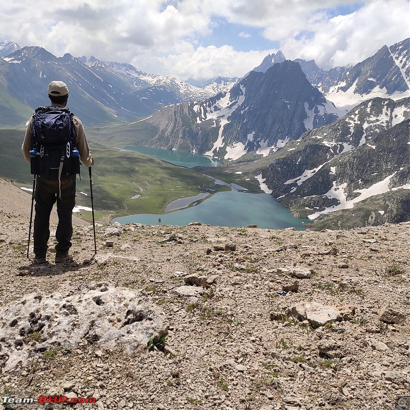 While admiring the beauty of the mother nature, was I still dreaming? It's a feeling of joy, which is simply unmatched by anything else in the world. 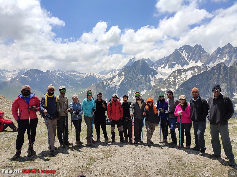 Without this cool bunch of people, the experience wouldn't have been the same. 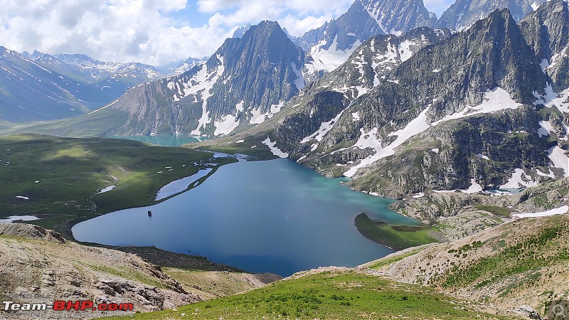  The view on the other side of the Gadsar pass, which was beautiful in its own unique way. 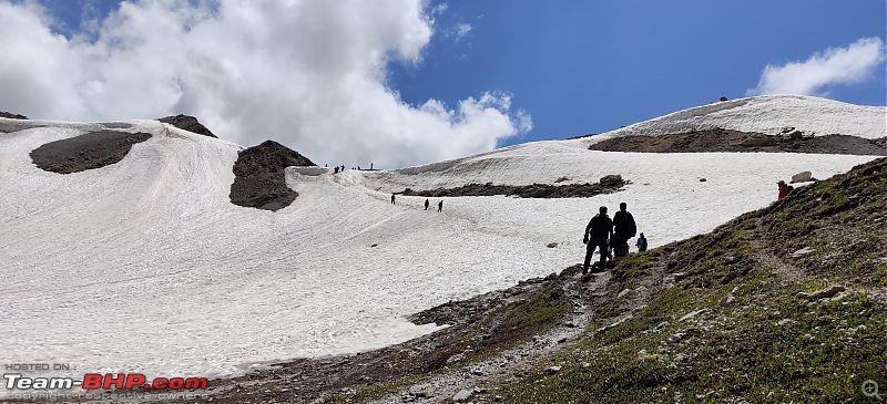 The view of Gadsar pass, from the other side while descending. 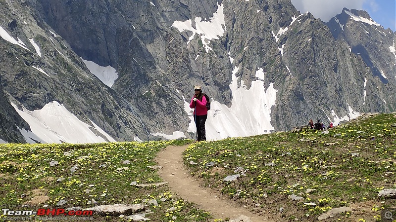 The trail remained surrounded by a carpet of beautiful flowers, on both sides for a long duration.   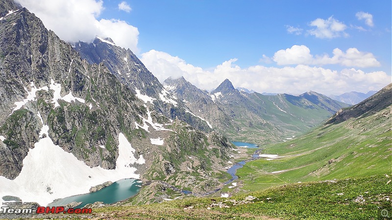 The picturesque landscape appears nothing less than a painting. 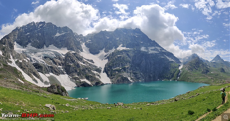 I was awestruck by the beauty of 'Gadsar lake', which is by far the most beautiful lake out of all. 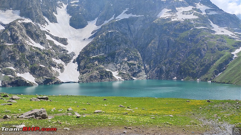  No amount of pictures can do justice to the sheer beauty of this landscape.   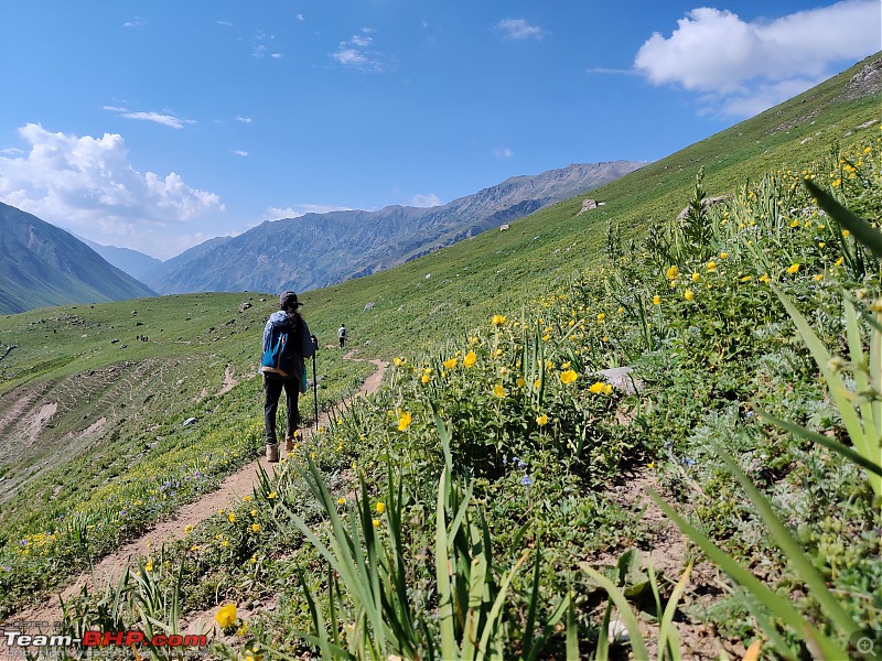   Well laid trail surrounded by grasslands and meadows. 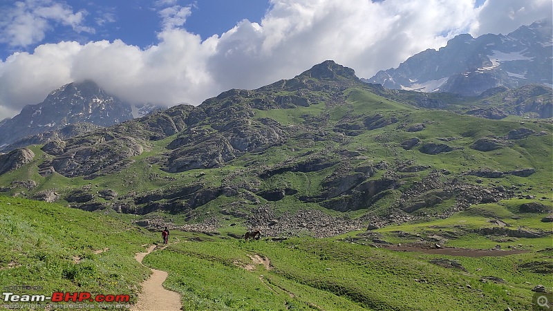 A unique pattern of the mountain with a mixture of grassland and big boulders.  The trail remained flat till the campsite of Gadsar.  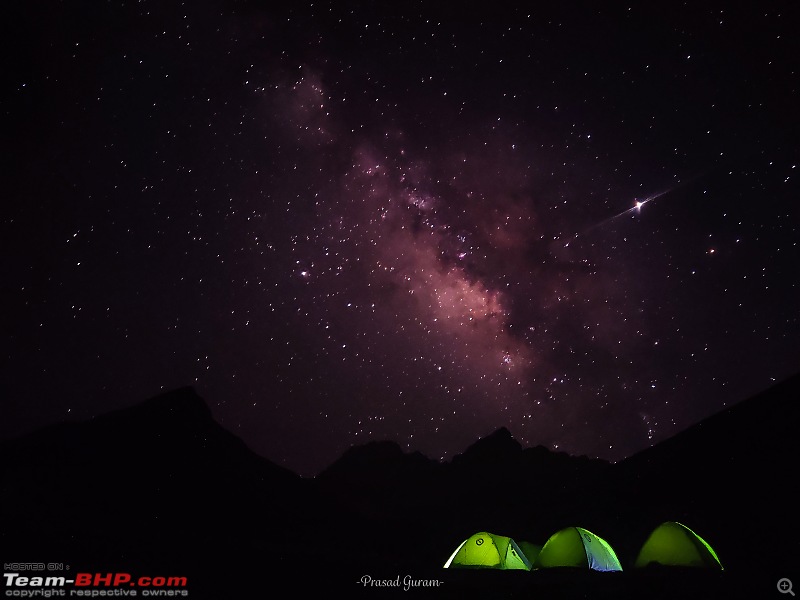 One of the best click of 'Milkyway Galaxy' by Prasad. Simply put, the pleasure of going away from polluted cities. 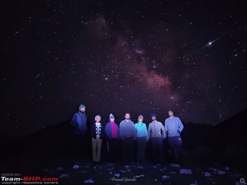 [ [Group pic with stars. (L to R: Archan, Shubhangi, Amar, Mukti, Aniruddha, Siddhesh) Last edited by Aniruddha_Ch : 11th April 2020 at 23:07. Reason: Alignment |
| |  (15)
Thanks (15)
Thanks
|
| The following 15 BHPians Thank Aniruddha_Ch for this useful post: | ast.ggn, CrAzY dRiVeR, GTO, haisaikat, Meer, mh09ad5578, sachinayak, Samba, Sheel, somspaple, suhaas307, swiftnfurious, Thermodynamics, Turbanator, vb-saan |
| | #7 |
| BHPian Join Date: Nov 2015 Location: Mumbai/Pune
Posts: 114
Thanked: 442 Times
| Day 4 of the trek- Gadsar campsite to Satsar lake campsite Day 6: Gadsar campsite to Satsar campsite, Location: Satsar lake (7 lakes in series), Highest elevation for the day: 11,150 ft (Nanga Parbat viewpoint), Trail distance: 13 km, 4th of the trek started by crossing the small snow bridge over a stream, which connects the start point of the trail on adjoining mountain range. A trail for the day been relatively easy, it's quite long like most of the mountain passes but with lesser elevation profile till the top i.e ‘Nanga Parbat viewpoint. The walk was quite scenic, surrounded by grasslands, a deep valley on the right-hand side and mountain range running parallel to it. The trail till topmost point appeared to be in a zigzag shape. From the top, on a clear day, one would be able to witness mountain of 'Nanga Parbat’ and also it marks to be the farthest point on the trek towards the POK (Pakistan occupied Kashmir). After this, the trail turns leftwards, away from the valley and towards the nearest possible civilisation. Post that, it's a mixture of downhill as well flat trails with 7 small 'Satsar lakes', waterfalls and streams flowing alongside. During last 30 minutes before the campsite, encountered a couple of boulders on the trail till Satsar campsite, something which lead to a reduction in the pace. The day ends at the campsite, which is next to Satsar lake (seven small alpine lakes). All in all, it's been an easy day for all of us and also day ended quite early in the afternoon. Late in the afternoon, the weather had suddenly turned cloudy, it was the 1st change of climate that we’ve witnessed.  The trail starts after the snow bridge, over the stream. (Picture credit- Mr Venugopal) 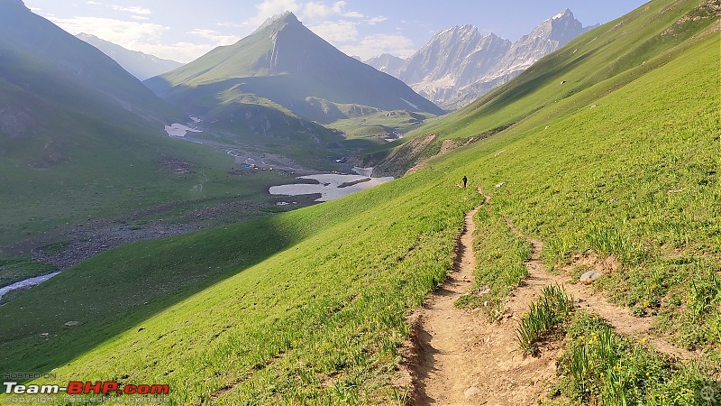 Looking back to where we've started. 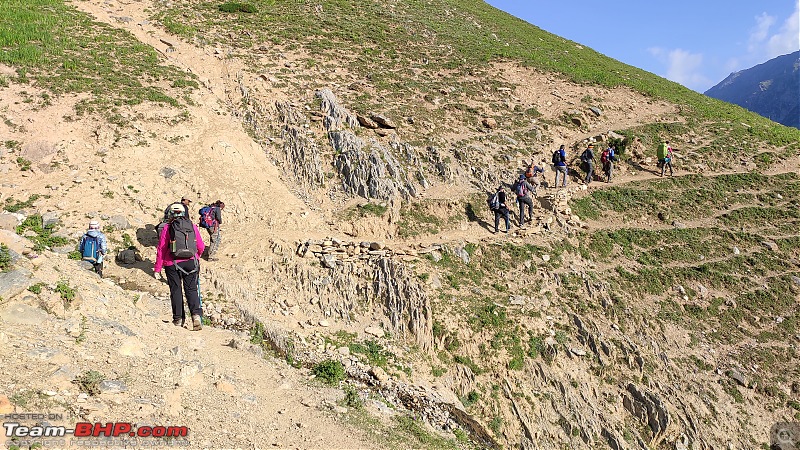 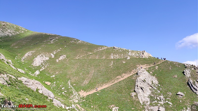 Observe closely, it's a nice vertically integrated Zigzag trail. 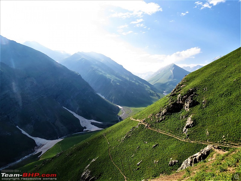 The trail is completely surrounded by meadows.  The valley and mountain range, which runs parallel to the trail.  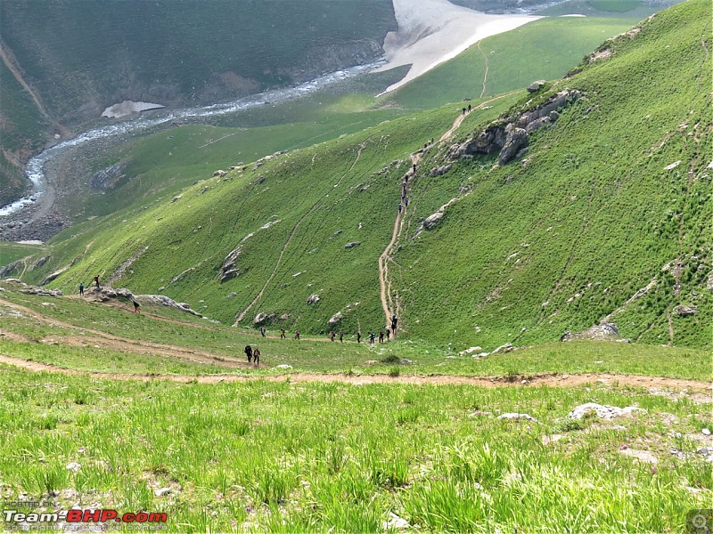 The aerial view of the Zigzag trail.  Time for some rest at the point which provides a hazy view of 'Nanga Parbat' (9th highest mountain in the world) 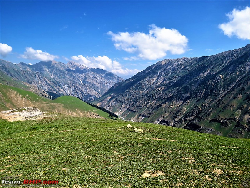 'Nanga Parbat' is located in POK region of Kashmir. This point is farthest most point of the trek. As per local trek guide, LOC is approximately at a distance of 10 Km.  Sheeps grazing had been a common sight throughout the trek.  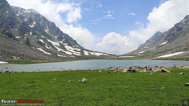 Seven lakes of Satsar in the series. 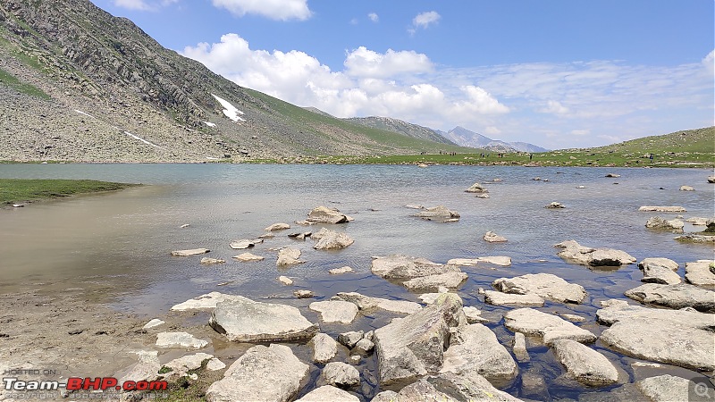     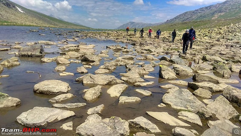 Boulders across the lake for some duration of the trek.(Picture credit- Sameer Patel)  Satsar campsite around the flowing stream.  Mountains with plenty of boulders, in this particular section. Last edited by CrAzY dRiVeR : 12th April 2020 at 06:46. Reason: Broken alignment tags corrected. Thanks for sharing. |
| |  (12)
Thanks (12)
Thanks
|
| The following 12 BHPians Thank Aniruddha_Ch for this useful post: | ast.ggn, GTO, haisaikat, mh09ad5578, sachinayak, Samba, Sheel, suhaas307, swiftnfurious, Thermodynamics, Turbanator, vb-saan |
| | #8 |
| BHPian Join Date: Nov 2015 Location: Mumbai/Pune
Posts: 114
Thanked: 442 Times
| Day 5 of the trek- Satsar campisite to Gangbal lake Day 7: Satsar lake campsite to Gangbal lake, Places visited: Zaj pass, Gangbal lake, Nundkol lake, Highest elevation for the day: 13120 ft (Zaj pass), Trail distance: 14 km, 5th day of the trek and the weather remained foggy after previous night's lightning, the trail started with the climb from Satsar campsite to 'Zaj pass' for nearly 3- 4 hours. Challenge for the day were the boulders for maximum duration till the top, for maximum duration. Along with that, the trail also had steep elevation, which in turn reduced the pace of everyone. It's recommended to fold the trekking poles, as it's not safe to use on boulders. The weather remained foggy throughout the day and also cold started to bite, as we were getting closer to the pass. As soon as we started descending towards Gangabal, it started to drizzle which later on turned to heavy rains. Also, this was the 1st showers since the time we started to trek. So naturally, it took some time for a few trekkers to adapt to the slippery trail, wet shoes/clothes and which turned out to be time-consuming. On a lighter note, the monsoon in the Himalayas has somewhere reminded me of Sahyadri's, barring the various shapes and pattern of mountains/ peaks around. While descending from Zaj pass, one would get a breathtaking view of twin lakes of 'Gangbal and Nundkol' with 'Mount Harmukh' at an elevation of 16870 ft in background. The day ended at Gangabal campsite with a magnificent view of Mt. Harmukh and the last night at the campsite of the trek. 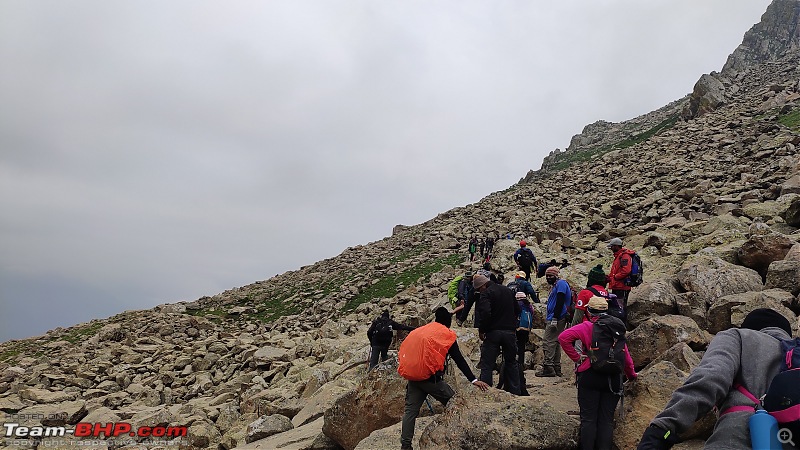 The walkers were moving at snail's pace, as few boulders were slippery and loose.  Shall I say 'boulders in the mountain' or other way round?  As we progressed, it was getting difficult to negotiate with boulders and also weather became foggy.  Meanwhile, she was wondering, whether these boulders would ever end.   Sanket (in the front) cracked some joke in order to make things lighter and Amar claps  over. (Picture credits- Mr Venugopal) over. (Picture credits- Mr Venugopal) 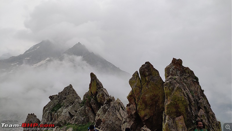  As we moved towards the pass, it gave an even better view of the valley and opposite mountain range.   One of the steepest elevated pathway of the trek.  Visibility has further gone down, indicating the drastic change in the climate.  Few of the trekkers did face altitude sickness on this pass. In order to avoid the same, it's highly recommended to drink a sip of water on frequent intervals, even if you're not thirsty.  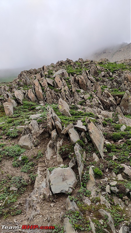 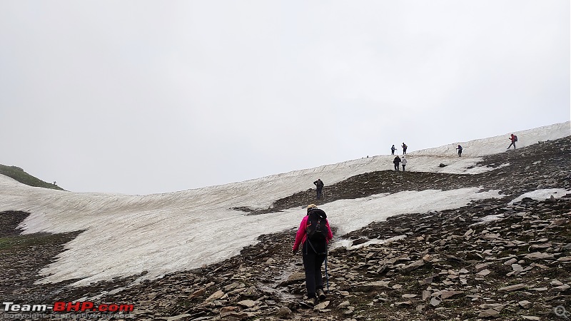 As we approach closer to the pass and it was almost visible, with a layer of snow on the top 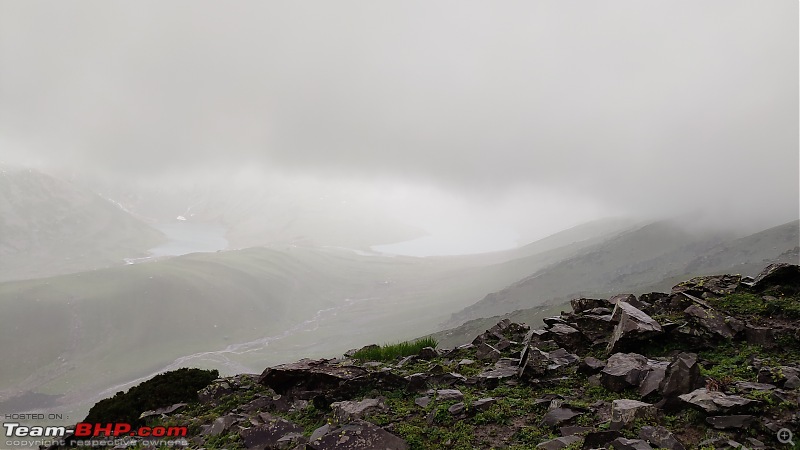 As we descend from 'Zaj pass', it started to rain and with almost zero visibility of lakes. 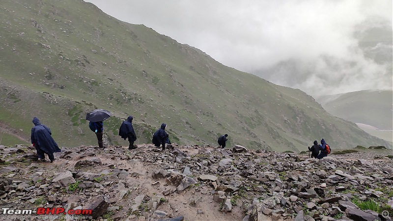 With the Poncho's ON, most of them were struggling with the slippery trail. 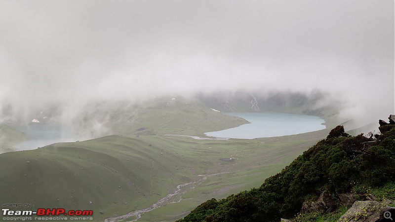 1st view of 'Gangbal' (on left) and 'Nundkol' (on right) lakes, which aren't yet clear-sighted.  As clouds moved away to provide a clear view of the twin lakes.  As we came closer to Gangbal lake campsite, Mt. Harmukh appeared clearly.  Dedicated campsite of 'Gangbal lake'.   The closer view of 'Gangbal and Nundkol' twin lakes. 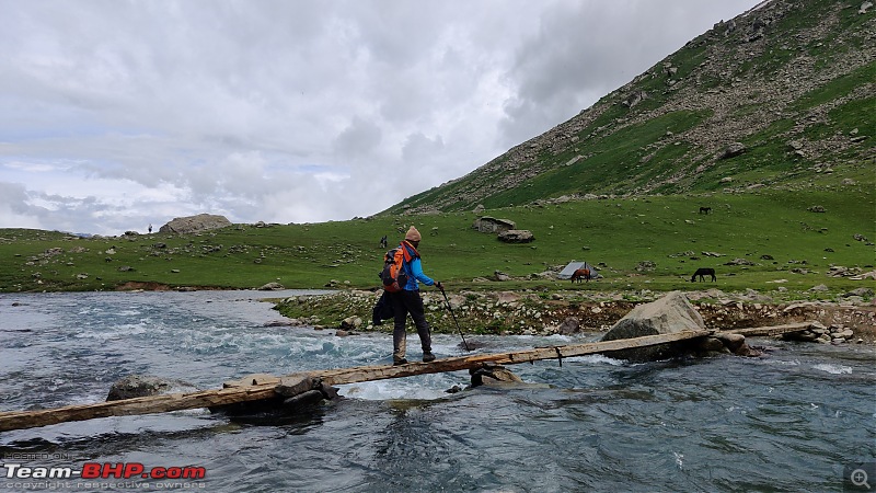  A friendly animal 'Mormot', usually found in mountain regions.  The stream which connects 'Gangbal & Nundkol' lake.  Mount Harmukh at an elevation of 16,870 ft, with Gangbal lake at its foot.   The warm atmosphere on the campsite and people engaged in some or other activity.  Last camp of the trek, before we descend to Naranag next day. Last edited by Aniruddha_Ch : 11th April 2020 at 19:03. Reason: Alignment |
| |  (14)
Thanks (14)
Thanks
|
| The following 14 BHPians Thank Aniruddha_Ch for this useful post: | ampere, ast.ggn, CrAzY dRiVeR, GTO, haisaikat, mh09ad5578, sachinayak, Samba, Sheel, suhaas307, swiftnfurious, Thermodynamics, Turbanator, vb-saan |
| | #9 |
| BHPian Join Date: Nov 2015 Location: Mumbai/Pune
Posts: 114
Thanked: 442 Times
| Day 6 of the trek- Gangbal to Naranag (Endpoint) Day 8: Gangbal to Naranag ( Last day), Location: Naranag (Endpoint), Highest elevation for the day: 7200 ft (Naranag), Trail distance: 19 km, Last day of the trek and the climate remained foggy throughout the day, with some light drizzle for a short duration. Post Army check post, the trail was surrounded by long pine trees till the base and appeared to be quite different with certain variations like a naturally fallen plantation, dense shady plantation and some breathtaking views of 'Naranag valley'. Also, there were signs of civilisation around, as we were able to see more than usual localities, who were hiking way up till Gangbal lake. Naranag happens to be the lowest point of the trek, even lower than Sonmarg (from where we've started on 1st day). Trail distance had been longest out of all days with the never-ending downhill slope for maximum duration. And that marks the end to 'Kashmir Great Lakes trek', most of the trekkers were excited to finish off the trek so naturally pace of walking was high. Everybody was eagerly waiting for the shower and a few of us waiting to satisfy their taste buds.  A big round of applause for the support crew, for being helpful in their best possible way.  As we started walking from the Gangbal lake campsite.  After nearly 5 days, we were able to find some proper trees.  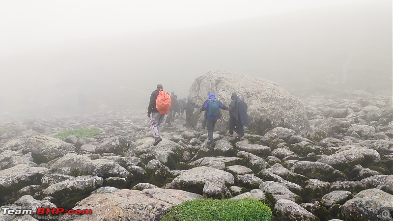  A short climb after Army check post.  Pine trees completely surrounded by fog. 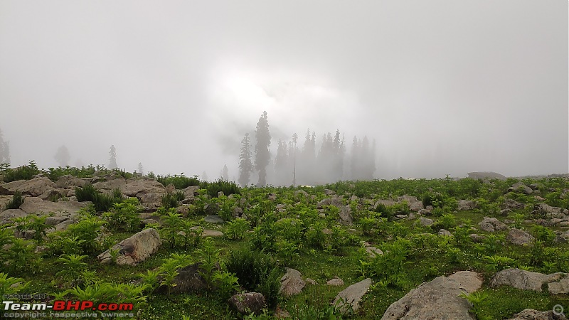    View of Naranag valley.     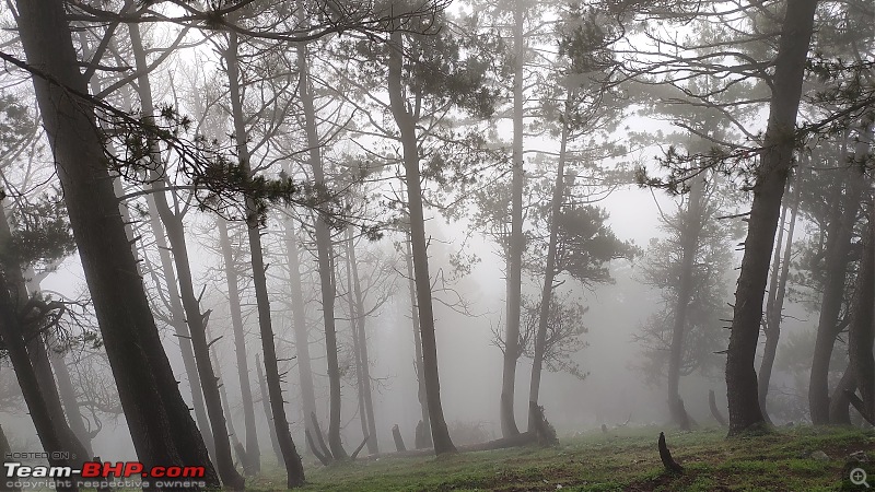     Trees which are naturally fallen.   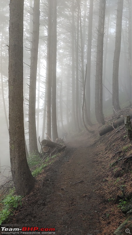 The pattern of the trail, which reminds of the day 1.  Some signs of civilisation and roadway after 6 days.  Me and Ankita successfully posing on the endpoint, at 'Naranag'. Post that, walking on the tarmac road felt as if 'something is amiss'  . (Picture courtesy- Mr Venugopal) . (Picture courtesy- Mr Venugopal)To conclude, though Kashmir great lake is considered one amongst the most beautiful trek and yes it is amazing, but being a 1st Himalayan trek for me, cannot compare/ comment about the beauty of the same. About the grade, would say it's the medium difficulty for a person with good endurance, as trails and passes are fairly long. If anybody out here wishes to attempt, make sure he/ she train's themselves well for mountains before attempting the same by indulging into daily sports activities like cardio training, running, a simple brisk walk before the trek. As it's being said, every travel experience changes your perspective towards the way of life. Likewise, this experience did teach me certain life lessons like:-
 (picture courtesy- Prasad Guram) That said, with this trek, had one time of my life which would remain unforgettable and most importantly met some like-minded people, who are there to remain forever, without the madness of each and every one of you, the time wouldn't have been same. Last edited by Aniruddha_Ch : 11th April 2020 at 22:21. Reason: Alignment |
| |  (14)
Thanks (14)
Thanks
|
| The following 14 BHPians Thank Aniruddha_Ch for this useful post: | ampere, ast.ggn, CrAzY dRiVeR, GTO, haisaikat, mh09ad5578, sachinayak, Samba, Sheel, somspaple, swiftnfurious, Thermodynamics, Turbanator, vb-saan |
| | #10 |
| BHPian Join Date: Nov 2015 Location: Mumbai/Pune
Posts: 114
Thanked: 442 Times
| Rest day at Srinagar Day 9: Rest day, Location: Srinagar, J&K. Well, this happens to be the unexpected additional day at Srinagar as trek got over a day prior than usual schedule, thanks to the pleasant climate. The day started quite late with some light breakfast, much-awaited lavish dinner and some local shopping Post that, few of us been for a Shikara ride, though it wasn’t the 1st time for me, have some fair share of childhood memories of more than a decade and a half old. Unlike 'Dal lake' which with time had turned out to be more touristy, 'Nigeen lake appears to be similar yet equally peaceful and less crowded. Though that silent 'Shikara' ride is one thing that most of the people look forward to doing, once at Srinagar. But at the same time, many local sellers would approach you once you're in the activity and that's something which spoils an experience, although one can deny them politely. This happens to be the final evening before everyone goes back to their respective routine.  We treated ourselves with much deserved tasty food, to curb our craving.  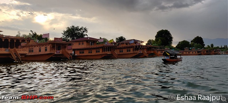 Shikara ride in quiet 'Nigeen lake'.   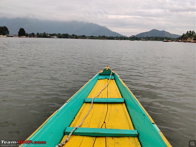   That's 'Hariparbat fort', on top of the hill.   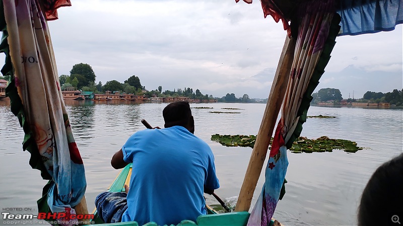 Last edited by Aniruddha_Ch : 11th April 2020 at 18:50. |
| |  (13)
Thanks (13)
Thanks
|
| The following 13 BHPians Thank Aniruddha_Ch for this useful post: | ast.ggn, CrAzY dRiVeR, GTO, haisaikat, Meer, mh09ad5578, sachinayak, Samba, Sheel, swiftnfurious, Thermodynamics, Turbanator, vb-saan |
| | #11 |
| BHPian Join Date: Nov 2015 Location: Mumbai/Pune
Posts: 114
Thanked: 442 Times
| re: Kashmir Great Lakes Trek - My 1st raw experience in the mighty Himalayas Day 10: Srinagar to Mumbai (flight journey), Location: Mumbai, Maharashtra. Last day of the trip, before each and everybody departs to their respective hometown. The morning went by packing up the belongings, as most of us had their flight schedule at around 1500 hrs in the afternoon. Post lunch, we departed towards Srinagar airport. Our flights were also on time and luckily, there was no heavy rainfall in Mumbai. 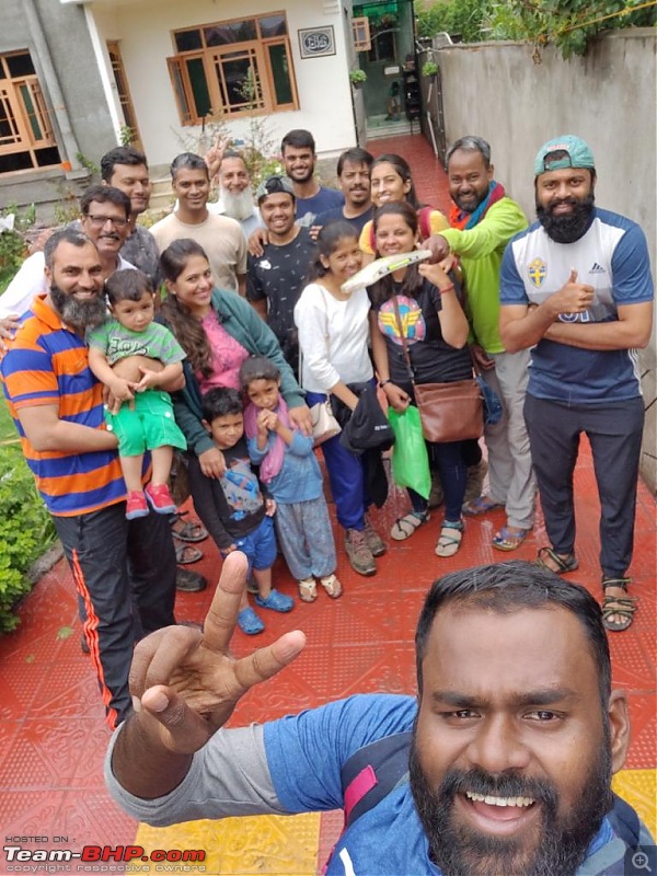 A special mention of our hosts at 'Hospitality home' (they truly live by the name) for a welcoming experience at their homestay.  All good things come to an end and so is this travel expedition, till the next one. This travelogue is dedicated to the people, who made this trip happen. A big shout of each one of you to make it special.  Last one at Mumbai airport, with all tan faces.  The first thing we ate, as soon as we got out of the airport  . Someone rightly said "Home is where the heart is". . Someone rightly said "Home is where the heart is". A 100 km drive, way back home. A travelogue on team-bhp must possibly come along with at least 1 picture of a car.  Last edited by Aniruddha_Ch : 11th April 2020 at 20:40. |
| |  (25)
Thanks (25)
Thanks
|
| The following 25 BHPians Thank Aniruddha_Ch for this useful post: | ampere, arun1100, ast.ggn, catchjyoti, CrAzY dRiVeR, GTO, haisaikat, HR 16, Meer, mh09ad5578, raihan, rst89, sachinayak, Samba, Sheel, somspaple, suhaas307, swiftnfurious, Thermodynamics, Tucker48, Turbanator, Vasuki, vb-saan, vdi, wolg |
| |
| | #12 |
| Team-BHP Support  | re: Kashmir Great Lakes Trek - My 1st raw experience in the mighty Himalayas Thread moved out from the Assembly Line. Thanks for sharing!  |
| |  (4)
Thanks (4)
Thanks
|
| The following 4 BHPians Thank CrAzY dRiVeR for this useful post: | Aniruddha_Ch, GTO, Samba, vb-saan |
| | #13 |
| Team-BHP Support  | re: Kashmir Great Lakes Trek - My 1st raw experience in the mighty Himalayas Absolutely stunning! Such experiences are truly the ones which make you feel alive the urge to carry on! Very nice indeed! |
| |  (2)
Thanks (2)
Thanks
|
| The following 2 BHPians Thank ampere for this useful post: | Aniruddha_Ch, Thermodynamics |
| | #14 |
| BHPian Join Date: Nov 2015 Location: Mumbai/Pune
Posts: 114
Thanked: 442 Times
| Re: Kashmir Great Lakes Trek - My 1st raw experience in the mighty Himalayas |
| |  ()
Thanks ()
Thanks
|
| | #15 |
| BHPian Join Date: Oct 2017 Location: Pune
Posts: 230
Thanked: 1,428 Times
| Re: Kashmir Great Lakes Trek - My 1st raw experience in the mighty Himalayas A well written travelogue! The main reason Kashmir great lakes trek is challenging is that it involves covering huge distances everyday. Also you got beautiful weather most of the duration of the trek except one day or else it drizzles endlessly here. I am seeing positive reviews of trekking with two poles from everyone. I will try it next time on a Himalayan trek. |
| |  (2)
Thanks (2)
Thanks
|
| The following 2 BHPians Thank rst89 for this useful post: | Aniruddha_Ch, Thermodynamics |
 |


