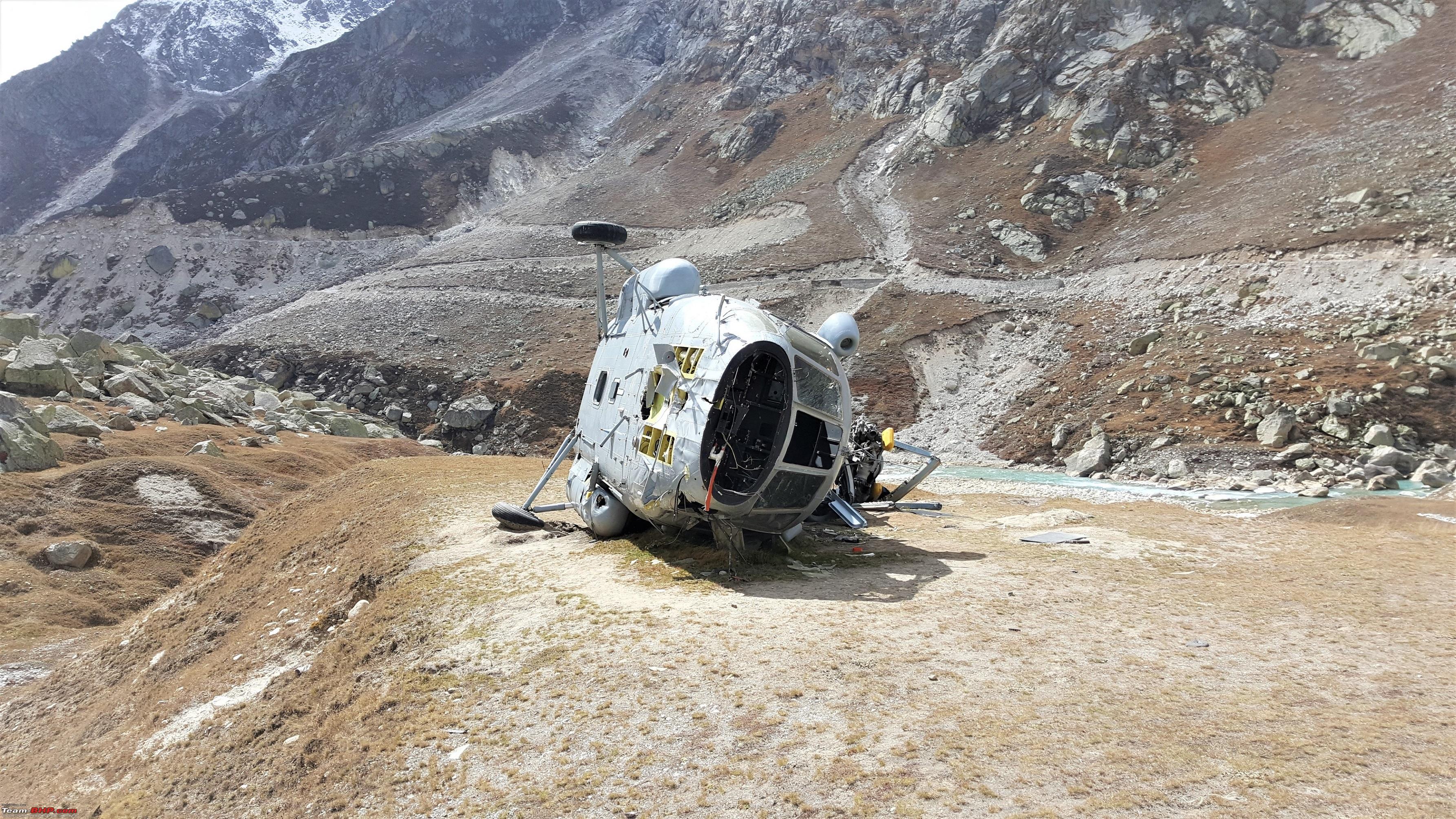
Mana, a name which has hung around like a proverbial Shangrila for quite some time. Some of the people have made it in reality, while some have claimed to have done it, but the claims need to be taken with a pinch of Salt. The route from the Mana Village up to the pass is treacherous to say the least. From starting at the Mana village, the first pitstop is the Ghastauli check post. This is the point most people make it to and from here onwards the details become sketchy and the pictures even sketchier as you are made to surrender your cameras and phones with the ITBP guys here at Ghastauli.
Further, before I evoke the reactions on posting of some of the pictures beyond Ghastauli, here on the forum, please note that the pictures shall be posted without any cross referencing geo points to make them unidentifiable to anyone who has not done that track. Further, this particular border is the most peaceful and sleepy of the lot and but still the pictures and narration shall have no reference to our fellow brethren in Green posted there.
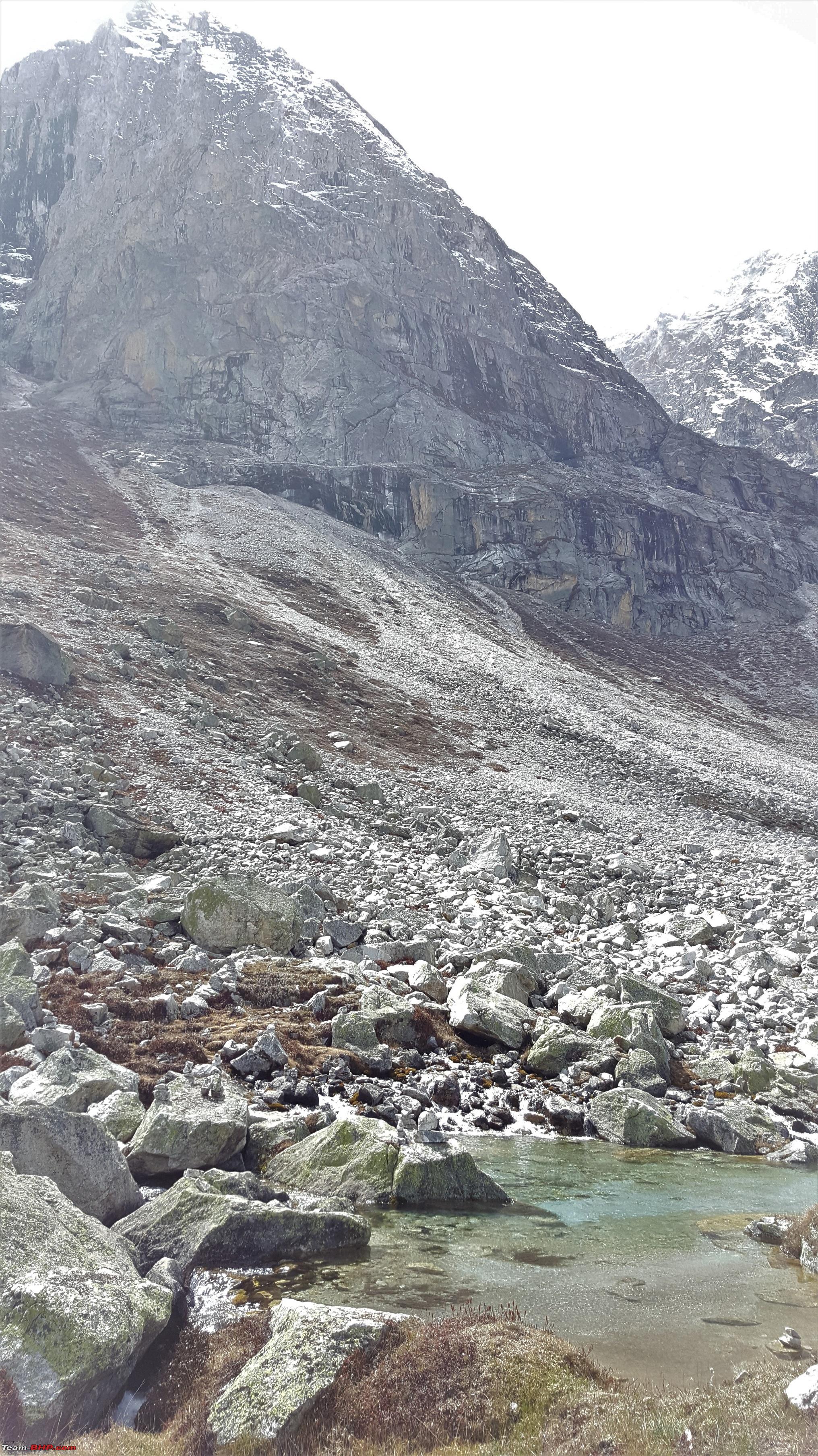
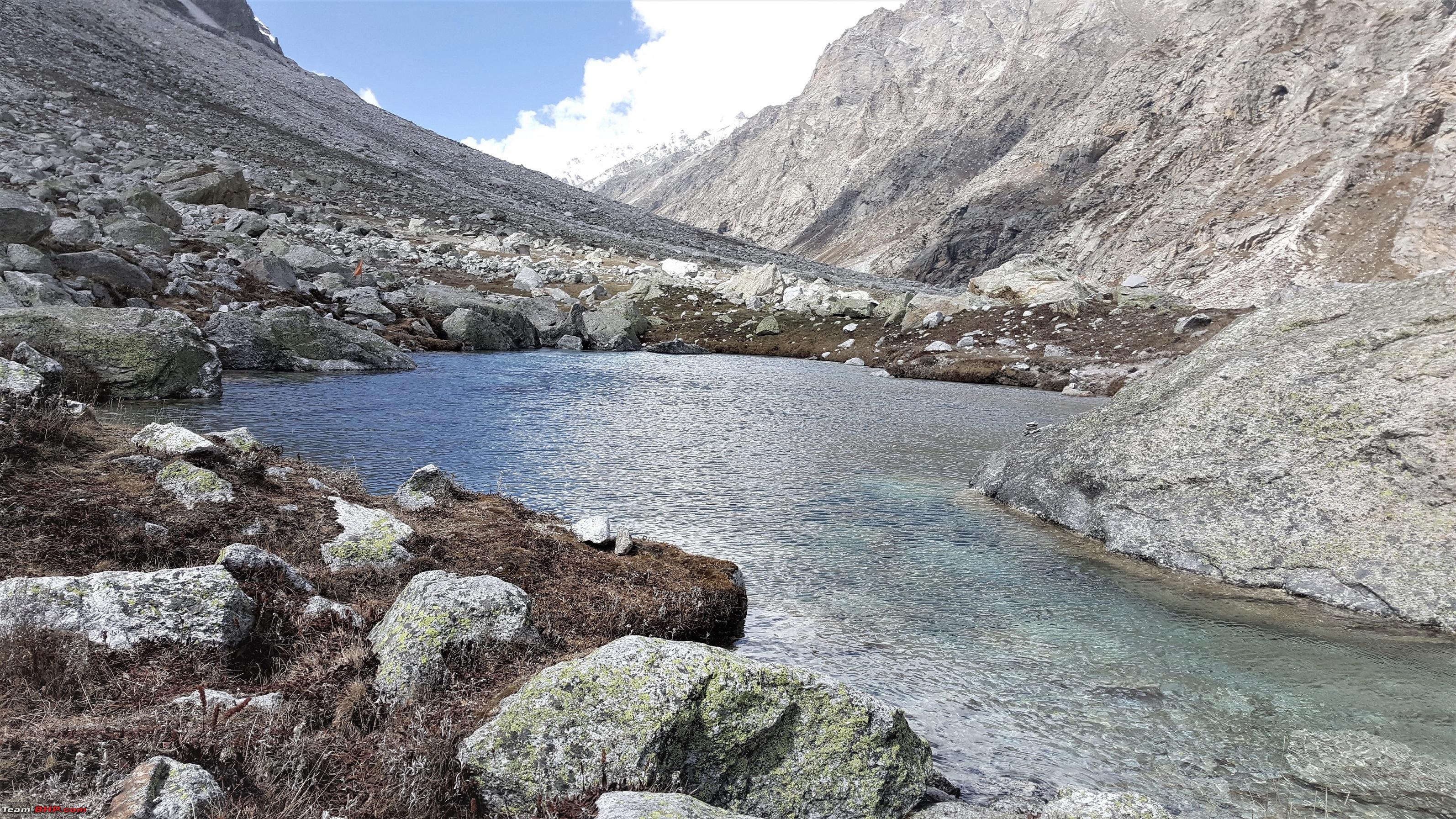
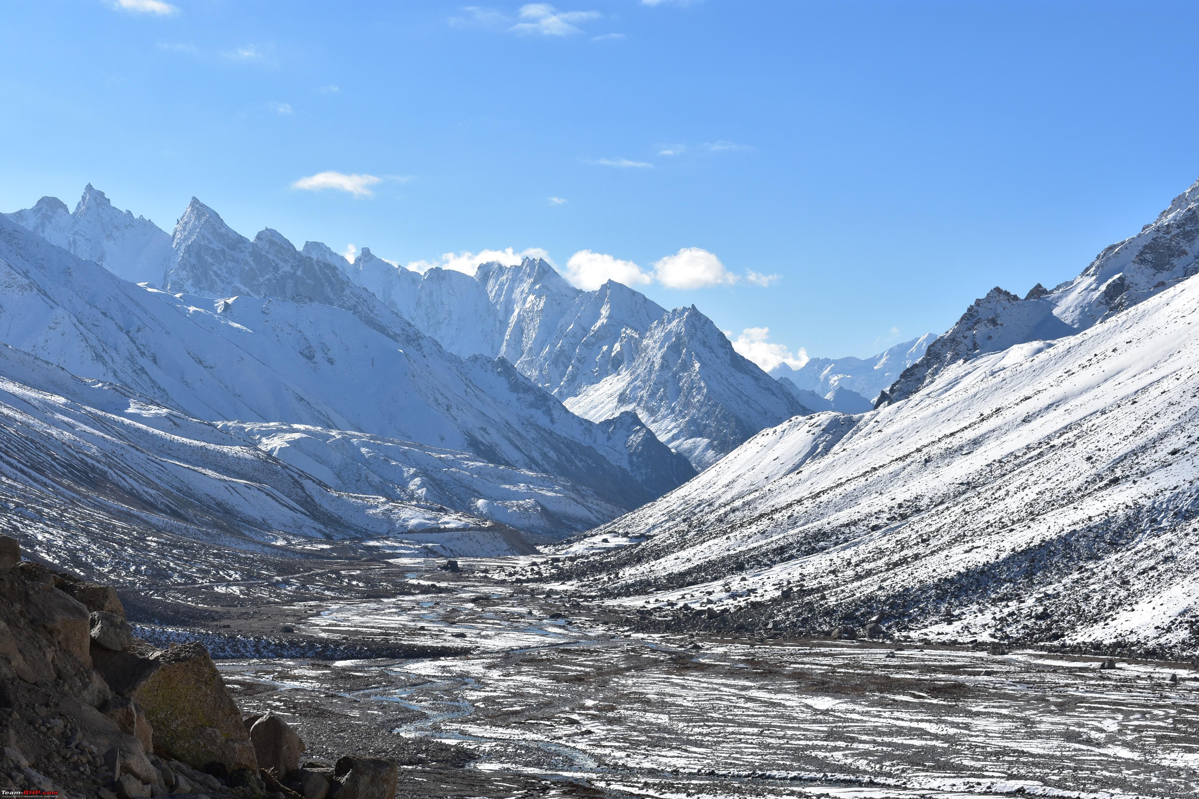
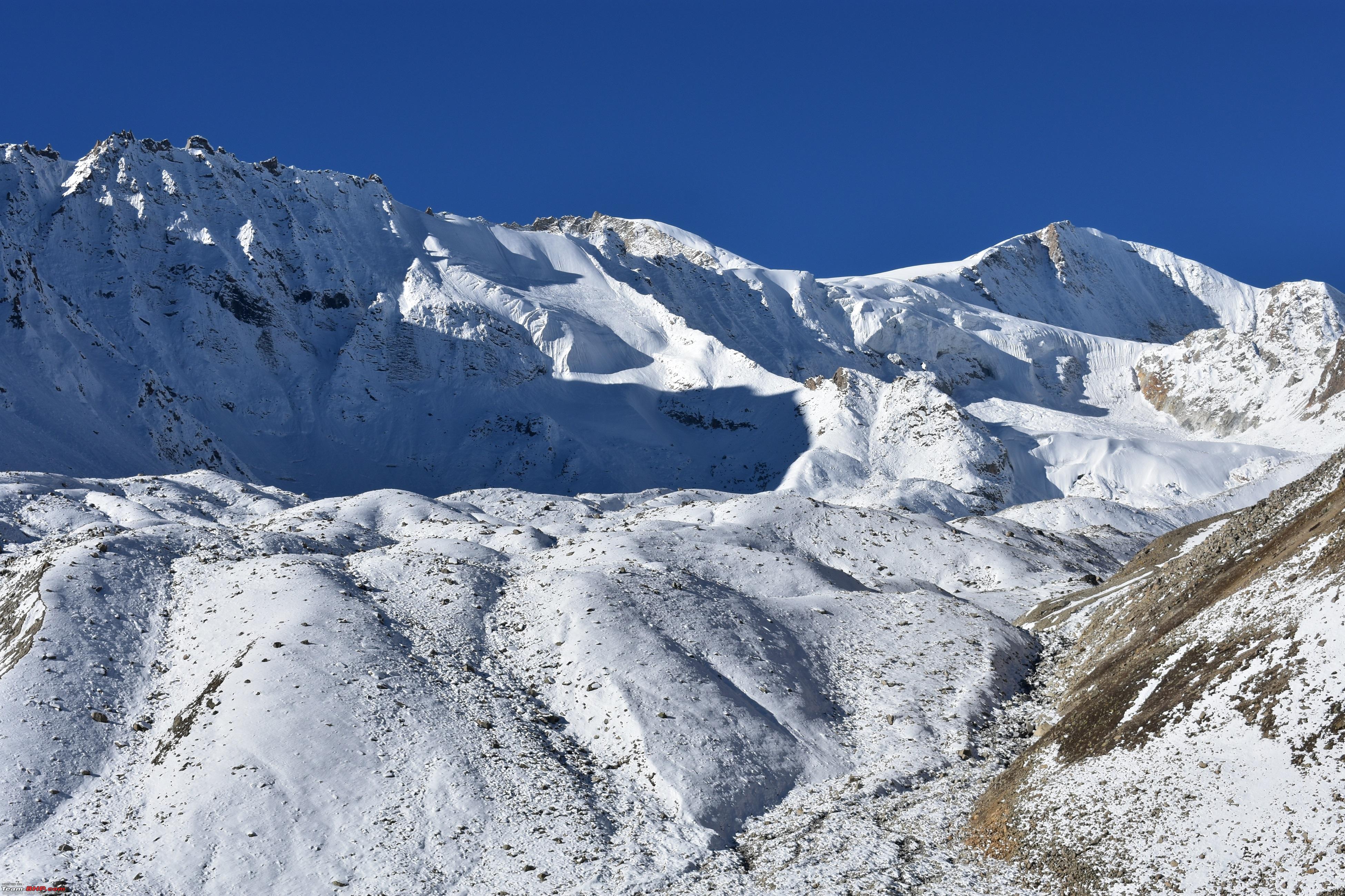
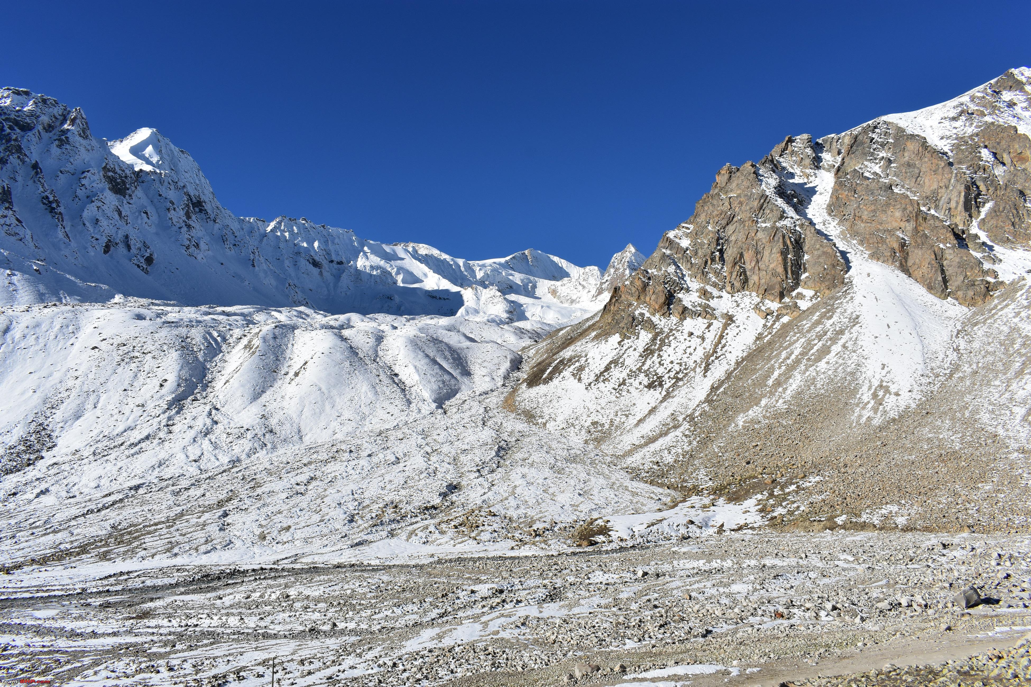
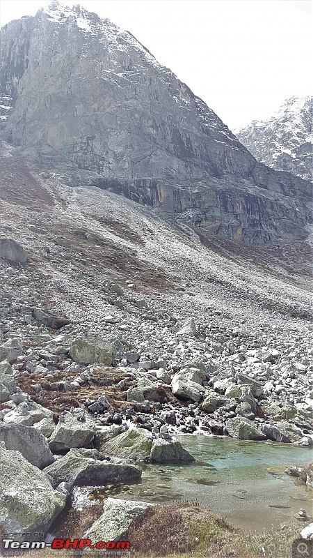
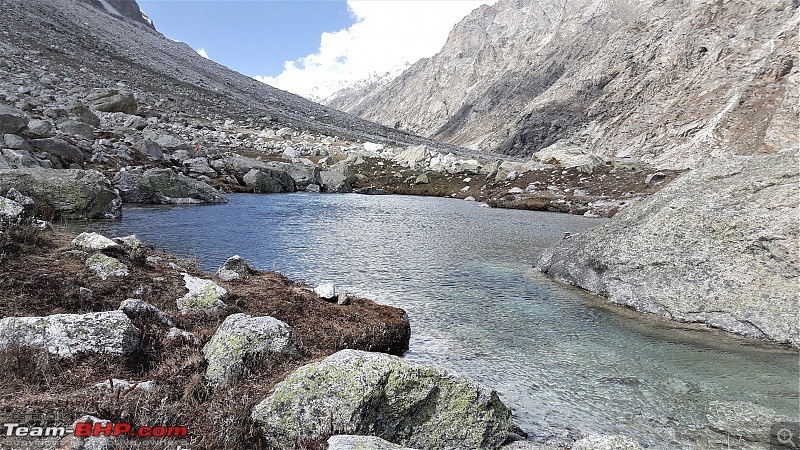
Now comes the moot question. Did I finally make it to the Pass? No, I could not because despite the best laid plans and the preparations, the nature had other plans. The road was snowed out and due to a broken down bulldozer, thereby causing one full day delay in clearing, we could only make it up to about 5 kms from the Pass. The elevation is crazy, the scenery spell binding. Now as to the logistics of it all:
1. For making it up the pass there is a holy trinity of permissions.
A. You apply to the DM office for the permissions. They recommend and forward it to the ITBP. Who in turn forward the same to the Army. Anyone of them on any given day can play spoilsport and your entire planning is doomed.
B. Ordinarily no permissions are given as the entire stretch passes through the Nanda Devi Bio Reserve, however, permissions till Ghastauli are more readily given, as from there goes the High Altitude Treks towards Kedarnath and Gomukh.
C. Even with all the permissions in hand, the movement beyond Ghastauli is controlled with the weather conditions prevalent beyond towards the Pass and 7 times out of 10 they are not conducive. Many a tales abound where after a lot of pleading and cajoling, many a bikers have been taken along in the back of the GREF truck as the bikes could not cross the Pagal Nallah.
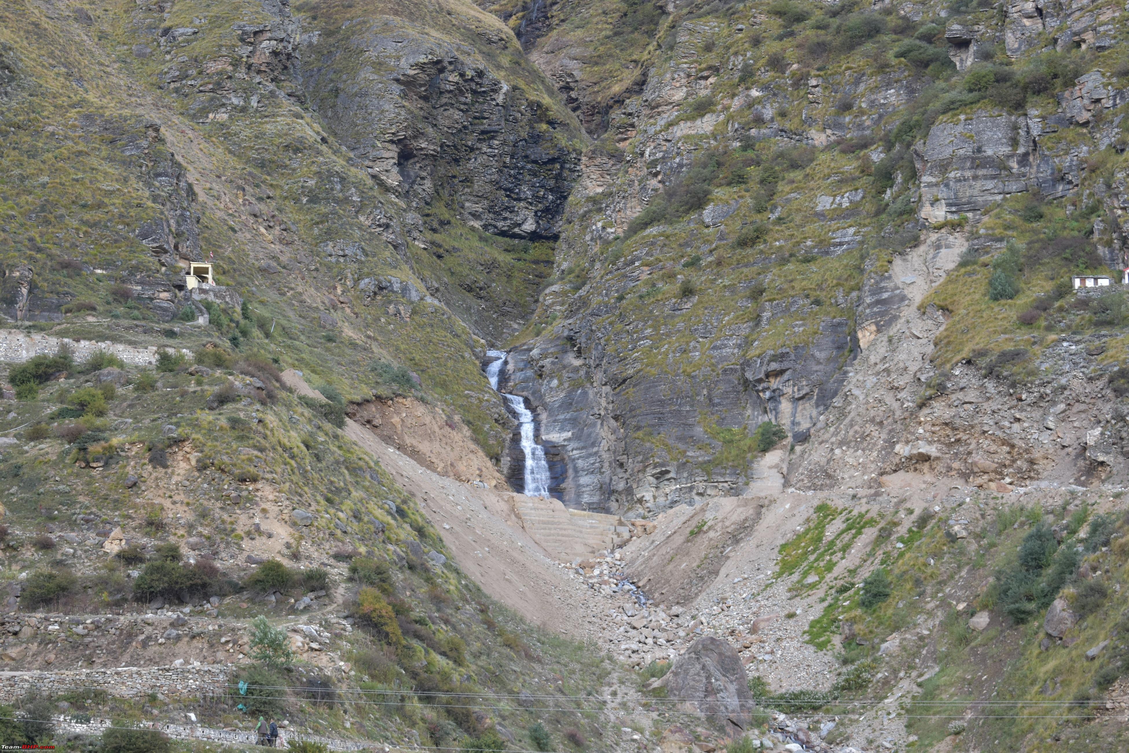
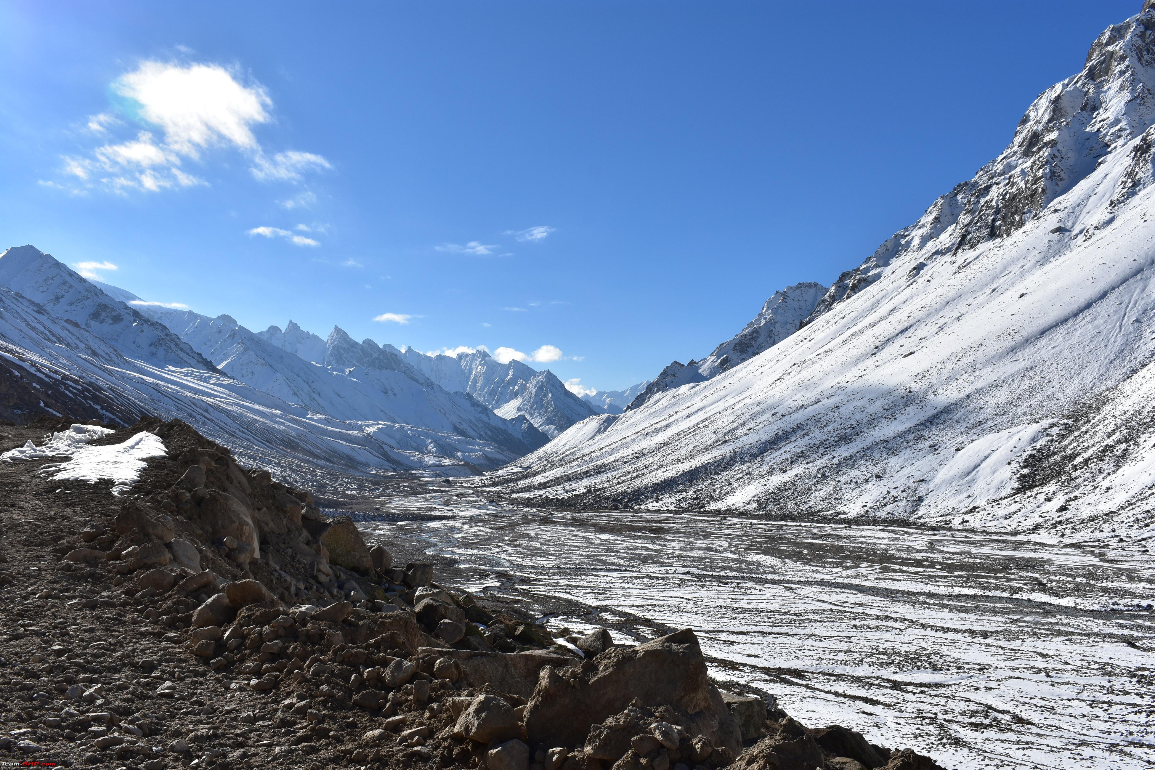
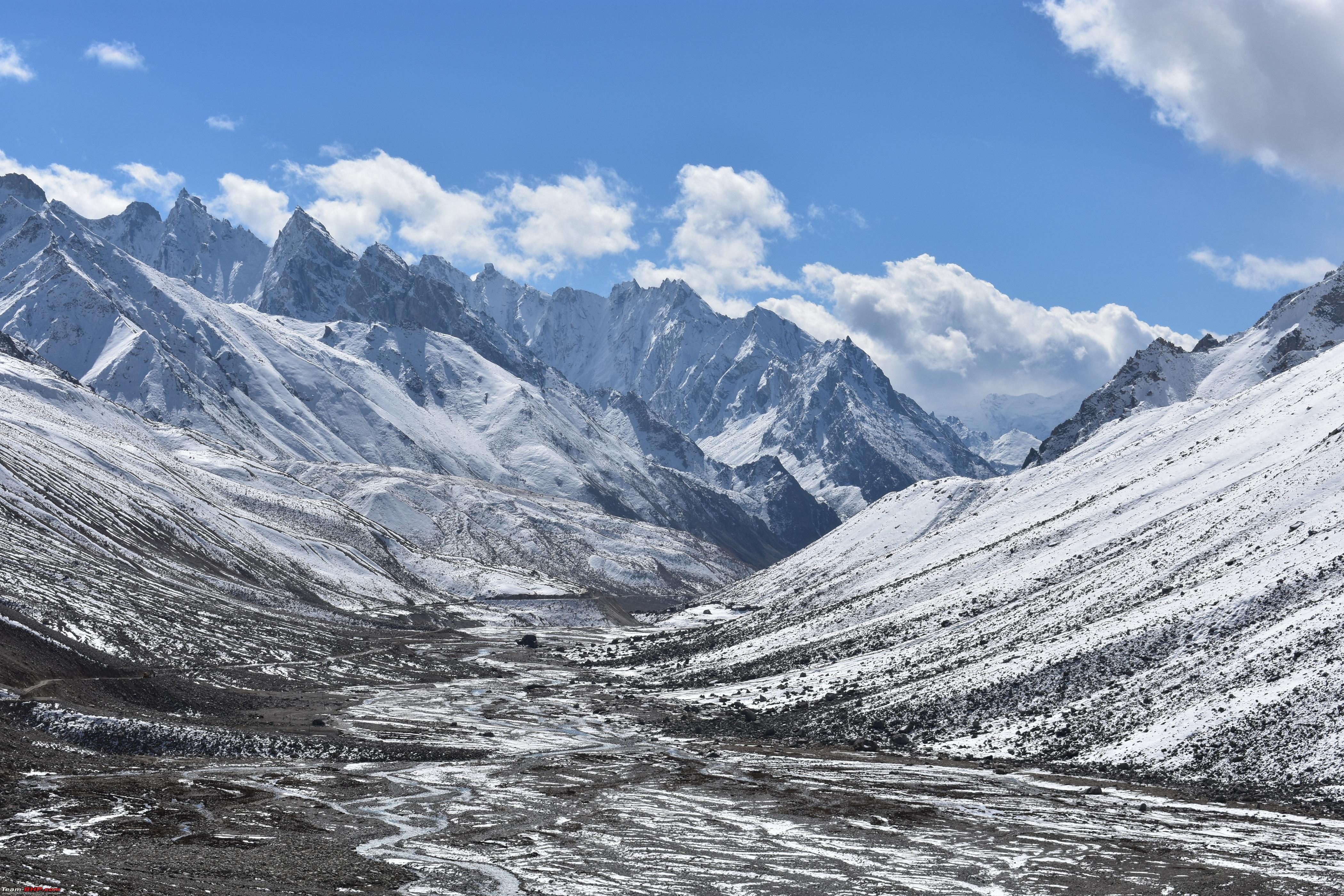
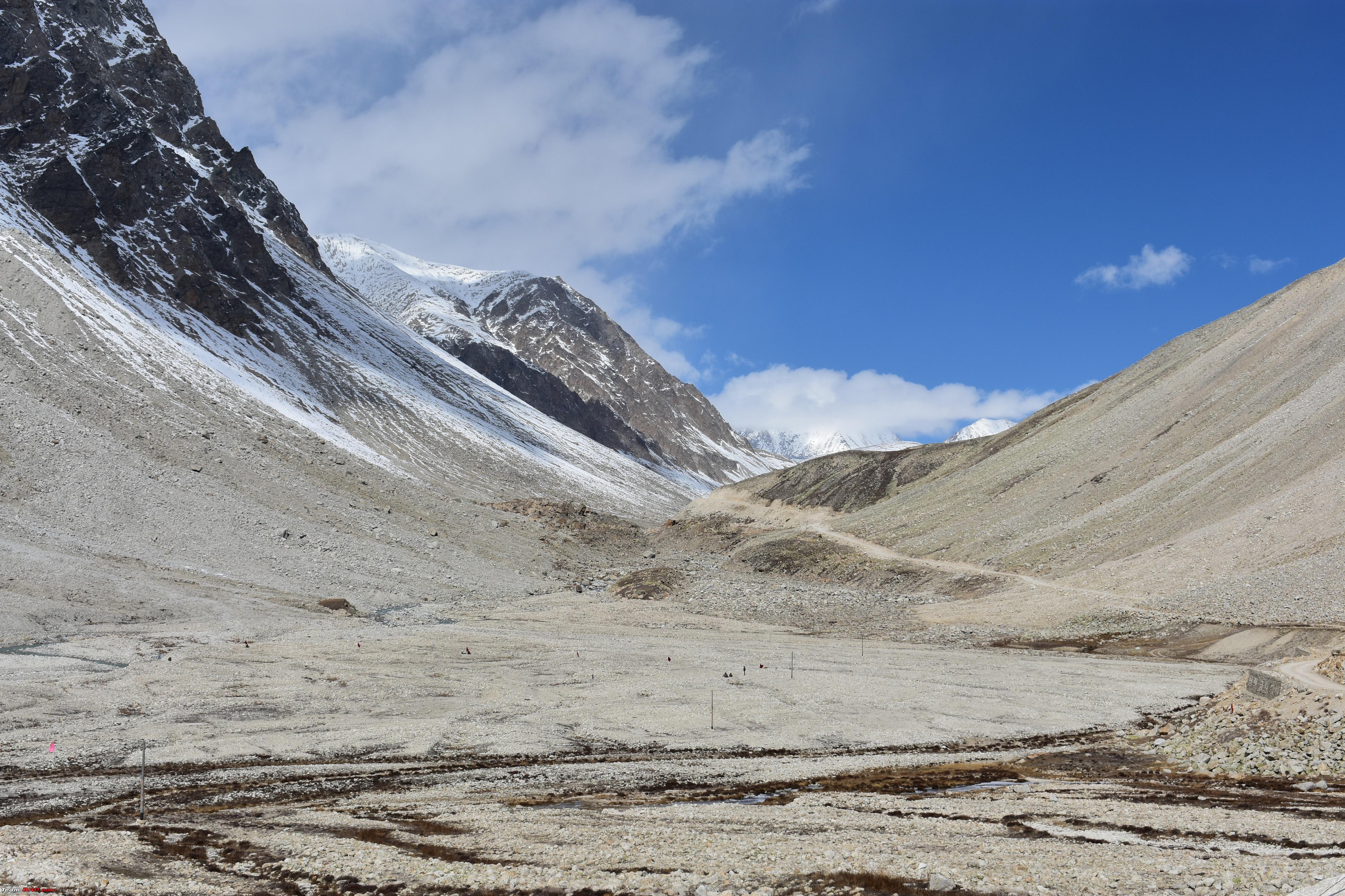
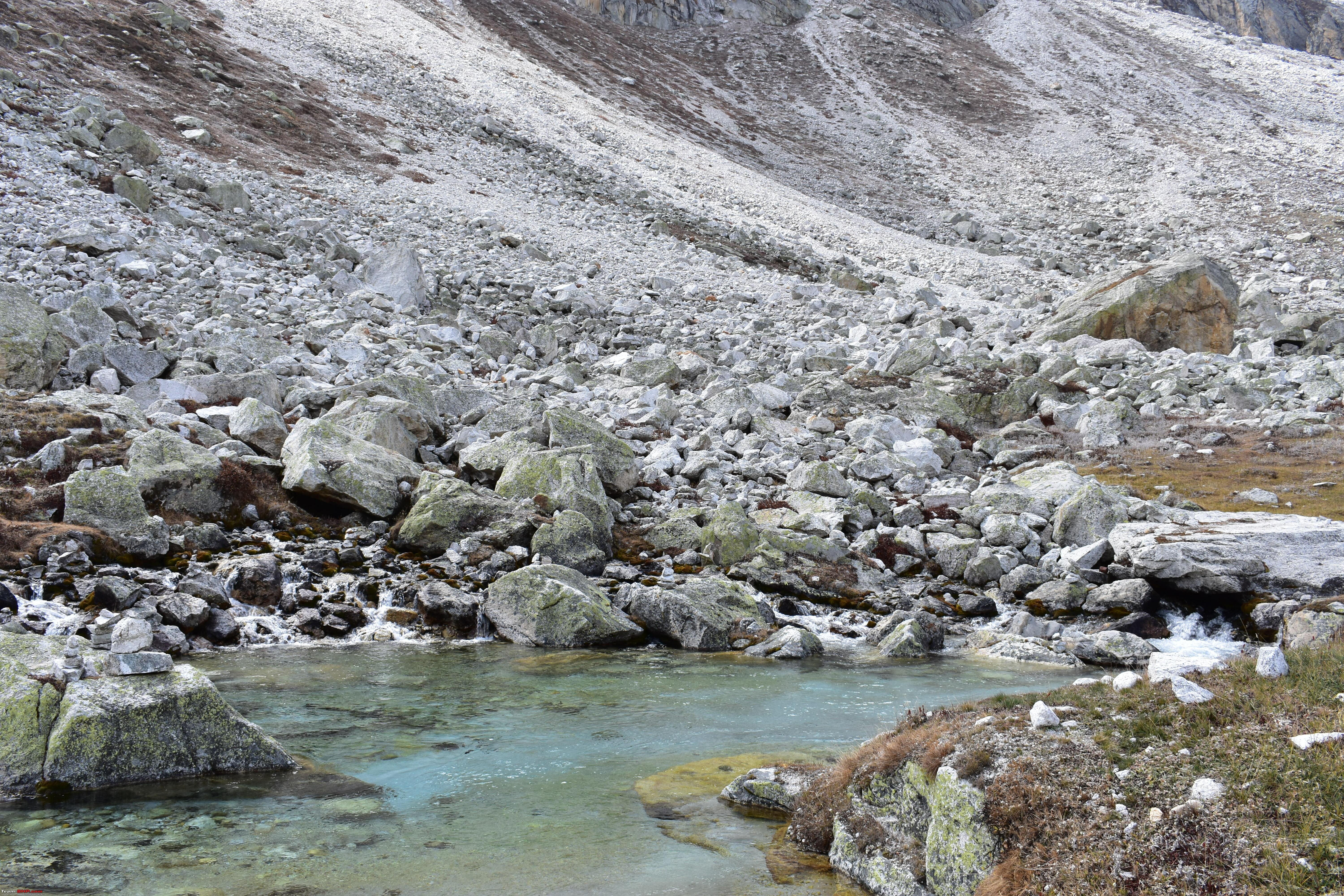
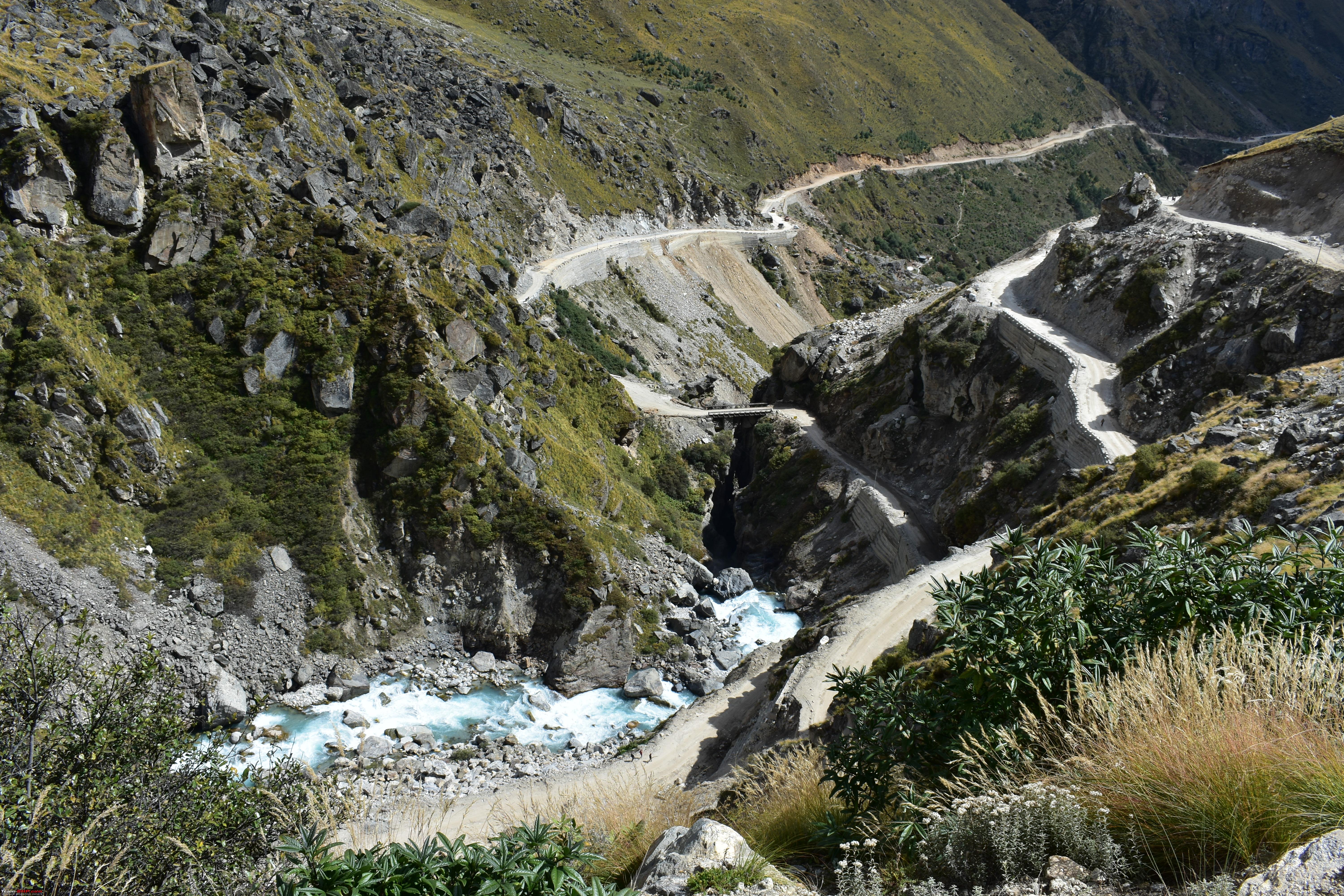
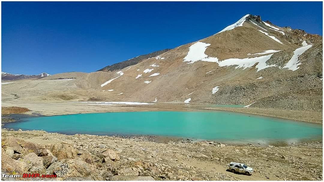
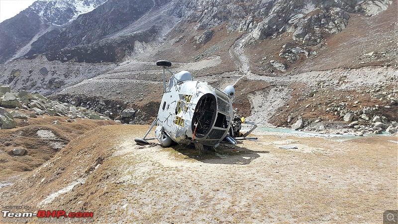
Now, with the above perspective in mind, I shall take you through the entire journey in a sequential manner. For the first post here are some of the customary teaser pictures:
Ever since I read Laluk's trip log to Mana pass, the pass had etched itself into the sub conscious. Then an opportunity presented itself to attempt the Mana Pass. The details were to reach Dehradun in the evening from Chandigarh and then next day with my younger brother and his family joining us, we would proceed to Badrinath. Aim one was to take the Parents to Badrinath and get them started on the 4 dham pilgrimage. They have already been to Puri, so it was strike two and this December plan is to take them to Dwarka.
Anyway, with the various threads tied up the journey was started from Chandigarh and went as follows:
Day 1:
Chandigarh 83834; 1730 hrs.
Naraingarh 83899;1825 hrs.
KalaAmb 83909; 1840 hrs.
Paonta Sahib 83964; 2055 hrs.
Dehradun 84018; 2200 hrs.
The road conditions are good with some bad and broken patches in between.
Day 2:
The real journey started from Dehradun with Mana as the target. Plan was to reach Joshimath for the night and next day start for Mana village. Have darshan at Badrinath temple during the evening and next day attempt the Mana pass. The roads beyond Rishikesh are in a mess with widening works going on. There are few stoppages due to landslides and road clearing works. The detailed log is as follows:
Dehradun 84018; 0750 hrs.
Doiwala 84042; 0840 hrs. About 20 mins were wasted crossing the Mohkampur Railway crossing. However, now the overbridge is functional and its no longer a bottleneck.
Rishikesh 84064; 0920 hrs. The broken roads and dusty driving conditions started and made driving a pain.
Shivpuri 84080; 0955. Stopped for Tea at a sleepy and useless place called Dalchini. Started back at 1030 and reached Kaudiala 84103 at 1125 hrs.
Devprayag 84133 at 1300 hrs. Included was 2 stoppages for about an hour for road clearing works.
Stopped for Lunch at Srinagar 84166 at 1440 hrs.Road conditions were acceptable from here on.
Rudraprayag 84201 at 1535 hrs.
Chamoli 84263 at 1810 hrs. Tanked up here as I was driving on the reserve for the last 20 odd kms.
Joshimath 84314 at 2000 hrs was going to be our pitstop for the day.
Day 3:
Joshimath 84314 at 0900 hrs to reach the Mana Village 84361 at 1115 hrs.
With the sad news coming in that the area is presently restricted to only a certain class of people and therefore, it wont be possible to take the families upto Mana, alternate arrangements were made and the rest of the day was spent visiting the Mana village and Badrinath temple.
Day 4:
Me and brother left early for a dash to Mana Pass, but had to return back 5 kms short of the pass as the road was still snowed out and the dozer was yet to clear the stretch. It took us a better part of the day to return back to Mana and in the afternoon, we left for Rudraprayag at 1425 hrs.
Joshimath 84414 at 1605 hrs.
Helam 84427 at 1640 hrs.
Pipalkoti 84448 at 1800 hrs
Chamoli 84460 at 1830 hrs.
Nandprayag 84475 at 1900 hrs.
Karanprayag 84494 at 1930 hrs.
Gauchar 84504 at 2000 hrs.
Finally, Rudraprayag 84527 at 2035 hrs.
Day 5:
The plan was to reach Chandigarh today and we left at around 0840 hrs after a heavy breakfast.
Srinagar 84560 at 0940 hrs.
Devprayag 84597 at 1055 hrs.
Shivpuri 84654 at 1300 hrs. Tanked up here as there is no fuel bunk between Devprayag and Shivpuri. I had not anticipated it and the GV had the reserve light on since Devprayag. Low FE coupled with slow moving and stop go traffic gave us some very anxious moments.
We reached Rishikesh 84664 at 1315 hrs and missed the byepass to get stuck in the horrific traffic inside.
Reached Dehradun 84708 at 1430 and then the twist in the tale happened. My brothers scorpio had suffered a puncture at Rishikesh Byepass and I was getting some horrific grinding noise from my front left tyre since Devprayag.
While the parents were having tea, me and brother decided to investigate the noise and took the tyre off. To our horror we realised that one of the brake shoe was completely devoid of the pad and the metal was grinding against the rotor. Decided to replace the pads and went looking into the town but it being a Sunday, we failed to find the desired part.
Called up my source at Chandigarh who fortunately had them in stock. Got my father's driver to procure the part and bring it over. He reached around 0800 hrs the next morning and it took me and my brother about 2 hours to replace the pads, with the majority of the time spent in trying to figure out on how to push back the brake pistons without the brake tool. Finally, decided to de pressurise the brake lines and then push back the pistons. Bled the front two brake lines and mounted the pads. Checked that everything was working perfectly, started back for Chandigarh at around 1100 hrs and reached home by 1400 hrs.
Now some interesting facts about all those who want to do Mana pass.
1. Not doable easily as it involves a complex system of permissions.
a) It being a reserve area, first of all you need to show that it is some kind of an expedition and then apply to the SDM Joshimath for the permission. Individual permissions are not granted normally.
b) Once SDM permits then the same is forwarded to the Army through the ITBP, which then allows the movement of vehicles beyond Mana Village.
2. The road till Ghastoli (13652 ft) from Mana village about 20 kms is doable by most vehicles with a high GC but at some places may need to engage 4X4.
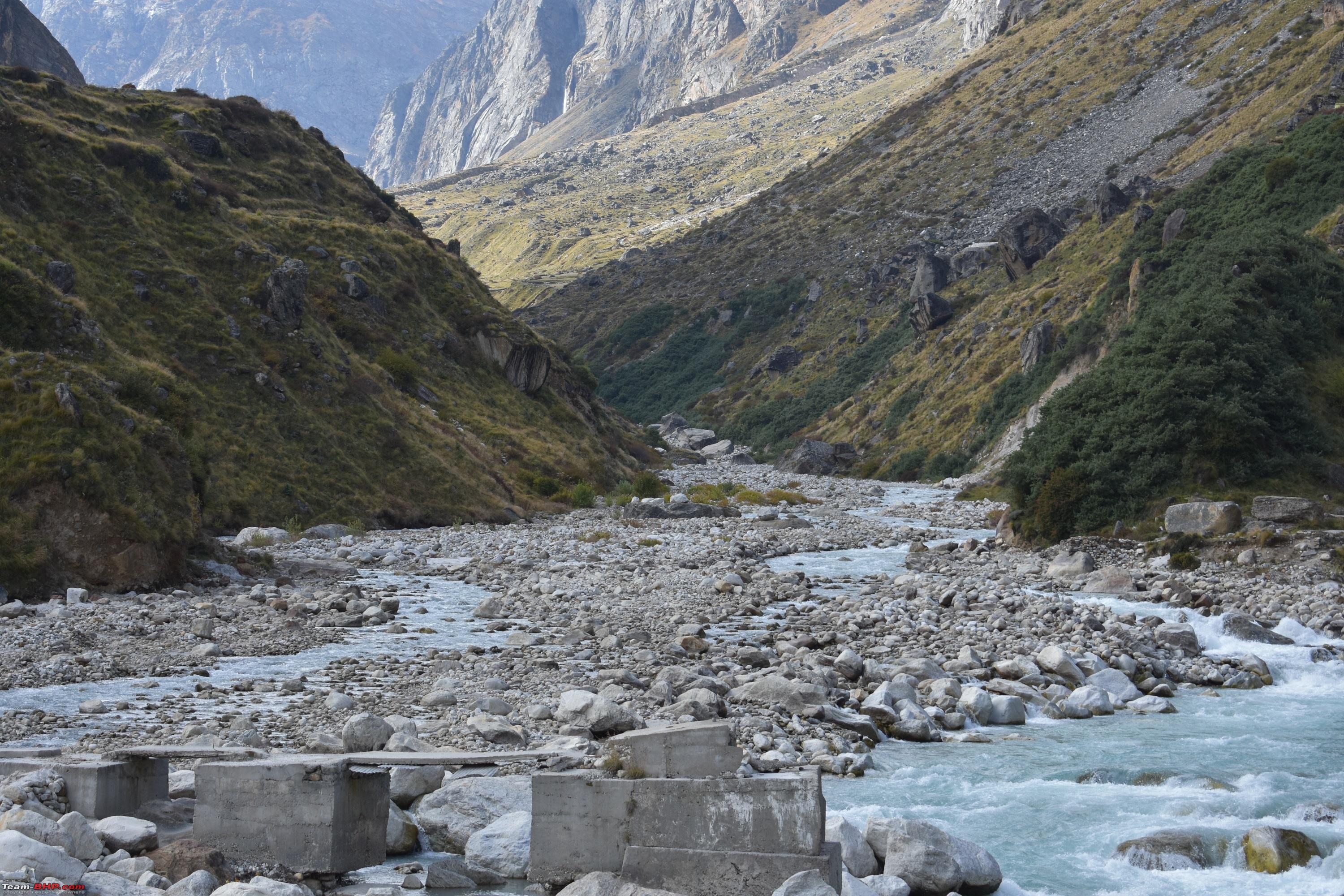
3. Beyond Ghastoli till Rattakona (15744 ft), about 15 kms, is an OP track meant solely for Military Grade Vehicles. It is tough, harsh and unforgiving terrain. The High Altitude coupled with Pagal Nullah makes it the most demanding stretch of the route. Pagal Nullah makes it impossible at times for any vehicle except a 2.5 tonner to cross. Most of the bikers cross this stretch by paying money to GREF guys to ferry the bikes across.
4. At TriJunction (17300 ft) the road to the Pass moves right onwards in the valley from where the Pass is then about 8 kms. This last stretch is once again not doable by a normal vehicle.
5. Preferred mode of travel is a bike as it is easy to manoeuvre in that terrain of huge rocks and loose soil however, if the glacial melt streams are raging, there is no way a bike will see you across.
The area being sensitive, I am not posting any major details but will be happy to answer any specific queries that you may have on the route details.
Ghastoli is the place where the trek towards Harsil on the Gangotri Axis separates from the Mana Pass trek/route.


 12th October 2018, 20:09

 (15)
Thanks
(15)
Thanks