| |||||||

| Search Forums |
| Advanced Search |
| Go to Page... |
 |
| Search this Thread |  35,629 views |
 7th January 2018, 22:51
| #1 |
| BHPian | Hyderabad to Arunachal, Assam & Meghalaya in a Duster AWD Total distance – 6858 kms Total time behind wheels – 172 hours Total days -18 Total States one way - TS, AP, OR, WB, AS ,AR, ML - 7 Total mountain passes - 2 , Sela Pass, BumLa pass Places halted - Kolkata - Siliguri - Mangaldoi - Dirang - Tawang - Bhalukpong - Kaziranga - Shillong -Guwahati Almost 40% of the vacation kept me occupied behind the wheel … what more can I ask for. 7 States so this is going to be a long one ... The Duster would be drumming the snow capped Himalayas of North East once again. A decree from my previous story- The more you see the Himalayas the more you feel you have explored less. The daily life of all city dwellers is pretty much the same and for us it was getting mundane to say the least. We try to be on the highways on long weekends. However the proposal of driving to Himalayas never gets old. The trip was planned to cover few vital needs that would revive us for the next 11 months or so. My 3 year old is not new to these wild long drives, he has done Asansol to Hyderabad at the age of 6 months with me. But now he was slowly starting to embrace the beauty that is life. There are few spots in Hyderabad where artificial snow is generated but we, as new parents attempting to do things differently decided that he should see snow in purest form. We researched about few places in the entire Himalayan range and concluded Tawang. The ambiguity that lay ahead of us was in the form of Sela pass. Fellow Bhpian Danush Menon and his beautiful narration of Tawang just an year ago was enough to boost the confidence. During the ownership of the Duster AWD I had tried few terrains and I was slowly learning to grasp it’s abilities and limitations. The stock MRFs had enough bite in them and ASC confirmed 10k-15k more however I had seen a 80bhp 2WD Duster with Maxxis Bravo 771 and to keep things in perspective decided to change the shoes. Shoes worthy of taking on the terrain. The Perks of driving all night to see the first rays of Sun .  One of the best part of road trip vacation is the planning phase. Some of the research and knowledge gain from fellow travelers is unparalleled. People sharing their familiarity with the terrain and the data about places are readily available and it makes things easy and baffling at the same time. Processing the information received is the most critical part of the journey. My better half takes equal if not more interest in the travel planning phase. Her knowledge, air miles and points comes in very handy while booking hotels. During the planning phase I was introduced to some bikers based out of North East and few travelers. Folks used the word ‘bro’ very often in their conversation and they really mean it. The whole experience before the actual trip holds equal value contributing to the entire experience called road trip vacation. The Reason 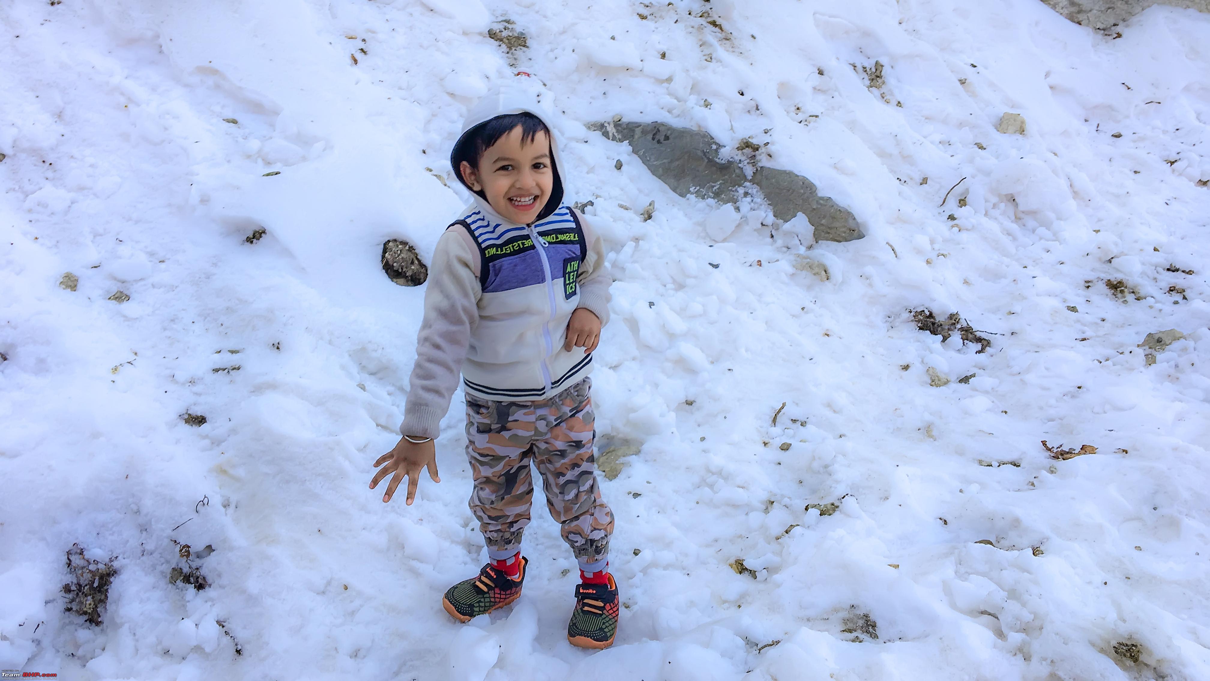 Finally after a lot of debate and research we made a rough plan of the route and decided to start executing it from 16th December 2017. The route and planning involved night drives on flat lands and follow the Sun on the hills. What Google says and what actually happens are somewhat different from that of flat lands. On flat lands you can dwindle the time what Google says. On the hills sticking to the numbers means you are doing a good job. To top that up if you miss a single turn 18minutes to a destination can become 4 hours. I found Google maps very helpful on the hills with offline maps. Also if there is no internet connection I was able to search for a destination and it was able to suggest routes. Backup GPS was in the form of Map my India in the HU which we used only to check the altitude. That being said it’s always suggested to consult the locals and they are very agreeable. The Map 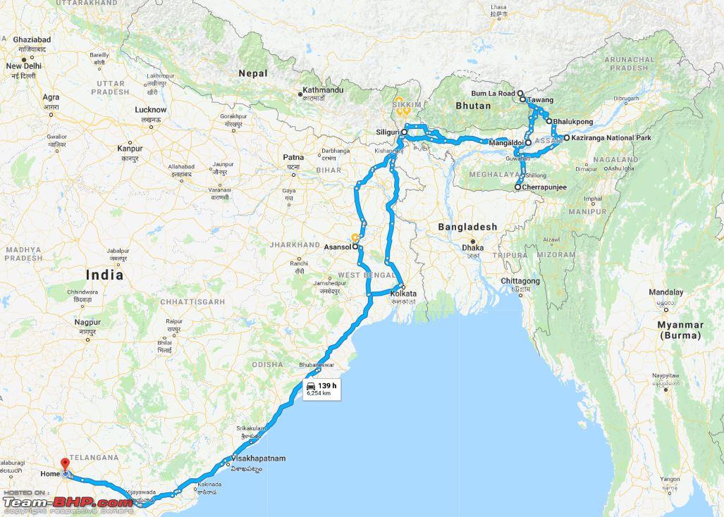 Day -1 ( Hyderabad – Kolkata ) Total time 22 hours. Road conditions were perfect, even the Rajamundry stretch has been fixed. It was a nonstop drive except for few short breaks. I had to stop by Chilka lake as a habitual rule, besides a 50kmph signal. I have been doing this since the day I started doing Hyderabad- West Bengal, moreover you get a chance to embrace nature.  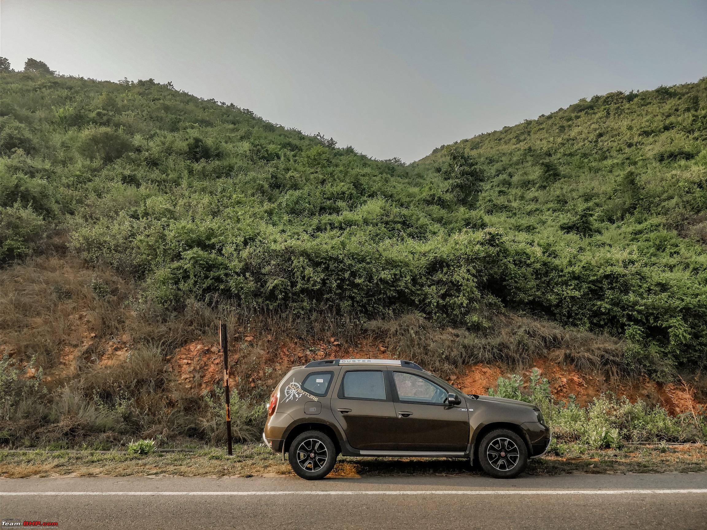 Route used: The usual, one of the best long stretches. Rajamundry patch is ready and exceptionally well lit.  Before entering Vizag 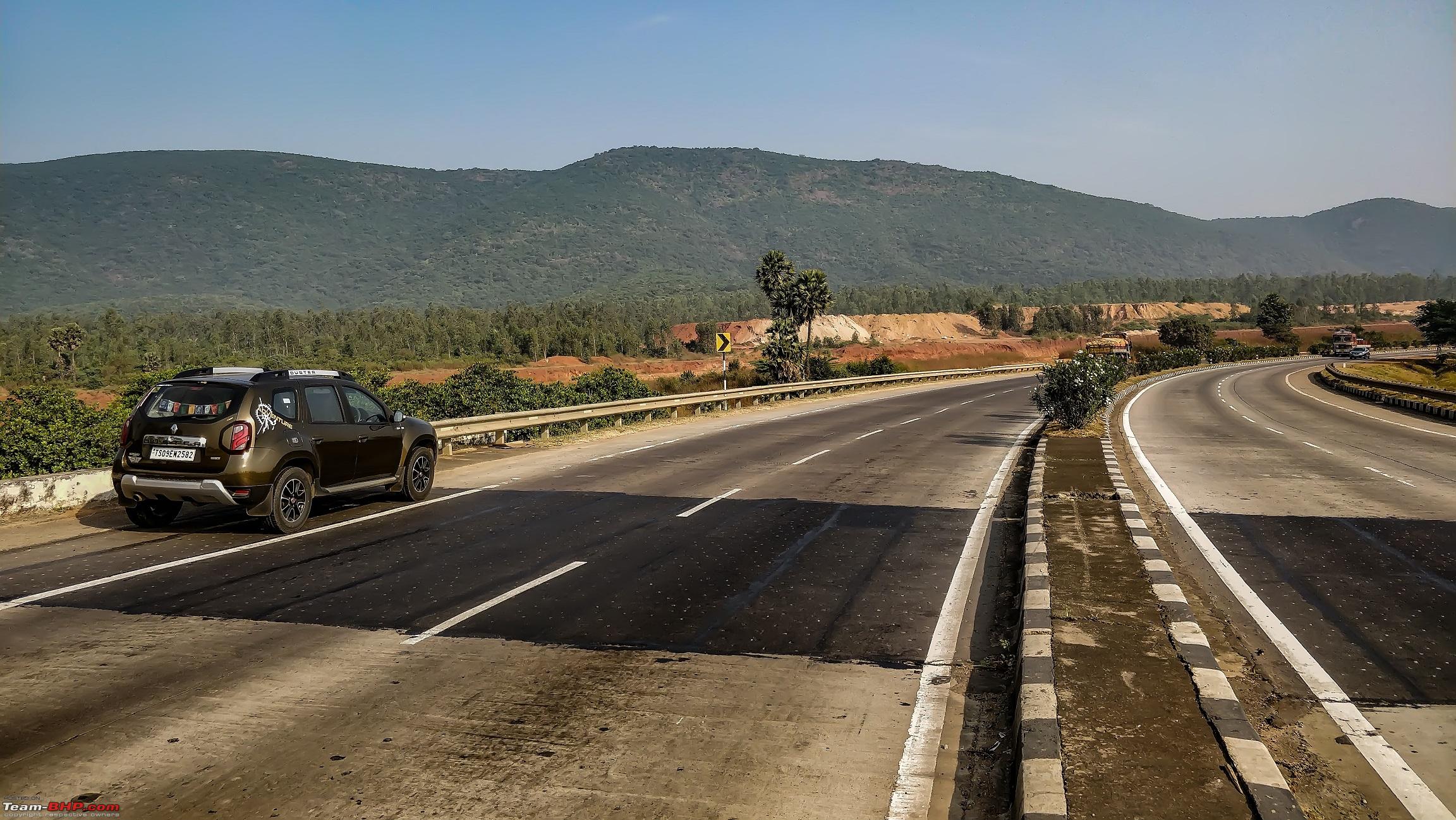 Scenic stretch before entering Vizag 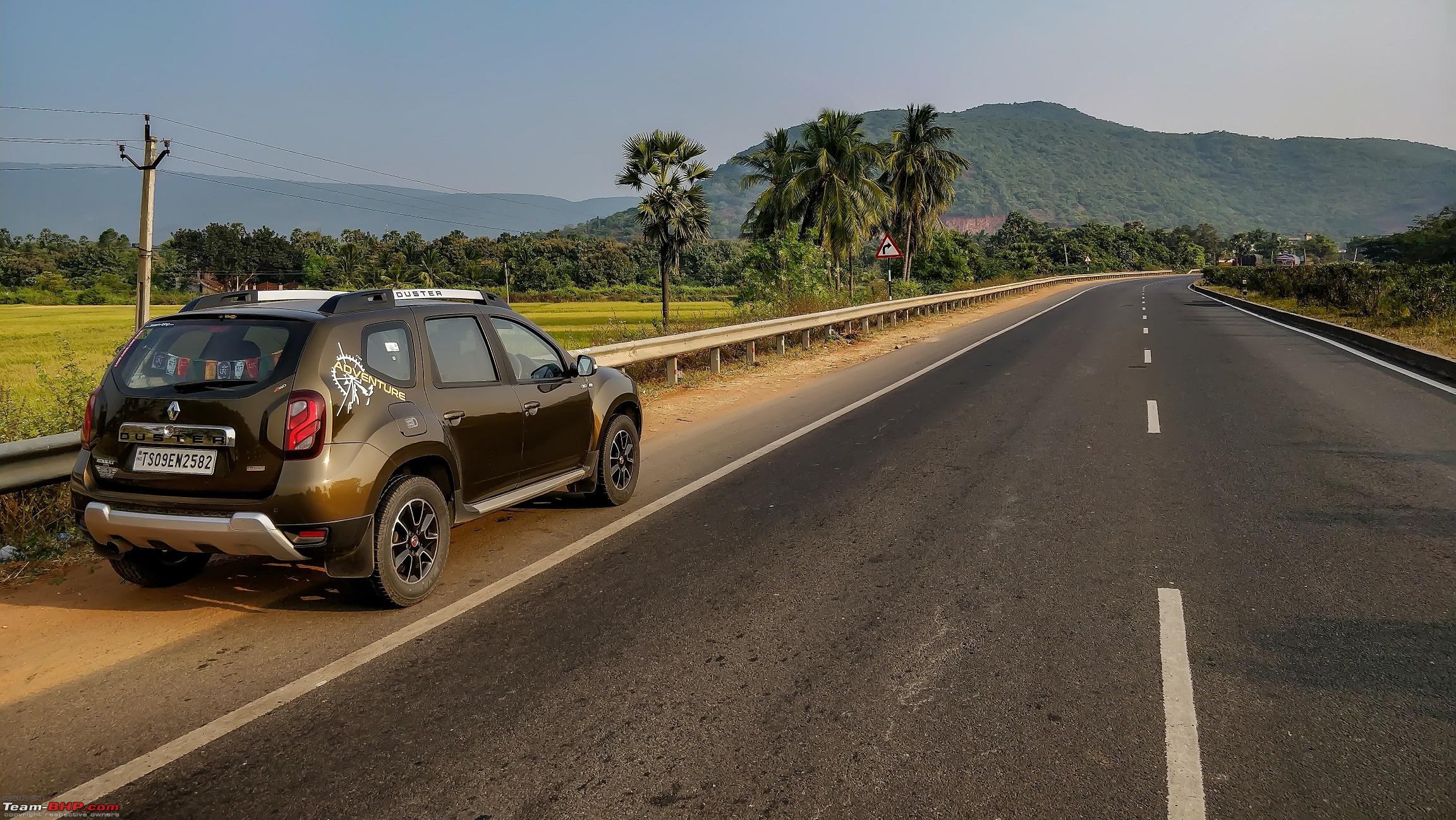 Been some time we have traveled in a train 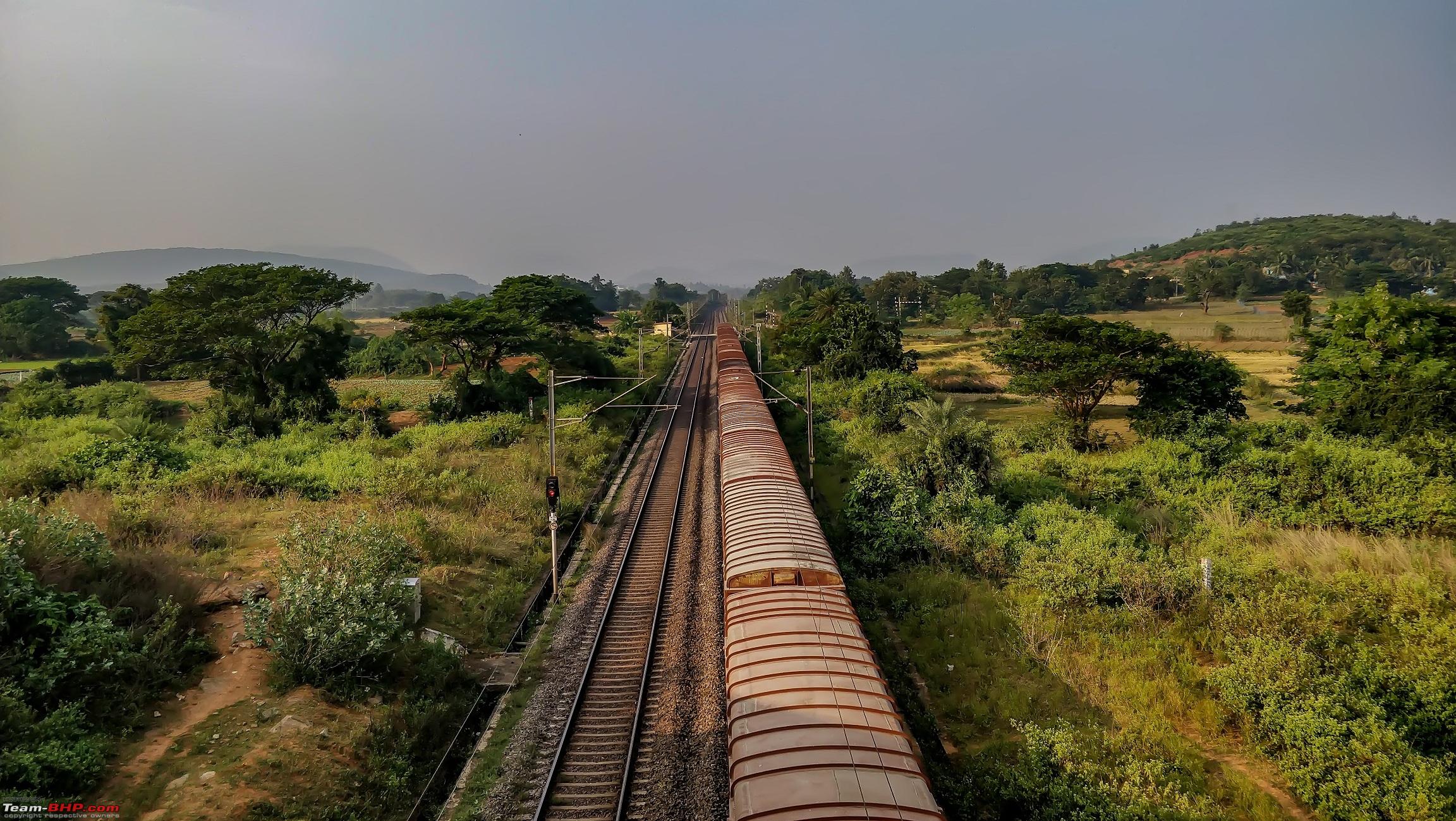 The authorities allowed me to check few mathematical numbers, which were astonishingly high while returning, more on that later. 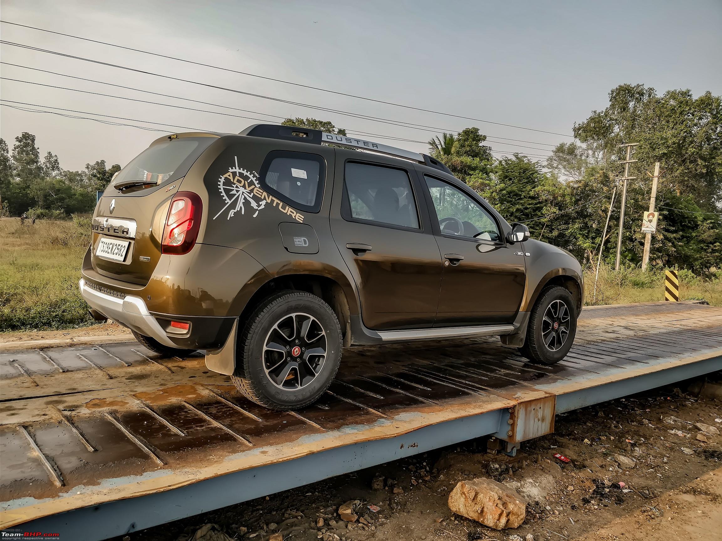 Random shots before the Sun set 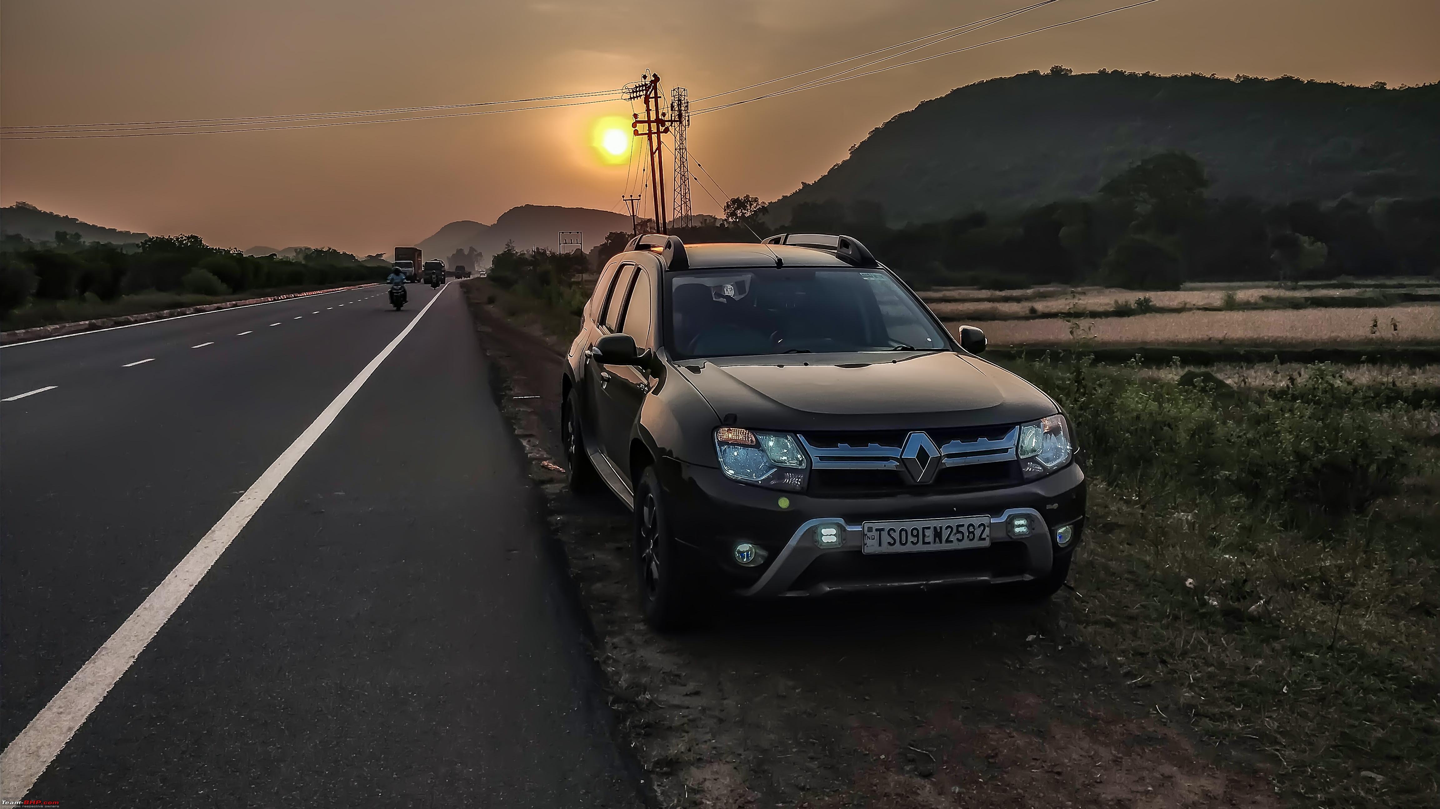 And then I realized that the shadow does look like that of Bat Man 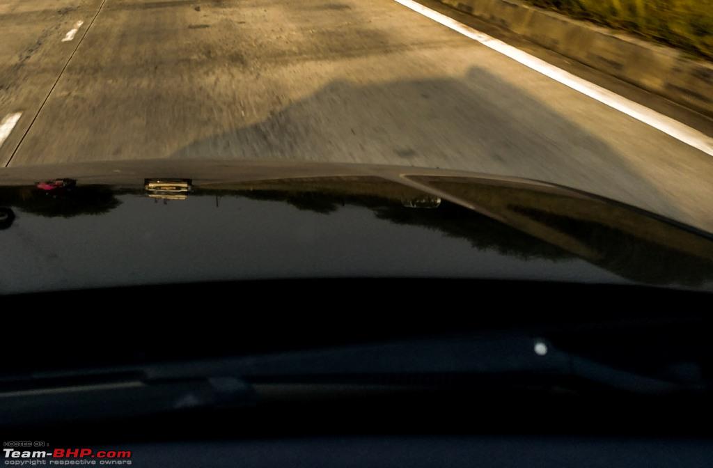 Still there were some kilometers left we had to munch  Last edited by ARAY : 13th January 2018 at 23:10. |

|  (27)
Thanks (27)
Thanks
|
| The following 27 BHPians Thank ARAY for this useful post: | agspins, arun_josie, atul.ktm, BlackPearl, darklord, gmhossain, Grand Drive, GTO, haisaikat, itwasntme, JoseVijay, kbishwa, Klub Class, mh09ad5578, procrj, Samba, sandx, sayakc, SDP, Shanksta, SmartCat, smuniswami, sparky@home, surjaonwheelz, Sutripta, tazmaan, TOINGPOING |
| |
|
7th January 2018, 23:39
| #2 |
| BHPian | re: Hyderabad to Arunachal, Assam & Meghalaya in a Duster AWD Since we were staying at Kolkata for a day or two, I decided to trip to a nearby beach, Bakkhali. Also I was told that the Duster would get an opportunity to sail over a small river separating two deltas. The very thought of sailing in a duster on a boat was adequate and who does not like a vacation in a vacation. Route: The road is good but slender and almost single lane with shopkeepers occupying a major portion. Start very early to shun traffic. There are several market areas which can become a bottleneck. If you are returning on the same day start late for the same reason. 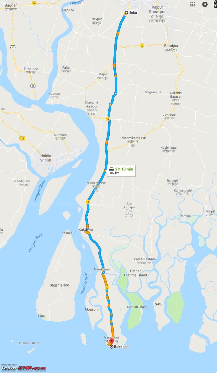 Driving up on the boat is easy. Driving to the harbor is the tough part with huge lorries parked all over. Sometimes you do realize that a small car with AWD can do magic everywhere. Say a Tata Nano with AWD and a relatively peppy engine. The arrangement 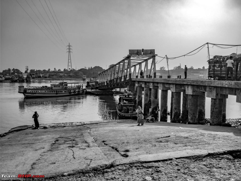 Boarding needs to be done in reverse, de-boarding is normal. 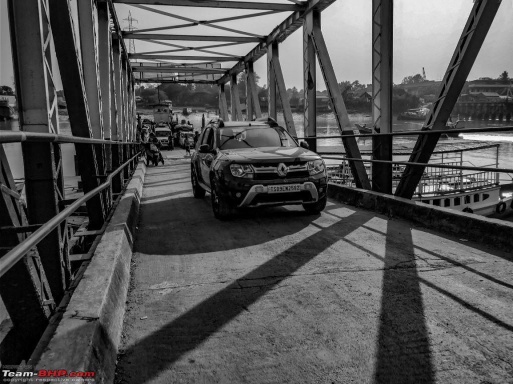 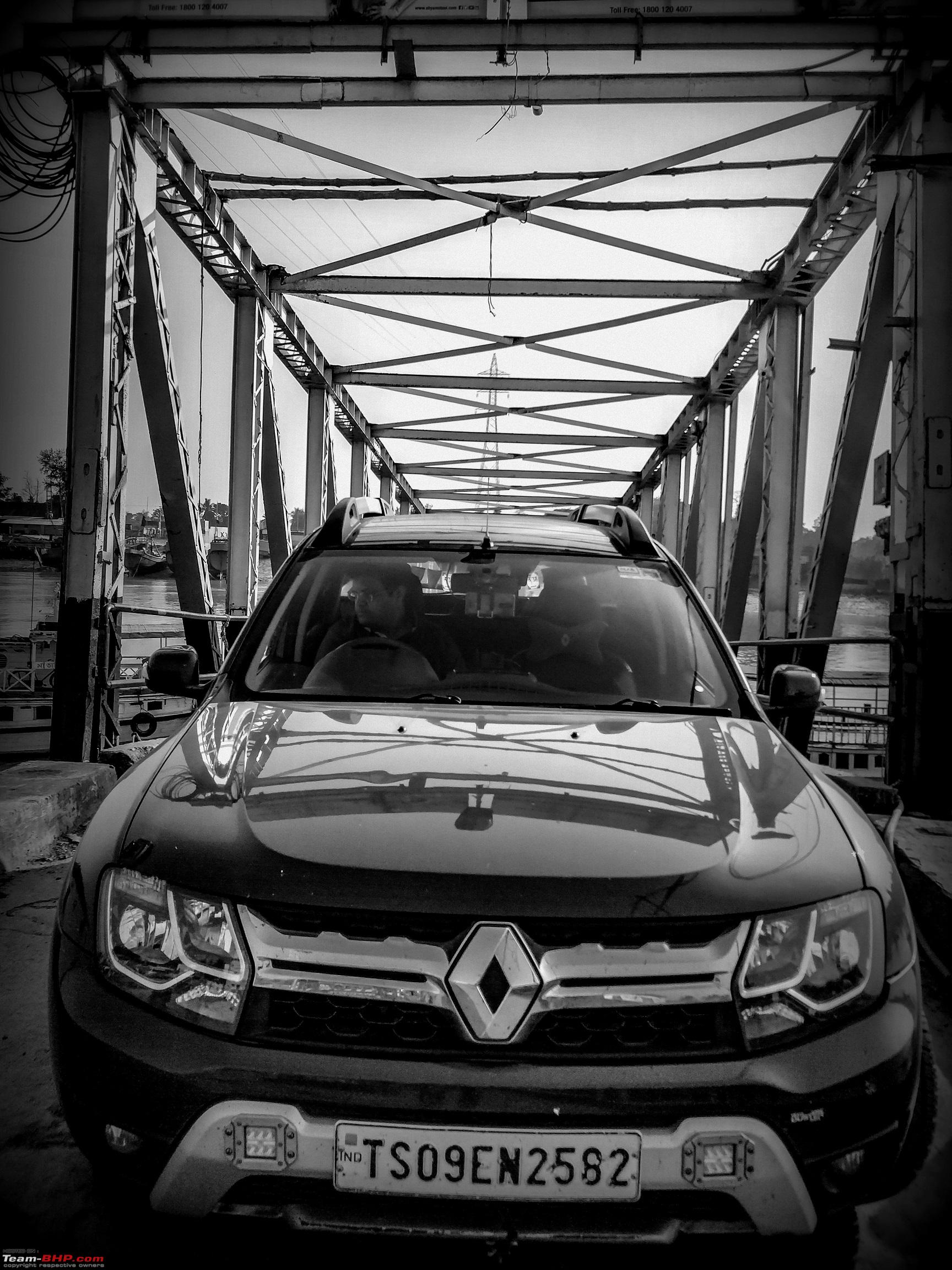 There are a lot of big and small restaurants and lodges all around the place. Decided to try the local delicacies and was mind blown with the taste and the price. 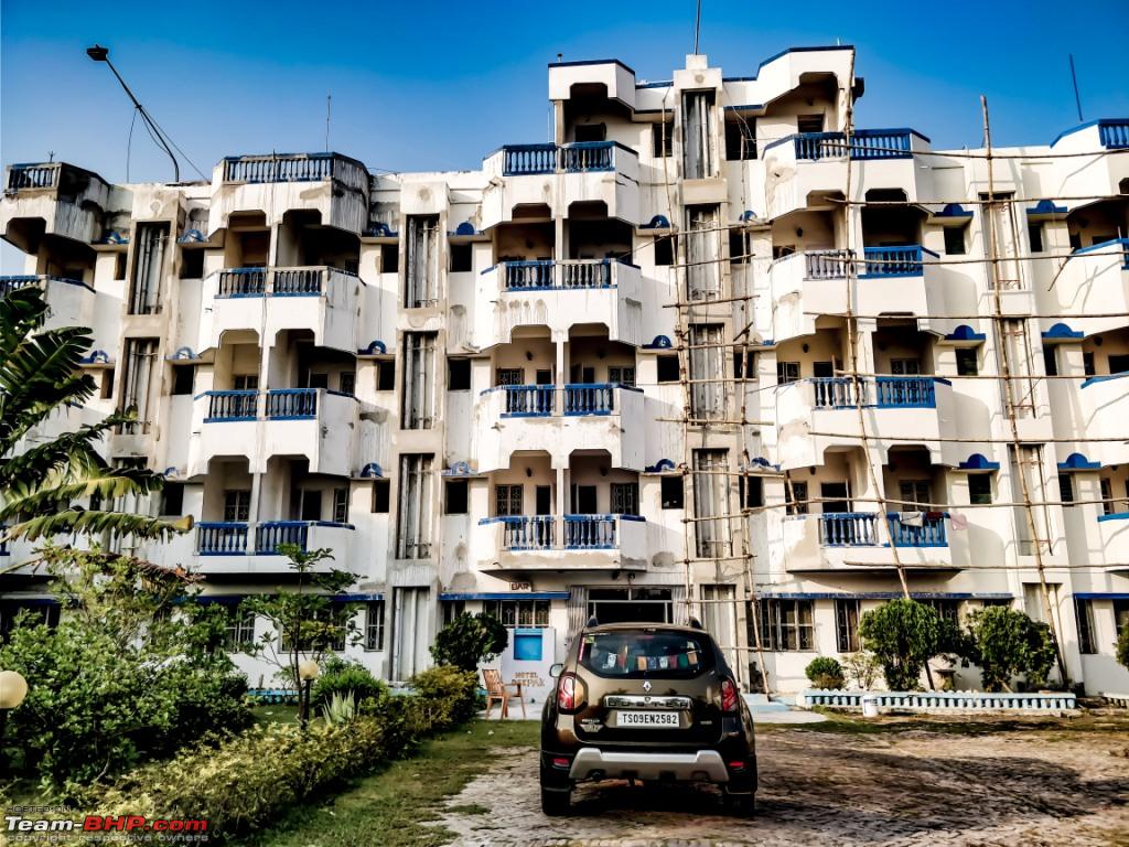 Due to low tide and winter there was deficit of water that gave way to a lot of business and fish farming in the area.  Although it was not the best place for seeing a sunset geographically but the sky and clouds said otherwise.   We drove back to our home in Joka by 11pm at night. Met fellow Bhpian PapaBravo and it was a delight to see another ardent traveler. It's because of Bhpian Samba and PapaBravo's suggestion I got the Duster AWD and it has been a charm so far. 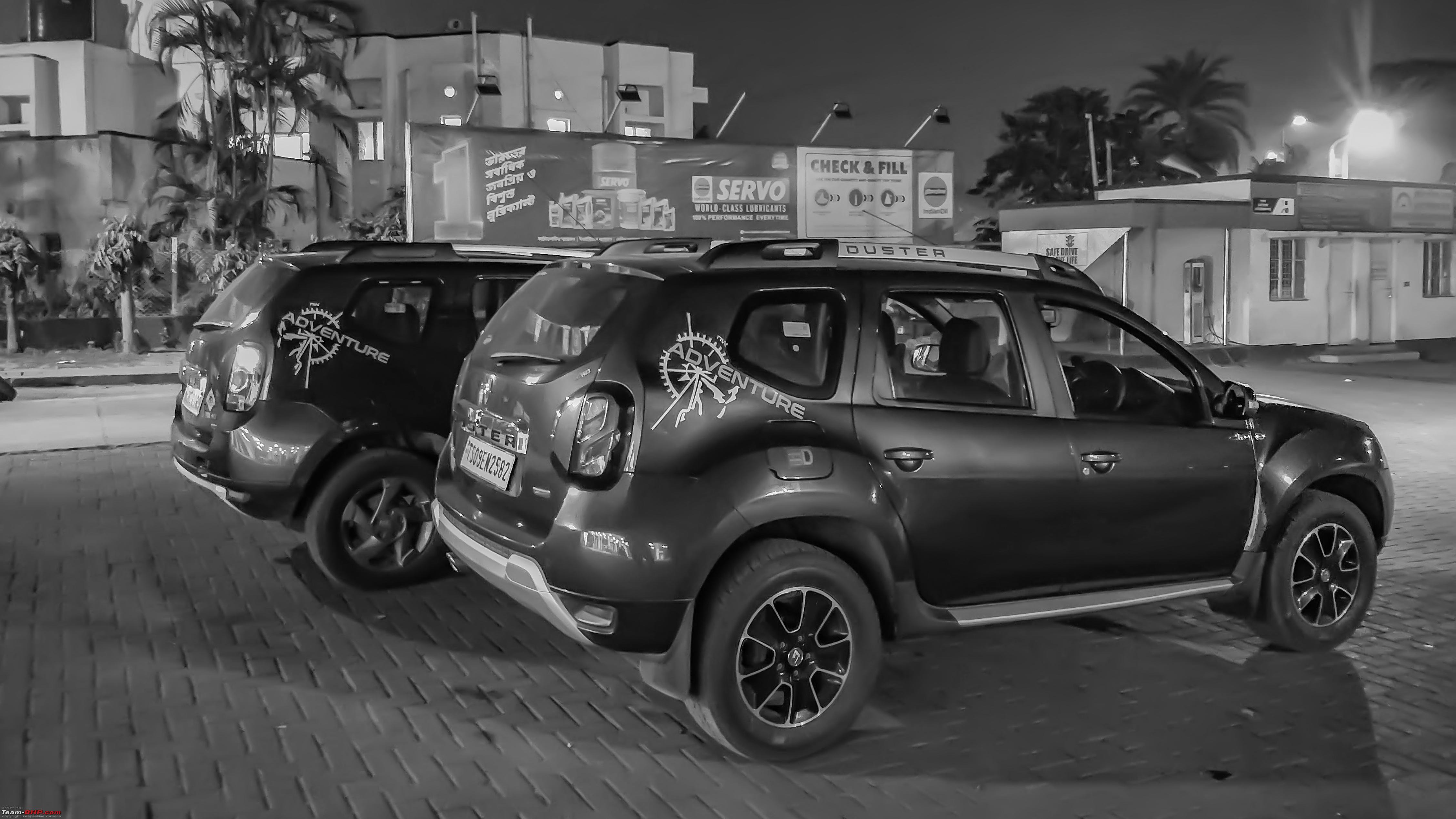 Last edited by ARAY : 13th January 2018 at 16:49. |
|
| (24)
Thanks
|
| The following 24 BHPians Thank ARAY for this useful post: | arun_josie, atul.ktm, BlackPearl, darklord, DrANTO, gmhossain, GTO, haisaikat, JoseVijay, kbishwa, Klub Class, navsjab, PapaBravo, phynix123, procrj, Samba, sayakc, SDP, Shanksta, SmartCat, smuniswami, sparky@home, surjaonwheelz, TOINGPOING |
|
8th January 2018, 00:21
| #3 |
| BHPian | re: Hyderabad to Arunachal, Assam & Meghalaya in a Duster AWD Day -2 (Kolkata -Siliguri) The highlight of this route was the Farakka barrage. Luck/Prayers/Timing, nothing can save you from getting stuck in the jam. It’s only your driving skills that can save you some time. Most of the truck drivers are good and they let you zig- zag past, if you request them. The next in line was the traffic jam at Kalia Chowk and Malda city. I used the BotolBari route as usual like last year but I did notice few dumpers taking that route. Folks who have used that route would know what happens when a dumper comes from opposite direction. For others let me elucidate. The width of the road at most places is roughly 3/4th the width of a single lane. Due to rains/ errosion the soiled part besides the road is a good 2-3 feet below the actual tar road. Now imagine a scenario where a truck comes from opposite direction and you have to give it space to pass. Although the probability of the scenario is less but with more trucks on that road it’s going to augment. Route: Used the Botol Bari route, saved sometime but in vain, it was consumed crossing the Farakka barrage. This would be my 6th time crossing that place since 2012, 5 years have passed and its still a muddle. This is a major tailback to the NE Corridor. 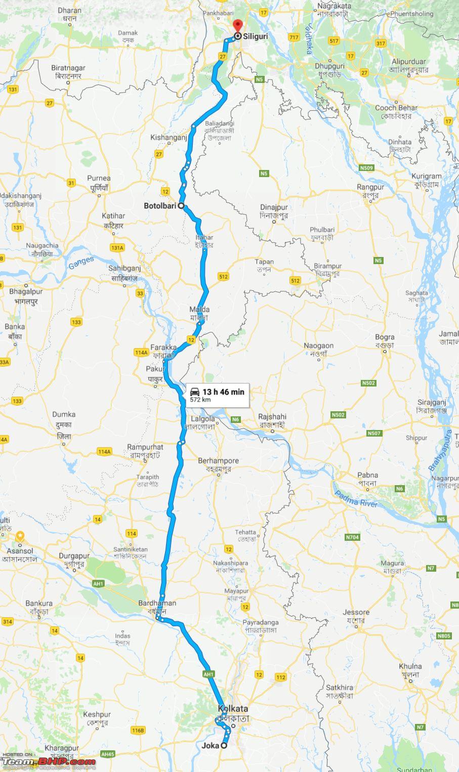 Hotel: Mount Embassy Please do call the hotel authorities before your arrival, parking is available right in front of the hotel but can develop into an issue if two or more vehicles arrive at same time. Rooms are spacious and the Hotel Staff is courteous. Food is great. From my last few visits I have realized it is best to tailgate the Volvo Buses. They are big and make way and they know when and where to take the wrong side. But the irony is even they get stuck, sometimes for more than an hour.  Day 3 (Siliguri – Mangaldoi) Average speed of 48kmph on a blend of flat and hilly roads is not that bad. Folks from Mumbai and Pune would relate this track, represents the Pune expressway so enormously. Not just the terrain but the road construction as well. However during the summer cemented roads heat up faster and more, so please keep that in mind. Truck traffic is sparse and few stretches have the roads meet the hills and the hills meet the sky. We stayed at Siddharta Palace at Mongoldoi. The reason was it had a covered parking spot. The rooms were bit too big which we liked when we entered the Hotel but the room heaters were not able to keep up. The guys at the hotel obliged and decided to wash my car before I hit the roads the next morning. Route: Stick to NH27, 471 kms, Post AlipurDuar till Nalbari its a breeze. As some great men said its difficult not to maintain triple digits. 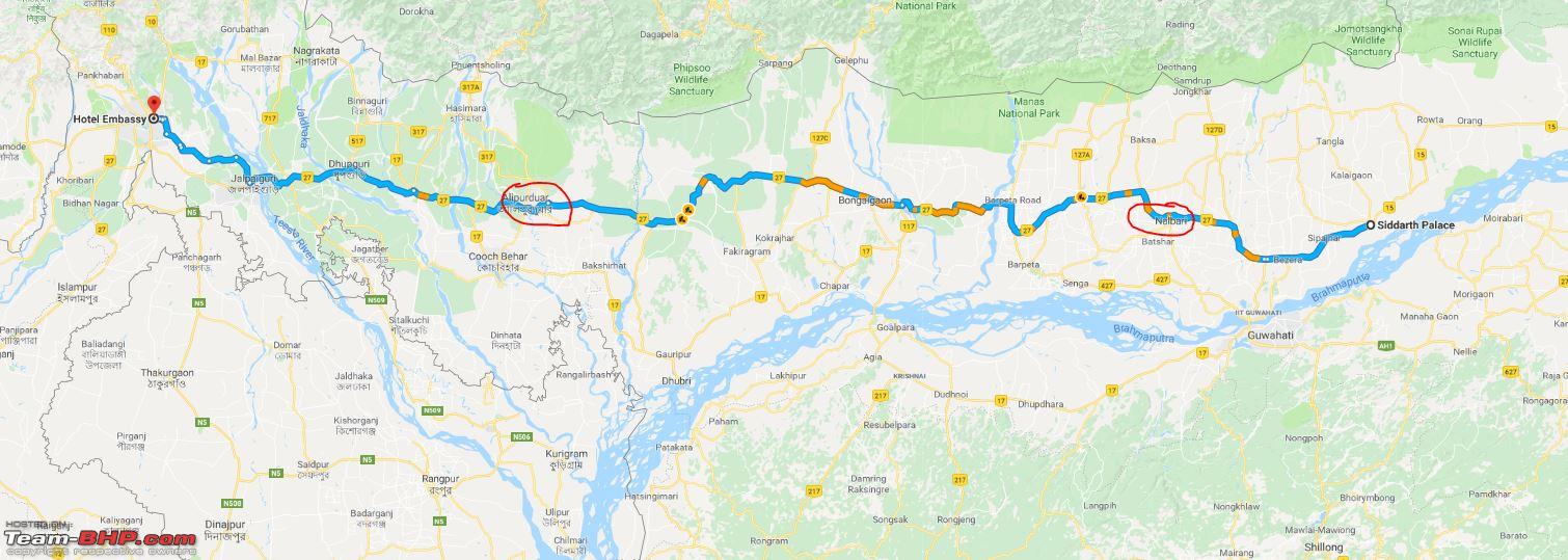 Hotel: Siddharta Palace Too big rooms, very spacious but takes some time to heat up. Lots of space to park. Hotel staffs are welcoming and cooperative. Food is good but you need to order and give them some time to prepare. Parking At Siddharta Palace. 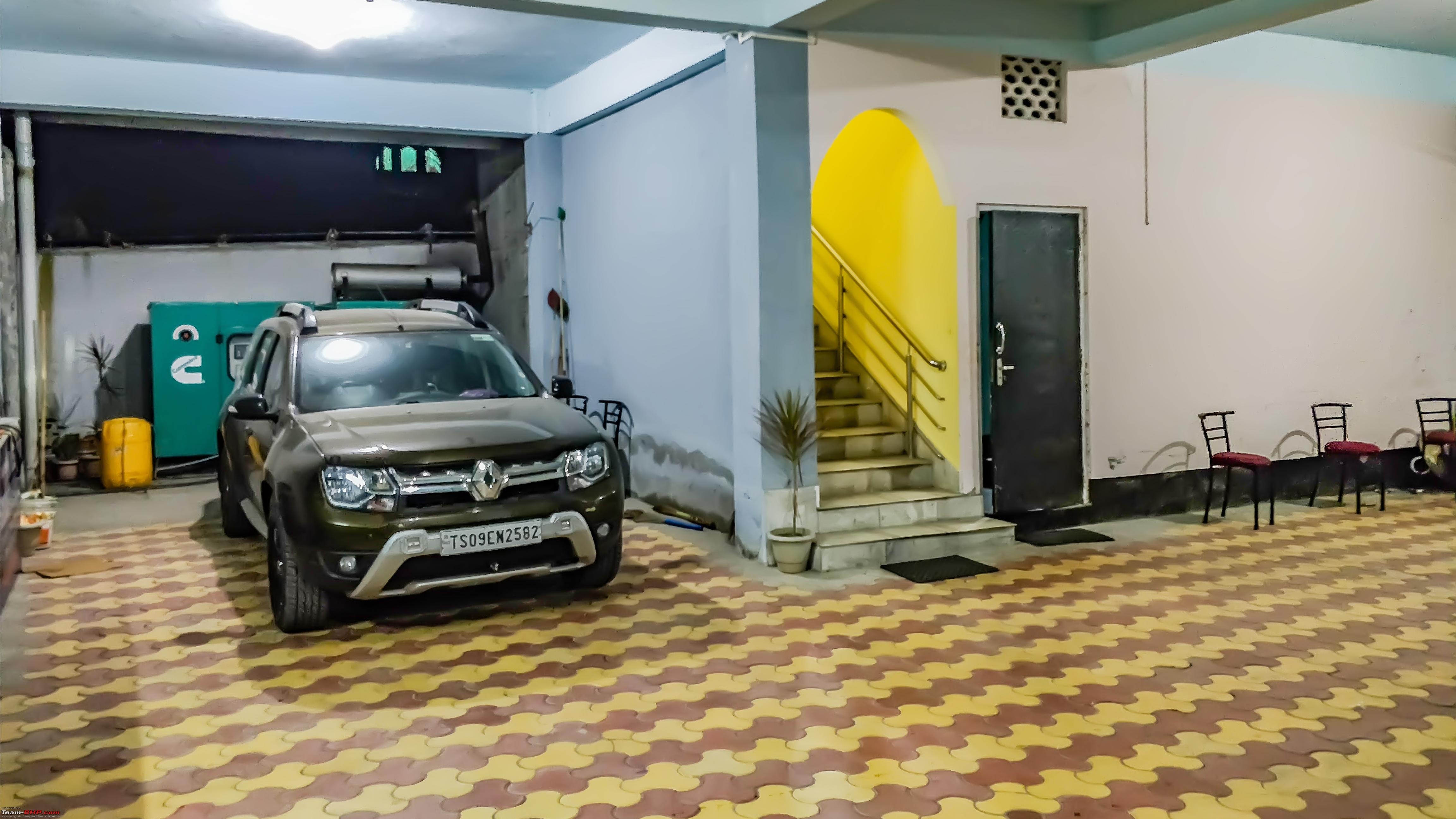 Playback of GPX data Mangaldai It was named after Mangaldahi, who was the daughter of the Rajah of Darrang and was wedded to Pratap Singha , a leader of the Ahom kingdom. Mangaldoi serves as the administrative headquarters of Darrang district. http://www.fallingrain.com/world/IN/03/Mangaldai.html Met a fellow Duster owner who had recently swapped his beast. Rituraj was a charming fellow who helped me a lot during the preparation phase. He happens to own a lodge as well where we stayed. It was more of a home away from home rather than a home stay. 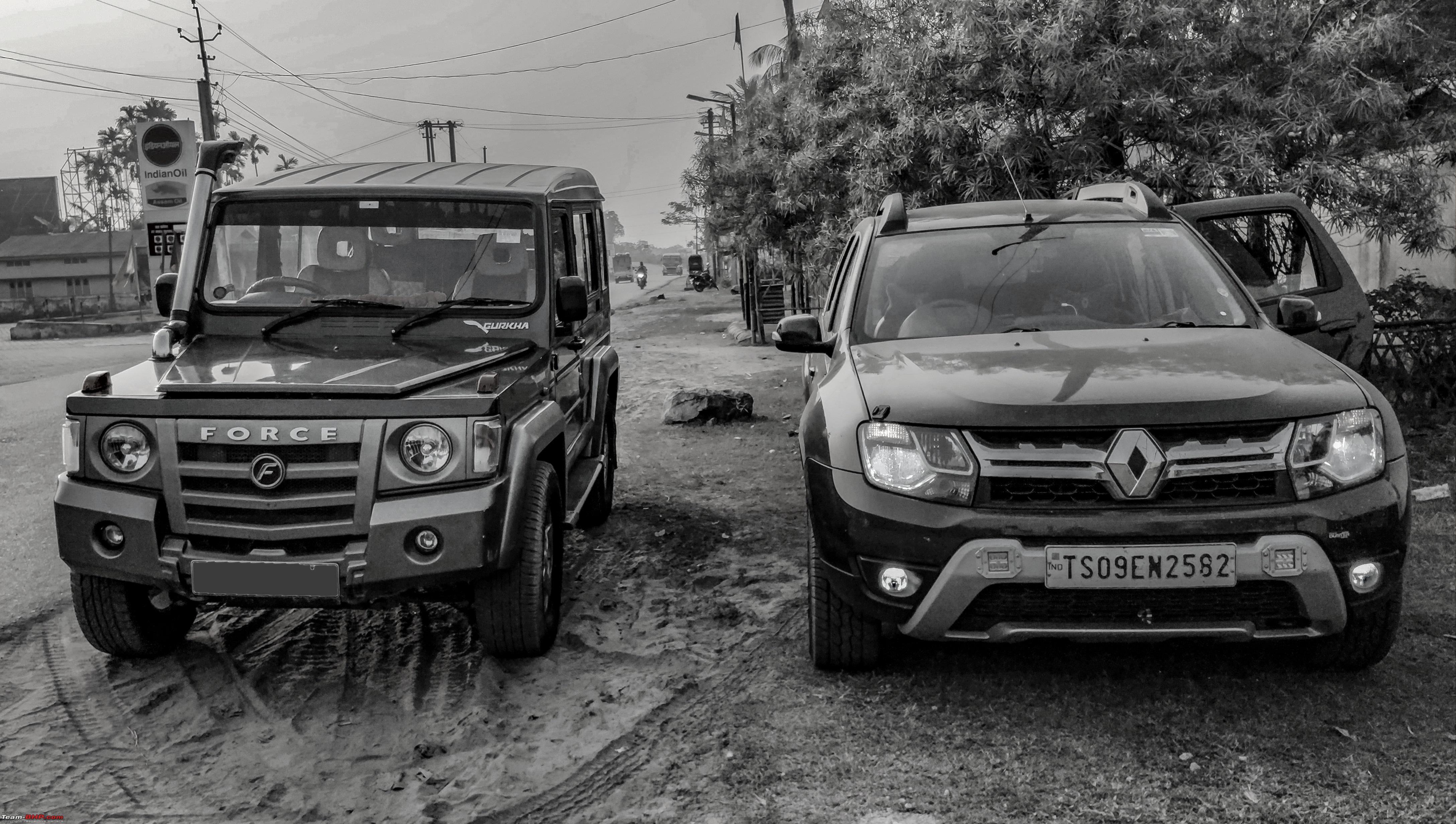 Aprila Lodge https://www.facebook.com/aprilalodge/ Last edited by ARAY : 14th January 2018 at 03:02. |
|
| (22)
Thanks
|
| The following 22 BHPians Thank ARAY for this useful post: | agspins, BlackPearl, darklord, DrANTO, gmhossain, GTO, haisaikat, JoseVijay, Klub Class, navsjab, Payaniga, phynix123, pranjal1984, procrj, Samba, sayakc, SDP, Shanksta, SmartCat, sparky@home, surjaonwheelz, TOINGPOING |
|
8th January 2018, 23:59
| #4 |
| BHPian | re: Hyderabad to Arunachal, Assam & Meghalaya in a Duster AWD Day 4 (Mongoldoi – Dirang) We were in Arunachal territory finally. It was no revelation, roads were steep, turns were sharp, hair pins were spiky but the exquisiteness all around made up for everything. As we travelled further, the gradual change of surroundings into picturesque landscape made us realise “exploring the unexplored ?”. The road from Mangaldoi to Dirang is not the best but the beauty and the Himalayas made up for everything. Dirang is a stunning town with excellent tarmac and it’s fun to drive around. The best part, Dirang is still unexploited by tourism and thus you get what you travel 3000 kms for - Peace ! Route: Stick to what Google map has to say. Since we had generous time we decided to cover Bomdila as well on the way and took a diversion near Rupa. This route can get perplexing and time consuming. But asking the locals once in a while helps. Suggested route if you go directly to Dirang 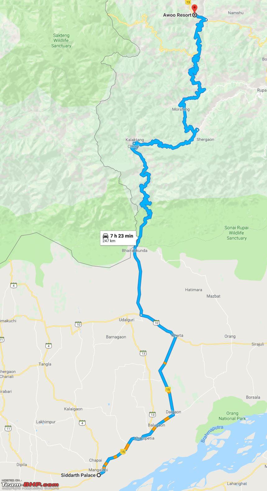 Earlier the route via Orang was suggested but you can now directly arrive at Kalaktang from Udalguri. Why do I say so, let me explain. Kalaktang - Dirang - 126kms in 3.5 hours Avg speed of 36kmph ( Not bad at all for hills) Rupa - Dirang - 60kms in 2 hrs - 30kmph ( again not bad at all for hills ) Both the routes are good however since we planned to visit Bomdila we took the diversion at Rupa 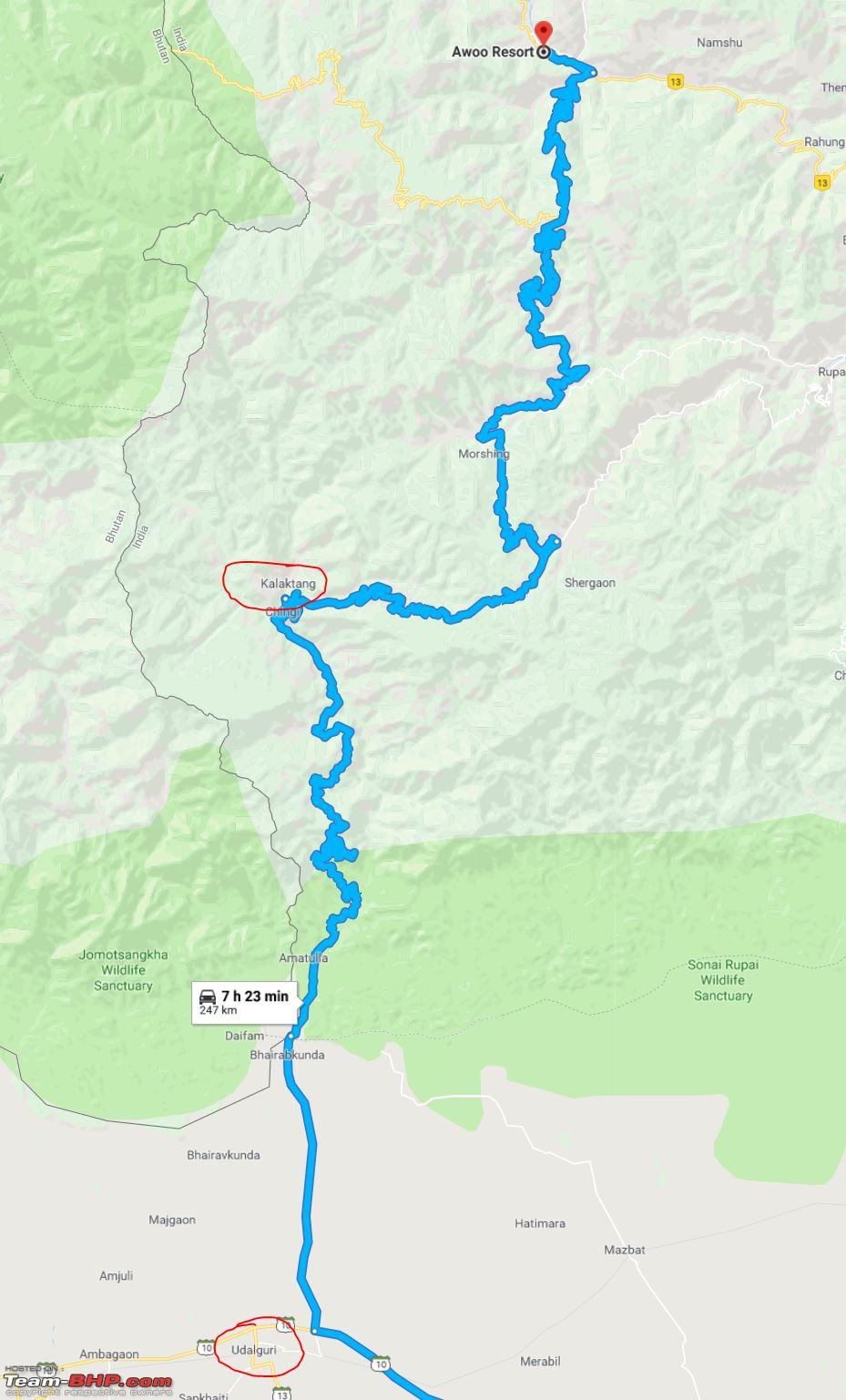 This is the route we took Mangaldoi - Kalaktang - Bomdila - Dirang ( GPX data)  Bomdila There are three monasteries in and around Bomdila. Locals call them Gompa. It is always paramount to ask directions to Gompa than saying monastery. Upper Gompa: This Gompa is the most regal of the three. It is situated about 5 kms from the Market. Crafts Centre: Crafts centre is situated just opposite the Lower Gompa. Local handicrafts are showcased here. Tipi Orchid reserve is a good place to spend some time. However it was closed for some maintenance work. Eagles Nest was something I wanted to visit but time did not permit us . Sesha Orchid was another spot bit crowded but had a nice ambiance. Short extract of the GPX file 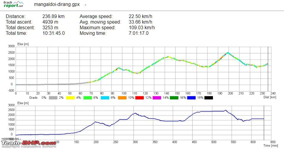 Playback of the GPX track Finally few Images to mellow down for the day Hills and Rivers 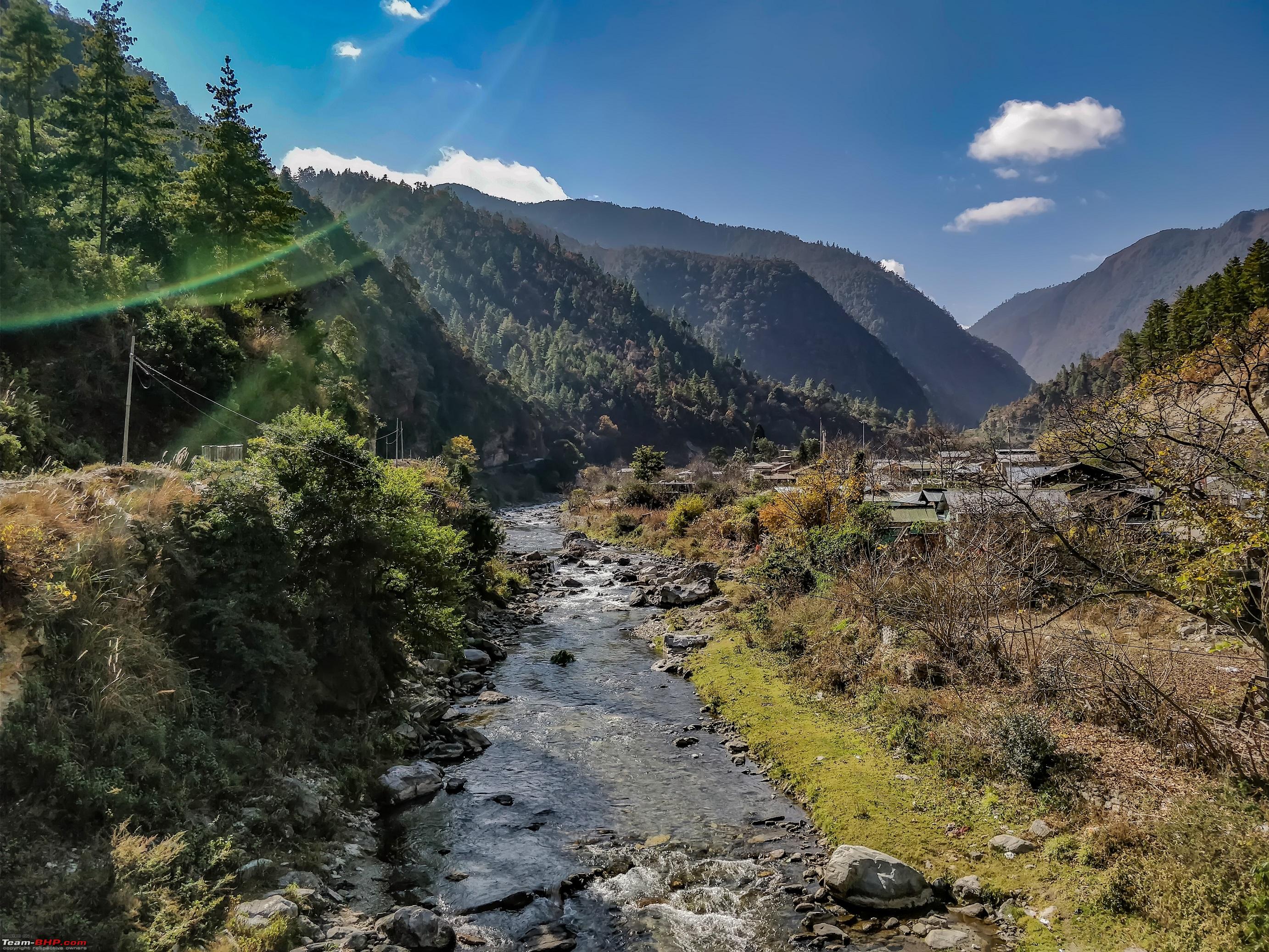 Prayers on the way 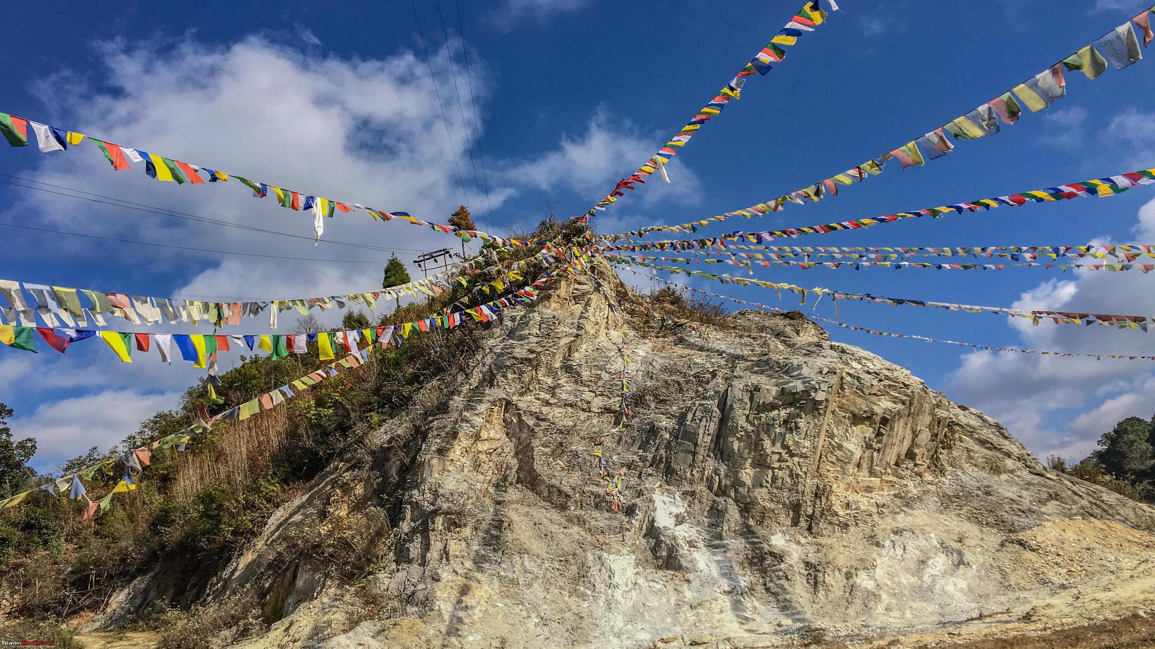 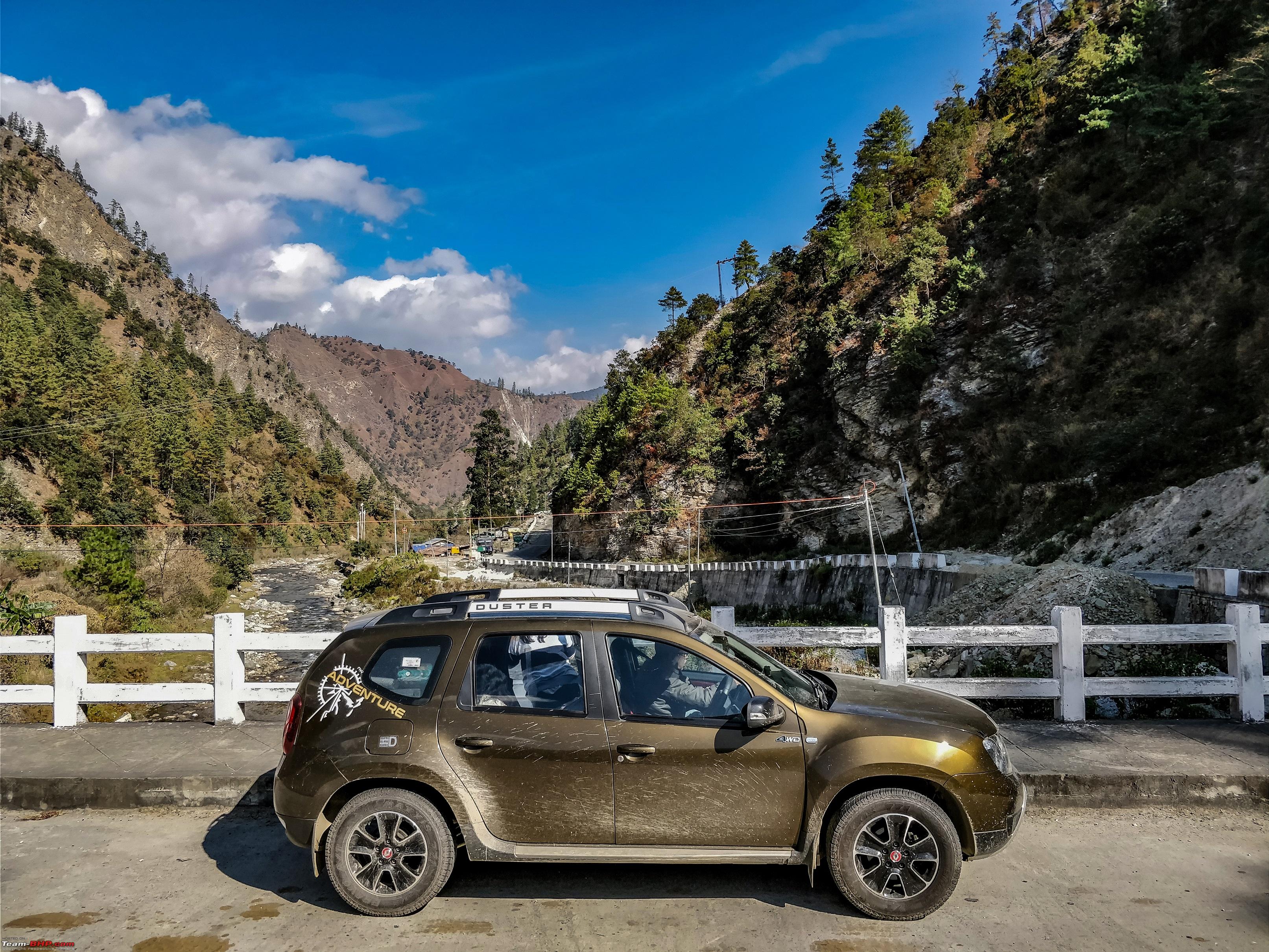 Calcium ?  River Valley 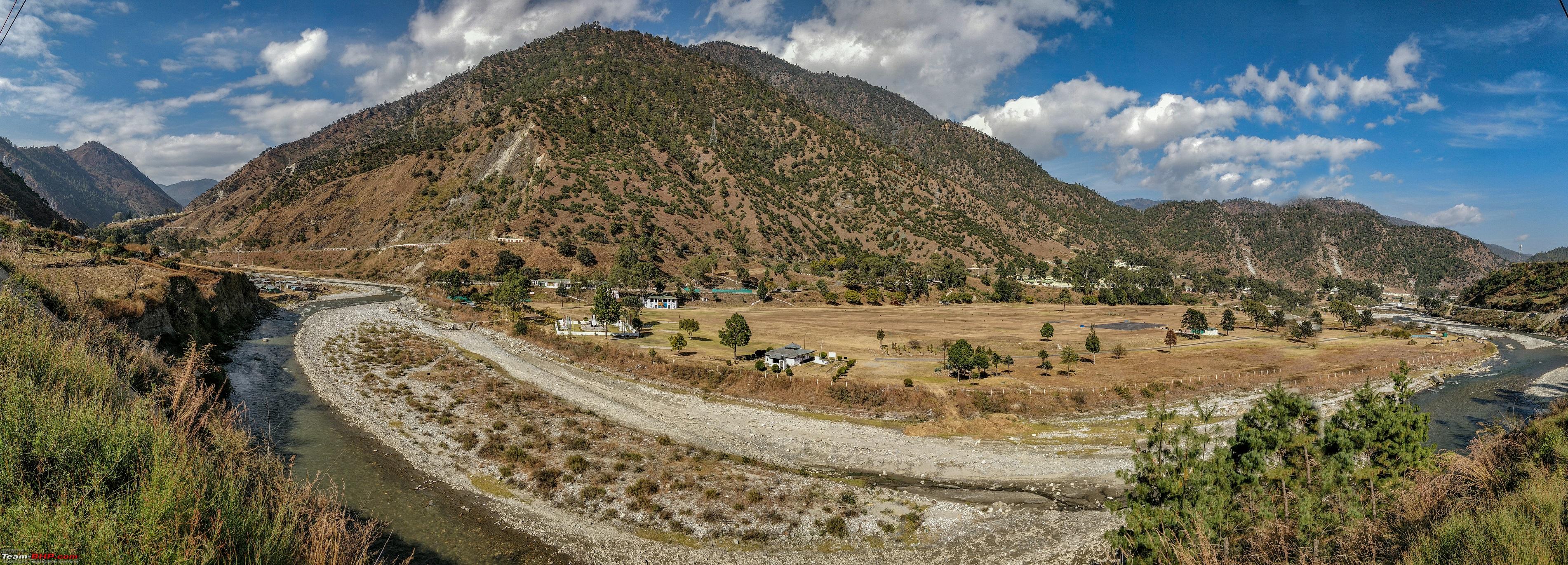 A river which I wanted to cross   A short video of the crossing Doorway to Bomdila 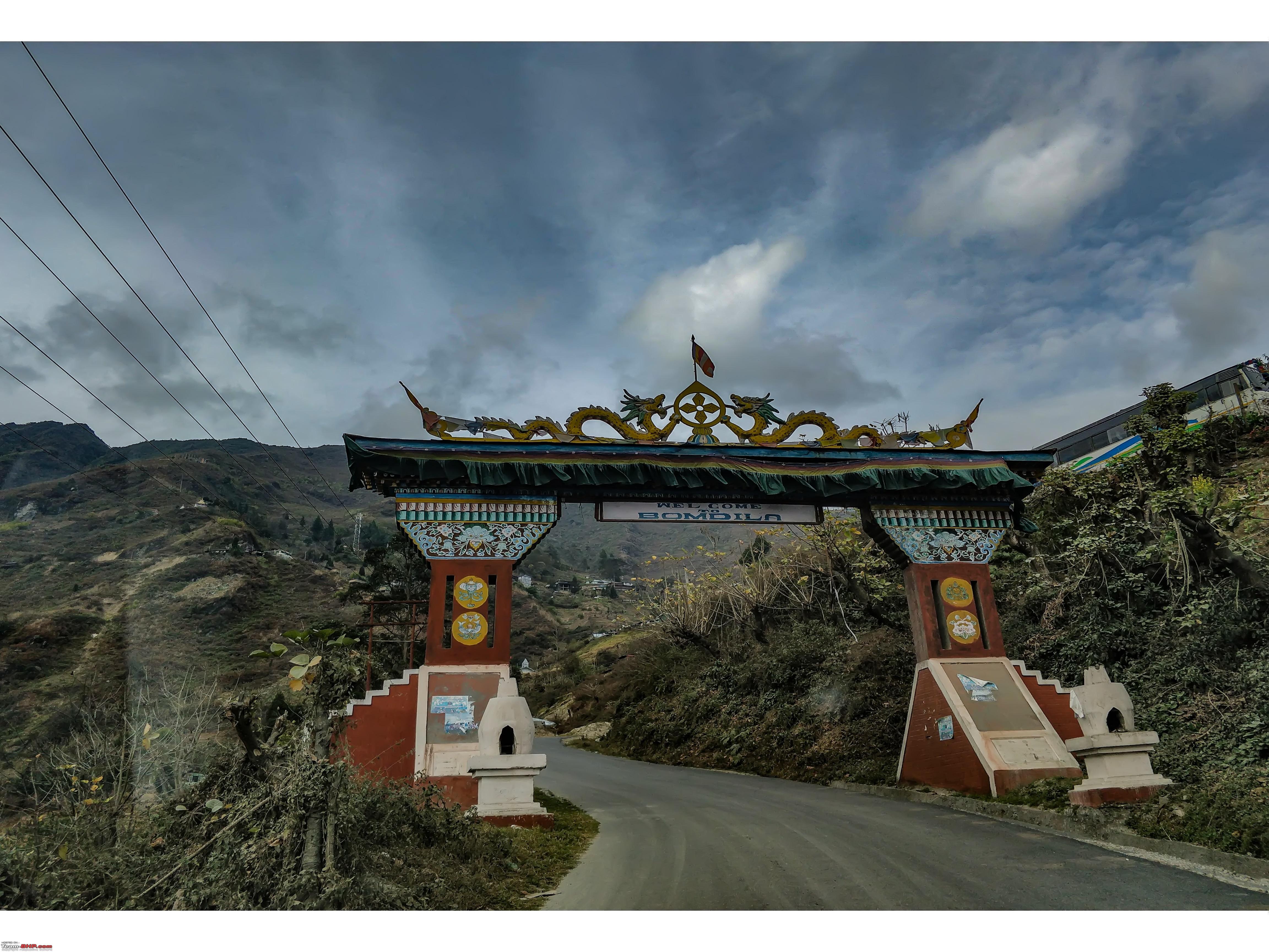 First View of Dirang Town 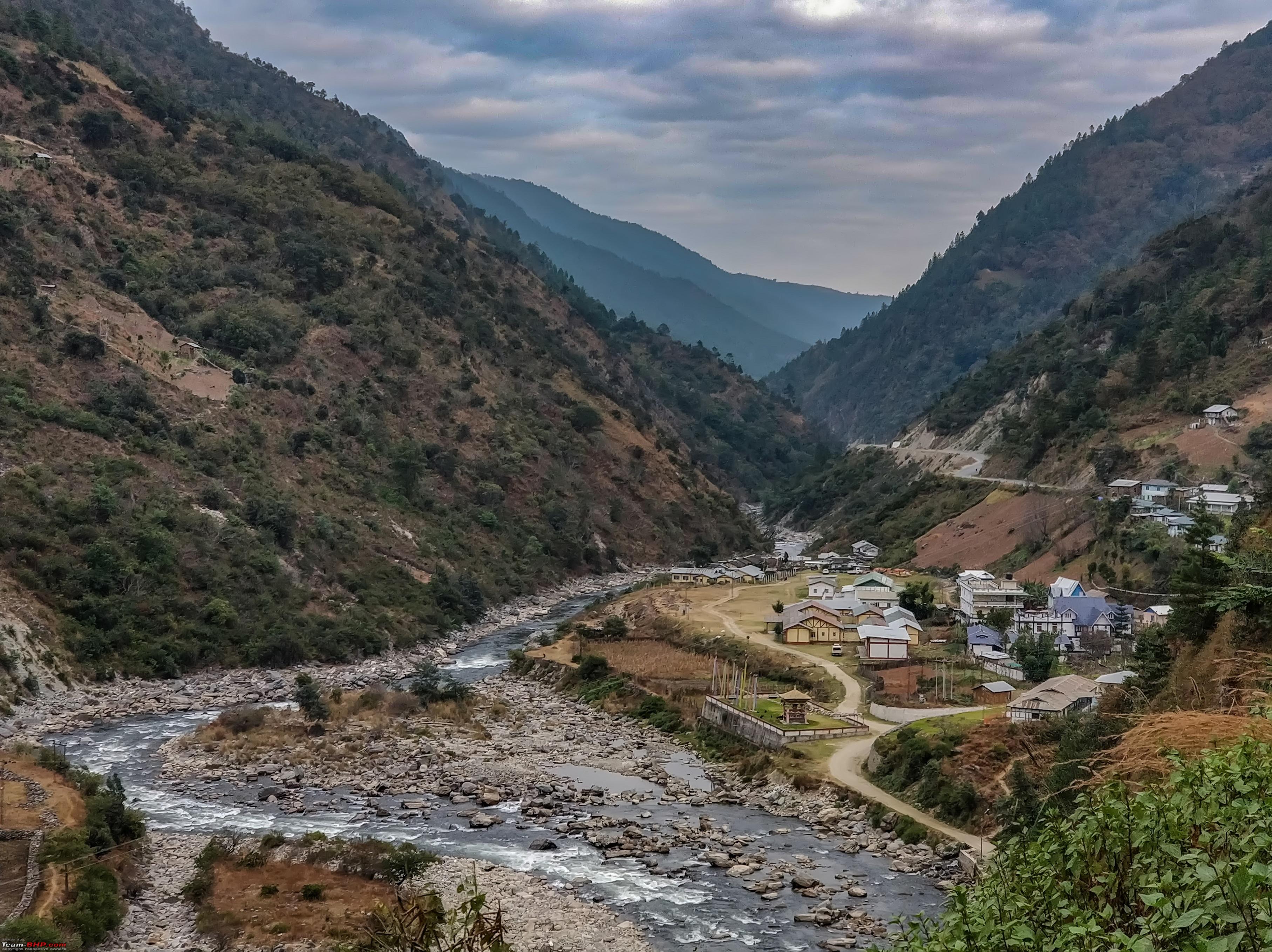 Dirang is slowly becoming a tourist spot and after speaking to the hotel guys we came to know that this small town is frequently used by travelers take a halt before hitting Tawang. It’s a good stopover place before heading further North. Mangaldoi to Dirang does not need traversing Bomdila but since we had time we decided to visit, divert from Rupa and go via Bomdila. Tasted Thuppa after one year and yes a steaming bowel of Thuppa just made the day for everyone. It was getting dark and foggy but the drive from Bomdila to Dirang was wonderful with wide roads and scenic beauty all around. We reached Awoo resort before sunset. Hotel: Awoo Resort, Dirang. Rooms are okey. Open parking space is available. Staffs are polite but not the people at front desk. Later during the trip we went to Hotel Pemaling for Lunch and regretted not getting a room there. I would not recommend Awoo if rooms are avilable in Pemaling. Some shots and view from Awoo 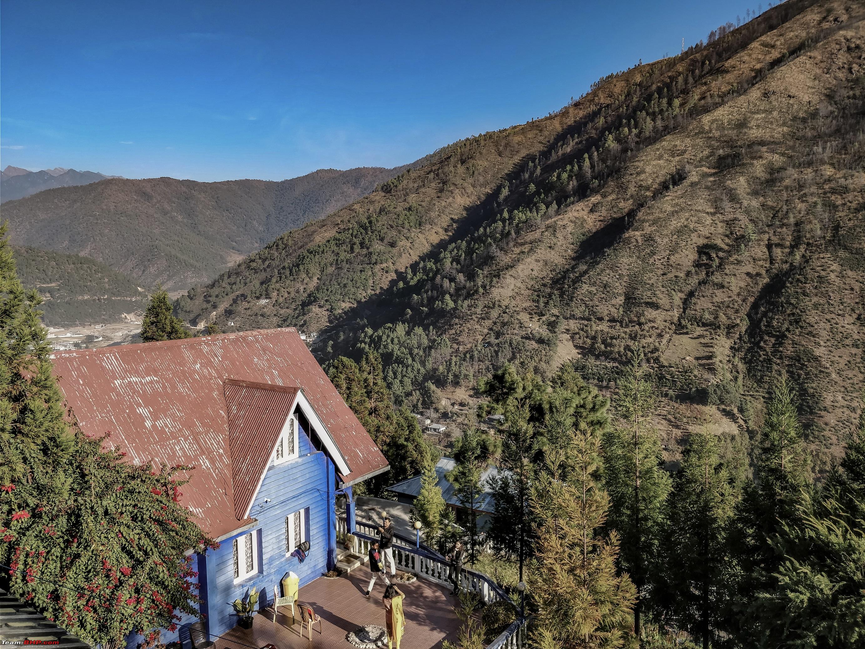   Last edited by ARAY : 13th January 2018 at 18:51. |
|
| (20)
Thanks
|
| The following 20 BHPians Thank ARAY for this useful post: | agspins, arun_josie, BlackPearl, catchdoon, dileepcm, gmhossain, GTO, haisaikat, JoseVijay, kbishwa, Klub Class, navsjab, Samba, sayakc, SDP, Shanksta, smuniswami, sparky@home, surjaonwheelz, TOINGPOING |
|
9th January 2018, 18:20
| #5 |
| BHPian | re: Hyderabad to Arunachal, Assam & Meghalaya in a Duster AWD Day 5 (In and around Dirang) We hired a local cab guy and asked him to sit in my car and be the guide. He knew the town in and out and we covered all the tourist spots and even had time for some offbeat tracks. He was flabbergasted to see a Duster AWD climb some of the apparently harsh terrains. Spent the next day at Dirang to acclimatize with the weather and altitude. However Bomdila could have been a better choice as it’s located at a higher altitude. Also Bomdila to Dirang takes just 1 hour as the roads are excellent. Dirang is famous for it’s apple farming and garden. (The GPX playback shows the climb to Apple Orchards) Sangti Valley This quaint little valley on the banks of Dirang river will unquestionably leave you mesmerized. As far as your eyes can take you, the lush green fields rimmed by crystal clear water of river banks are a sight to cherish. There is so much to ponder your mind into and survey the places beyond. . Dirang is a small town located on the banks of River Dirang which was once allied to River Kameng 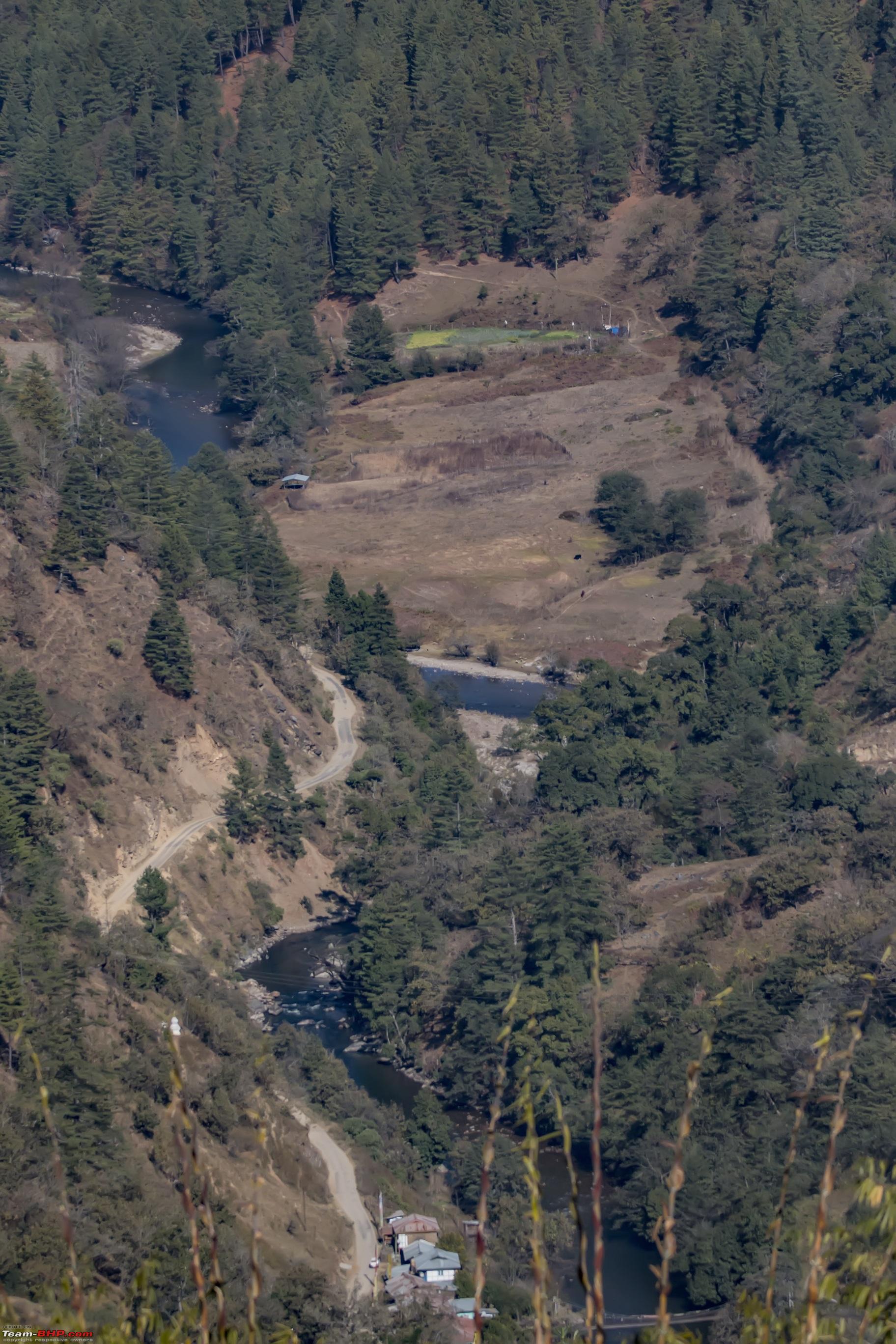 River Kameng , also called Dirang River  Sheep Breeding farm  The sheep breeding farms were beautiful and also shared a dazzling view of the Sangti Valley beneath. This is where the sheep graze usually but it was just the Duster grazing 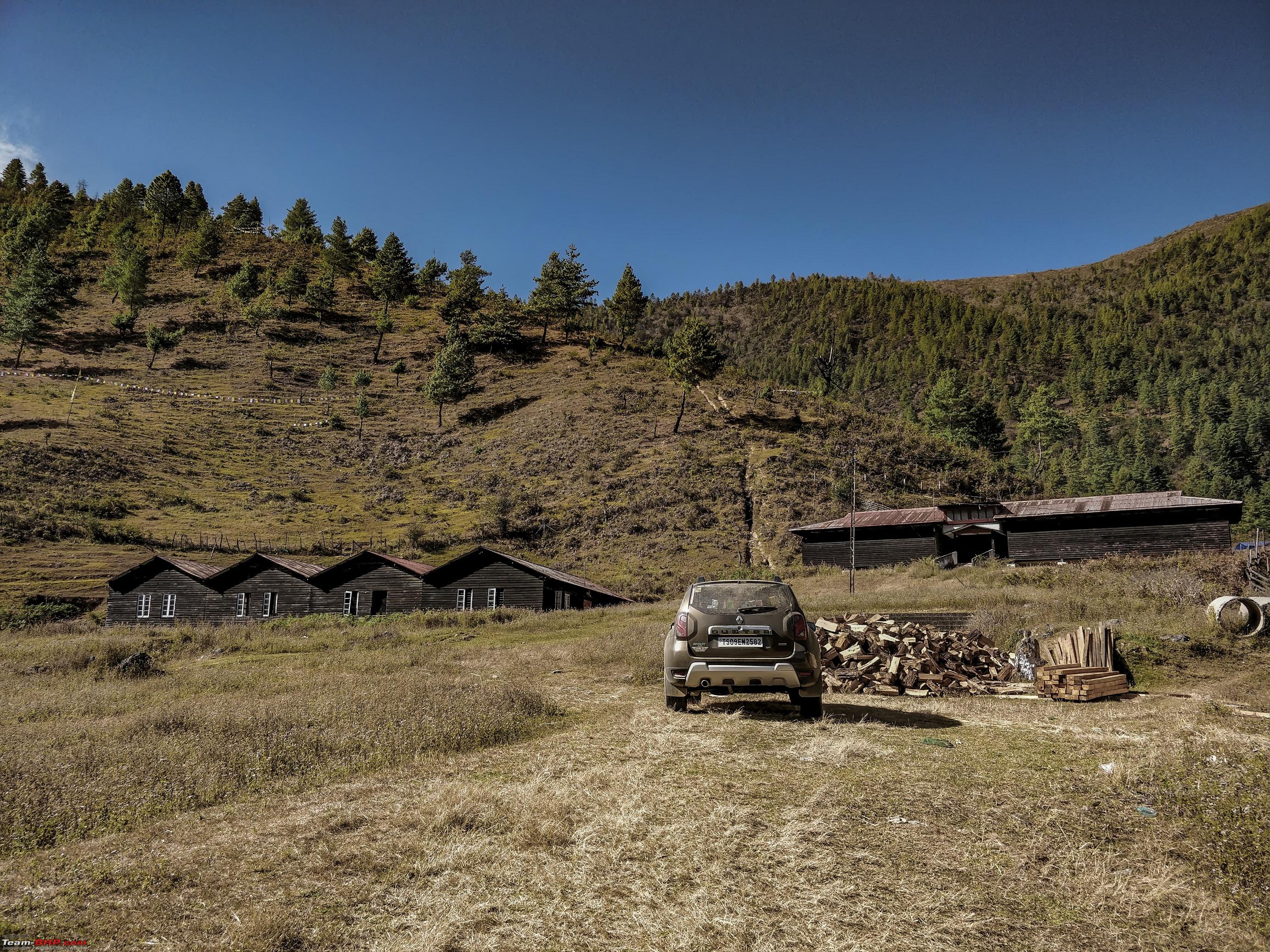 We headed for the river next with Orange and kiwi plantations on the way.   Can't thank BRO enough  Crystal clear water  Zea mays plantations , post harvesting. 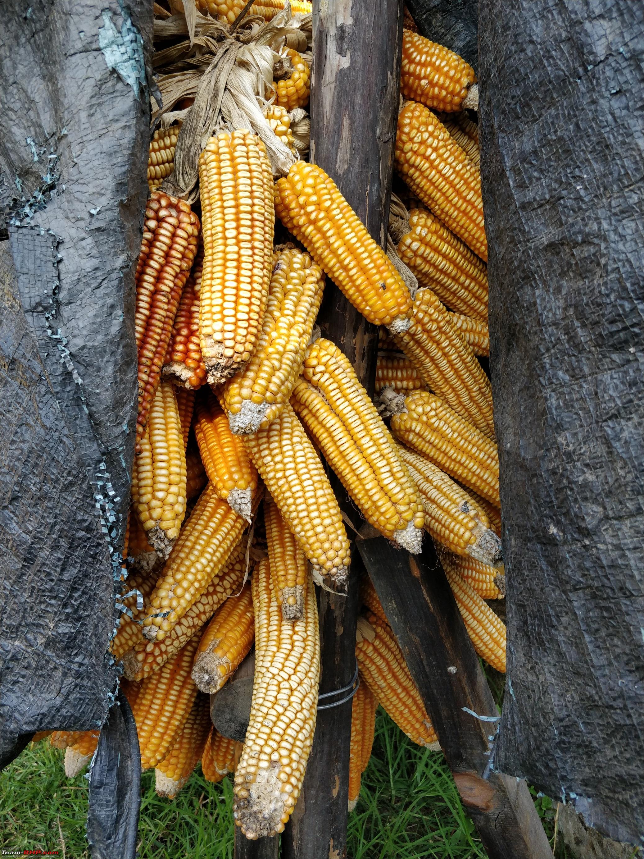 Kiwi Plantation 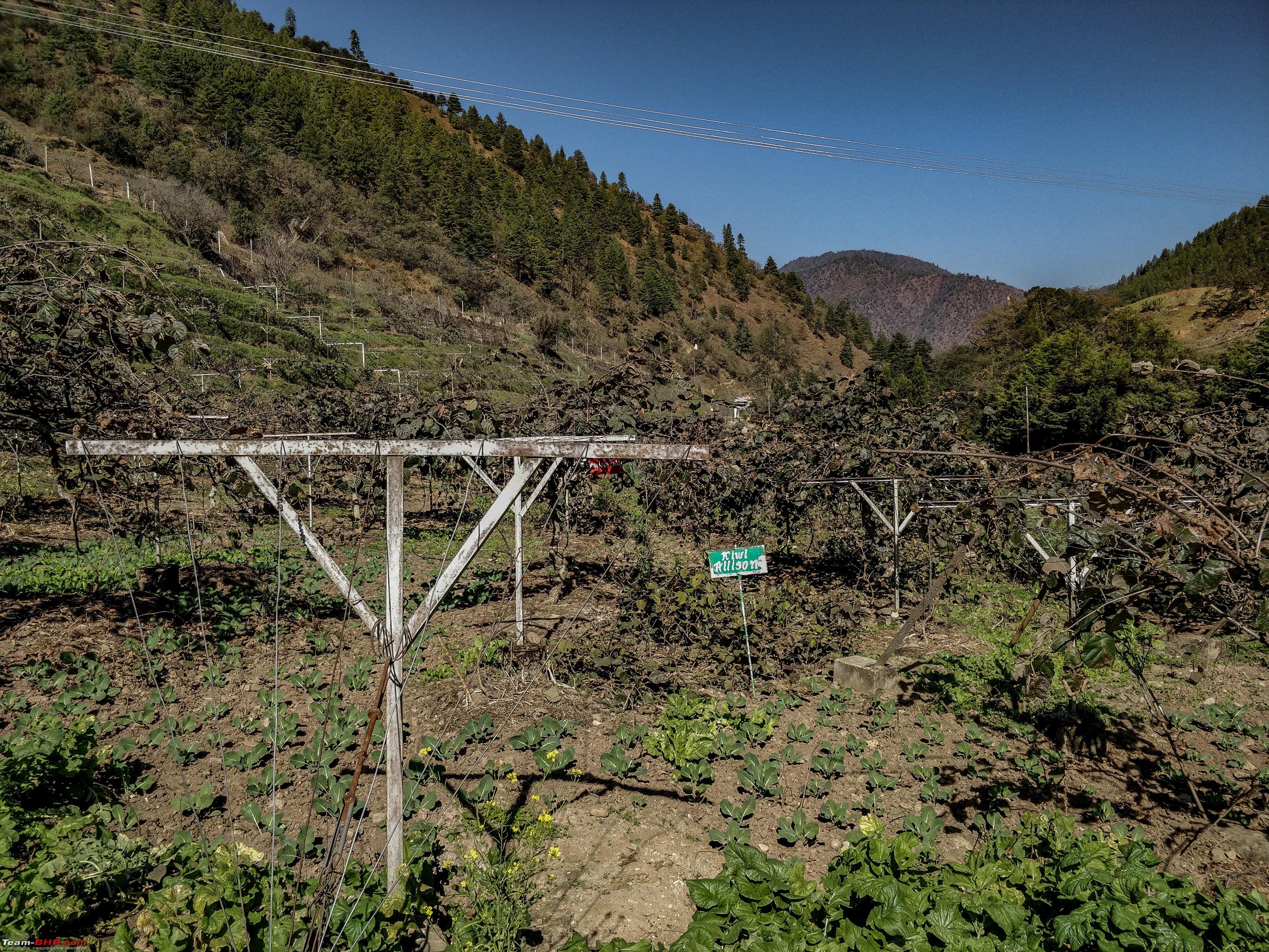 The Sangti Valley beneath 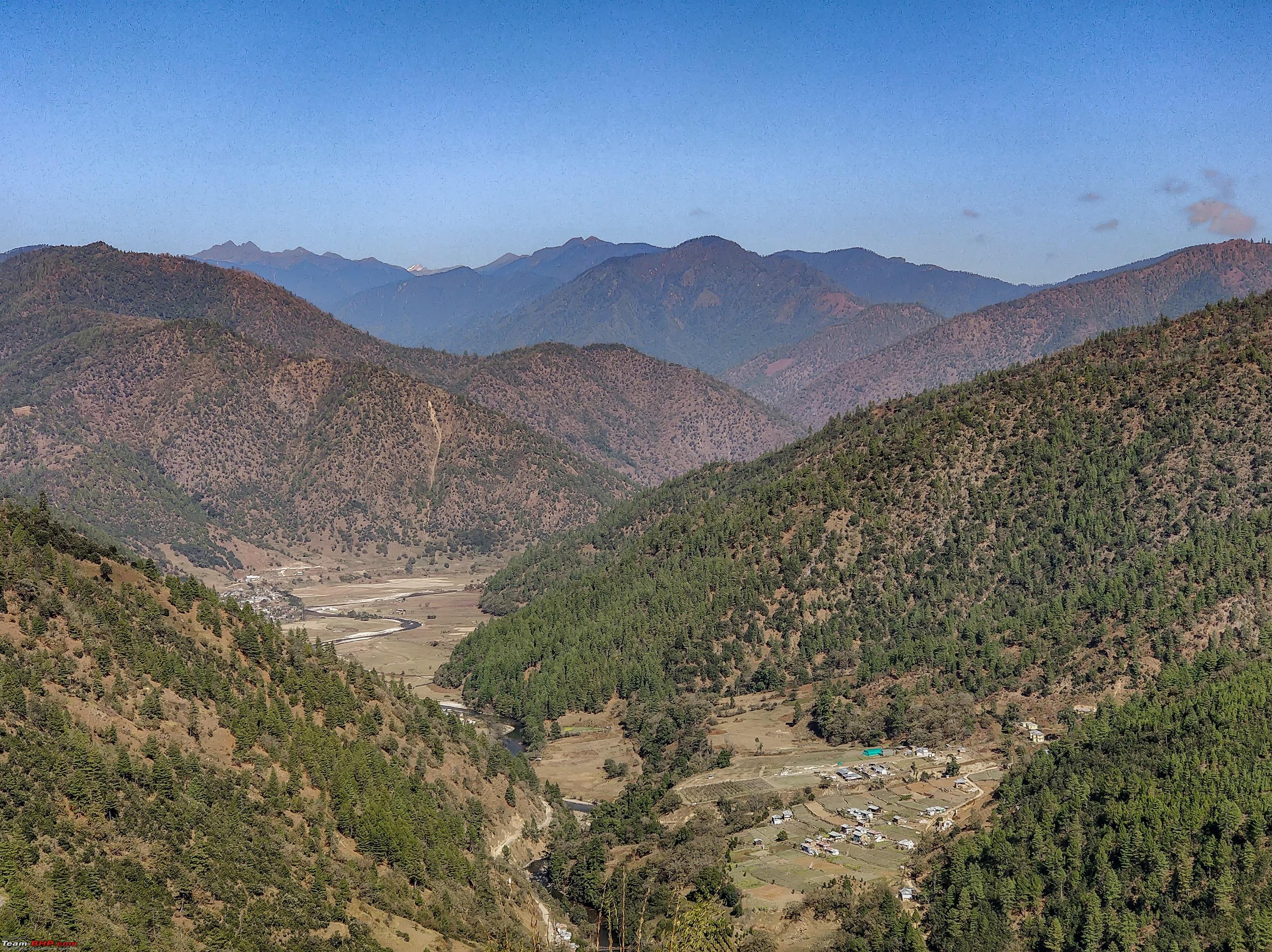 The perks of getting an Amazon Green Duster. You get Black and Brown free.  Next in plan was the Apple Orchard. Until few months back it was a chief tourist attraction but a recent fire spoiled a major portion of the plantation. The yak research center is a tourist hotspot but we decided to avoid it. Mountaineering the apple orchard demanded AWD at few spots and I could feel the rear wheel gripping while the front wheel throwing dust but the view from the apple orchard was out of this world. There is a helipad on the top which was used recurrently earlier. Drive to the apple Orchard 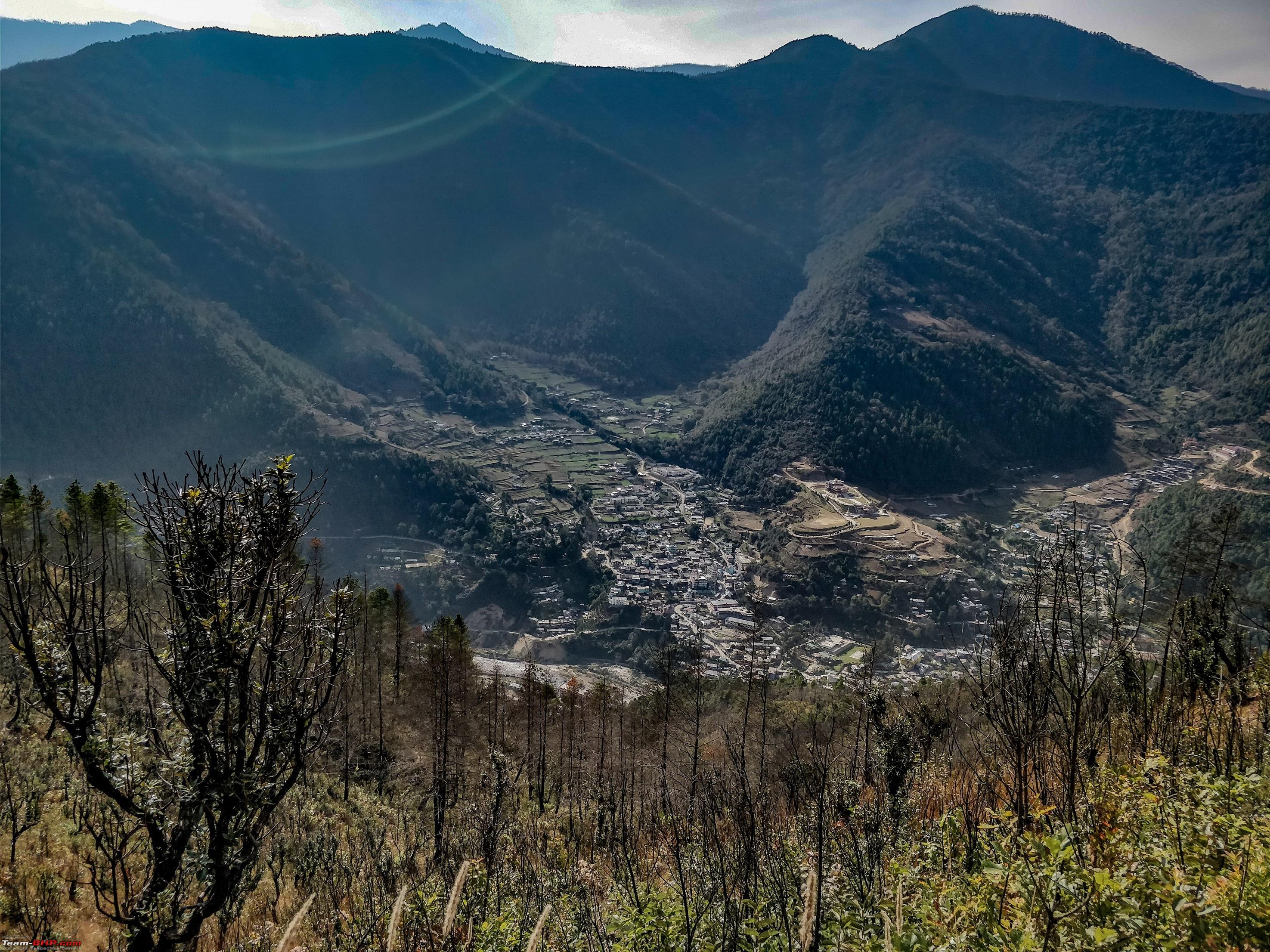 Some more shots from the Helipad atop the apple orchard. 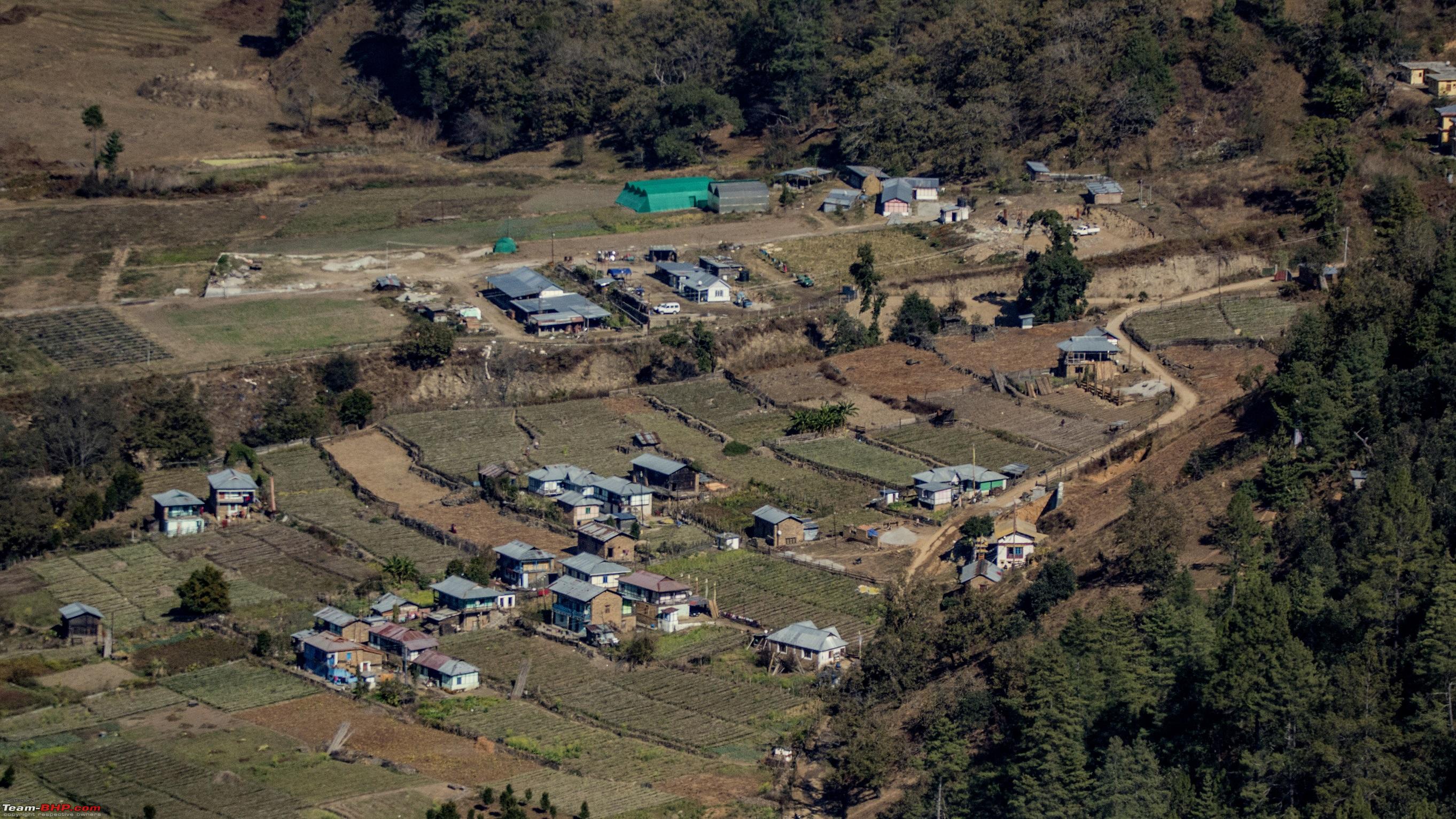 Dirang Monastery from the Apple Orchard 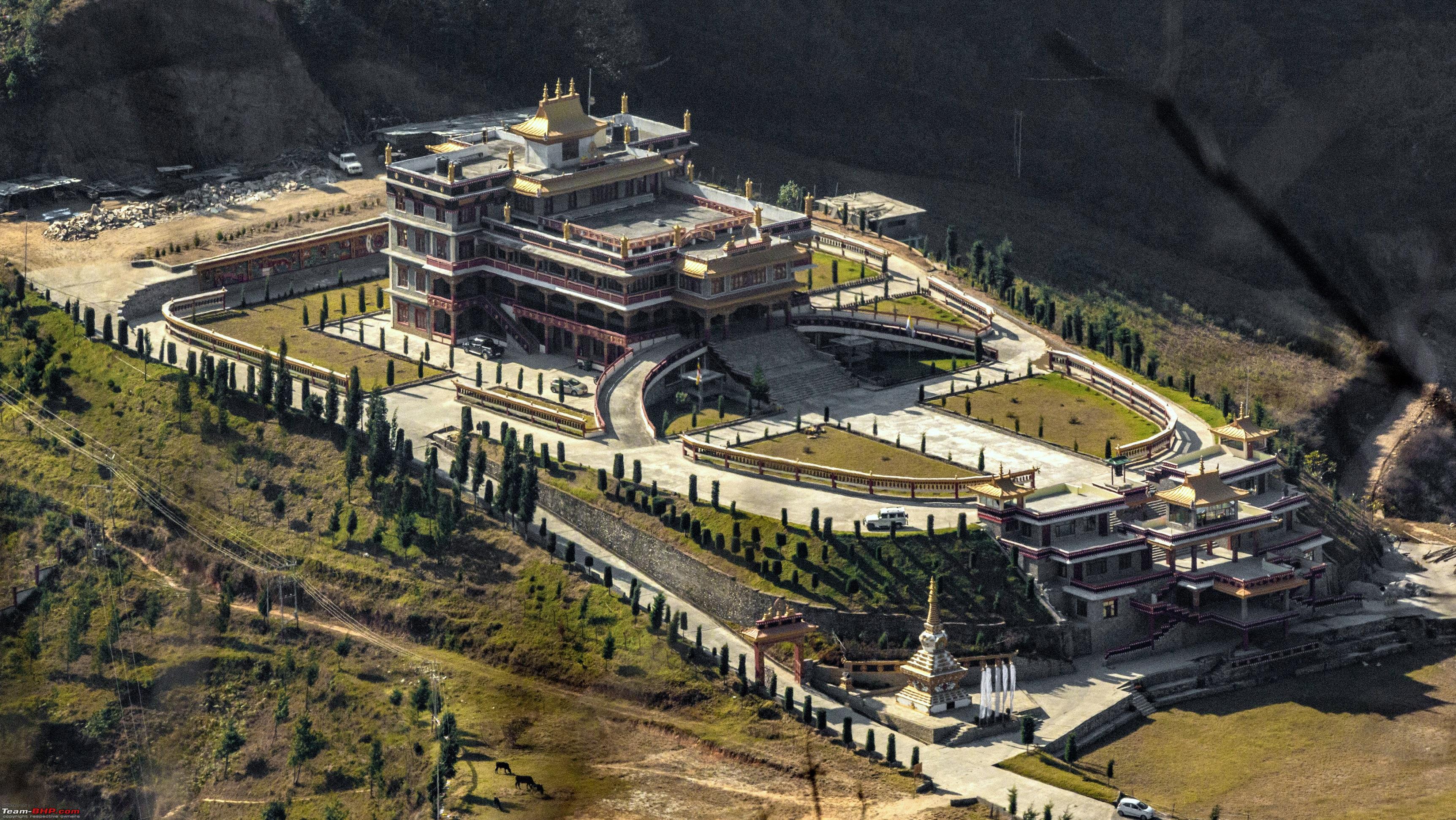 We saw this while hiking up  Happy did this trip in AWD, not so happy with the torque figures 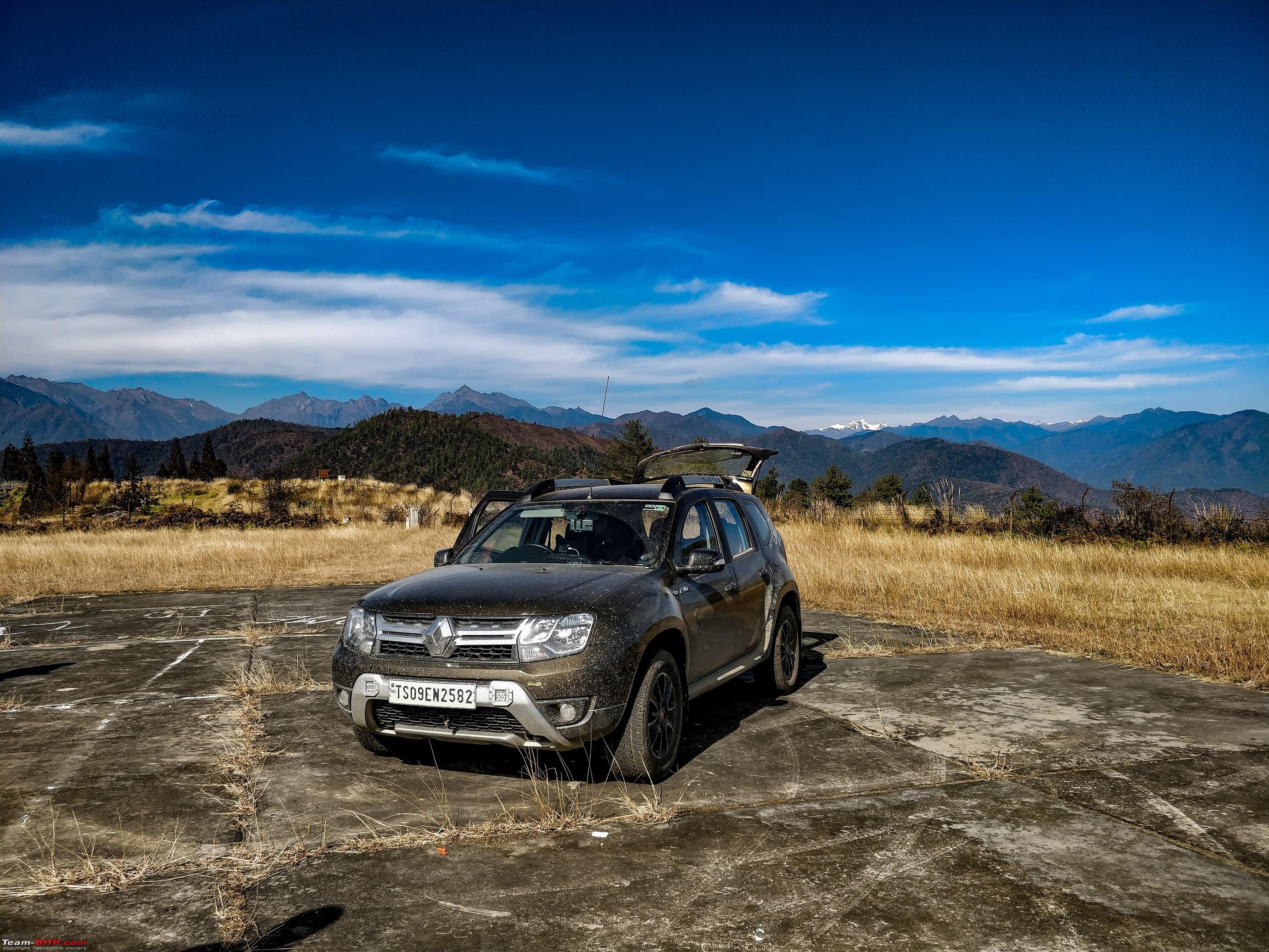 Dirang Monastry This place is by far the most passive, one day halt at Dirang is suggested. Not many people go there and it captures the fabulous glimpses of nature and preserves them in one place. The monastery overlooking the gorgeous Himalayan range, punctuated by floating clouds and fog is definitely a visual indulgence. Few Pictures of Dirang Monastery, newly constructed from what I understood 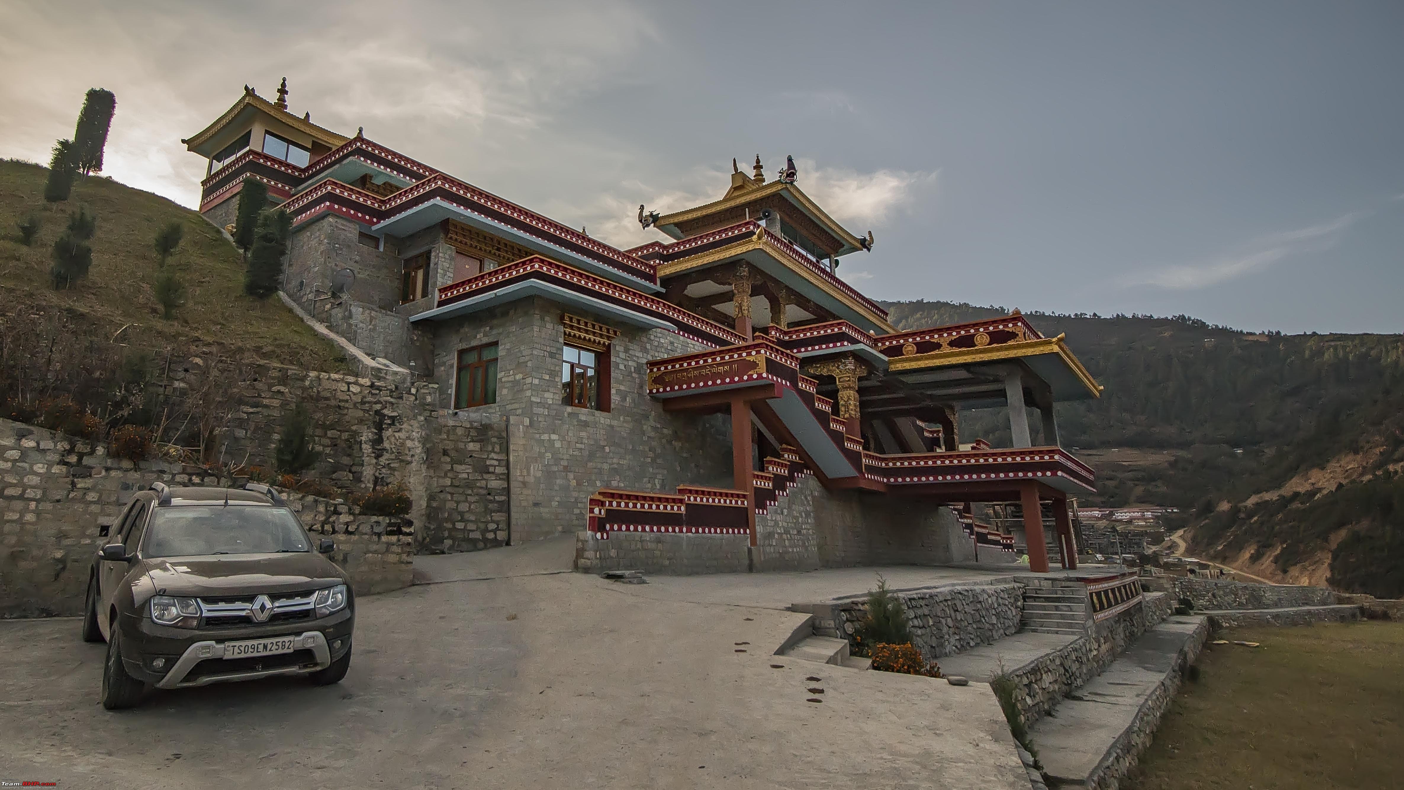 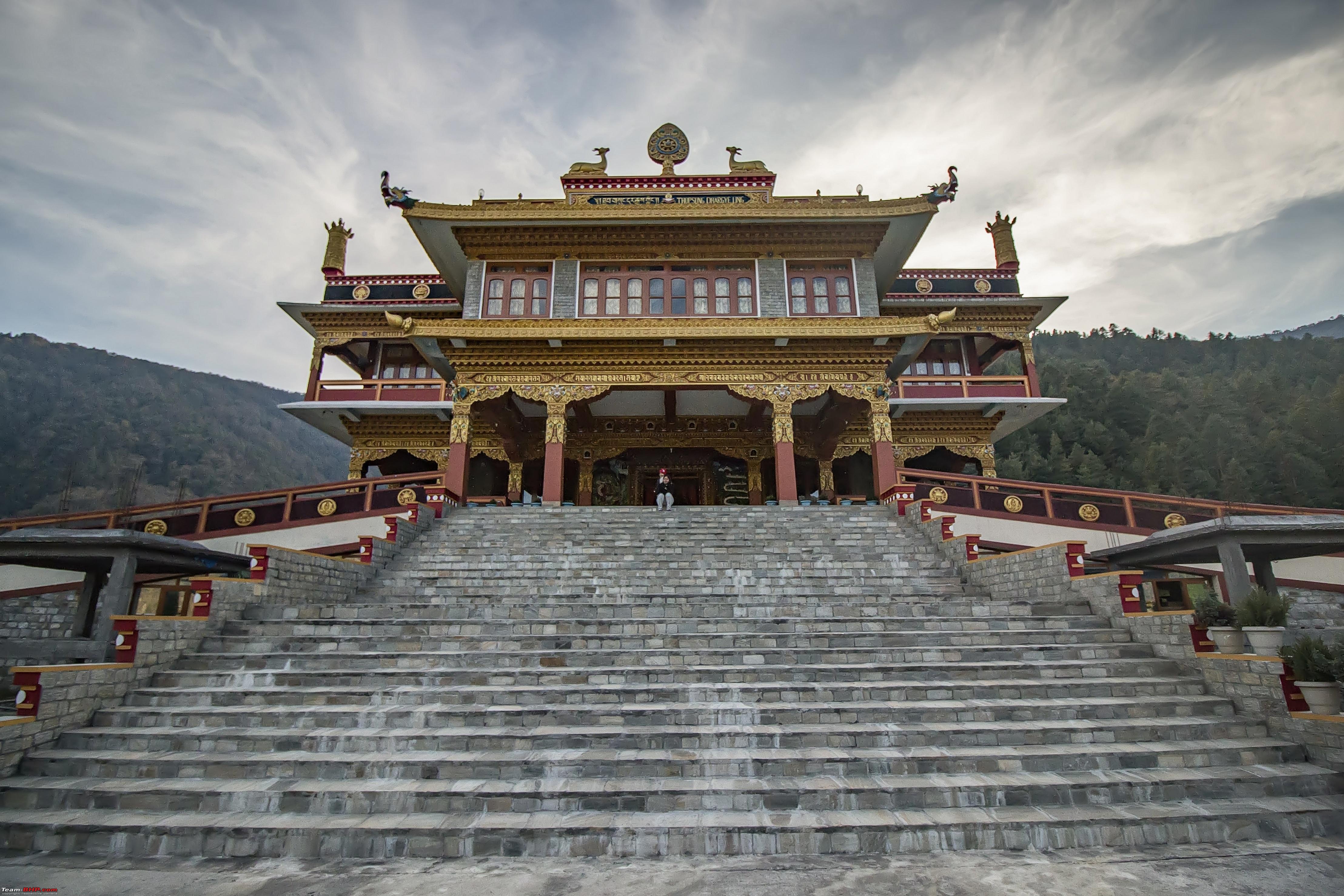  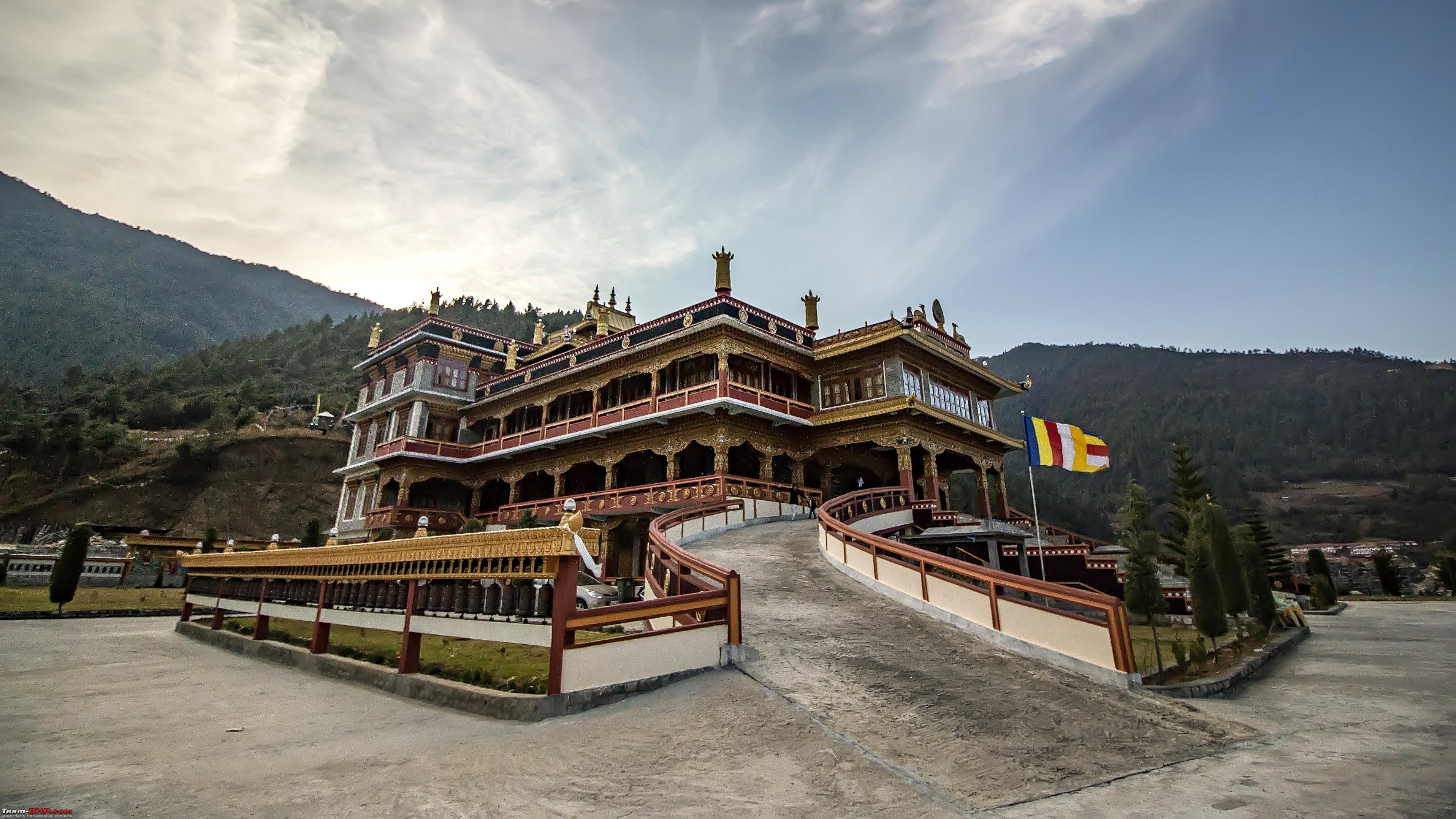 How peacefully it slept 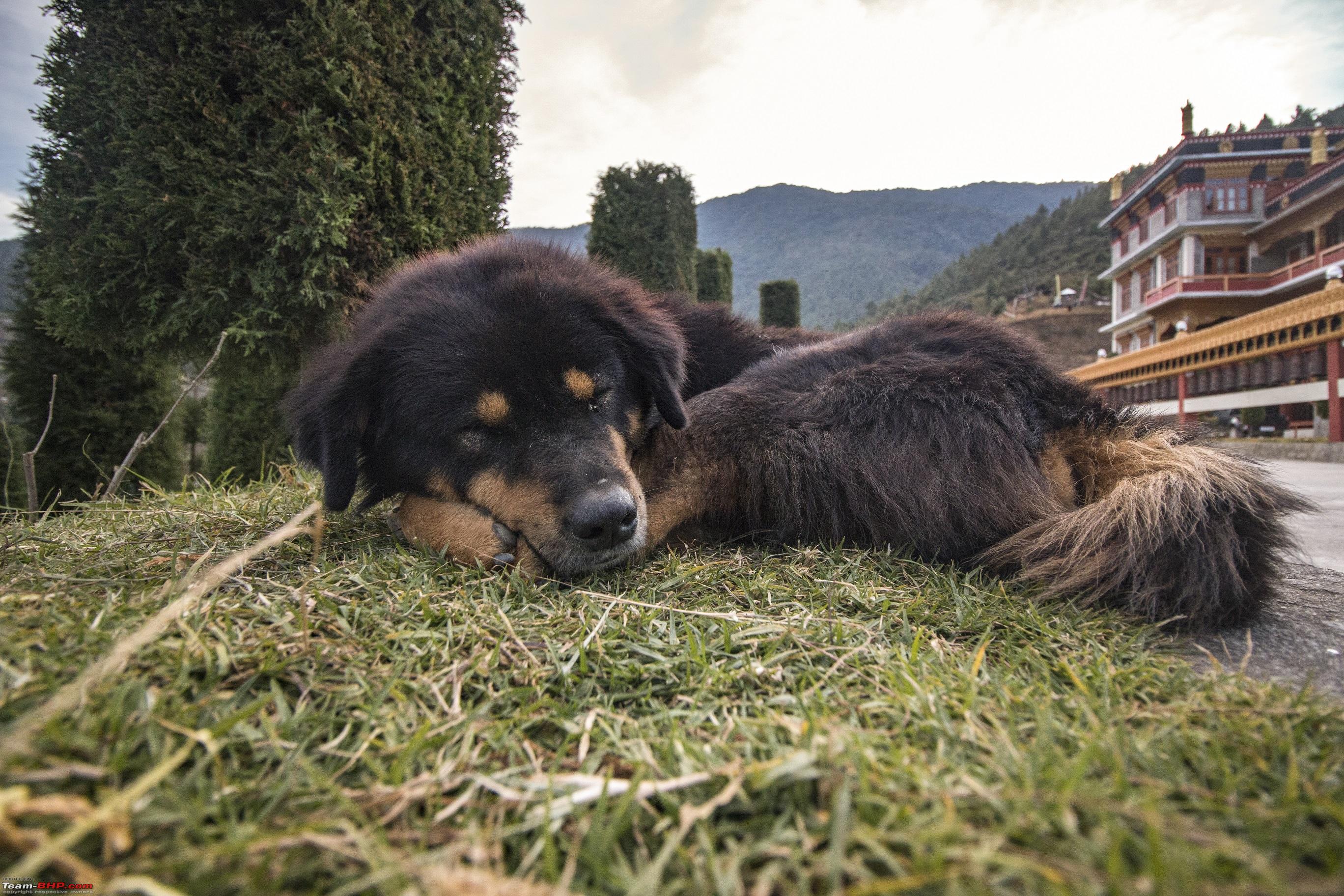 The Guide suggested visiting the hot spring but it was no where close to what it sounds like. The place is teeming with tourists and it’s a small 2 feet sprinkle of warm water. Dirang Dzong – About 5kms away from this place, a visit to this place will be fruitful. The place was a central jail once upon a time when kingdoms, empires and kings flourished but now a village with stone houses on banks of the river. The stone houses in the Dzong are unscathed despite the bargain of civilisation that makes the place antique and profligately rustic. Gpx Playback of our drive in Dirang Last edited by ARAY : 13th January 2018 at 21:48. |
|
| (15)
Thanks
|
| The following 15 BHPians Thank ARAY for this useful post: | anandpadhye, arun_josie, BlackPearl, gmhossain, GTO, haisaikat, JoseVijay, Klub Class, navsjab, Samba, sayakc, SDP, Shanksta, smuniswami, surjaonwheelz |
|
9th January 2018, 21:20
| #6 |
| BHPian | re: Hyderabad to Arunachal, Assam & Meghalaya in a Duster AWD Day 6 (Dirang Tawang) Under normal circumstances this is a treacherous route, involves crossing the Sela pass but the weather made me both happy and sad at the same time. Sad, because my plan to drive on snow and test out the Maxxis 771 and snow chains were getting farfetched. Happy, no snow means extra talented transmission not needed the AWD would be adequate. Sela Pass is located between the Tawang and West Kameng Districts. Its at 13,500ft and you can feel the altitude if you get down from the vehicle instantly. Although O2 cylinder is not needed but its a good thing to carry especially if you are travelling with kids or elders. Sela Pass is a consecrated site in Tibetan Buddhism. Buddhists believe that there are about 101 sacred lakes in and around the pass. Sela lake being one of the major ones among them. Sela lake is a large lake positioned on the north side of the pass at an elevation of 13,650 ft. This lake often freezes during the winter and feeds Nuranang River, a tributary of the Tawang River, at other times inadequate vegetation grows around the lake which is used for grazing yaks during the summer. Immediately after crossing Sela pass we encountered snow. The roads were wide and the snow was thick just the kind I wanted. Slotted in 1st gear crawl and AWD auto took care of the rest. Route: Its a straightforward path through Sela Pass. Straight forward not literally though. 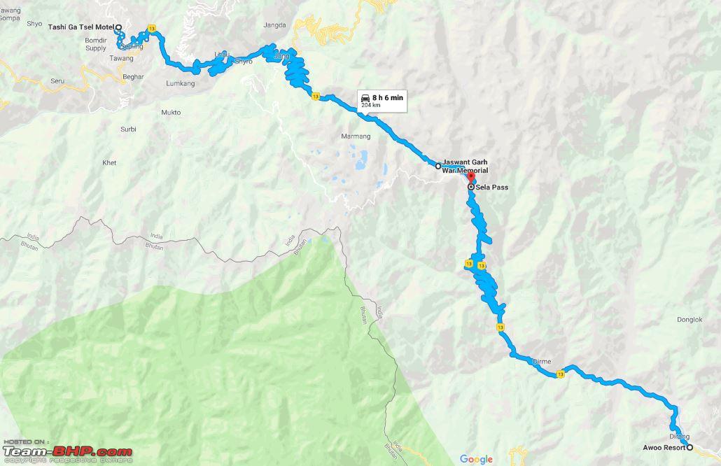 Gpx data playback , note the Sela pass and the Sela lake we stopped at. Few shots of the altering landscape  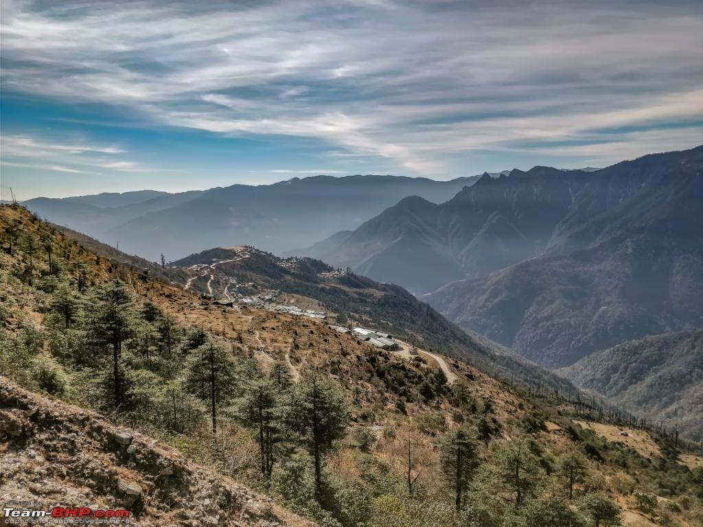 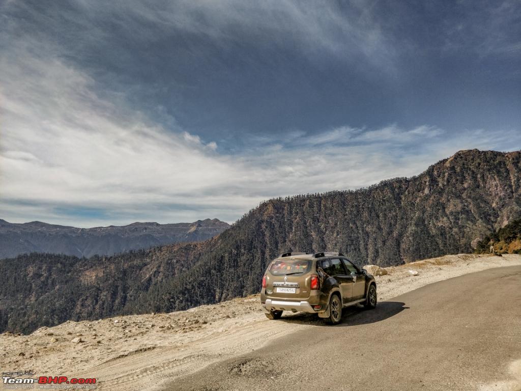 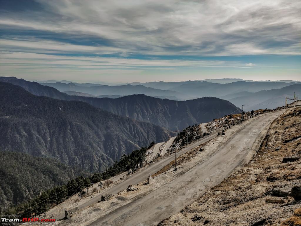 Finally we saw some snow 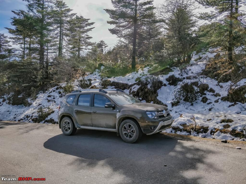 Next was the Jaswant Garh War Memorial, roughly 6kms from Sela lake. The commendable bravery shown by Jaswant Rawat was honored by building a memorial at the post where he fought the Chinese army. The post which he held against the Chinese Army was named as Jaswant Garh. Another honor bestowed upon him is that he continues in the service even after death, he has been awarded promotions as if he is still serving the Nation.Local people around Tawang area believe that he has become a saint and his spirit protects the area. The Indian army keeps at least half-a-dozen workforce here to take care of Rawat as if he is alive. This is a good link to know about the Legend: https://prashantb.wordpress.com/2016...t-singh-rawat/ Few pictures of the renowned location. 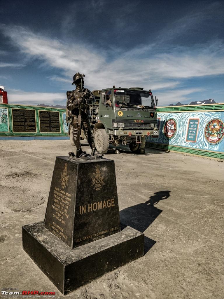 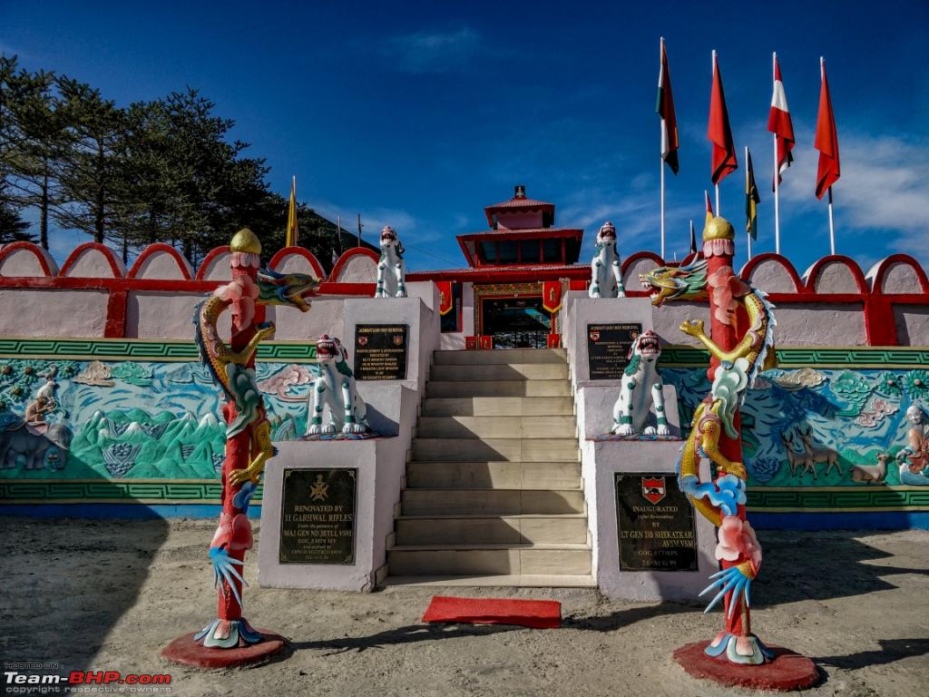  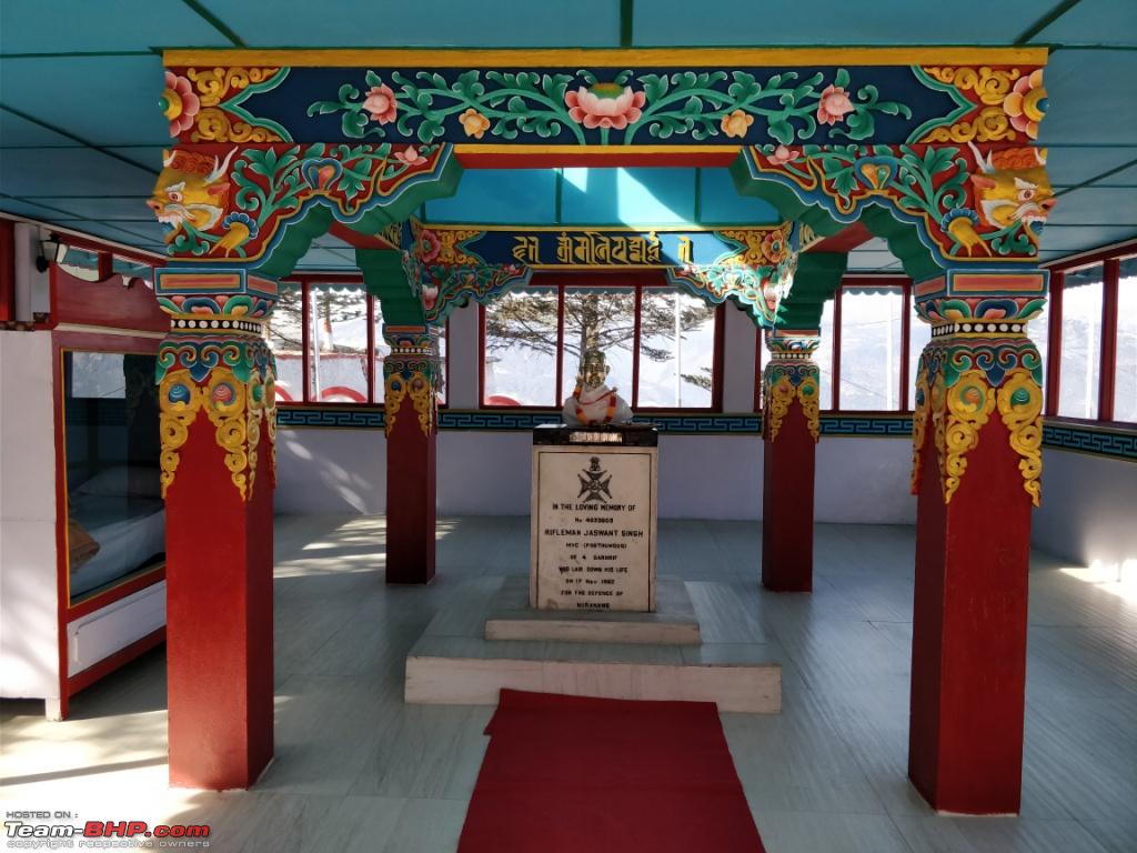 The famous foyer to Tawang  Sela Lake  Finally tastes white blood   Nuranang Falls This is also called the Bong Bong Falls. With a height of 100 meters it is indisputably one of the most beautiful waterfalls in North East India. The waterfalls is located a couple of kilometers away from Jung, on the road linking Bomdila and Tawang. There is a small hydro electricity plant at the base of the waterfalls. The waterfall mixes with Tawang River. It flows like a multi layered cascade through the slopes of hills. There is a prodigy of the waterfalls being named after a yuung Monpa girl Nura who aided an Indian soldier during the 1962 Sino-Indian War.  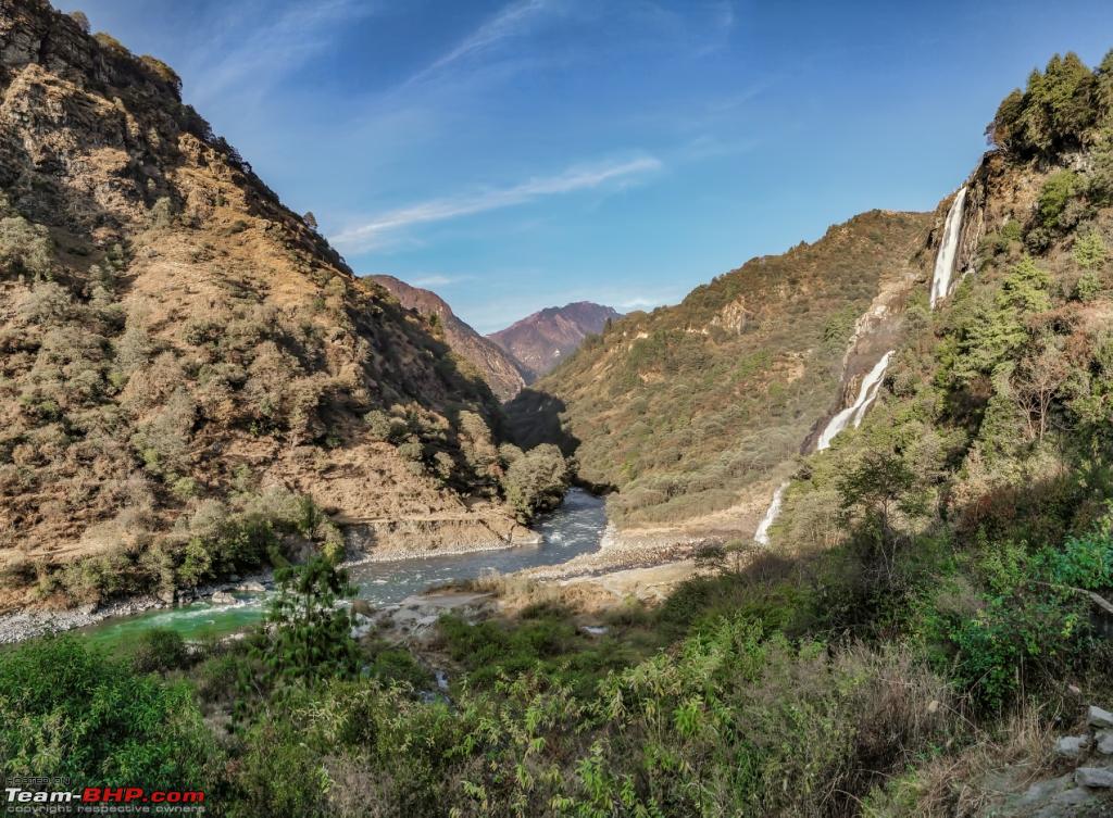 Before entering Tawang town  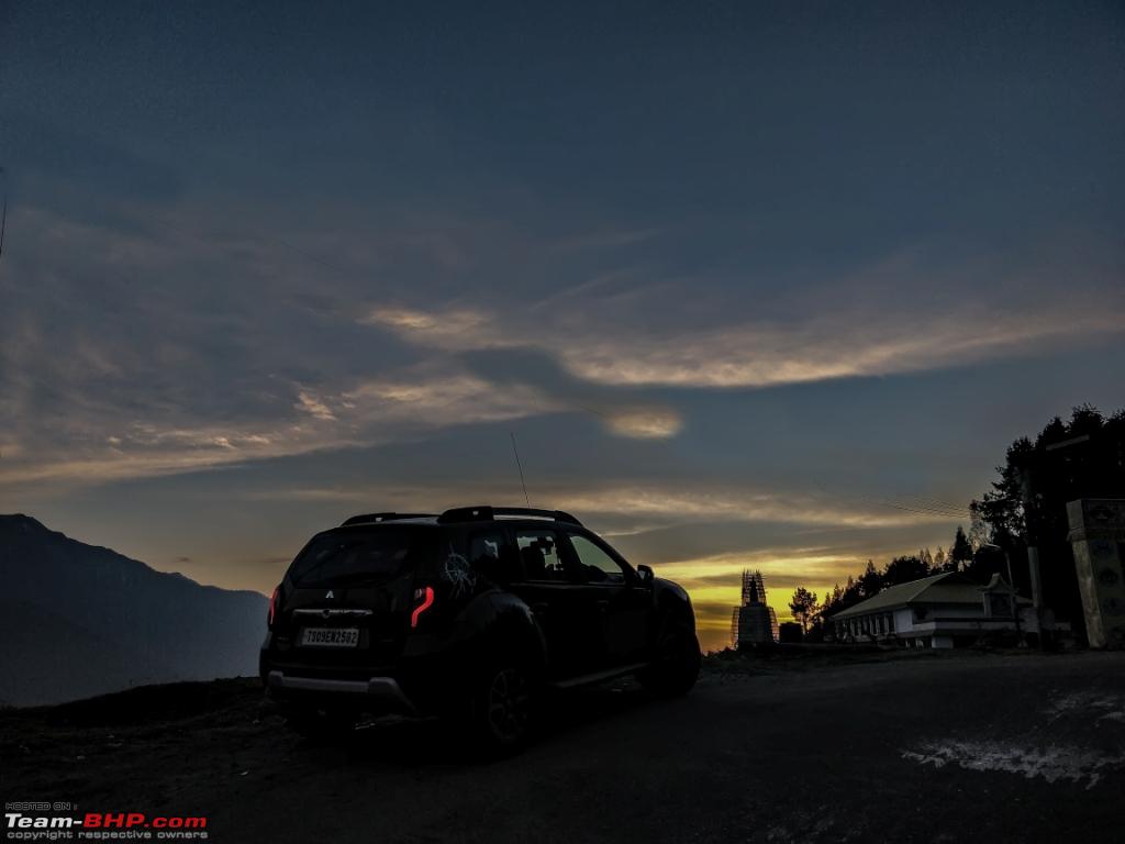 Road conditions are not the greatest to reach Tawang. However the patch just before entering the city makes up for the time loss. We reached the hotel after some roaming around in the City at around 6pm. Hotel: We were put up at Tashi Ga Tsel. The rooms are spacious and the hotel staff was very helpful. However the receptionist guy was not the greatest. I was aware of permit that would be needed to get to BumLa pass and came prepared however what I came to know from the receptionist was completely the contrary. Let me share the exchange. Me: We would like to visit BumLa what are the permits needed. Receptionist: Give me your IDs we will get everything done. Rs 500 we will get all permits ready. Me: Sure but whats the process and formalities. Receptionist: You dont worry about all that, just give us your IDs we will get it done. Me: I would like to know and if there is another permit needed for my car. Receptionist: No cars allowed only local Taxis and Taxis have permits already. Me: Ok, but mine is private white board car it should be allowed. Receptionist: Last week the local taxi guys and army had a meeting where it was decided only local Taxis would be allowed. Taxi associations have a very stringent rule of not allowing private cars. Me: Sure they do, give me some time and your wifi password, let me check things out. Receptionist: Also your car cant go to BhumLa , roads are bad and only big vehicles can. You will need lots of ground clearance. Me: Wifi password please. Even though Airtel 4G did a great job but still who does not like free wifi. Smiled and left for the room. Posted in HVK- Forum and everything was sorted in next 15minutes. [LINK: https://www.facebook.com/photo.php?f...&theater&ifg=1 ] Although I understand that tourism is a major economic contributor in the region but hotels misguiding tourists was the last thing I anticipated. Anyhow Day 6 was pretty long but was very glad things were sorted and I was a bit more confident about the process. Last edited by ARAY : 13th January 2018 at 21:50. |
|
| (18)
Thanks
|
| The following 18 BHPians Thank ARAY for this useful post: | agspins, anandpadhye, arun_josie, BlackPearl, gmhossain, GTO, haisaikat, JoseVijay, Klub Class, navsjab, Nonstop-driver, PapaBravo, Samba, SDP, Shanksta, smuniswami, surjaonwheelz, TOINGPOING |
|
9th January 2018, 23:01
| #7 |
| BHPian | re: Hyderabad to Arunachal, Assam & Meghalaya in a Duster AWD Day 7 (Getting permits for BumLa , in and around Tawang) The procedure for getting the permit is easy and straight forward, folks at all offices are helpful. Let me elaborate. Started from hotel at 8:30am , reached the DC office by 8:55am. The authorities arrived by 9:15am. Spoke to one of the senior folks there and was as usual a bit amazed to see a Telengana registered Duster parked at their premises. He gratified and asked one of his colleagues to collect the documents from me. I handed over the Inner Line permit (ILP) photocopy, Adhaar card of all members, Photocopy of the RC book of the car. While I stood there chatting with the Police folks in next 8 minutes the same guy came back and handed me over two documents with all the obligatory stamps. One was a carbon copy and another original. He asked me to submit both the documents to Brigade office (Opposite to Tawang War memorial) before 2pm so that I could get the permit before 8am the subsequent day. The places are positioned nearby, its just a matter of taking the right turn at the hills  To stay away from the market every time that U turn is critical and just before entering the war Memorial the extreme left turn in important. All the Government as well as non Government building premises are beautifully constructed and very well maintained in the entire State. Entrance to DC Office 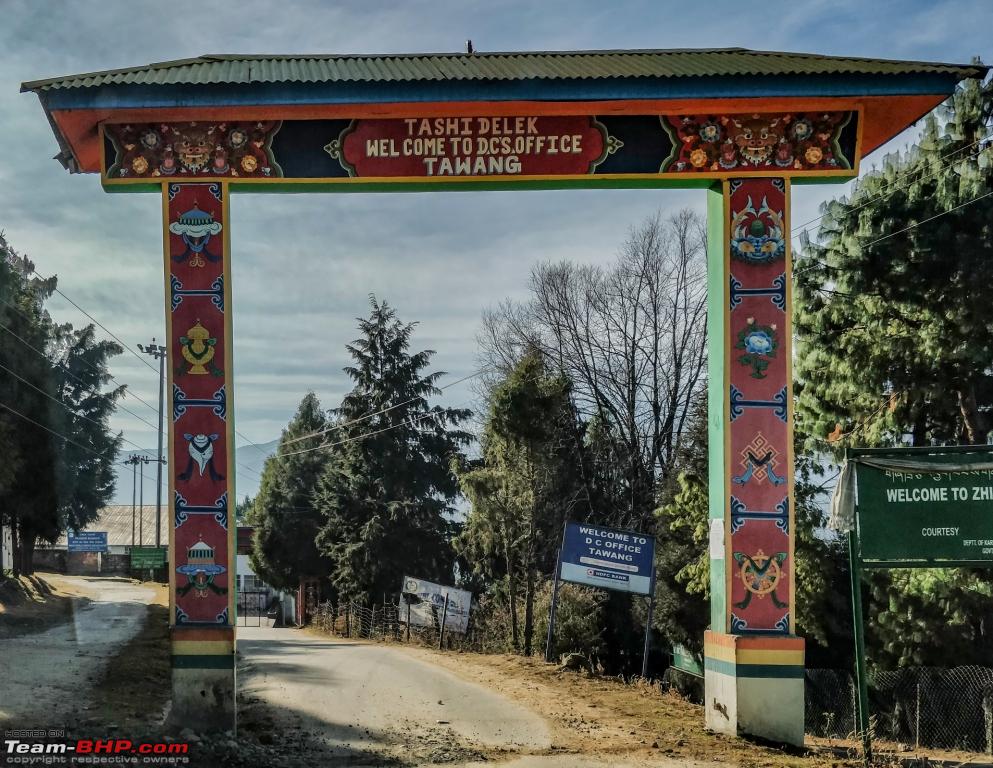 We had plans of visiting the war memorial next, headed for the Brigade office. The Army folks took both the documents and an additional copy of the Adhaar cards and RC book and asked me to come at 7:30am to collect the permit the next day. To appreciate the War Memorial better we need to comprehend the war of 1962 better. In November 1961, Nehru authoritatively adopted the "Forward Policy" of setting up military outposts in dubious areas, including 43 outposts north of Zhou's LAC. The McMahon Line is a edging line between Tibetan region of China and North-east region of India, anticipated by British imposing administrator Henry McMahon at the 1914 Simla Convention which was signed between the British and the Tibetan legislature. It is currently the LOC between China and India, even though its lawful status is being uncertain between the Indian and the Chinese government. The McMahon Line is regarded by India as the legal nationwide border, but China rejects the Simla agreement and the McMahon Line, challenging that Tibet was not a sovereign state and therefore did not have the power to wrap up treaties. In 1954, India renamed the undecided area the North East Frontier Agency. There are two common ways in which the term "Line of Actual Control" is used. . On 8 September 1962, a Chinese unit attacked an Indian post at Dhola in the Namka Chu valley immediately south of the Thag La Ridge, seven kilometres north of the McMahon Line .In 1981, Chinese leader Deng Xiaoping offered India a "package settlement" of the border concern. Eight rounds of talks followed, but there was no harmony. In 1984, India Intelligence Bureau personnel in the Tawang region set up an surveillance post in the Sumdorong Chu Valley just south of the premier hill summit, but three kilometres north of the McMahon Line (the straight line portion extending east from Bhutan for 30 miles). Tawang War Memorial   Just trying to understand the proportions 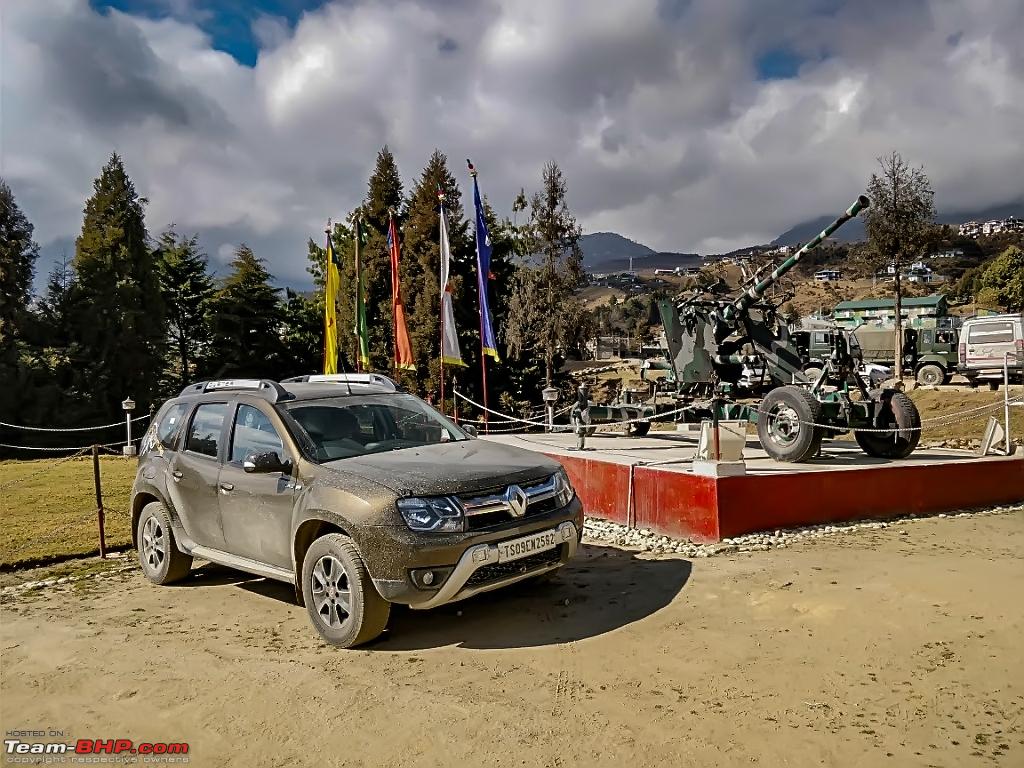 View of the Tawang Valley 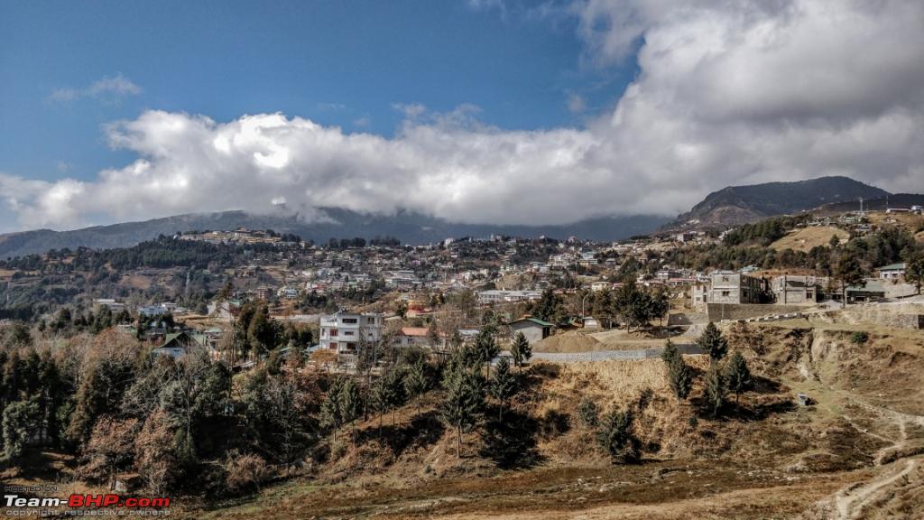 Cultural and economic relations between China and India date back to ancient times. The Silk Road not only served as a major trade route between India and China, but is also endorsed for facilitating the spread of Buddhism from India to East Asia. Relations between contemporary China and India have been characterised by border disputes, resulting in three military conflicts — the Sino-Indian War of 1962, the Chola incident in 1967, and the 1987 Sino-Indian skirmish. Spent the evening browsing places in Tawang. Tawang monastery is a place you might want to go before 3pm on wintery days. It is situated in the valley of the Tawang River. It’s a huge monastery and requires significant amount of time to understand the sentiments of the place. The monastery was founded by Merek Lama Lodre Gyamsto in 1680-81 at the behest of the 5th Dalai Lama, who was his subordinate. When Merek Lama was experiencing difficulty in building the monastery at the chosen location of Tsosum, the ancient name for Tawang, the 5th Dalai Lama issued guidelines to the people of the area to provide him all help. The monastery has a printing press for printing religious books using paper made locally. Prior to the dominance of the Gelug sect of Buddhism in Tawang, the Nyingmapa or the Black Hat sect of Buddhism was dominant and this resulted in their hegemony and even hostile approach towards the founder, Merek Lama. This problem was compounded by the Drukpas of Bhutan, who also belonged to the Nyingmapa sect, who even tried to invade and take control of Tawang. Hence, when the Tawang monastery was built like a fort structure, a strategic location was chosen from the defense point of view. Tawang Monastery, is the largest monastery in India and second largest in the world after the Potala Palace in Lhasa, Tibet. Entrance to Tawang Monastery 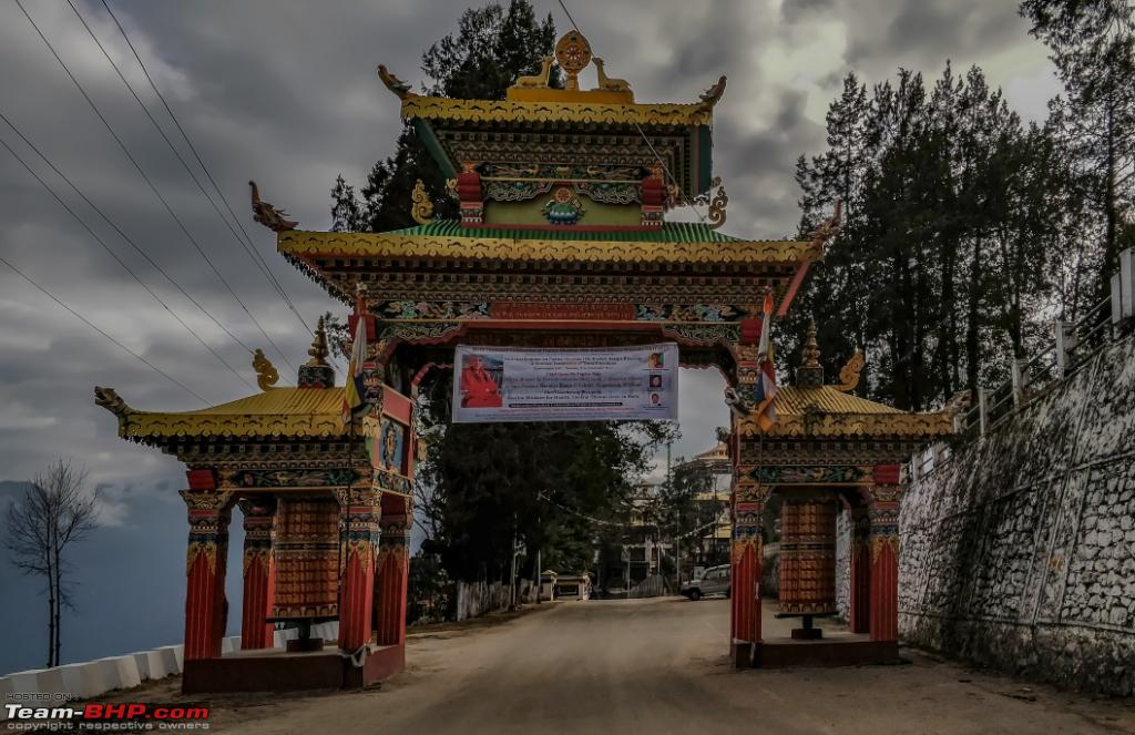 Inside the Tawang Monastery 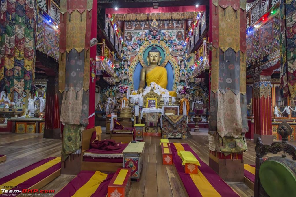 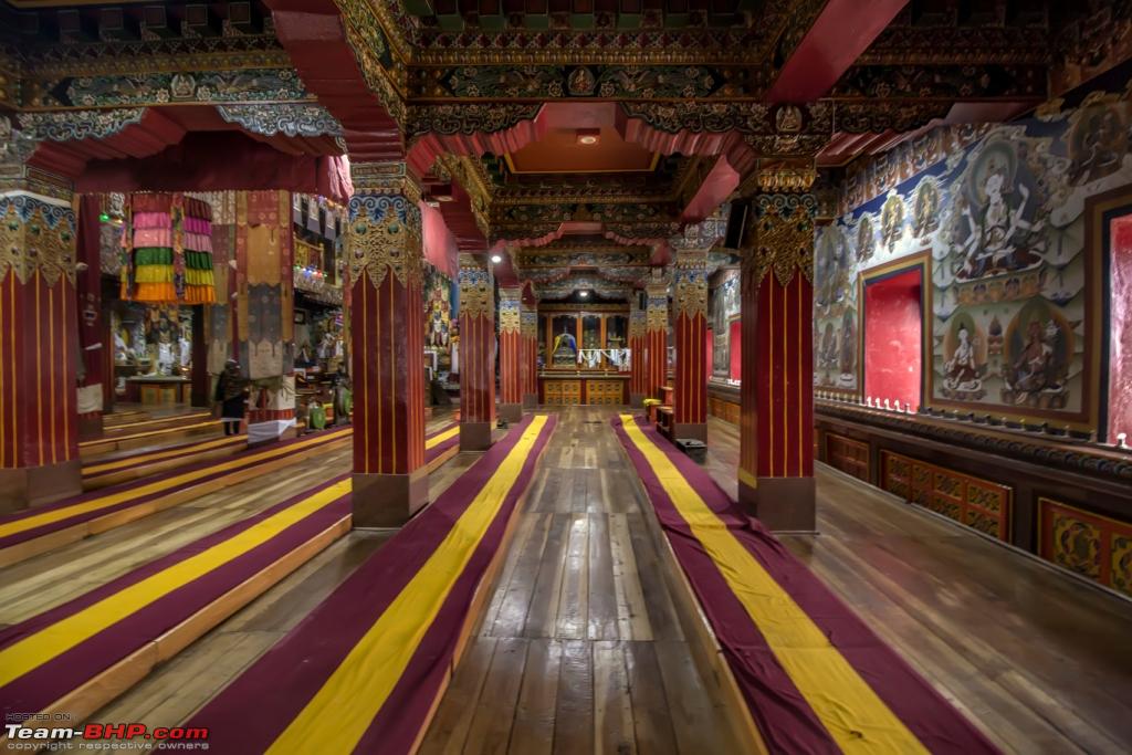 Few Images of the Gompas inside 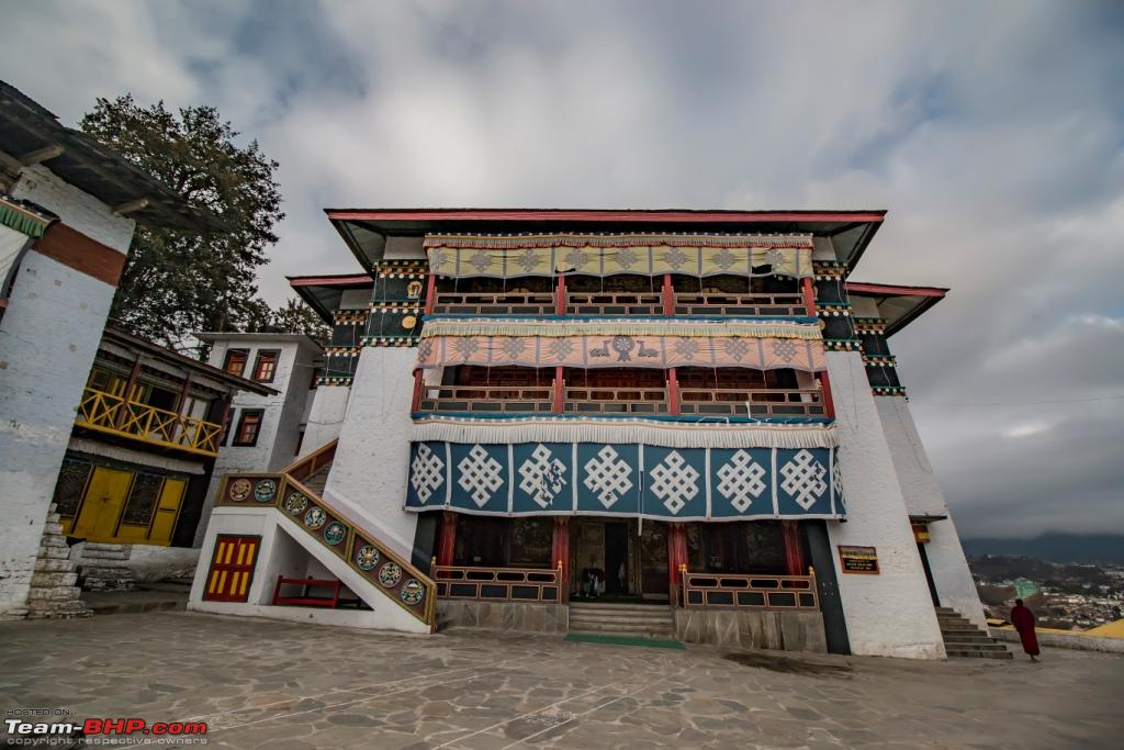   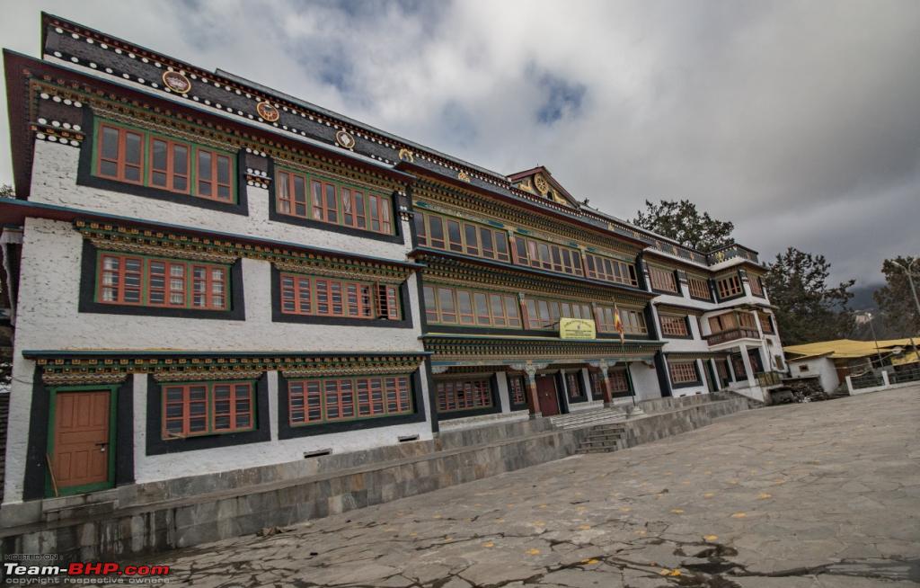 Post sunset, the evening was exhausted in shopping , there are two markets Old market and Nehru market. Unlike other Hilly markets, you can park your vehicle right in the middle of the market. Its crowded but very well managed. Few roads near the market are one way till 9pm so watch out for that. Tawang was a great experience, touristy spot but not excessively. Shopkeepers are good and the people around smiled even though they didn't know. We called it a day, The next day would be long and into unknown. 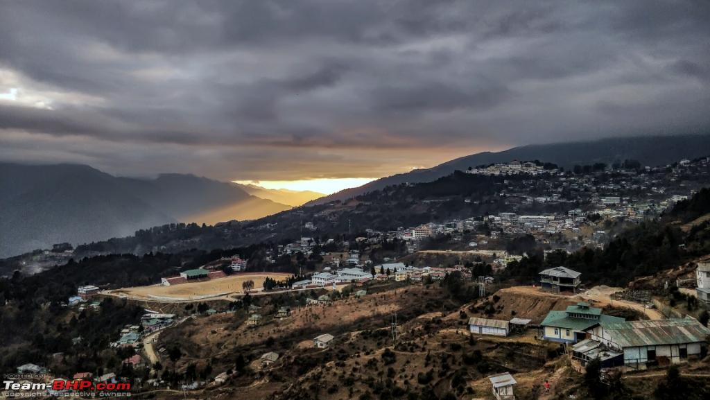 Last edited by ARAY : 13th January 2018 at 21:51. |
|
| (16)
Thanks
|
| The following 16 BHPians Thank ARAY for this useful post: | agspins, anandpadhye, arun_josie, BlackPearl, gmhossain, GTO, haisaikat, JoseVijay, Klub Class, nilanjanray, Samba, SDP, Shanksta, smuniswami, surjaonwheelz, TOINGPOING |
|
10th January 2018, 21:19
| #8 |
| BHPian | re: Hyderabad to Arunachal, Assam & Meghalaya in a Duster AWD Day 8 ( BumLa , Sungester Lake and few other places) Speaking to few local folks the day before we came to know that Taxi guys do try to act smart and block you enroute. We were suggested to bypass the market area and take the road that goes immediately after Tashi Ga Tsel to avoid unwanted questions. We exactly did that and no one bothered us. The first check post is approximately 30kms from the city. After 34kms you can forget good roads. The plan initially was to go to BumLa but we crossed almost 30-40 cabs and spoke to few of them and all of them were heading for BumLa first. We decided to go to Sungester Lake first and then do BumLa. At the second check post we met a Charming young Major and shared my plan and enquired about the gate closure times for BumLa. He suggested the same to avoid tourists and that the BumLa closure time due to the weather would be 4pm. Took left at the “y” junction and headed for Sungester Lake. From the Lake we went for Taktsang Gompa. We wanted to go to Zemithang the same day but that needed a whole day. If we had an additional day the best option would have been. Tawang – Zemithang (stay a day) – T Gompa - Sungester Lake – BumLa – Tawang. However that being said the terrain is vast and remote its best to tailgate any army vehicle or local cab if possible. Route: 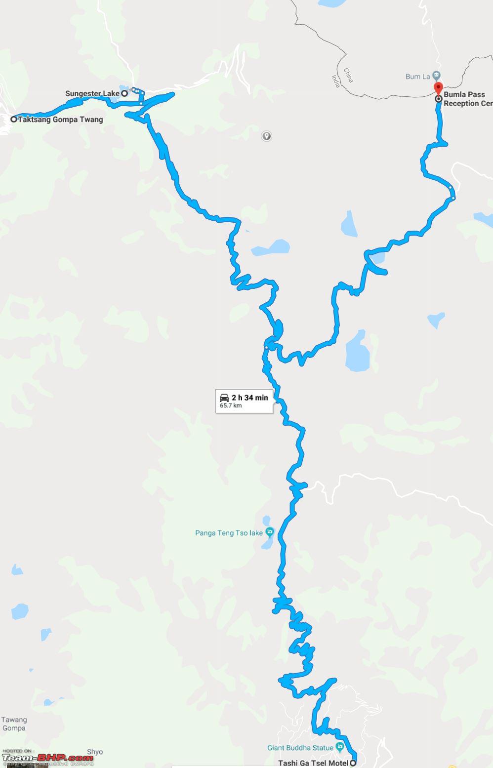 Short extract from the GPX data 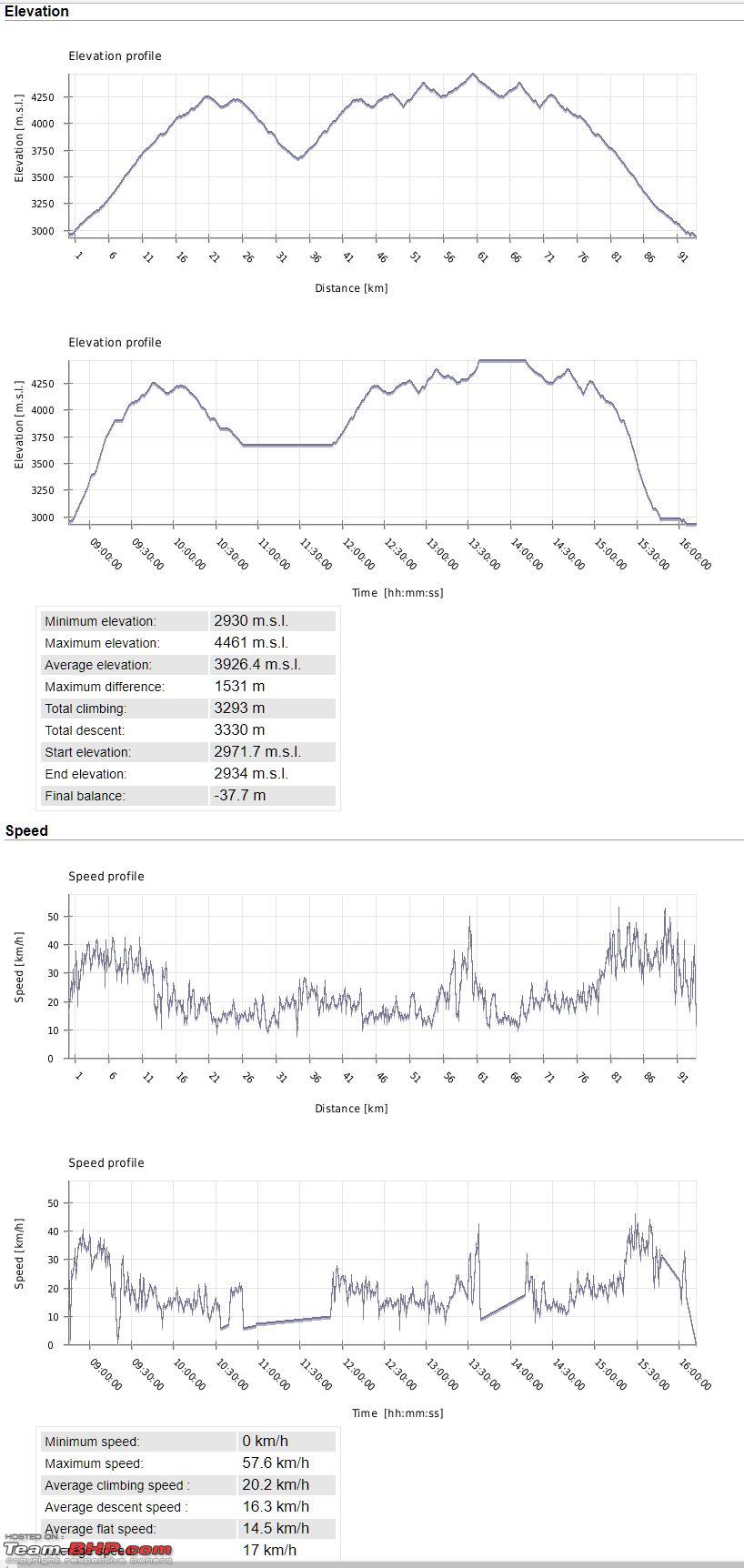 For last 31 years I have written the letter "Y" in several ways, but this Y , I am really happy about.  Stopped by the Buddha Statue which can be seen from anywhere in the city.  First view point after we started climbing for BumLa 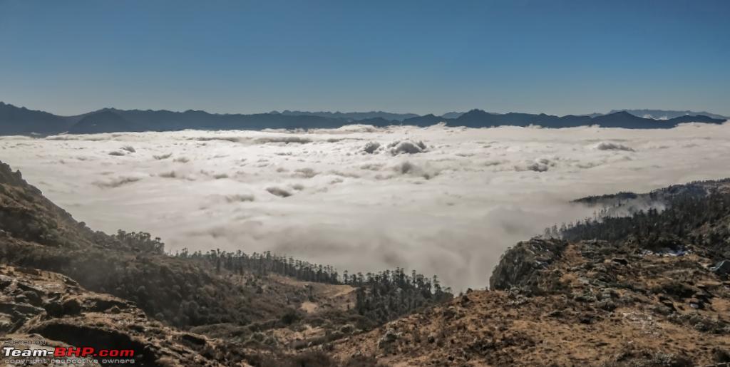 A lake en route [Pangateng Tso Lake] 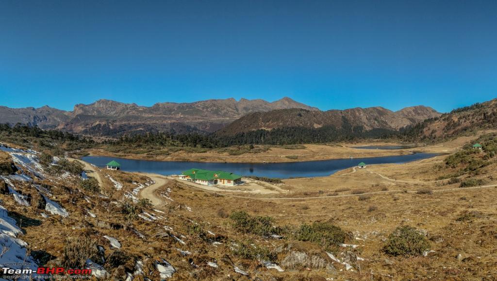 On the way almost before the Y junction  Soon enough we reached the Sangetsar lake also called Madhuri Lake but I will stick with Sangetsar lake. The Sangetsar Lake is located about 30 kilometres in the north-east of Tawang. The Lake is one of the remotest high-altitude lakes in the country and is deeply revered by Buddhists. Formed after an earthquake hit the region in 1950, the lake has a picture-perfect Himalayan milieu and ideal for photo-ops. There's a cafeteria by the lakeside which is run by the Indian Army and serves basic snacks. The breathtaking view of the lake makes you feel your imaginations and paintings have really come true. The adorable calmness and tranquility of the place is sure to mesmerize you for your lifetime. It’s once in a lifetime experience and makes it’s tough to depart from this area. No words can justify the magnificent view of the place. “Beautiful and Incredible India indeed”. Areal View from an adjacent hill. 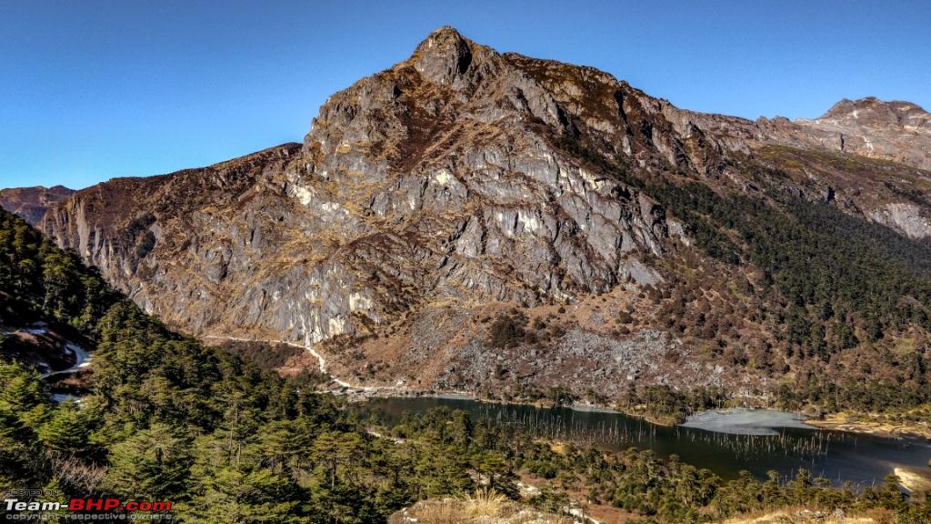 Road leading to Sangetsar lake 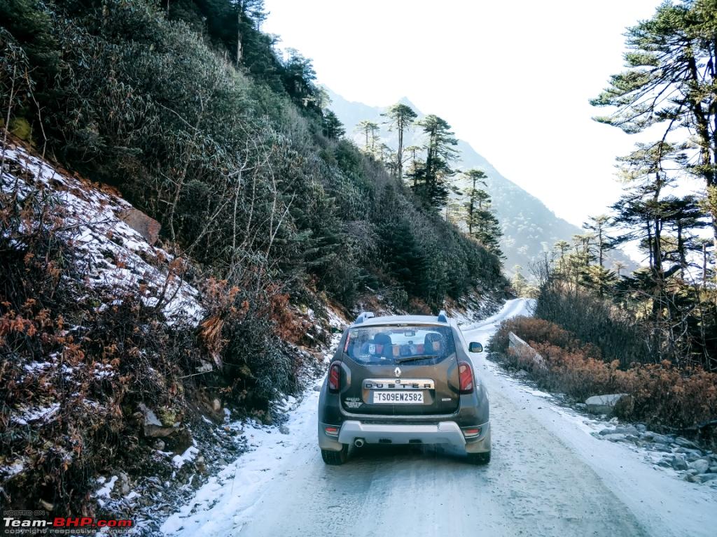 Entrance to the Lake 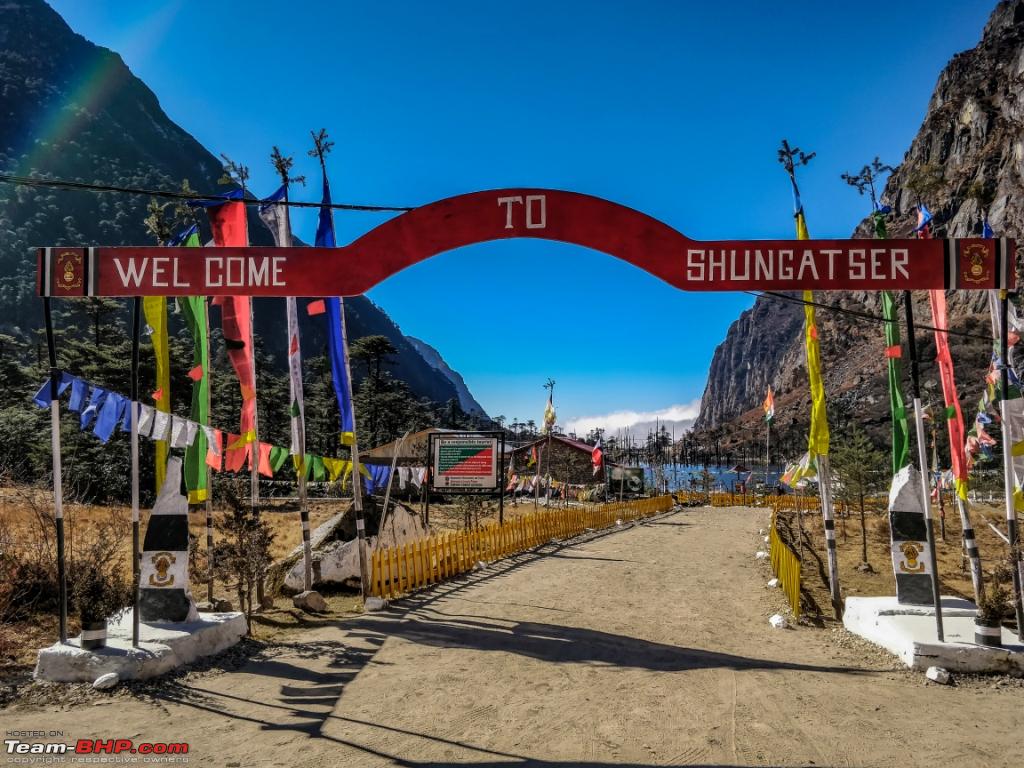 Formed after an earthquake hit the region in 1950 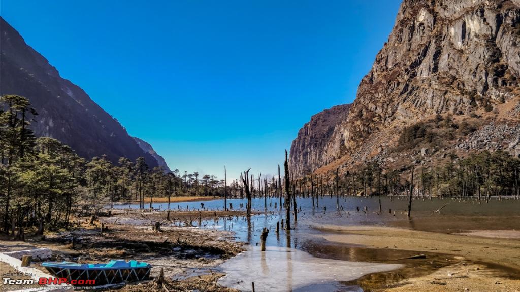 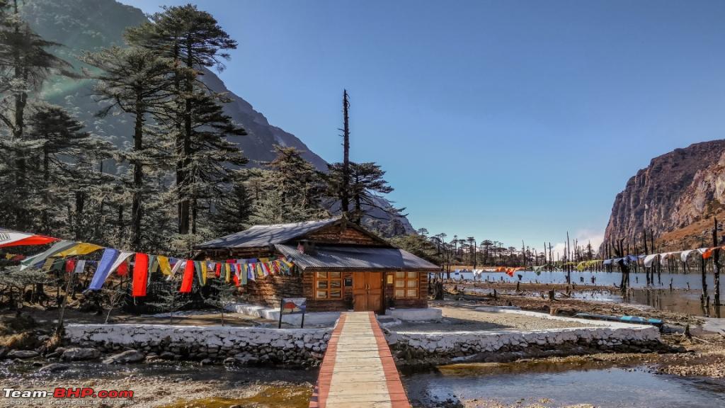 Parking near the lake.  Short video of the drive to the Lake, Christmas was round the corner and what better ways to celebrate The region is famous for its numerous lakes and we could see most of them from the roads that passes by. Although the pictures wont do justice but all of them were frozen. 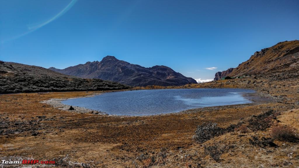 Notice the frozen streams leading to the lake. 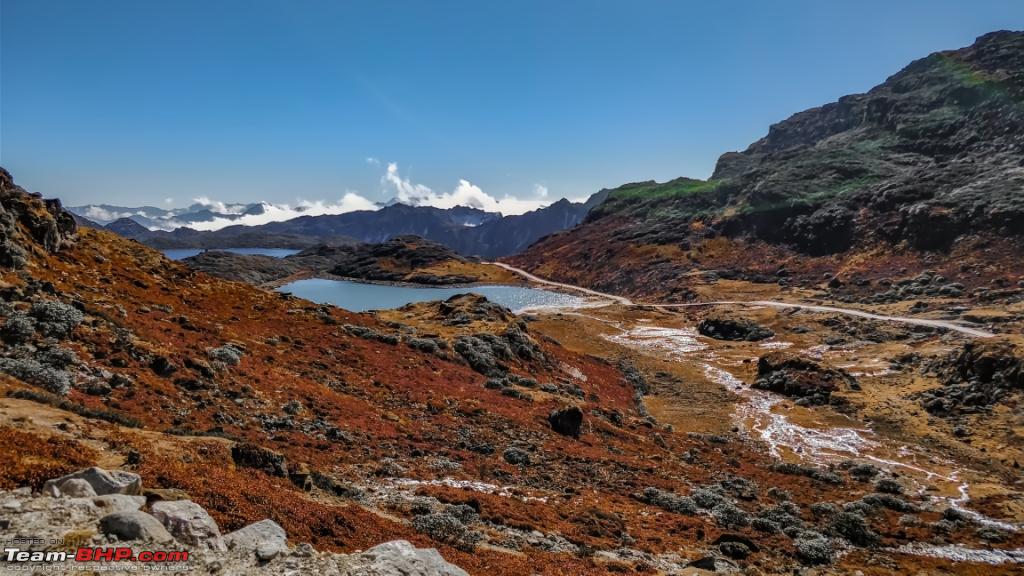 There are 100+ of these here, 101 of them being very sacred. 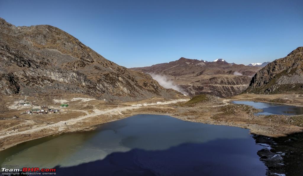 The road from the lake to the T Gompa is roughly 4kms but takes around 20 minutes  Located at a distance of around 50 km from Tawang town, Taktsang Gompa is placed near the Sangetsar Lake and border of China. This Gompa stands on the edge of a small hill. It is believed that Guru Padmasambhava visited this place for meditation during the 8th century. Encircled by thick coniferous forest and lofty mountains, this monastery is visited by devotees in decent numbers every year. 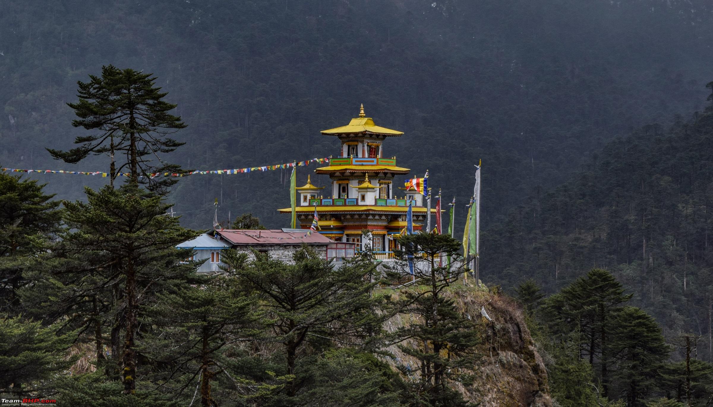 Next was BumLa Pass, one of the reasons why I had driven all the way. In 2006, Bumla pass was re-opened to traders for the first time in 44 years. Traders from both sides of the pass were permitted to enter each other’s territories, in addition to postal workers from each country. It is often covered with heavy snow throughout the year. It is one of the most off-beat passes in the world and is also referred to as the pass from where Dalai Lama entered India escaping from Tibet. Just before reaching BumLa 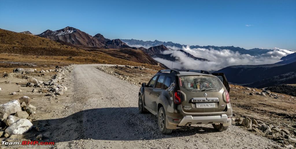 The road  The Parking 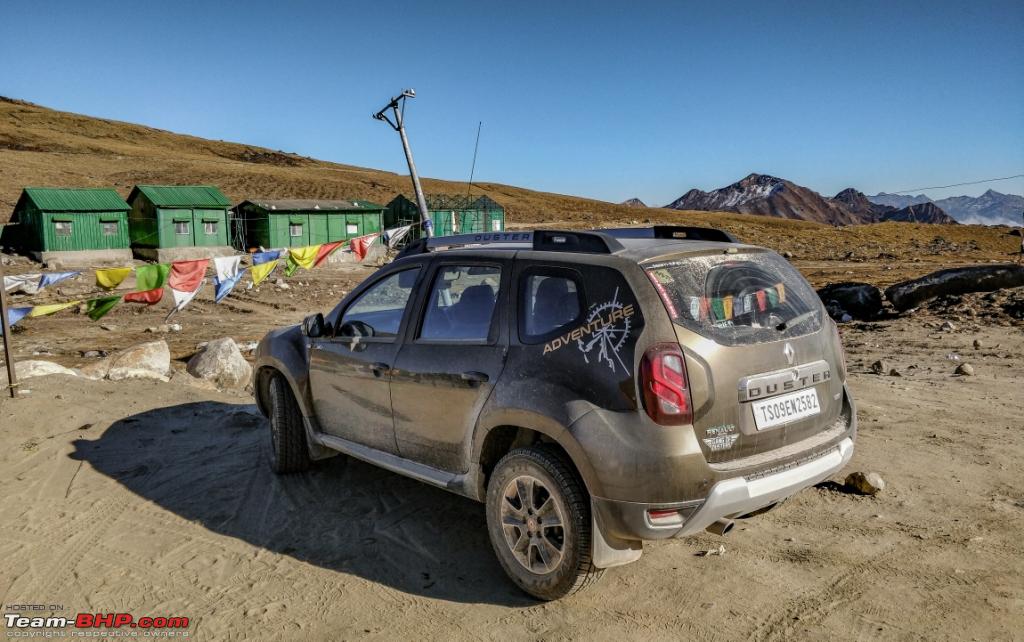 A funny incident happened at the parking lot though. ME: Bhaiya parking idhar hi hay ya aage hay ? ( Brother, is the parking here or somewhere further) Army Guy : Aage ? Aage kahan parking karoge aap, India toh idhar hi khatam hogaya. ( Further, this is where India ends) ME: Theek hay fir Idhar hi park kar deta hoon . ( Sure, then ill park here then ) Never had I thought I would get this reply. The place, situation and the way the Army guy addressed my question was ironical to say the least. Video of the terrain, climbing BumLa There is a Heap of Stones where tourists and visitors place a pebble on the Heap of Stones as a reminder that Mighty Himalayas as our Guardian of Northern Frontier and as a tribute to the Indian Army guardians of the border. We came to know there are meetings held 4 times in India and twice in China, few Army officials exchange good faith. Their visits are remembered by writing the dates on the rocks. An Army personnel received us at the parking and explained us about the place and the border situation. The amount of new updates we got from him and the way he described the place and how their daily chores revolve around our country is a charm to hear. It was a pleasure interacting with the young Army guy. No matter how much we thank them its not enough what they are doing for our Nation. 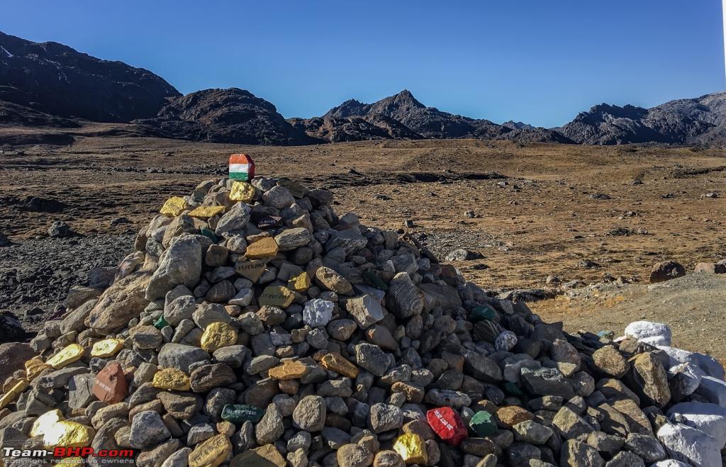 India , that's it.  Somewhere North of the North 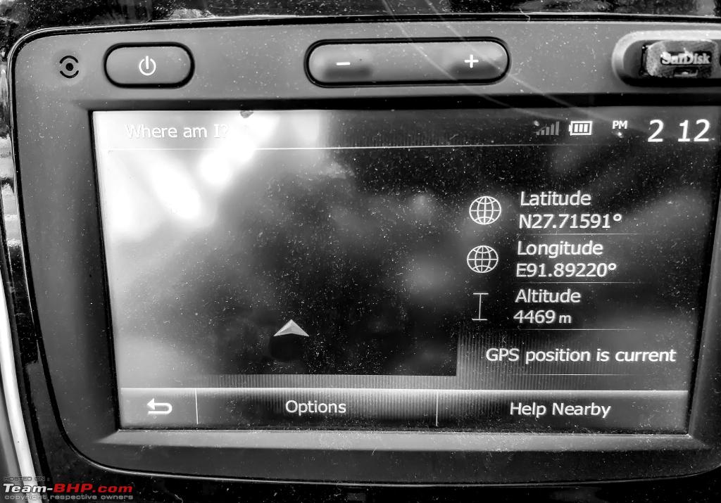 Since we were with a 3 year old we left the place in next 40 minutes. While returning all of us were kind of bit sad but felt proud of our heroes, THE INDIAN ARMY. Few structures on the way reminding us of the valour and bravery. 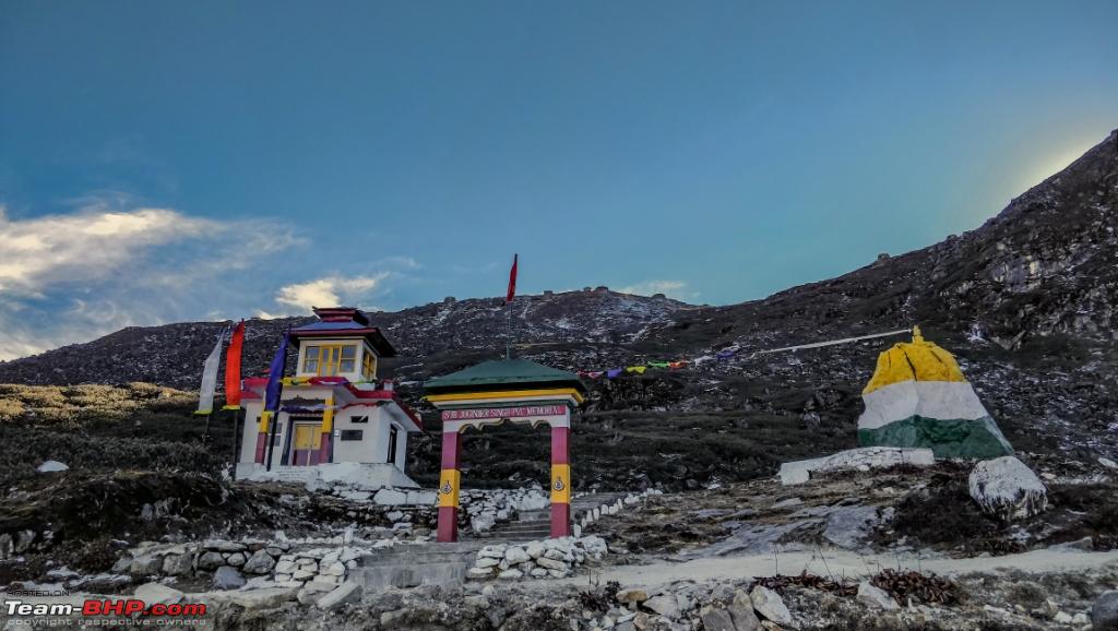 Frozen Sela Lake  The descent from BumLa was fast and except few lakes we saw a Gurdwara located at that altitude. Its said Guru Nanak Dev JI was a great missionary and traveler. He traveled through South asia with his message of salvation. His travel in 4 different directions are called "UDASIS" . The Lamas hold high esteem and refer him as Bhadra Guru. Details of Guru's further visit into China is shrouded in mystery. However the Chinese claim that because of him they had named one of their prominent cities as 'NanKing' after Guru Nanak Dev Ji. I was unaware of the the existence of Sikhs in that area and curiosity led to this URL : http://www.sikhiwiki.org/index.php/N...dakh_and_Tibet and http://www.patheos.com/blogs/drishti...etan-buddhist/. 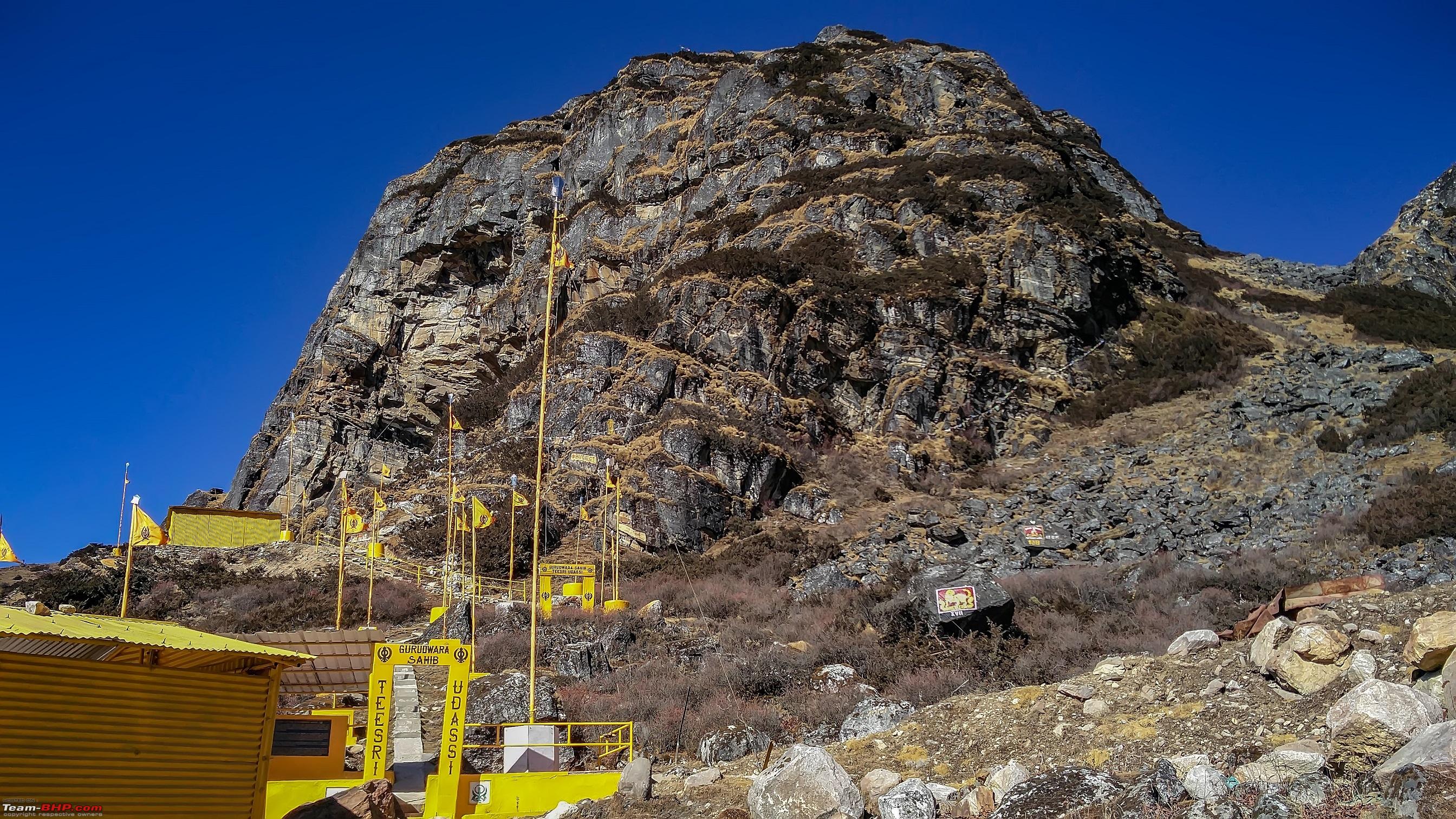 Finally GPX, Playback - I played back several times myself. We reached the hotel and there was still some light left of the day. It was a long day but not tiring, thanks to the rear independent suspension my wife and kid were very comfortable to the extent they wanted to finish their shopping. We came back to hotel at 8pm yes finally the shop keepers had to close their shops. Last edited by ARAY : 14th January 2018 at 03:13. |
|
| (19)
Thanks
|
| The following 19 BHPians Thank ARAY for this useful post: | agspins, anandpadhye, arun_josie, BlackPearl, dpkbehera, GTO, haisaikat, JoseVijay, Klub Class, navsjab, nilanjanray, rrsteer, Samba, sayakc, SDP, Shanksta, smuniswami, surjaonwheelz, TOINGPOING |
|
11th January 2018, 11:29
| #9 | |
| BHPian | re: Hyderabad to Arunachal, Assam & Meghalaya in a Duster AWD Day 9 ( Tawang – Bhalukpong) This was a long stretch but decided to do it anyways to save a day. The decision sounded perfect till Bomdila and even till Rupa post which situation deteorated. Due to the recent widening of the roads presently there are NO roads. Rupa to Bhalukpong is 80 kms and takes 4 hours so average speed is 20kmph. It was dark and there were no roads thanks to the LED setup at least things were lit up. However all that melted away once we were in the hotel. Since Bhalukpong is a small town we did not have too many options for hotel. The return journey from Tawang was equally breathtaking and we finally got a chance to drive over clouds. We decided to get off from the car at one of the places and the wind almost took us off. It was fun and the clouds underlined the vastness of the terrain. Please use headphones, I think we all love some bass. Route : Tawang - Dirang - Bomdila - Rupa - Bhalukpong Tawang - Rupa - 200kms 7 hrs ( ~29kmph) Rupa - Bhalukpong - 86kms 4 hours ( ~ 21 kmph) The Rupa to Bhalukpong stretch is under major rennovation, best bet would be to cross this stretch very late at night (post 7pm is late night at Hills) or early morning. GPX data file playback of the track Quote:
The weather at Sela Pass had changed drastically. While going we encountered a lot of dust and red soil. While coming we could see fresh snow all around. Uponn coming down a little we even experienced fresh snowfall. This was a very big deal for the trip, all of us got down and started messing with fresh snow. Small cotton like white things dropping on our palms. Its something we would remember and cherish for a long time.  Ice formations  The Sela Pass 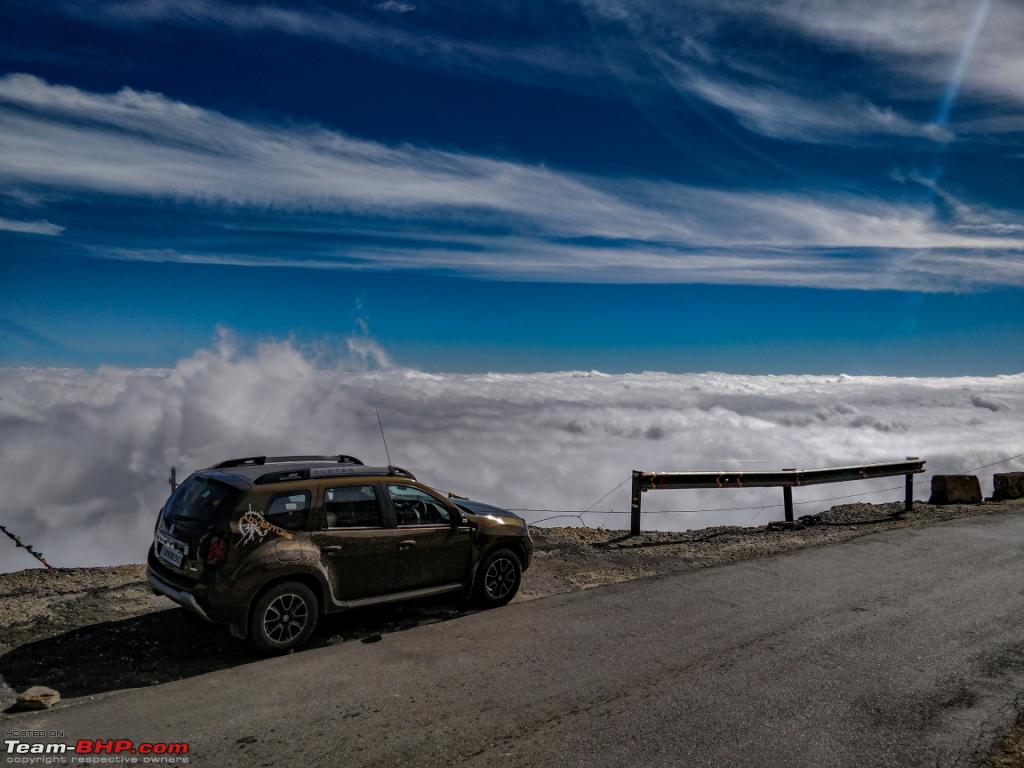 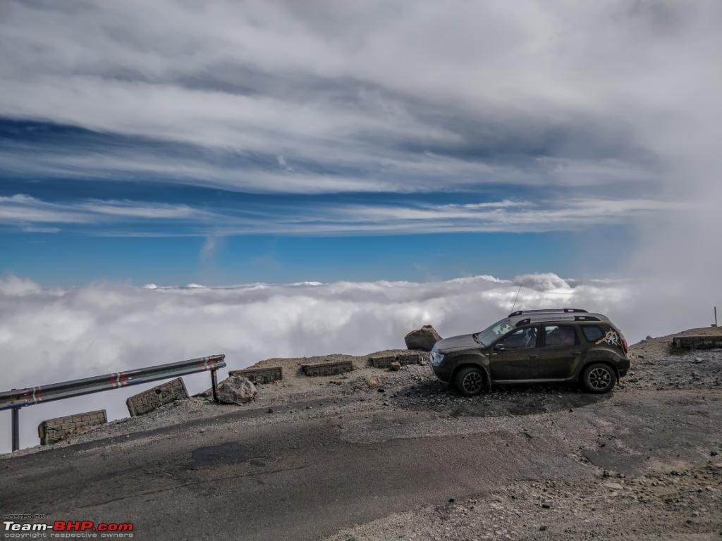 Random shots near a stream at Sela Pass 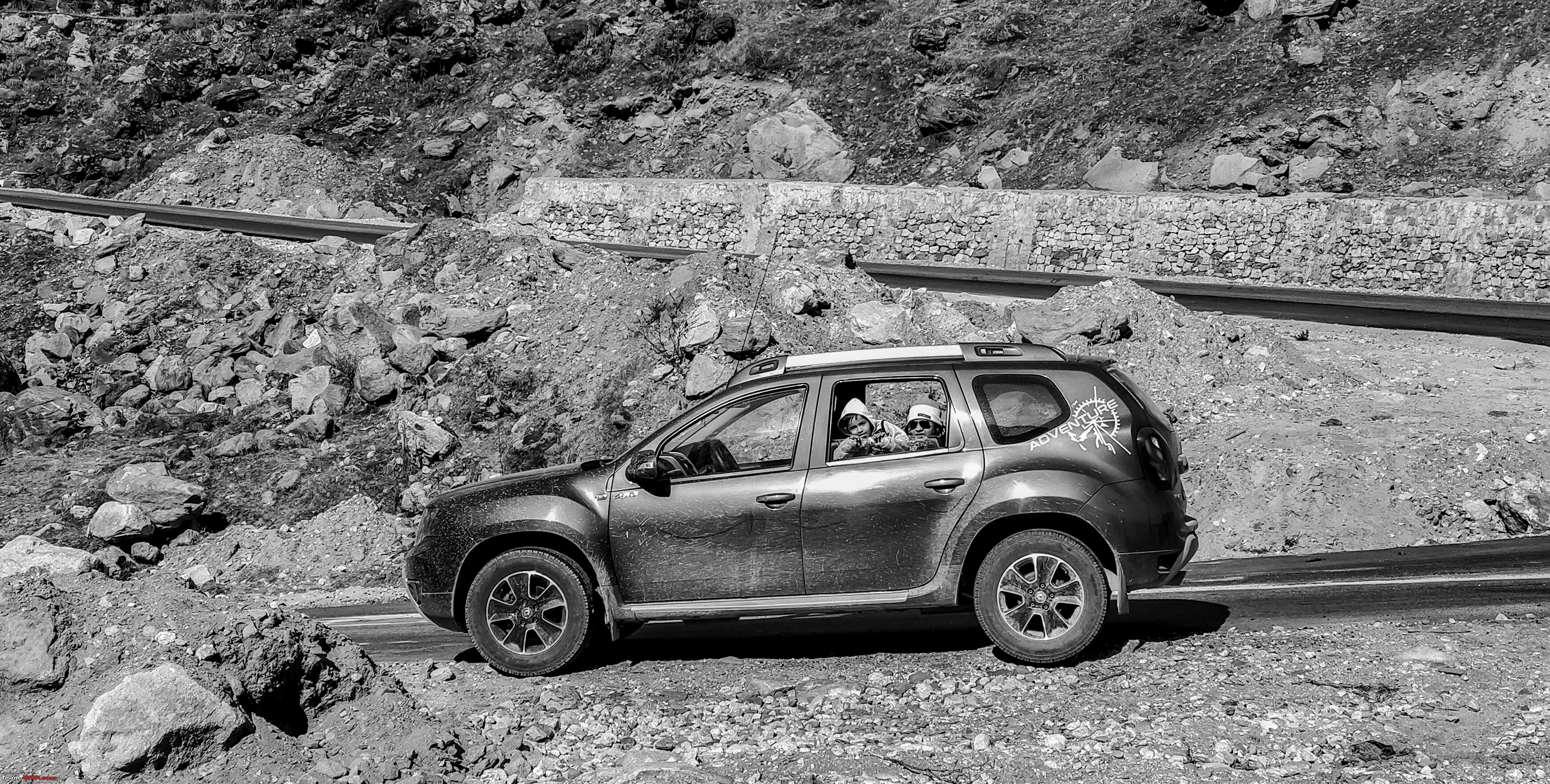 Scenic yet treacherous  And then we have BRO 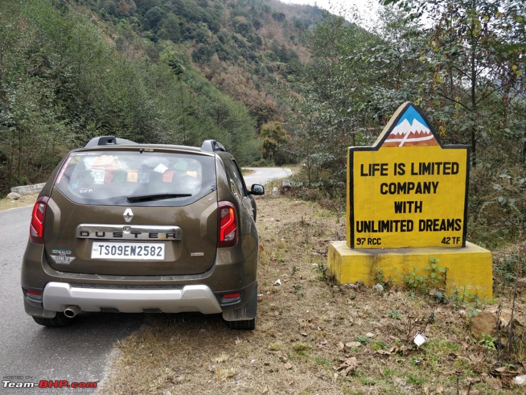 They don't ask for Toll yet they make some of the most beautiful stretches  Beautiful roads all around till Rupa  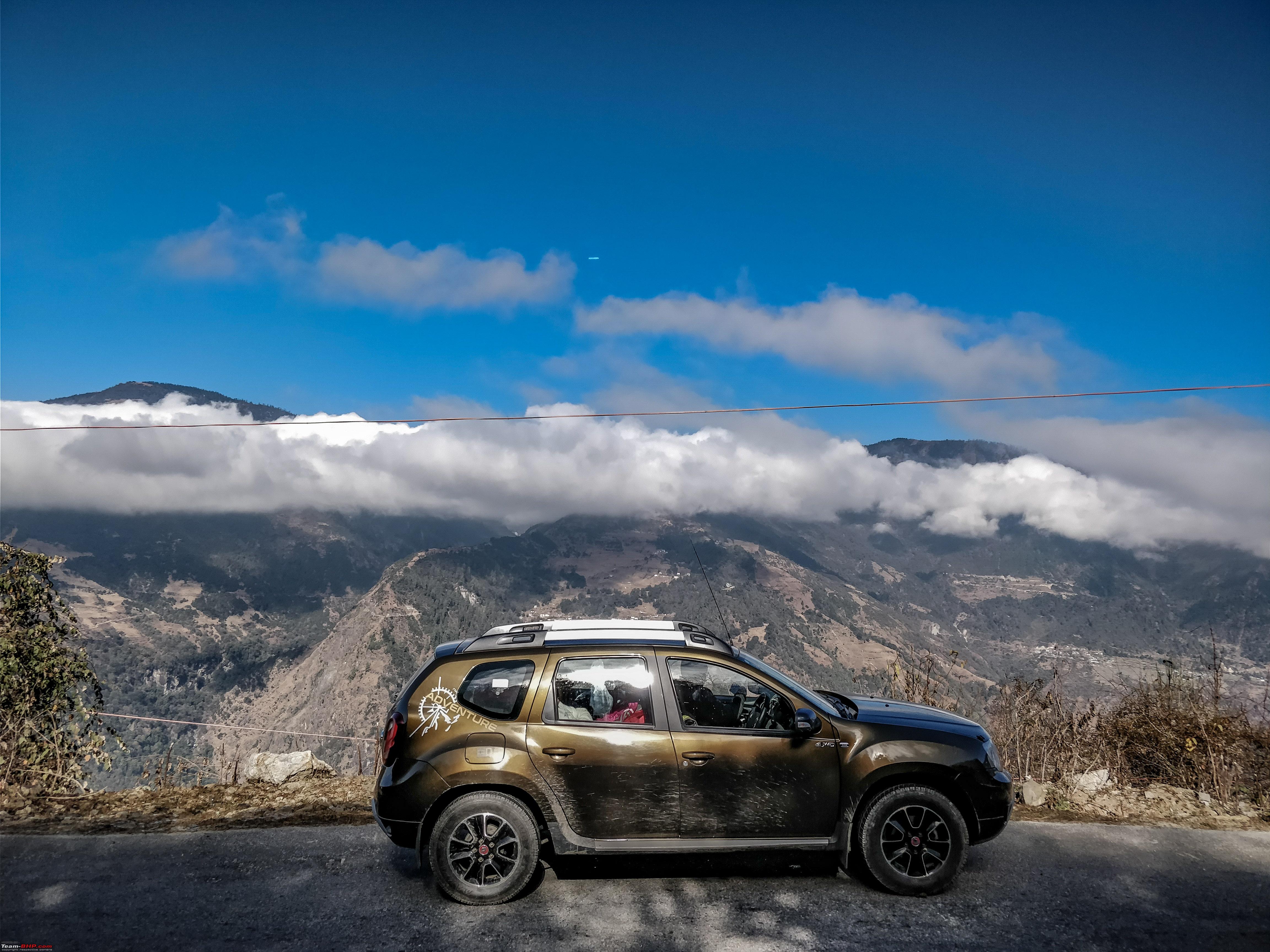 Hotel: At Bhalukpong we were put up at Hotel Druk, not the best but rooms are clean and fresh. The hotel staff comprises of little girls. Food is good though and the room service response is prompt. The next morning we started late as Kaziranga was not very far off. Day 10 ( Bhalukpong- Kaziranga) Route: The road is straightforward and wide single lane. Bhalukpong - Balipara - Tezpur - Kaliabore - Kaziranga. 120 kms in 2 hours. Speed limit is mentioned throughout Kaliabore and is strictly followed by every one. 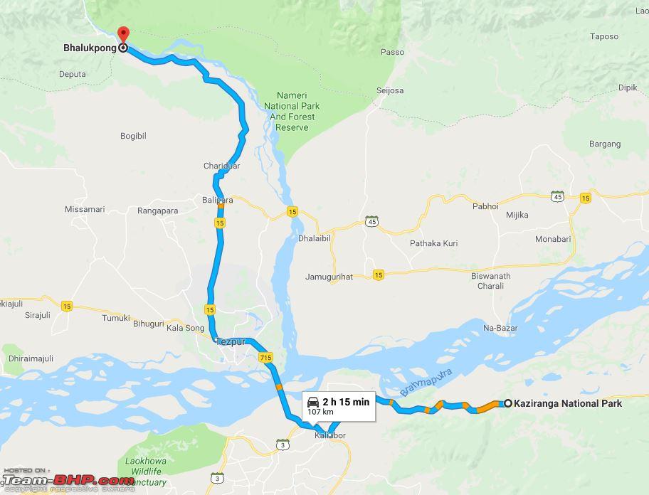 We decided to get closer to Brahmaputra immediately after crossing this bridge  Thats Nameri on the opposite bank  We stopped by seeing a huge gathering of people on the left. Parked the Duster on the patch besides the road and got down to see a group of Single horned Rhyno grazing all around the pasture just below the road. 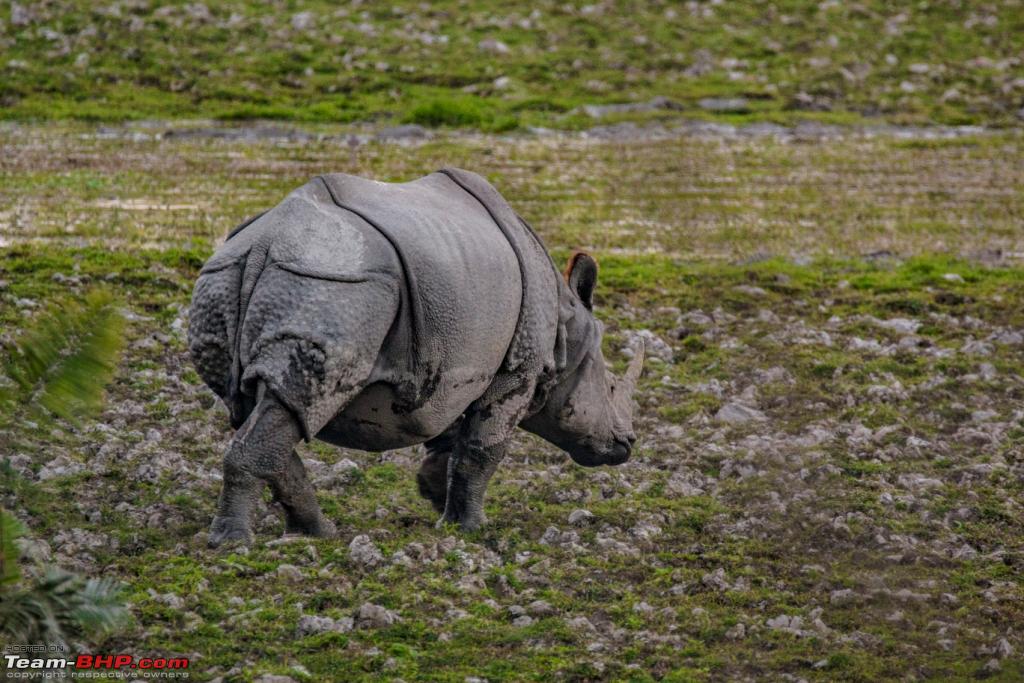 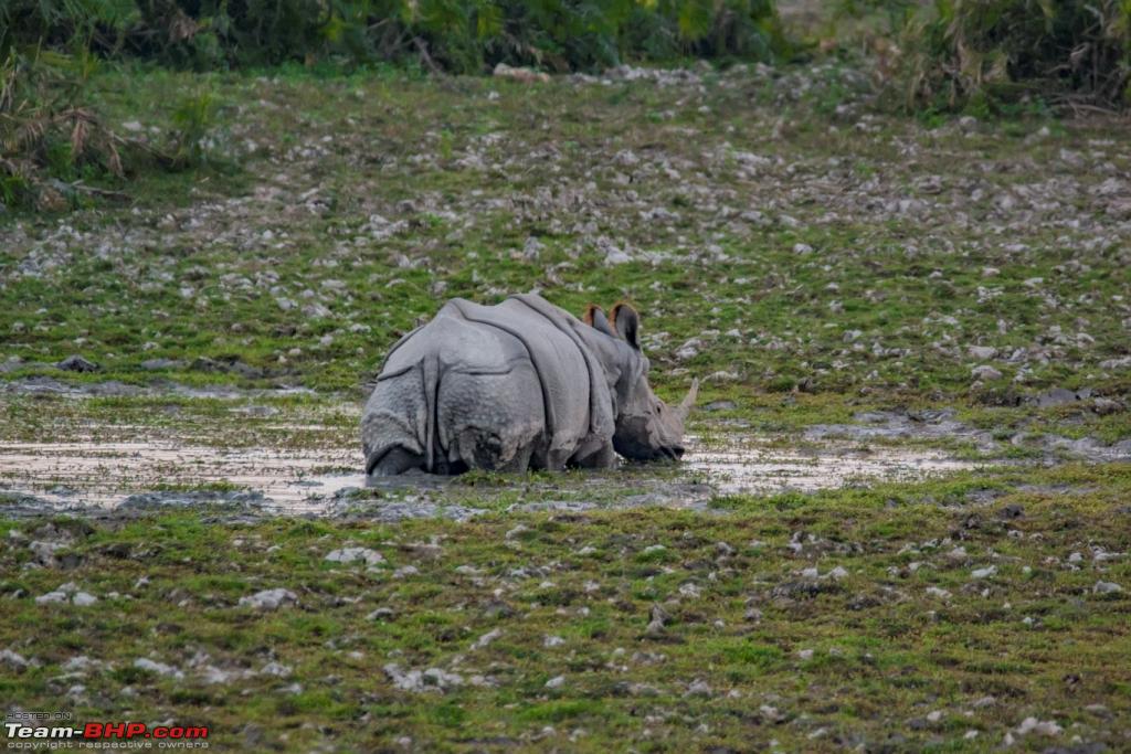 Hotel: After a little browsing of the local market, mostly raw tea sellers we checked in at our guest house. The guest house name was Rhino Guest house and it was a very bad decision to book rooms there. It was a last minute decision to cover Kaziranga though and only the residual hotel options were left out, we freshened up closed our eyes and just wanted to take rest for the night. We had bookings for 2 nights but decided to cover as much as possible in Kaziranga the next morning and start late for Guwahati, leave a night early. We for once were thankful that we were dead tired and the moment we hit the bed, well nothing mattered much. Last edited by ARAY : 13th January 2018 at 23:00. | |
|
| (15)
Thanks
|
| The following 15 BHPians Thank ARAY for this useful post: | agspins, anandpadhye, arun_josie, BlackPearl, darklord, DrANTO, gmhossain, GTO, JoseVijay, Klub Class, navsjab, Samba, SDP, Shanksta, surjaonwheelz |
|
11th January 2018, 22:38
| #10 |
| BHPian | re: Hyderabad to Arunachal, Assam & Meghalaya in a Duster AWD Day 11 ( In and around Kaziranga) We checked out from the hotel early in the morning packed up our stuff in the car and started for the booking center. Kaziranga just like any other aged tourist spot has too many locals to confuse you. A little homework would not hurt. Kaziranga is split up into 4 prominent regions. PARK RANGES-----------------------------------SAFARI ROUTES Kaziranga Range or Central Range-----------------Mihimukh - Kathpora -Daphlang - Diffolu River Bank -Mona beel - Karasing & back Bagori or Western Range---------------------------Dongabeel -Rouman - Rajapukhuri -Monabeel & back Agratoli or Eartern Range---------------------------Agratoli Sohola beel - Rongamotia -Maklung - Turturoni - Dhoba & back Burapahar Range------------------------------------Ghurakati - Potahi beel - Diffolu - Phuloguri - Tunikati  Rates are predefined by the Assam Government at every booking counter. Its best to park your vehicle at the designated parking lots before the gates and grab a Maruti Gypsy driver. Start early to get things moving. The ticket counter opens sharp at 0730am and things go smoothly. Private vehicles are not allowed. Do note the Maruti Gypsys are not owned by forest department. They belong to individuals who get their licenses / permits. At present there are roughly 300 Maruti Gypsys registered by the Assam forest department designated for all the regions of Kaziranga. Most of the drivers are experienced and travel in a convoy. Some of the Jeeps have locals with tranquilizer guns but not all Gypsys get armed guide. Coming to the ranges its not impossible to cover all the regions in one day. Central being the nearest to all the hotels and the lodges is the most crowded. Start very early to get a Gypsy somewhere in the beginning. The probability of seeing wild animals and migratory bird increases when you are the first few to sight them. Gypsy vs Elephant - Elephant ride once in a life is a must. However in this case Elephants would have consumed more time and thus we dropped the plan. Elephants go just 2-3 kms into the forest, rates are higher and time taken is more. That being said elephants can take you silently near an animal or bird and get you that shot you have been looking for. Most of the jeeps are open top and at 6-7 degrees in winter it takes a lot of courage to sit at the back all alone to get some beautiful shots. We started off with the Central -> Western -> Center again for lunch -> Eastern. The perimeter of Kaziranga on three sides is adjacent to human settlements leading to challenges in protecting the site from illegal incursions of poachers and herdsmen. The presence of the busy national highway No. 37 along the southern border of Kaziranga has brought increased settlements which disturb wildlife movements in this landscape. The introduction of domestic buffaloes has had negative effects on the wild water buffalo population. Facts the Gypsey driver shared with us. The Central Kaziranga was roughly 5 kms, we parked our Car there and spoke to the parking lot in charge and shared our situation. He agreed to let us park there at no extra cost. He said since the way out of Kaziranga would be through the Central its best to leave it there. Parked the duster under a nice big tree and left on the Gypsey. Rate details at the booking counter  Few Shots from Central Zone  The watch towers located all over the region  Peaceful Co existence 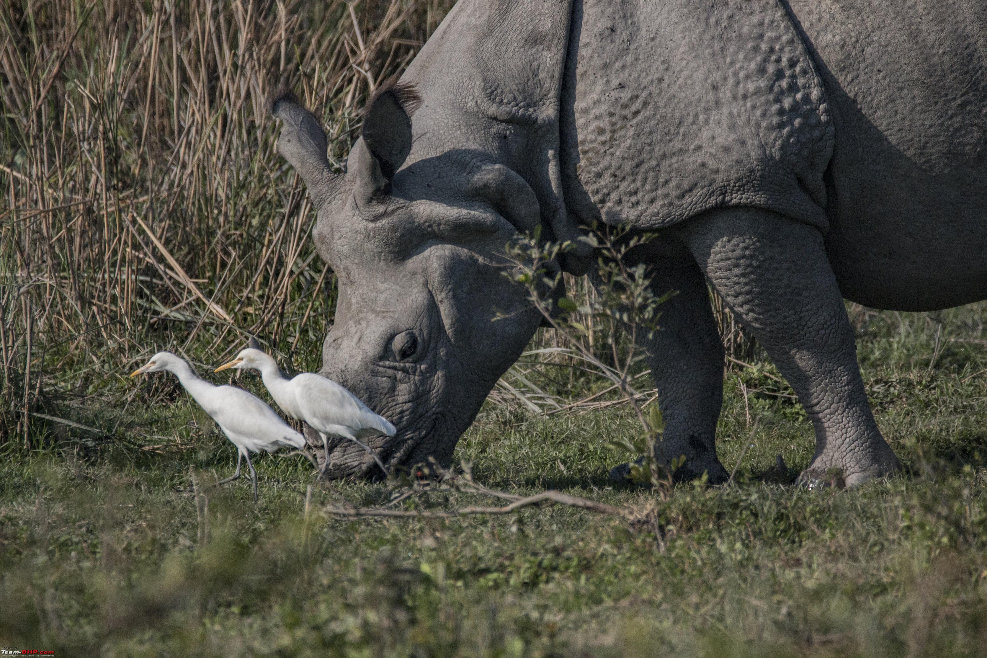 Black Crested Eagle 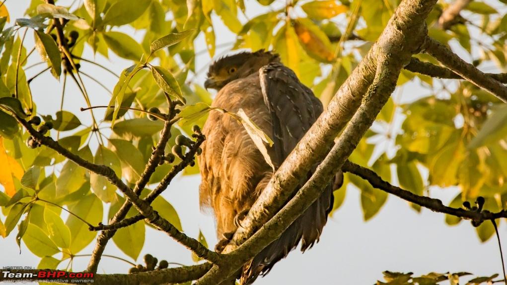 Yellow Footed Green Pigeon  Finally they acknowledged our presence  Moving on to the Western Range Class of Black necked Stork 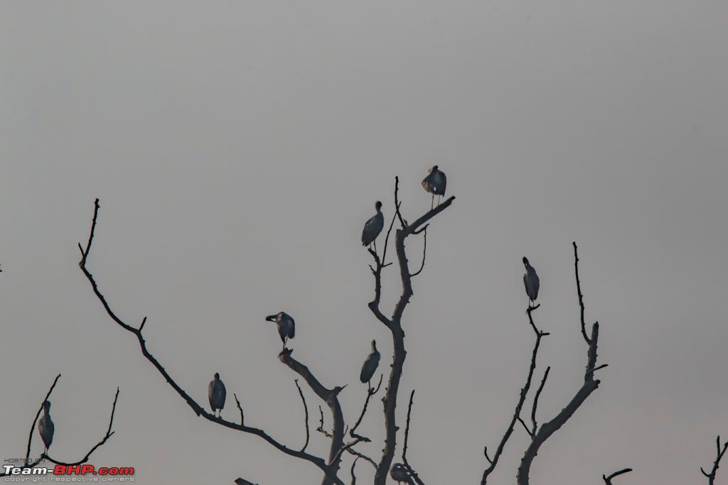 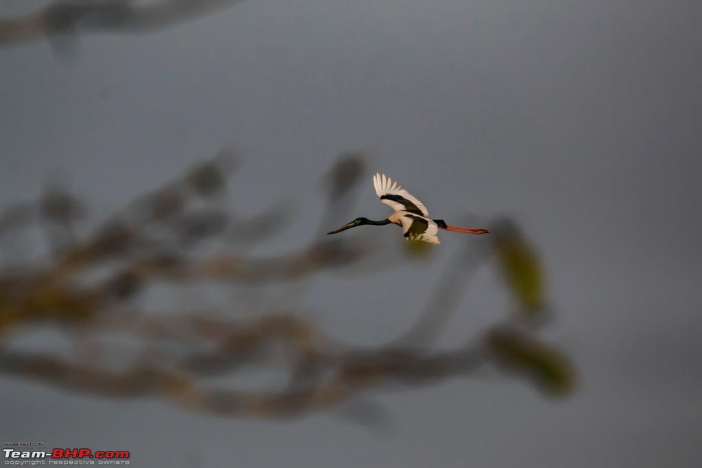 Yellow throated Kingfisher 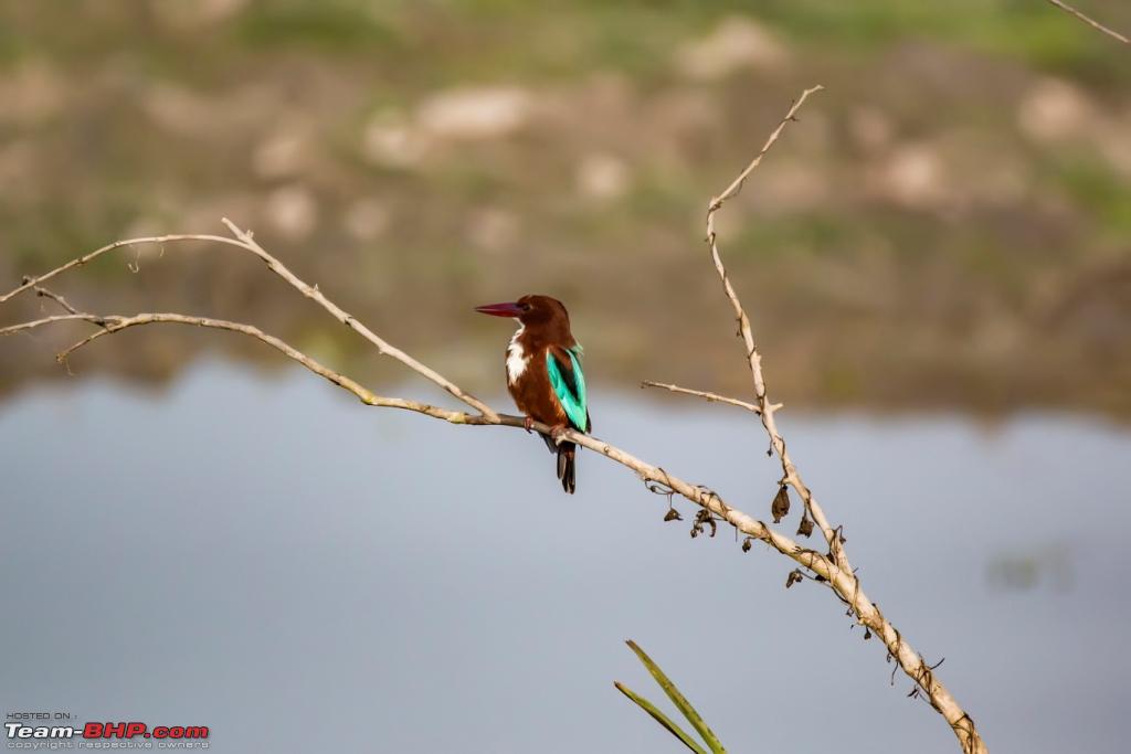 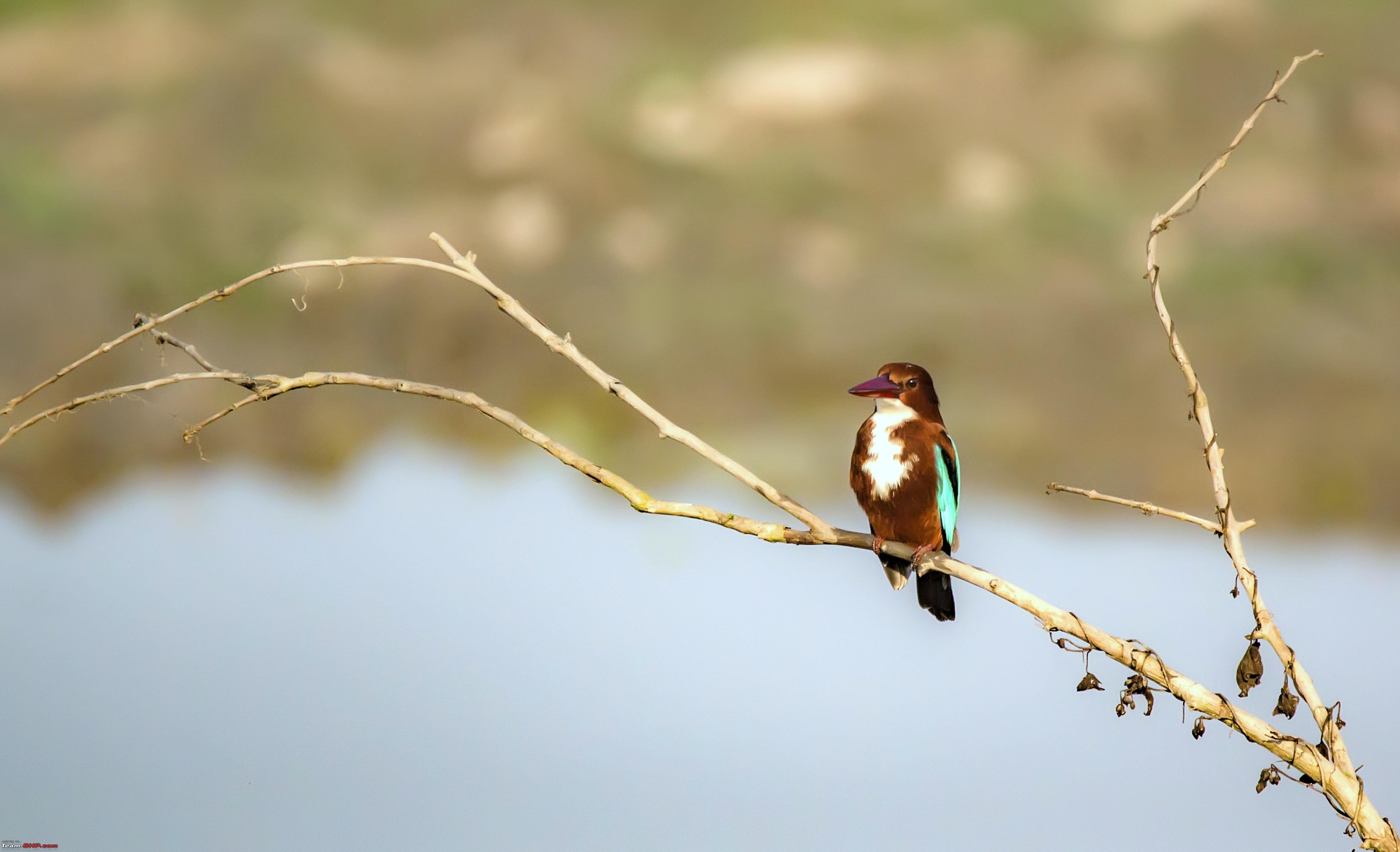 Few more encounters 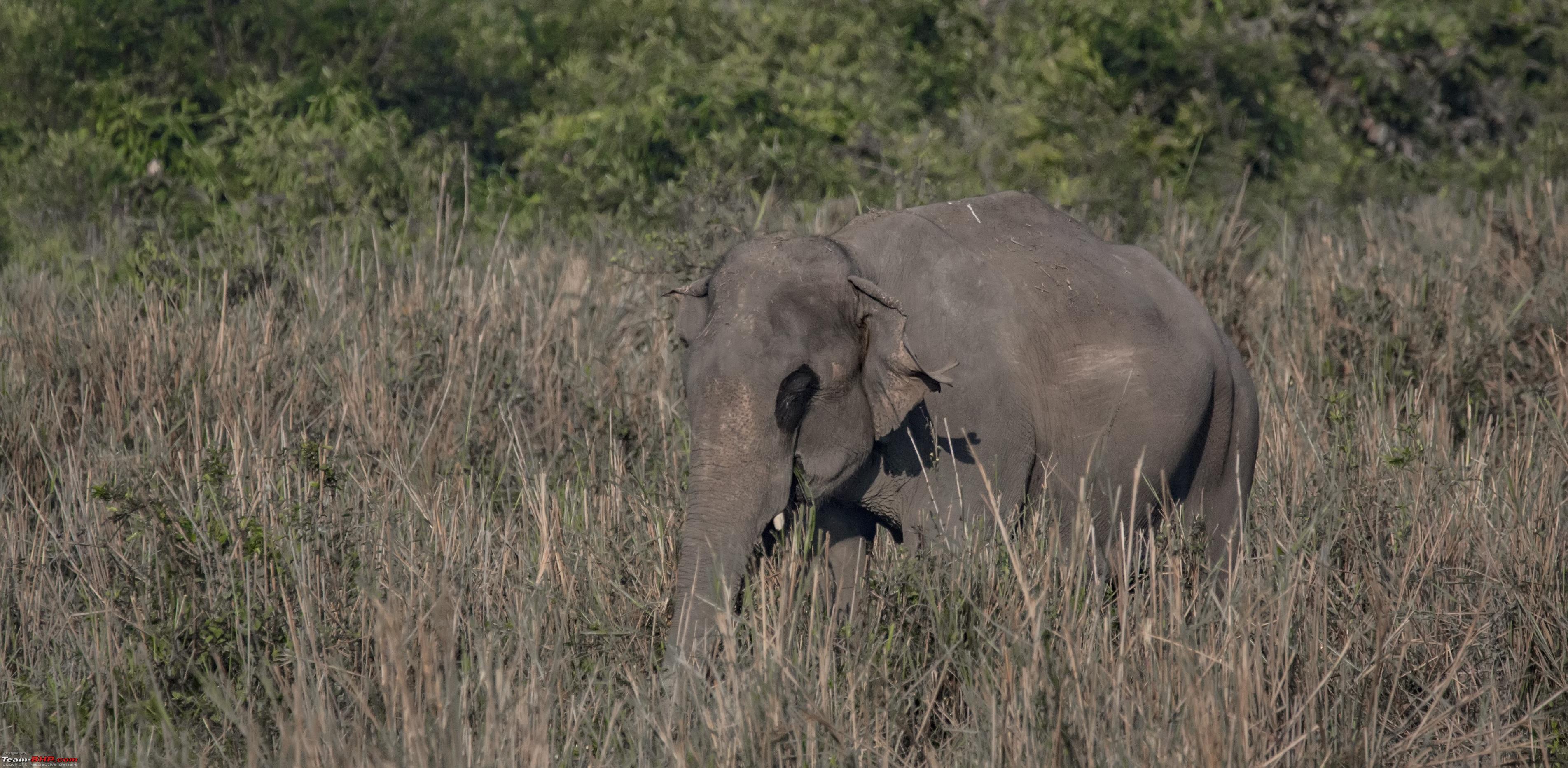 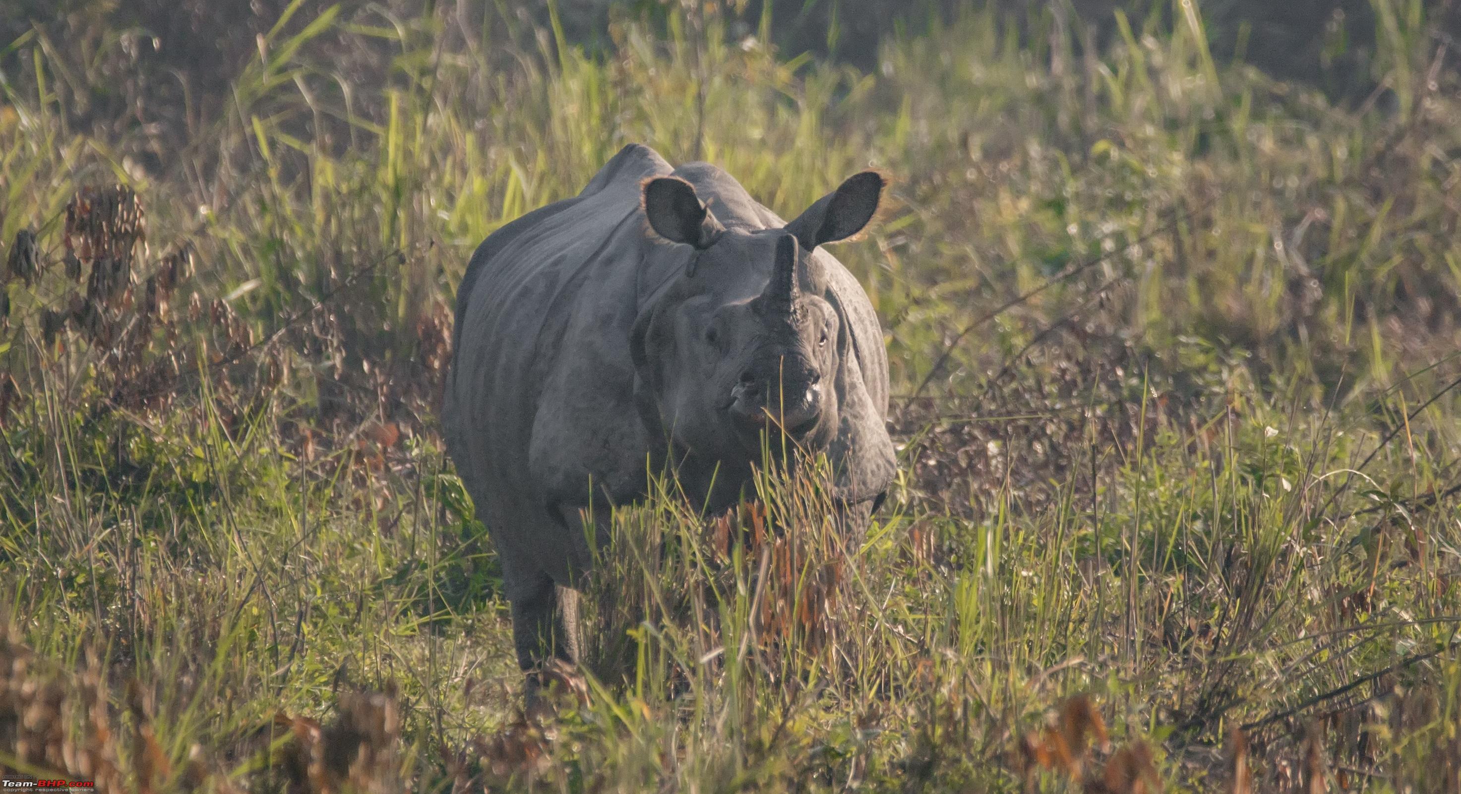 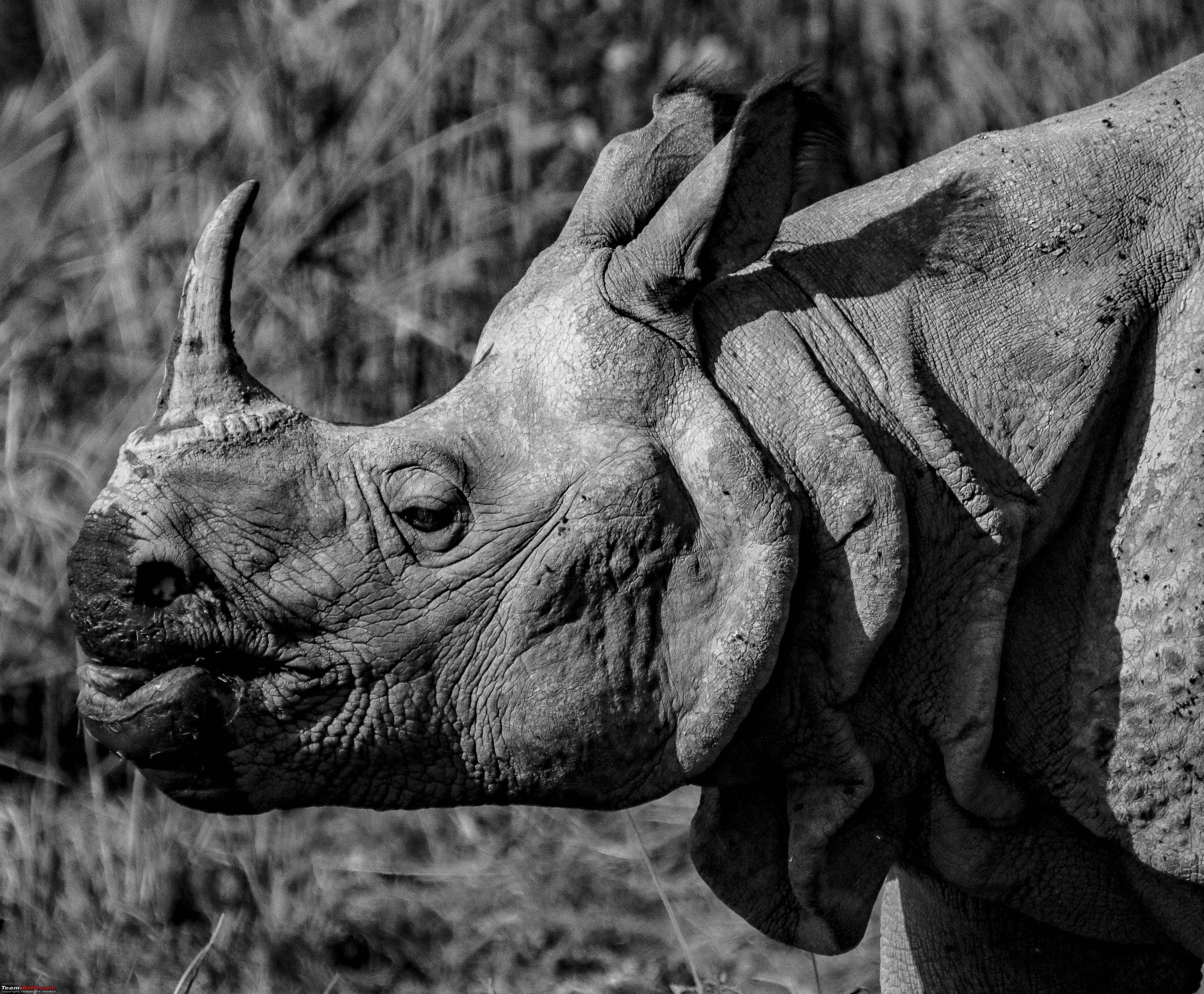   After a quick lunch we headed for the Eastern Zone, I was most interested because of this google image below. The water body should draw in some more animals and birds. GPX extract  First thing we saw was this, tigers often clean their nails on the trees.  Pond heron disturbed by the sound of our Gypsy 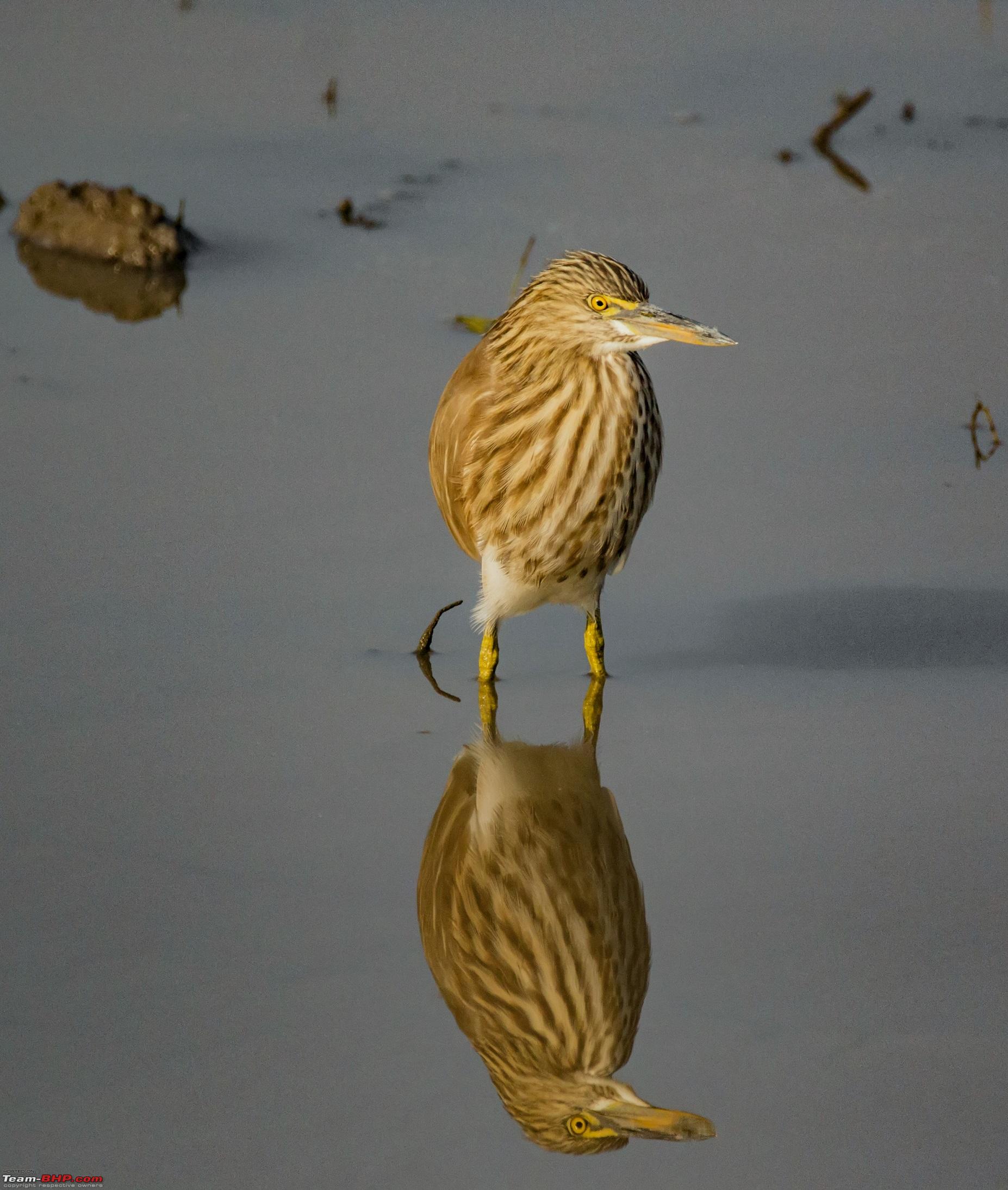 Black Necked Stork  Red Headed Vulture, rare 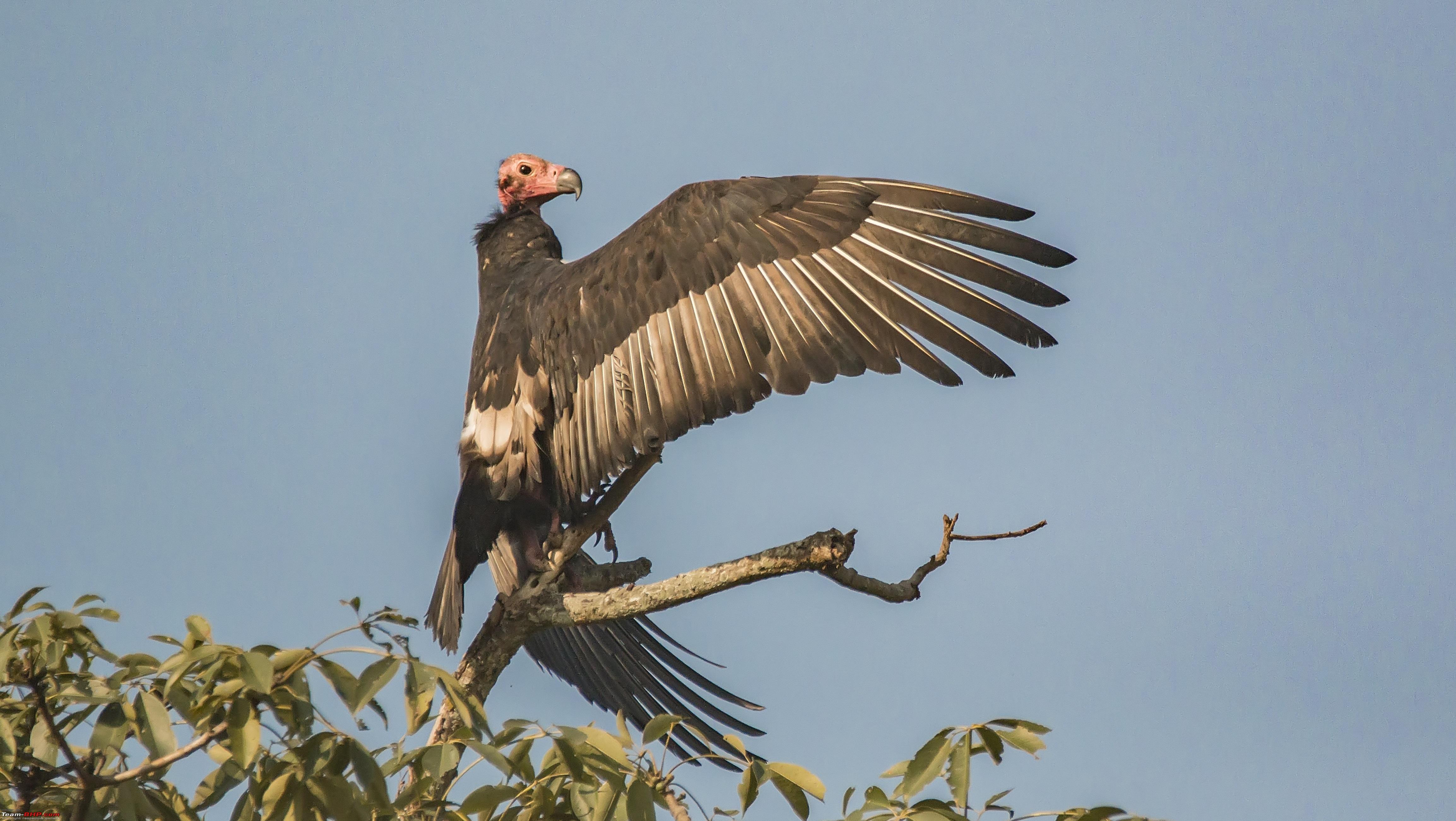 Indian Roller 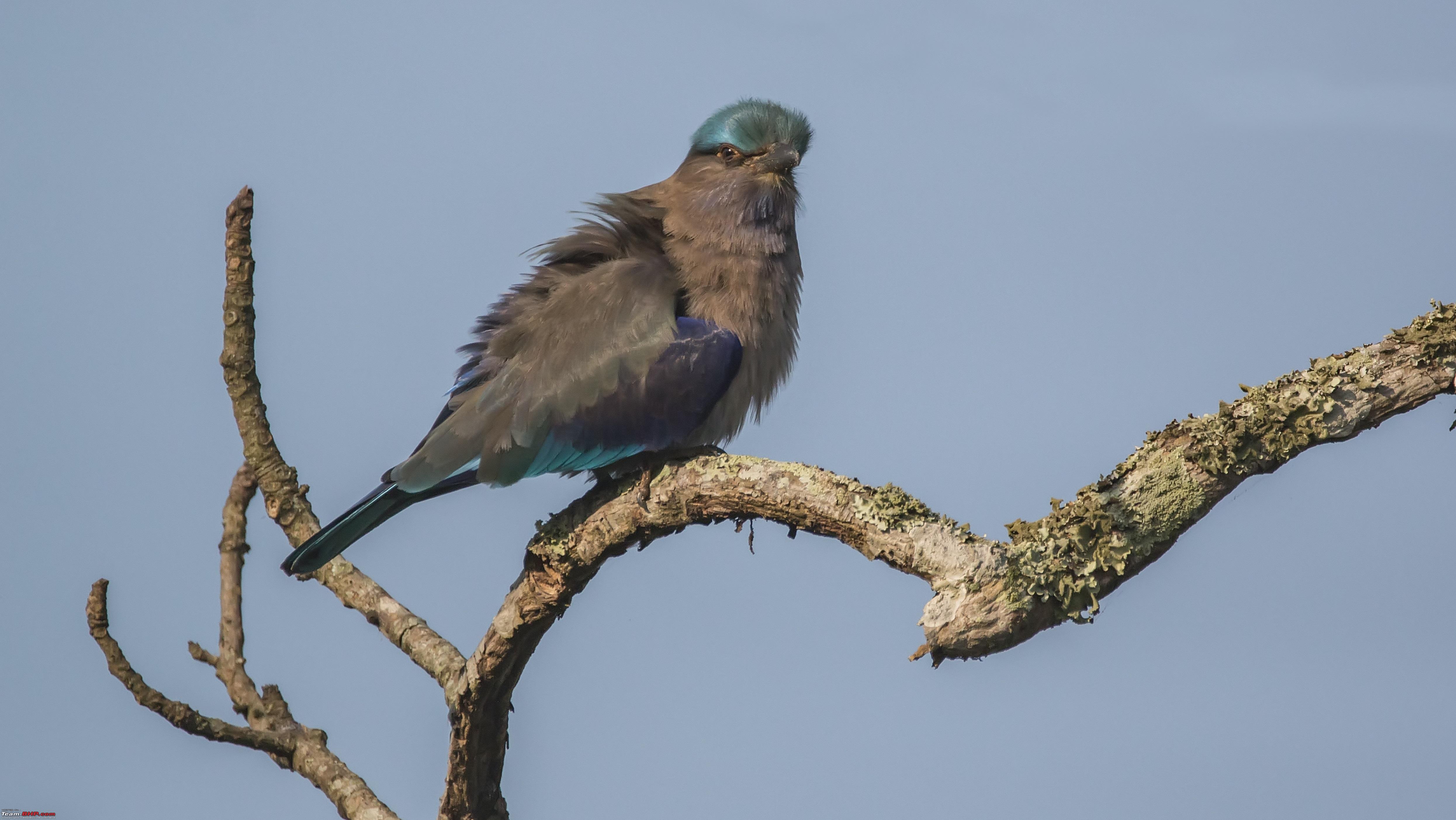 Pond Heron  Mallard Ducks, they always stay in pairs 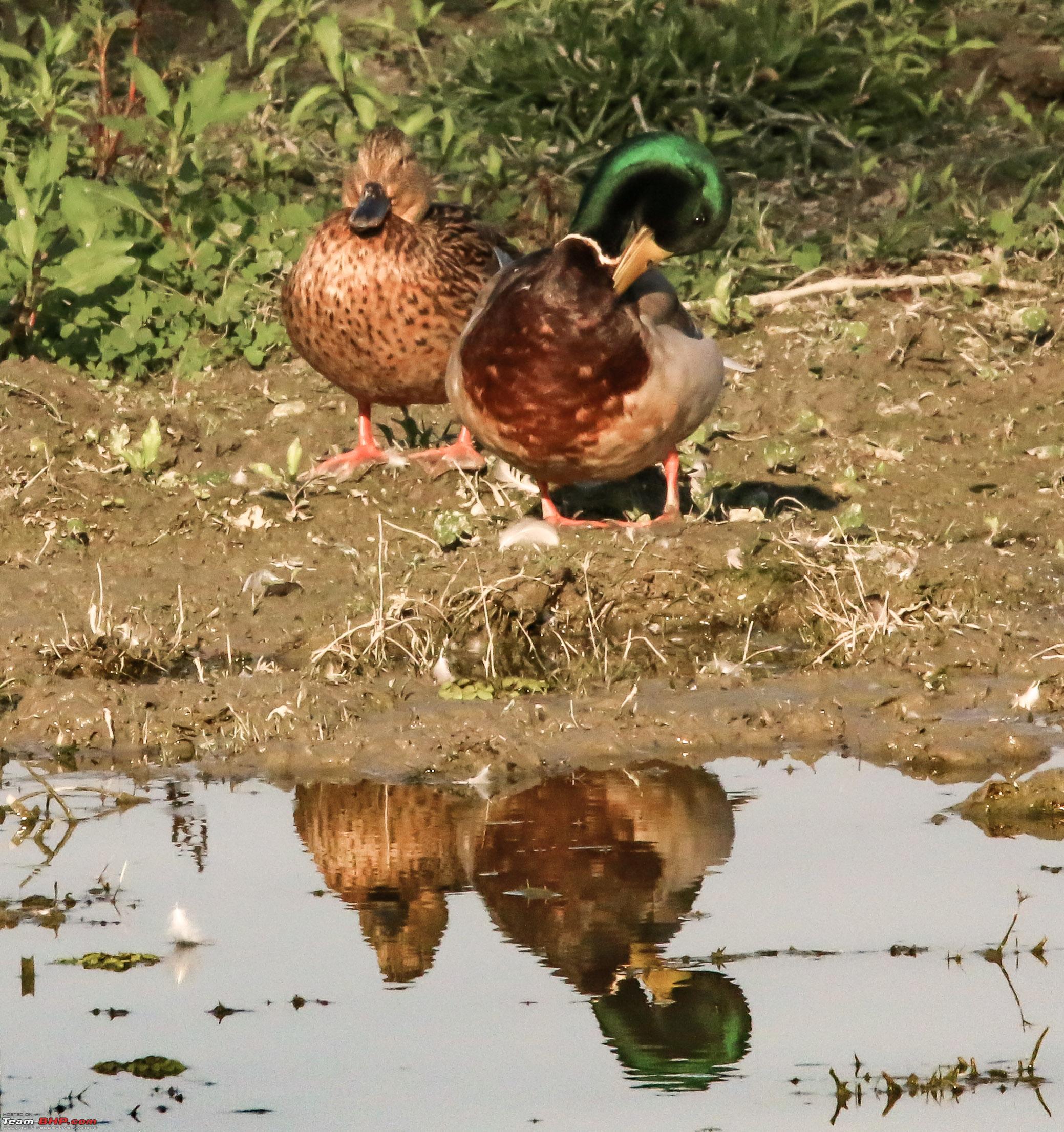 Northern Lapwing  Mallards 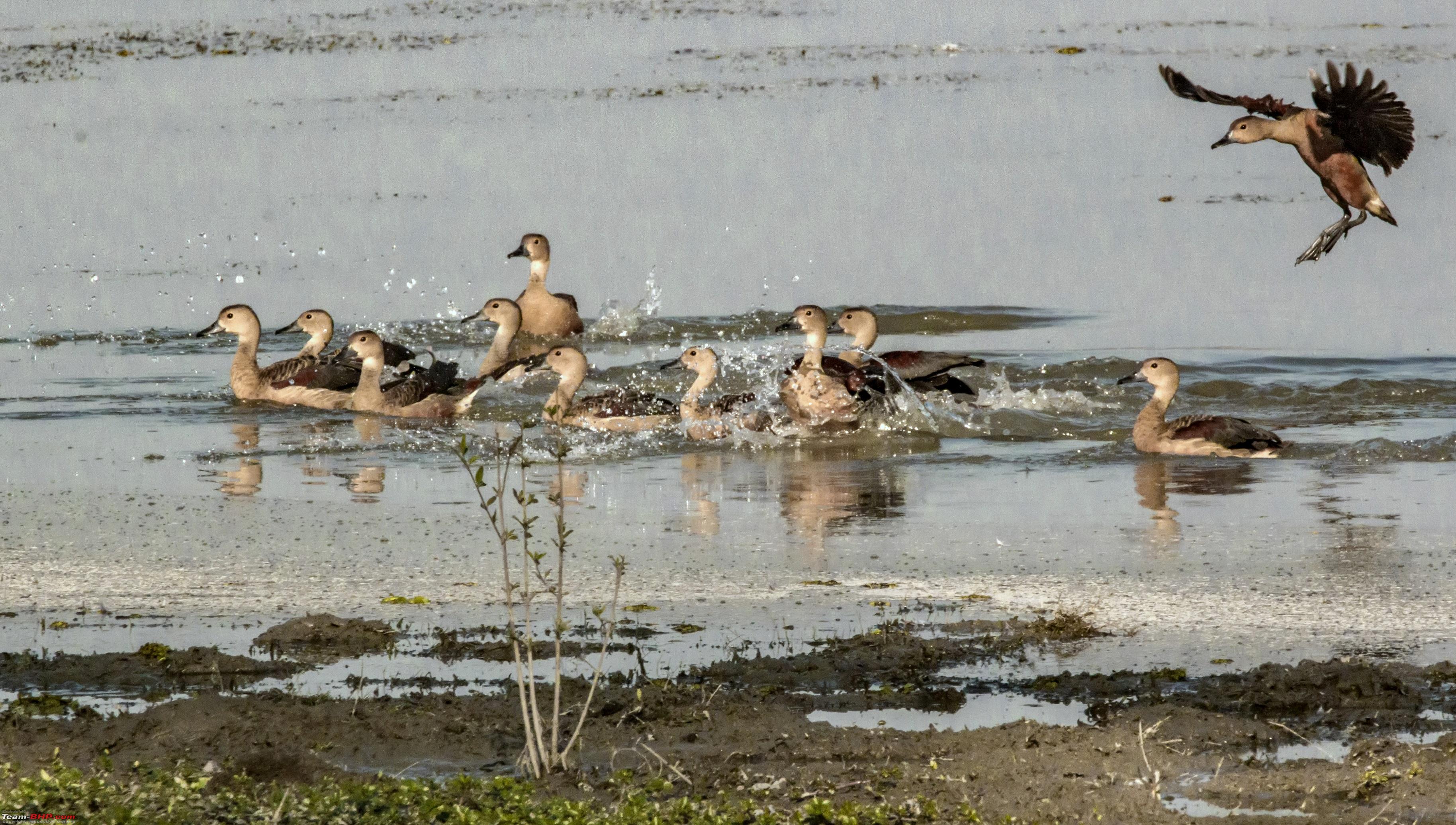 Bar Headed Goose 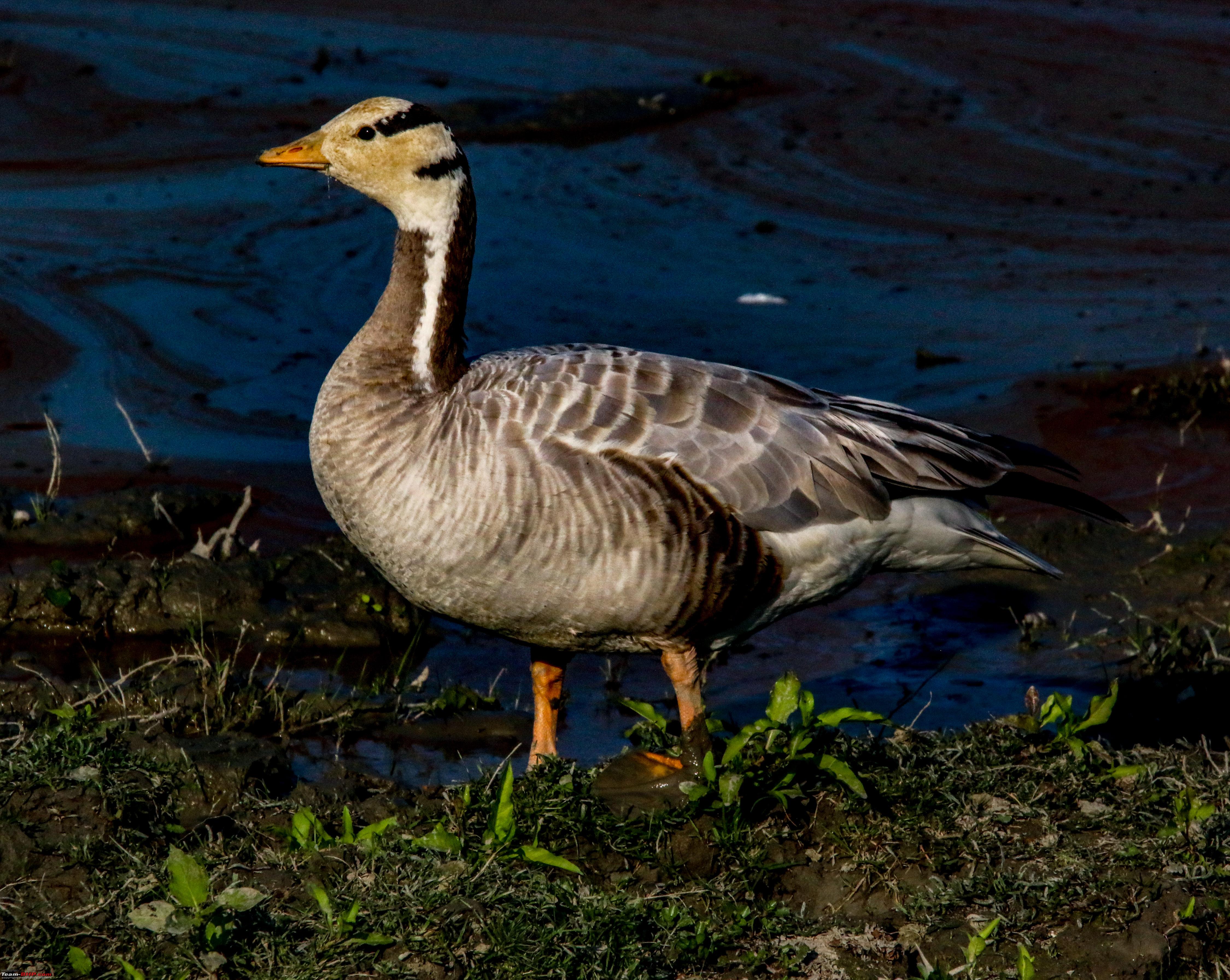 Common Sandpiper  Pied kingfisher  Last edited by ARAY : 12th January 2018 at 16:09. |
|
| (14)
Thanks
|
| The following 14 BHPians Thank ARAY for this useful post: | agspins, anandpadhye, arun_josie, BlackPearl, darklord, gmhossain, GTO, JoseVijay, Klub Class, navsjab, Samba, SDP, Shanksta, surjaonwheelz |
|
12th January 2018, 14:24
| #11 |
| BHPian | re: Hyderabad to Arunachal, Assam & Meghalaya in a Duster AWD Day 11 (Continued Kaziranga - Guwahati) After a fruitful day and some satisfying shots we started for Guwahati at around 8pm. The road is perfect post Nalbari and probably one of best stretches I have driven on. Although it says 6 hours at the time of writing this. But at night it can be easily done in less than 4 hours. 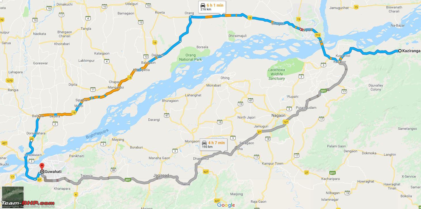 We could have gone directly to Shillong but due to lack of rooms available during the season we stayed back at Guwahati. Day 12 (Guwahati Shillong) From 1996 we have been reading in Geography, Cherrapunji receives rain through out the year. We thought of checking that out for ourselves. Route: 100 kms in 2 hours. NH6 is a treat to drive on and on a car like Duster curves become more fun. Loved every bit of the drive. Bomdila route had curves too and you can drive almost without using the brakes too much. NH6 was a different game, roads were wide but the curves much sharper. Banking was great too, just perfect. 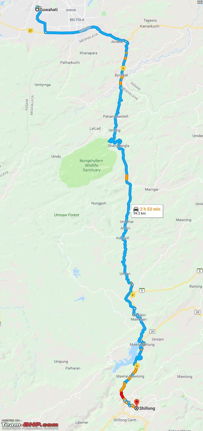 Umiam Lake  The lake serves as a major tourist attraction for the state of Meghalaya. It is also a popular destination for water sport . We spotted kayaking, water cycling, scooting and ofcourse boating. It was built by the Assam State Electricity Board in the early 1960s. The dam's original purpose was to store water for hydroelectric power generation. Then we started entering Shillong, the entrance to the city will give you the feel of entering a crowded hilly station. Roads were narrow with shops occupying a significant portion of the roads. Driving around the city is difficult. Fortunately our hotel had a designated parking spot in the basement else things would have been trickier. It was Christmas time probably because of that there was a huge inflow of tourists from all over. Entering Shillong did remind me a lot of entering Darjeeling. After checking in the hotel we spoke to a local cab guy who agreed to cover the tourist spots. almost all cabs are M800s. When I spoke to the cab guy he preferred the M800 over the Alto 800. I told him maybe because the 59Nm comes at 2500 rpm in M800 but the 69Nm comes at 3500rpm in alto 800 so peak torque comes in earlier that's why you guys prefer ? He just looked at me and asked not to worry he will take care of everything. I was happy he said that. Elephant Falls Its 12km from the city and can be easily reached . It is a collection of three smaller falls which eventually merge into one. The place is crowded when we reached there in the evening.  On the way back to the hotel we visited the AirForce Museum , unfortunately photography was not allowed. After spending some time there we headed back to the hotel. Thought of going out in the evening for some local shopping but it was difficult to even step forward in the crowd. Hotel: We were put up at Hotel Silk Route. Luckily it has its own parking but its better to let them know before you start to the hotel. The rooms are average sized and warm. It gets really cold at night specially in December when we stayed. We had food outside but the hotel staffs were good. Day 13 ( Shillong and Cherrapunji) These were the places we planned to visit. Started at around 6am to cover all the places and to avoid the traffic while getting out of the city. After 15 kms out the roads were wide again and almost no traffic at all. 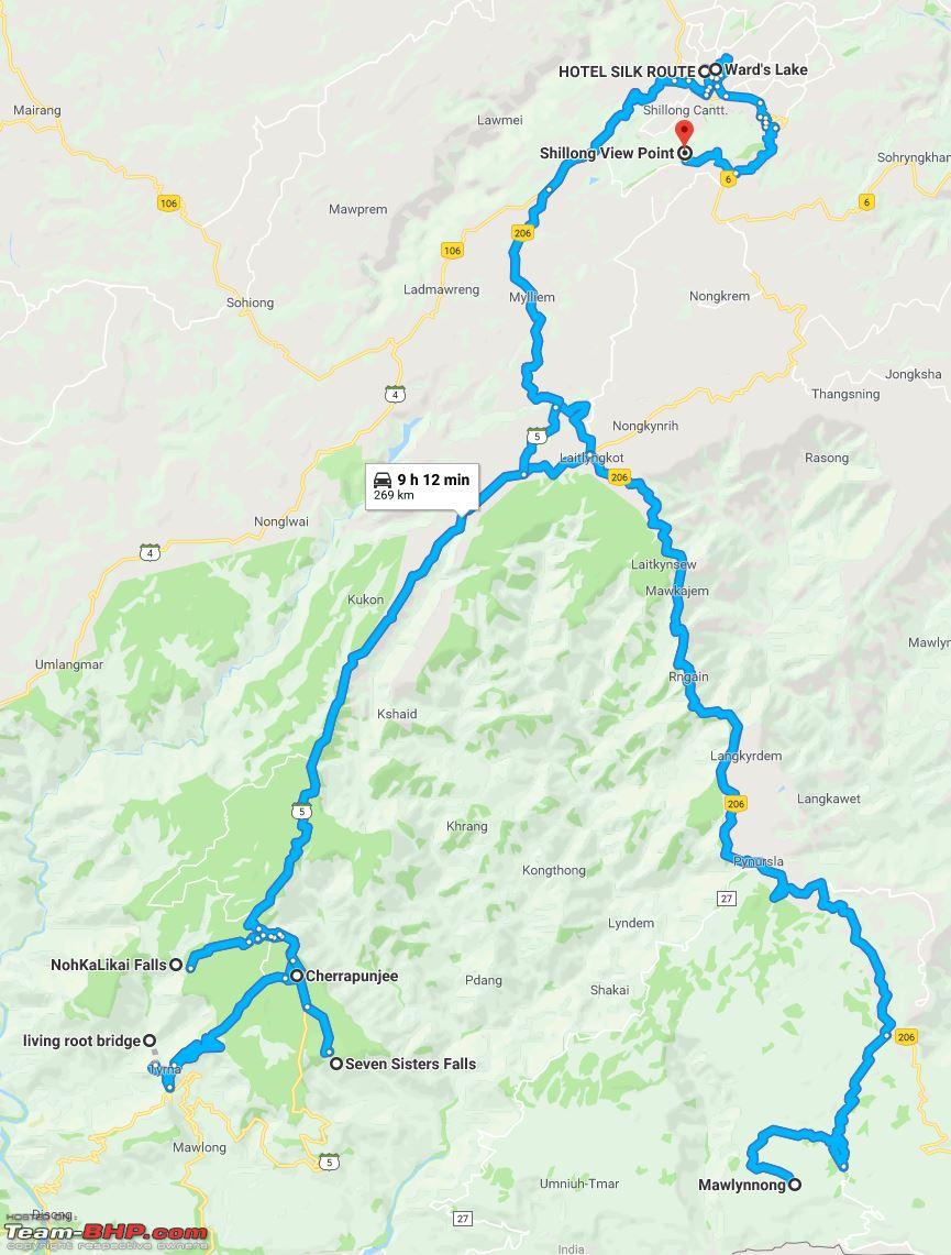 Living root bridge, there are two of them. Single tire - Near Mawlynnong Double Tire - Cherrapunjee Living root bridges are ancient handmade bridges made from the roots of Banyan trees. This is a type of tree shaping which was done by Khasi and Jaintia people belonging to the southern area of the Plateau of Shillong. These bridges are most commonly found in East Khasi Hills district in and around Cherrapunji and Mawlynnong. These bridges are made by naturally growing the roots of the banyan trees and it takes about 15 years for the bridge to be completely ready. It might be surprising for you to know that the life span of these bridges is about 500-600 years and they strengthen as then grow old. We headed for Mawlynnong first. Single Tire living root bridge. 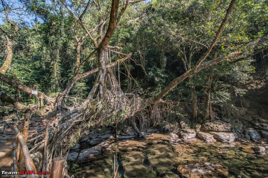  The other side of Living root bridge. 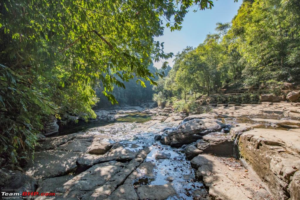 Our next destination was Mawlynnong Village, supposedly the cleanest village in South Asia.  Mawlynnong village is probably the most cleanest village as they say but the cemented roads all around and heavy commercialization has made the place loose its charm. By the time we started getting out of the village tourists started pouring in. Note: Park your vehicle as close as possible to the exit. You have to walk a bit more but at the time of exit things will be much easier. This parking reminded me a lot of Borra Caves in Araku valley. Next destination was Cherrapunji. Google map: in 500 meters take the left turn. Me: But I see no clouds or overcast sky, is it not raining. Wife : Global warming Kid: yes, Gopal mining. Not that I was expecting any rains in winter but some water in the lakes beneath the valley - Nothing ! But yes the terrains reminded me a lot of Mahabaleshwar. The Hills / plateaus were of exactly same height to each other. Few Shots of Cherrapunjee 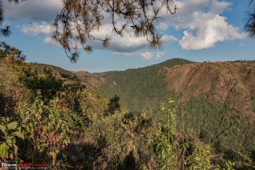 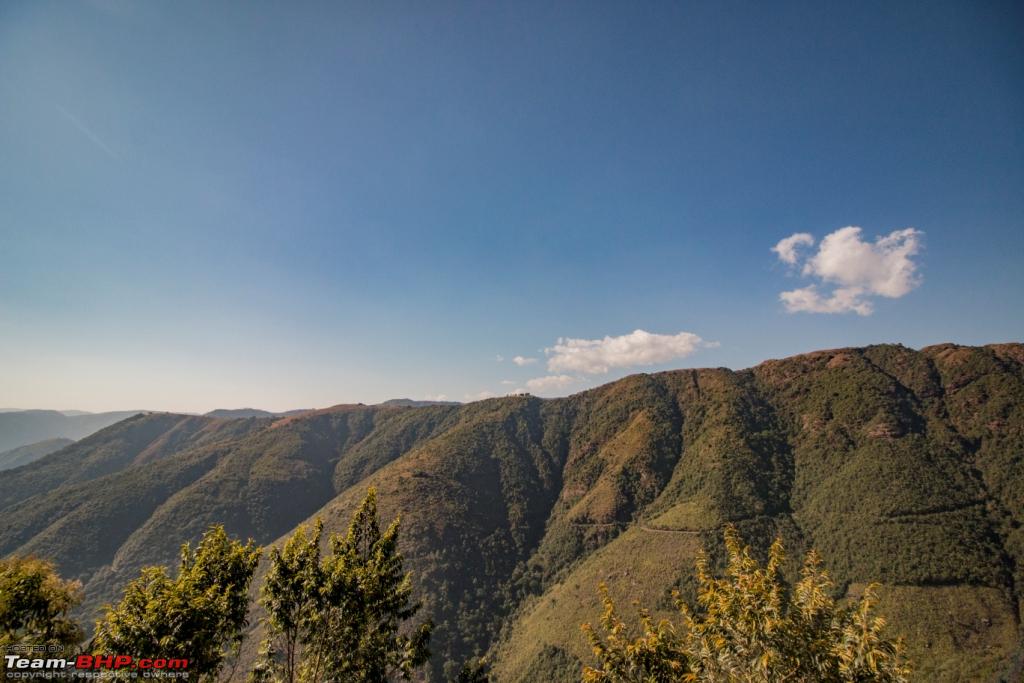 Cherrapunjee ( Looks like Mahabaleshwar) 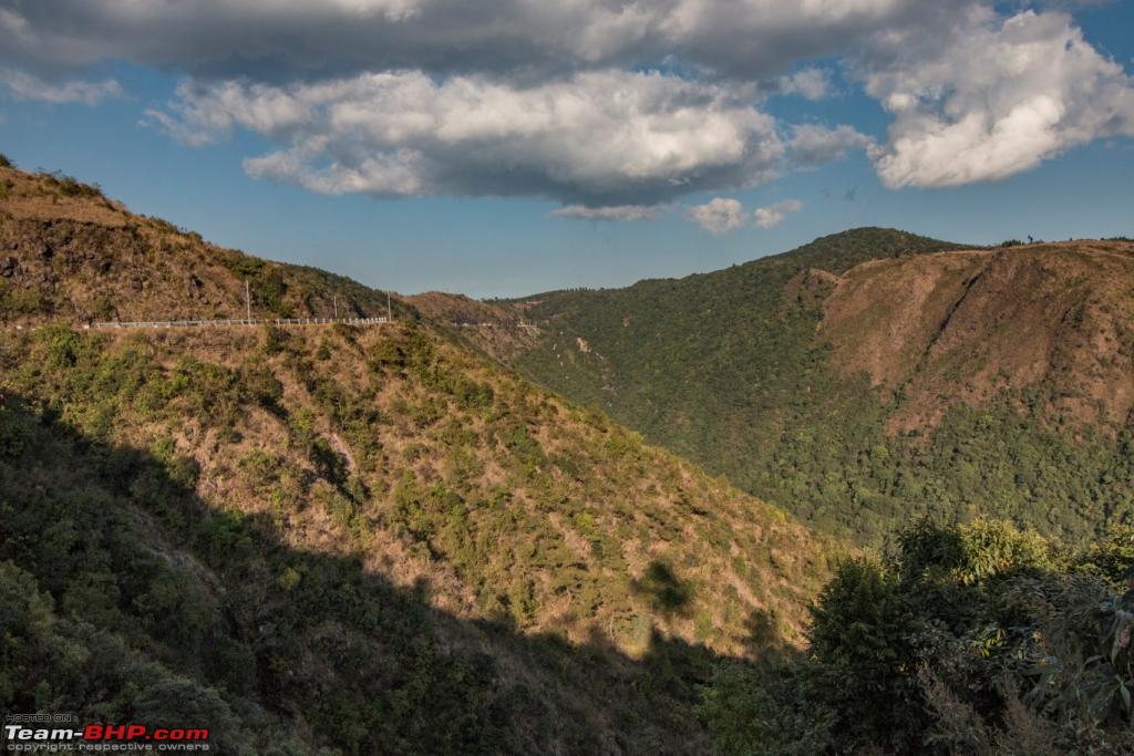 Notice the same heighted plateaus 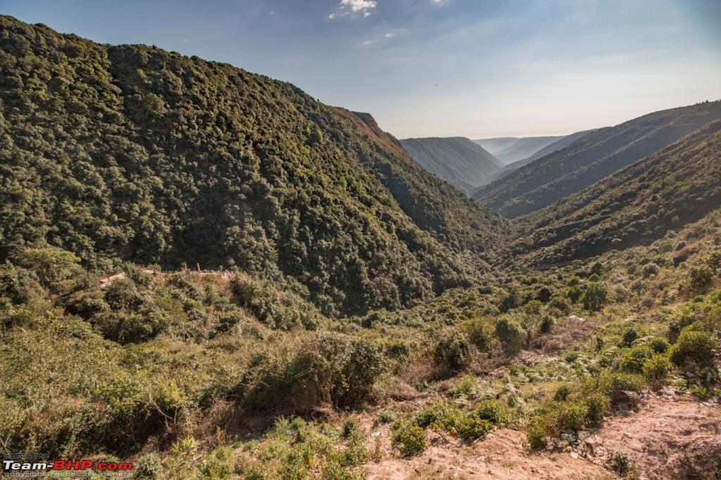 Although we didn't see any cloud or rain but this sudden change in weather did say a lot about the place. The entire place and the valleys below were covered in deep fog in no time. 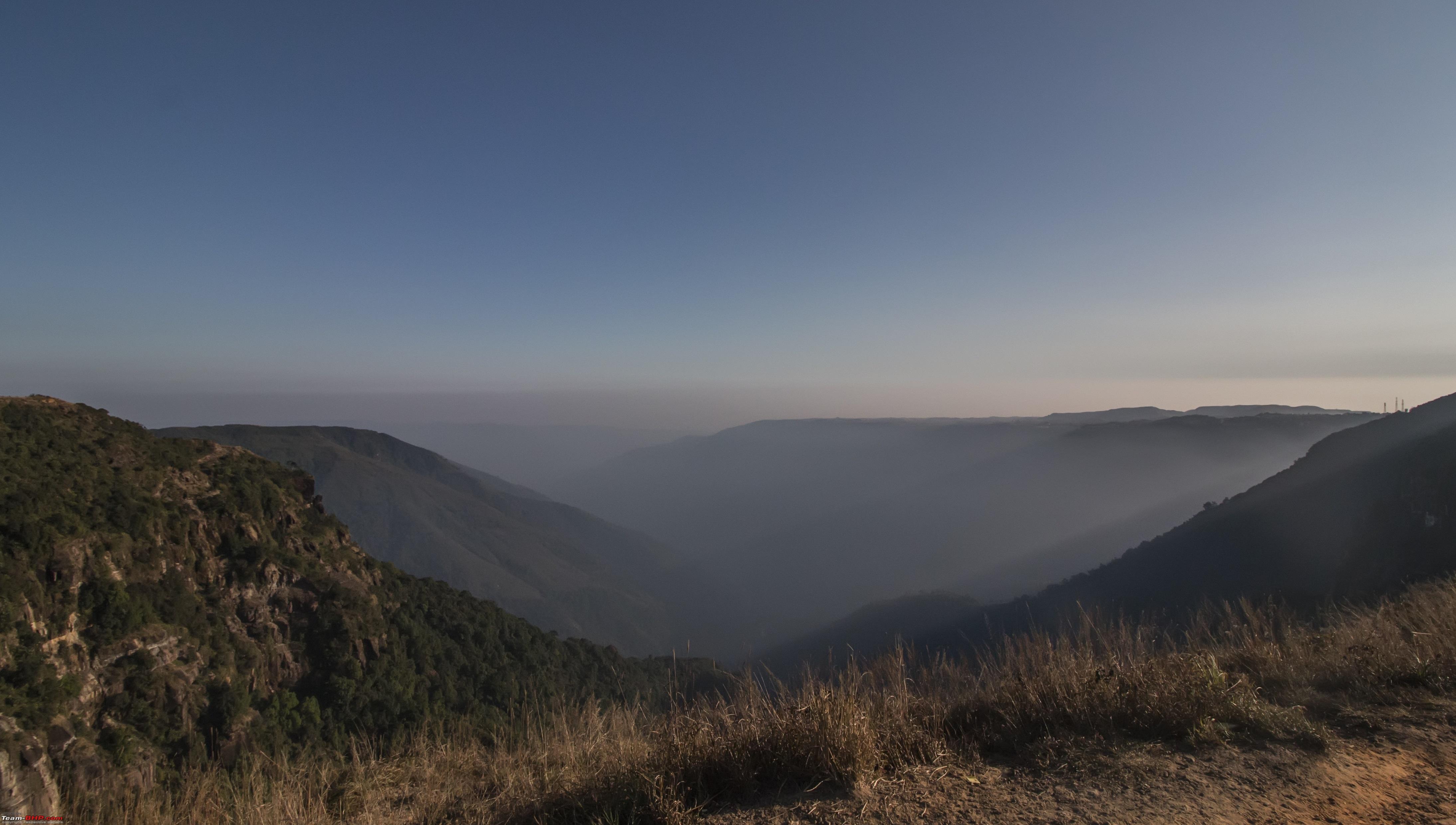 Although Cherrapunjee didn't exactly match up to what we read at School yet the place was beautiful and the people around seemed very nice. Lined up were few waterfalls, being winter we were not expecting much. Headed for Seven Sisters falls, just like us the five Sisters went for vacation and the younger two were left for us visitors. Seven sisters falls 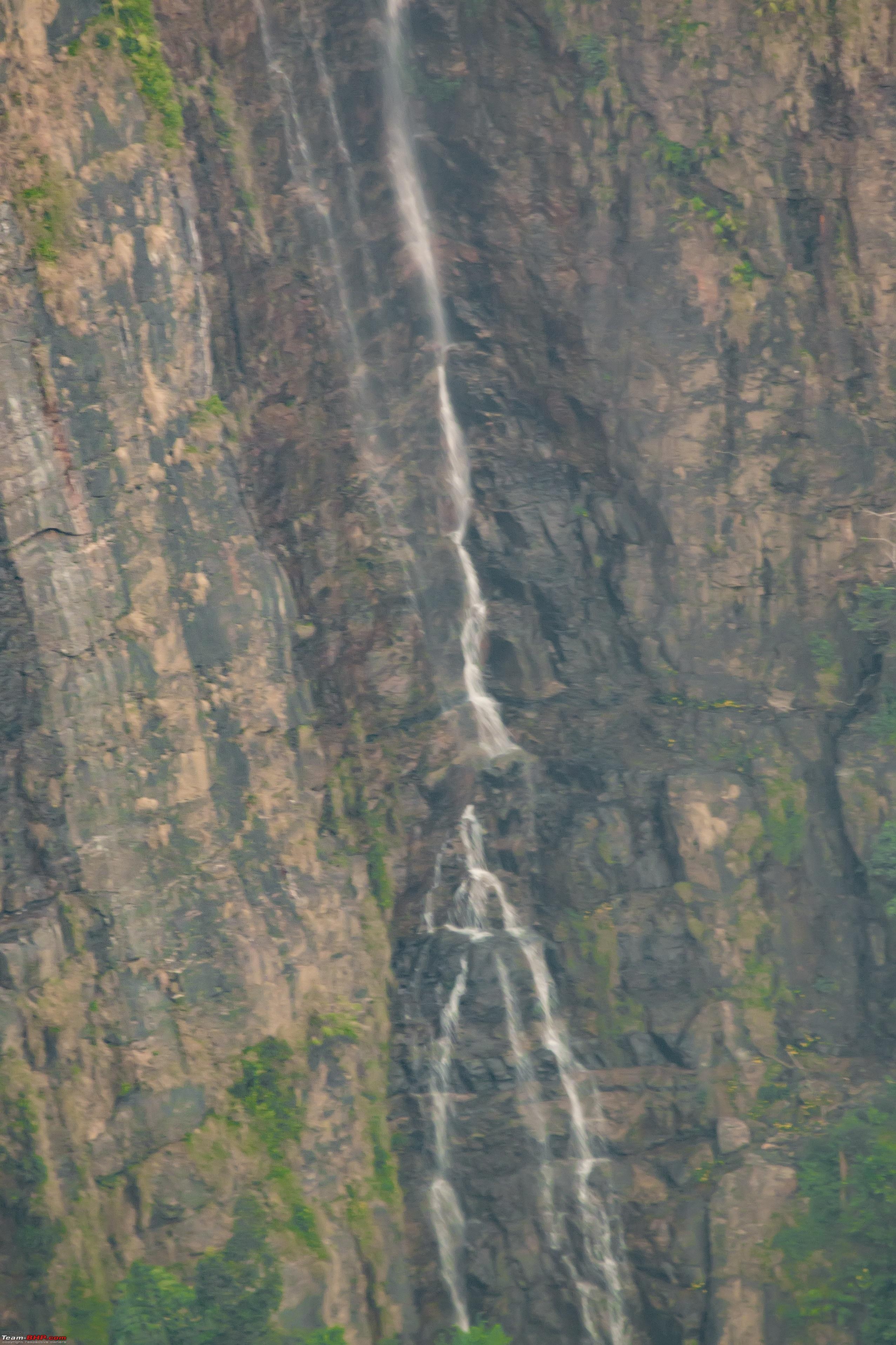  The falls, there they are, nah. they are there ! 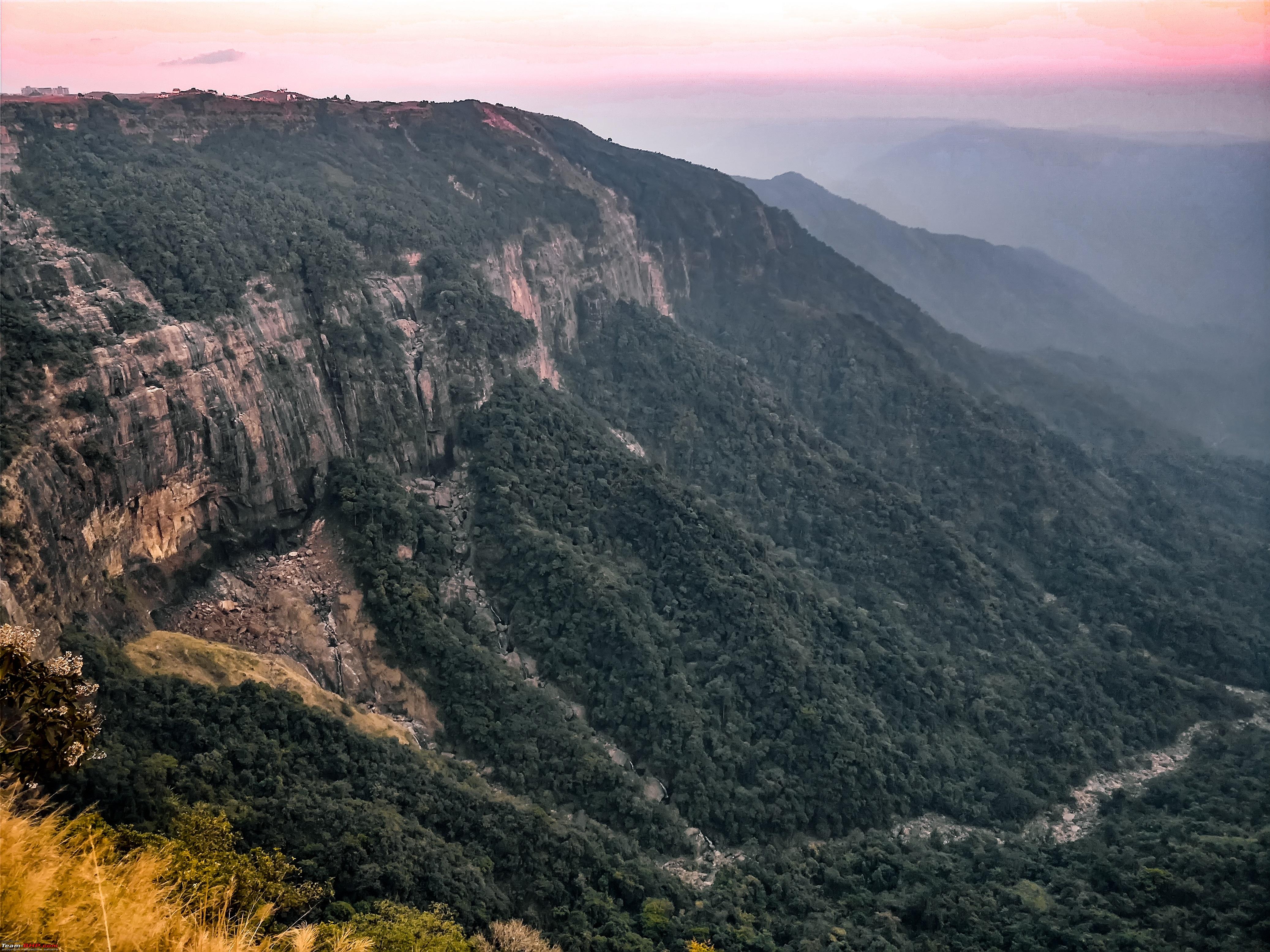 This is how it would look under normal circumstances : https://upload.wikimedia.org/wikiped...herrapunji.JPG View of Eco Park as seen from the view point. I am sure during the monsoons this would be a gorgeous spot.  NohKaLikai Falls, Meghalaya   The beautiful moon at the NohKaLikai Falls reminding us of the conclusion of our trip 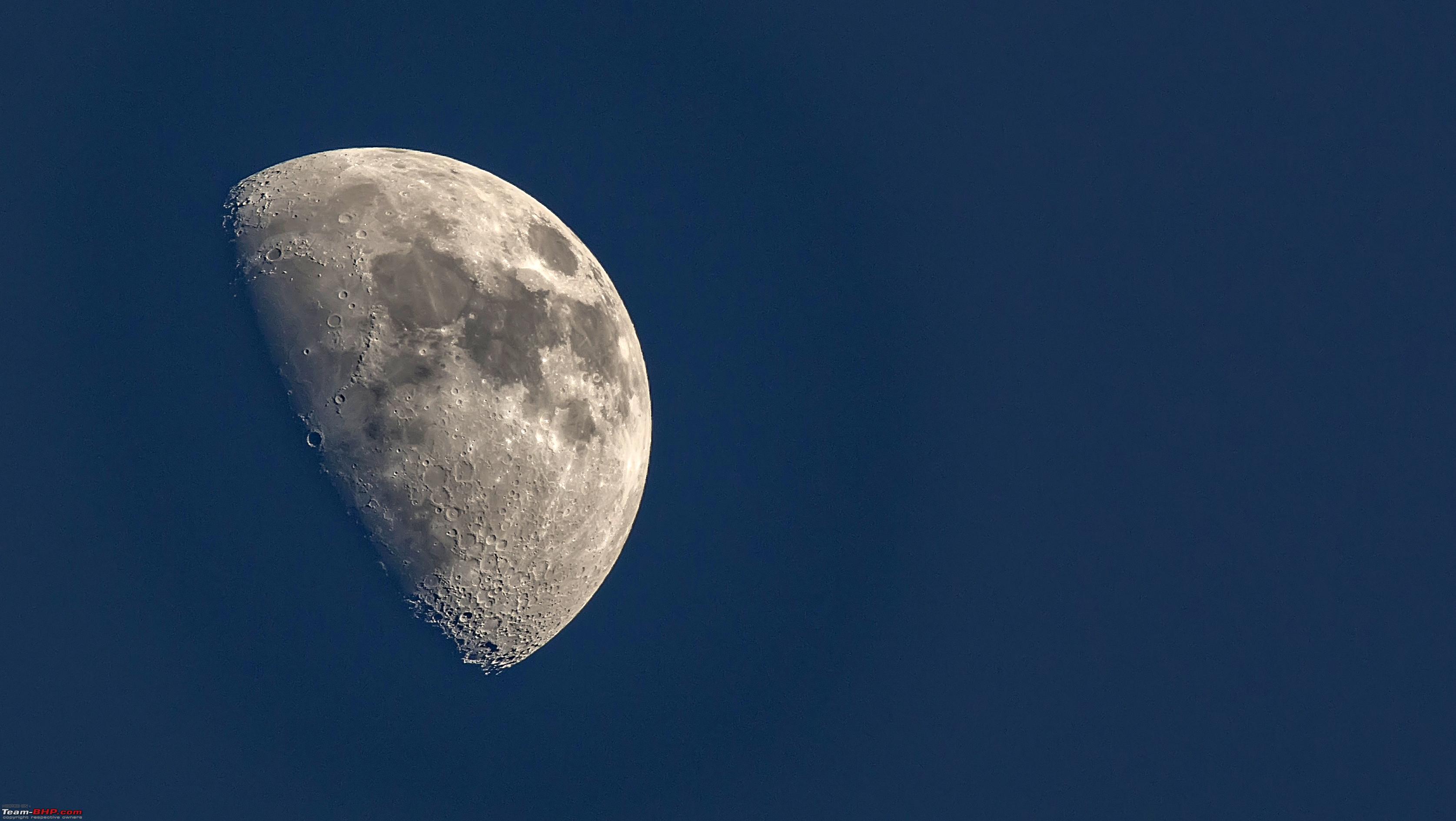 Since it was dark already we missed out few more places located near our hotel. We returned to the hotel at 7pm and trust me driving in the city was not as difficult as I though. Parked at the hotel and engaged in some shopping with my wife and kiddo. I was astonished to see so much energy in them. Day 14 (Shillong Guwahati) Started from the hotel pretty late and reached Guwahati late night. Dear friend and fellow traveller had made all the necessary arrangements at his lodge. Once we entered the rooms it reminded us so much of our native houses in West Bengal, very high ceilings and beds with wooden stands to tie mosquito nets. This might sound weired to many but trust me towards the end of such a trip anything presented from heart looks so beautiful. We were meeting Rituraj and his family for the first time but it never looked like that. As if they knew us for a long time. They had even come to meet us almost far off on the other bank of Brahmaputra. It was a very short stay but we would be coming here soon. Day 15 ( Guwahati - Siliguri) After spending some time with the host we bid goodbye and started for Siliguri. We had booked the same hotel, mount Embassy. The reason being its located very close to the Hong Kong market. Last year during the Sikkim trip my wife wanted to visit the market but was a near miss. Parked the car with the rear boot facing the Market so that I have to walk the least with "whatever she was planning to buy". -> Remember the weight of Duster after crossing Chilka while coming on the weighbridge, lets just say the number increased by 57kgs. Few images of Siliguri market 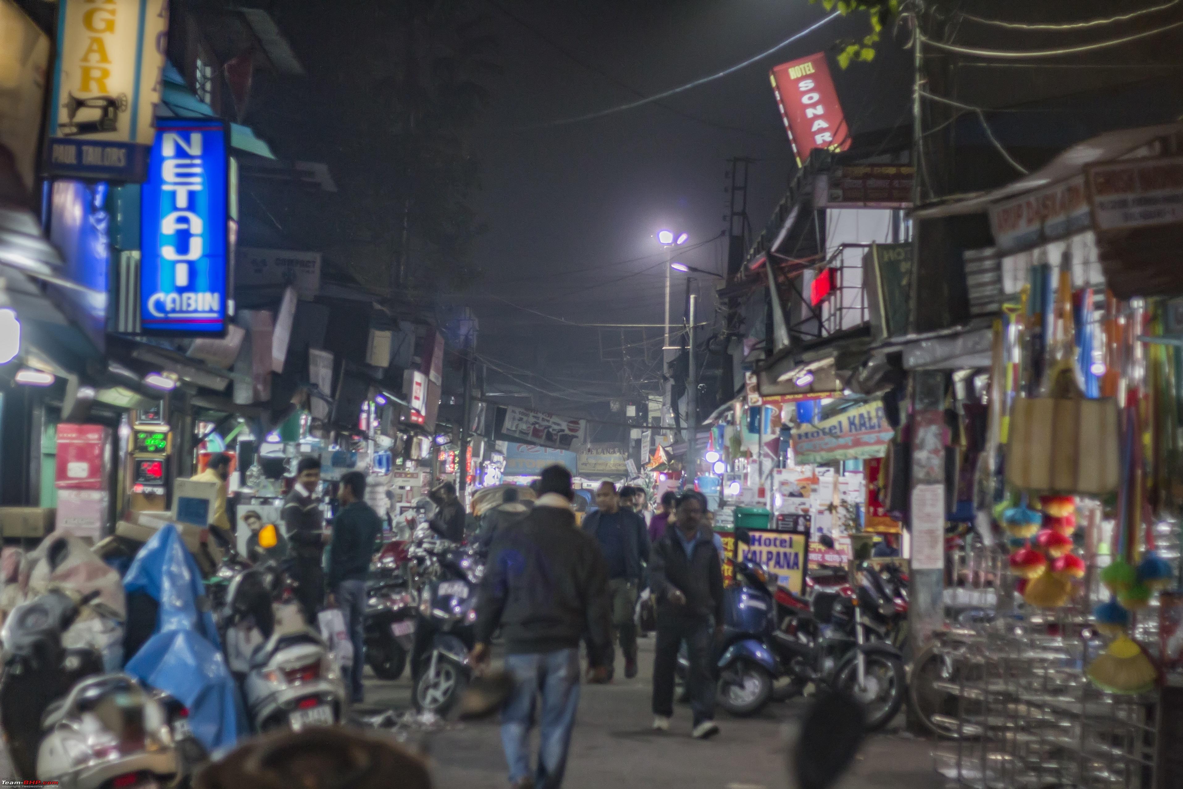 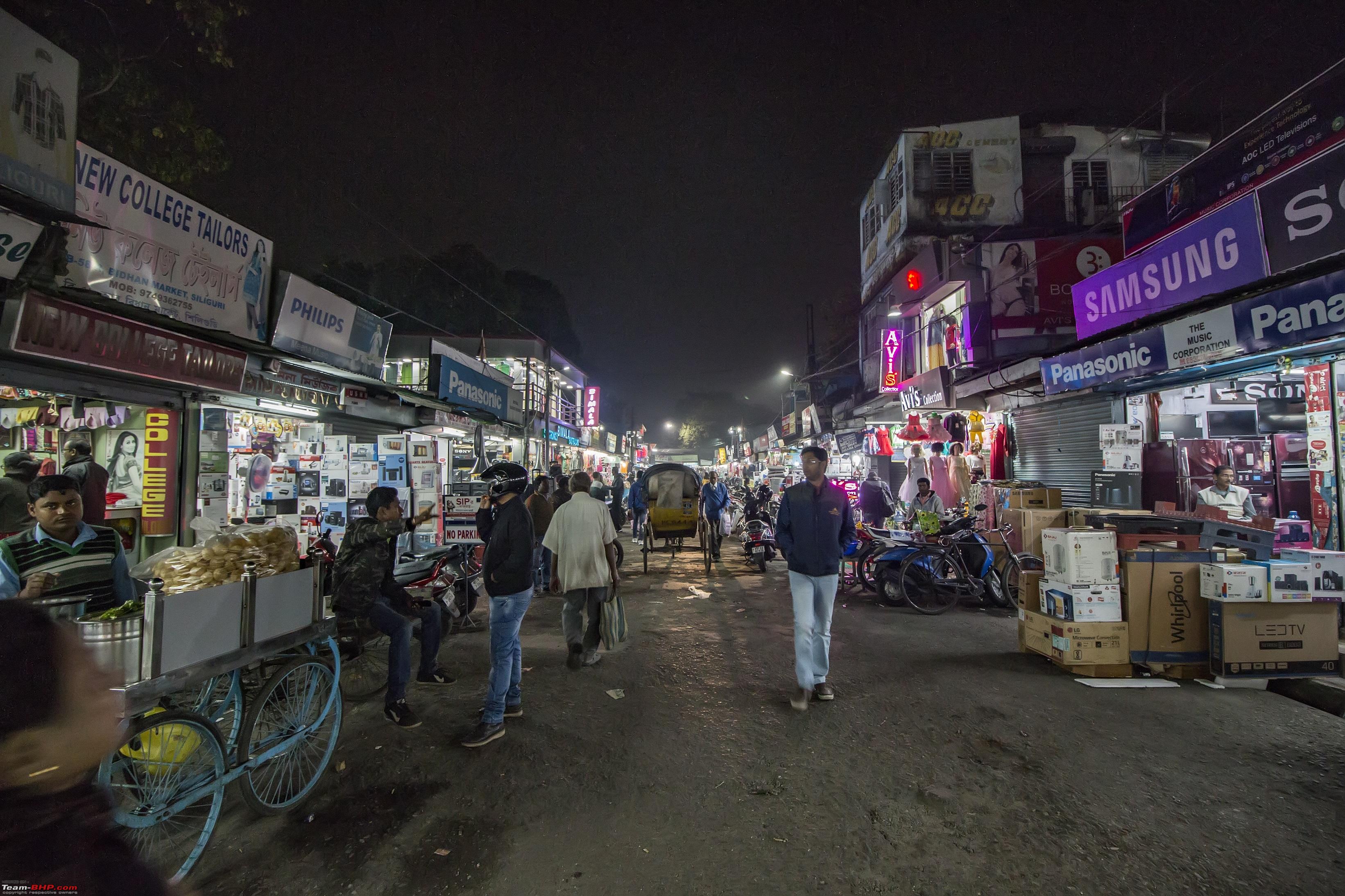 Day 16 (Siliguri Asansol) Tried Farakka in the afternoon while coming waited 55 minutes. Tried Farakka at 1:15am waited 45 minutes. Thanks to a Volvo which took the wrong side, I tailgated and saved some time. At night the truck queue was longer and more haphazardly parked preventing one from crossing from extreme left. The officials ( very few of them) even ask you to take the wrong side. Day 17 ( Rested at our place ) Day 18 ( Asansol Hyderabad) 1672 kms door to door in 25 hours non stop. As usual Google will try to help you by asking you to take a left near Rajamundry. But I went further by 150kms and the Eluru road (NH65 ) was a charm to drive on. Finally the Map of India after the trip  Summary... Total Distance - 6858 kms Total days - 18 Total Passes traversed - 2 ( Sela Pass, BumLa pass) Total money in fuel : 38,752 Total Money in Hotels: 51,800 Extra money on other vehicles ( Kaziranga + day 1 of Shillong) : 7800 Total Money at tolls : 6255 Route Used Hyderabad - Joka ( Kolkata) -BotolBari route - Siliguri - Mangaldoi - Dirang - via Kalaktang , no need to enter Bomdila unless under normal scenario - Tawang - BumLa pass - Tawang - Bhalukpong - Kaziranga - Guwahati -Shillong - Cherrapunjee - Guwahati - Siliguri - Asansol - Hyderabad Hotels used Siliguri - Mount Embassy , would I recommend - Yes I would but need to call earlier for parking. Mongoldoi - Siddhartha Palace, would I recommend - Yes, massive parking lot and friendly people. Dirang - Awoo Resort, would i recommend - Keep it as second option, Pemaling is slightly better. Tawang - Tashi Ga Tsel, would I recommend - Yes , just ignore what the mis guidance they try to give, guys are good otherwise. Bhalukpong - Hotel Druk, would I recommend - Yes if its a last minute booking and you have run out of options. Kaziranga - Rhino Guest house, would i recommend - Never, Try to search for Hotels listed under Assam Government's website. Shillong - Hotel Silk Route, would I recommend - Yes, hotel with a parking in congested Hill station is always welcome. Guwahati - Aprila Lodge - Highly recommended https://www.facebook.com/aprilalodge/ Siliguri - Mount Embassy , would I recommend - Yes I would but need to call earlier for parking. Since I started this blog with the Sunrise. Here is a parting shot - Sunset at Kaziranga.  I know its a pretty long blog but thanks a lot for going through and I hope it helps fellow travellers.  Last edited by ARAY : 14th January 2018 at 03:22. |
|
| (31)
Thanks
|
| The following 31 BHPians Thank ARAY for this useful post: | agspins, anandpadhye, arun_josie, BlackPearl, catchdoon, dailydriver, darklord, DrANTO, dre@ms, gmhossain, GTO, Insearch, JoseVijay, Klub Class, navsjab, NomadicLife, PapaBravo, pulsar56, RAHS, Samba, sandx, sayakc, SDP, Shanksta, SohamBiswas, sreerknair, SRT, strawhat, subhojitb, surjaonwheelz, VaibhaoT |
| |
|
14th January 2018, 09:26
| #12 |
| Team-BHP Support  Join Date: Jan 2010 Location: Mumbai
Posts: 4,735
Thanked: 11,296 Times
| re: Hyderabad to Arunachal, Assam & Meghalaya in a Duster AWD Thread moved out from the Assembly Line. Thanks for sharing! |
|
| (2)
Thanks
|
| The following 2 BHPians Thank SDP for this useful post: | ARAY, GTO |
|
14th January 2018, 17:06
| #13 |
| BHPian Join Date: Nov 2017 Location: Pune
Posts: 118
Thanked: 490 Times
| Wow !! Thats quite a journey you have done. Great clicks and wonderful narration. I will definitely bookmark this thread for future reference. A quick calculation of the fuel efficiency says you got about 10.5 kmpl for this trip. Is this mileage normal for your Duster ? |
|
| (1)
Thanks
|
| The following BHPian Thanks Maddy3008 for this useful post: | ARAY |
|
14th January 2018, 19:27
| #14 |
| Distinguished - BHPian  | re: Hyderabad to Arunachal, Assam & Meghalaya in a Duster AWD Stunning!! This is by far your best travelogue penned down in Team Bhp. Excellent narration and terrific photographs. Rated 5*. Now how many states in India are left by your Bong Duster to cover?  Keep travelling and keep sharing the travelogues with us. |
|
| (2)
Thanks
|
| The following 2 BHPians Thank Samba for this useful post: | ARAY, Shanksta |
|
14th January 2018, 23:54
| #15 |
| BHPian Join Date: Jun 2012 Location: Kalyani, WB
Posts: 646
Thanked: 3,159 Times
| re: Hyderabad to Arunachal, Assam & Meghalaya in a Duster AWD Thank you very much for putting up such a beautiful travelogue! A road trip spanning eighteen days is simply an epic drive, to say the least. Keep travelling and keep revving! Cheers, |
|
| (1)
Thanks
|
| The following BHPian Thanks gmhossain for this useful post: | ARAY |
|