Hey guys,
My cousin walked 1200 Kms across South India, then went to Sri Lanka, rented a motorcycle there and rode about 2000kms around Sri Lanka (apparently he wanted to retrace Hanuman’s path to Sri Lanka and rediscover his faith! Yeah, he is a bit crazy…) I managed to get my hands on some information and pics of his trip, so thought of sharing this with other Team BHPians as well. Enjoy…! If you guys want more details about his ride within Sri Lanka or even his walk in South India, please post them here and I will get answers..!
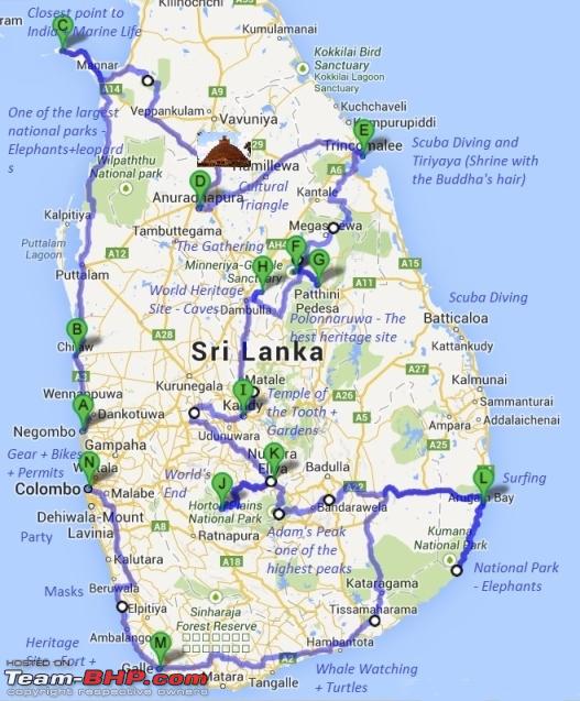
 The Route:
 So this is the map of the route that he followed - 2000 Kilometers on a motorcycle covering a majority of Sri Lanka’s beaches, national parks, heritage sites and religious shrines.
The setup: Valid Sri Lankan driver’s licenses or International driver’s licenses are compulsory to rent bikes. Temporary licenses can be acquired at the Department of Motor Traffic – Werahera branch in Boralasgamuwa, Colombo.
The price offered for the bikes - 17000 SLR for 17 days for a Hero Honda Hunk or 20000 SLR for a Yamaha, roughly $9 per day and $18 per day for a Honda Baja.
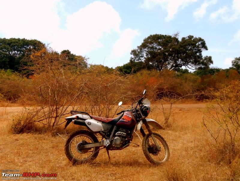
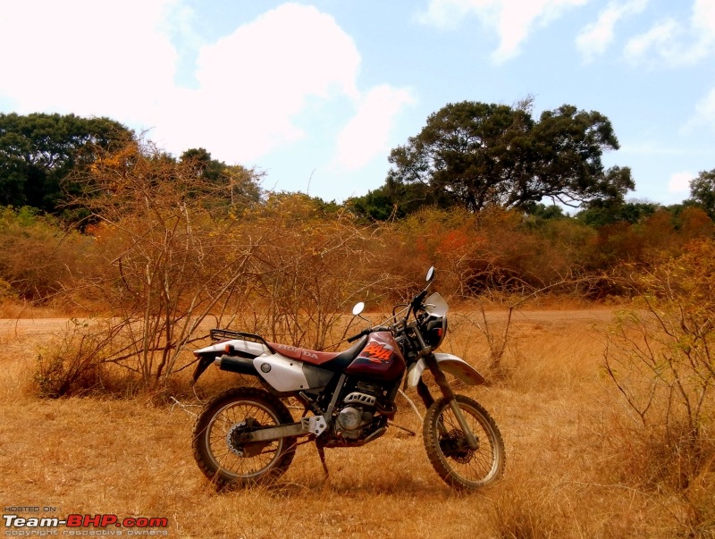 The Ride: Honda XR 250R Baja. 249 cc enduro motorcycle, 20Bhp at 8100RPM and 6 speed gear box Daily Logs of the trip
Day 1 – After getting the bikes and gearing up - Negambo to Chilaw
Distance 60 Kms
Road conditions - Good
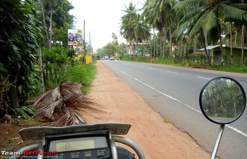 Road to Chilaw – pretty good driving conditions
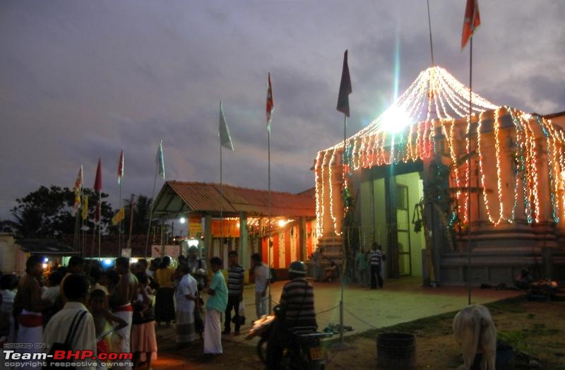
  Munneswaram temple near Chilaw - this was the place from the Ramayana where Lord Rama prayed to Lord Shiva for a solution to the Brahmana Dosha for killing Ravana
Day 2 – Chilaw to Mannar Island through Wilpattu national park.
Distance ~200 Kms
Road conditions – Average. Significant part of it is a dirt road which is fine in the dry season.
 Wilpatu national park - famous for its leopard and elephant populations. It is one of the largest national parks in Sri Lanka covering over 130,000 hectares. It is known for its multitude of Villus (lakes) from which it gets its name. While driving through, spotted a couple of warthogs, a pair of hornbills, a huge variety of birds, monkeys and several monitor lizards.
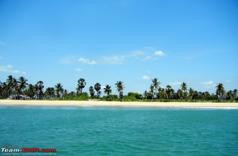
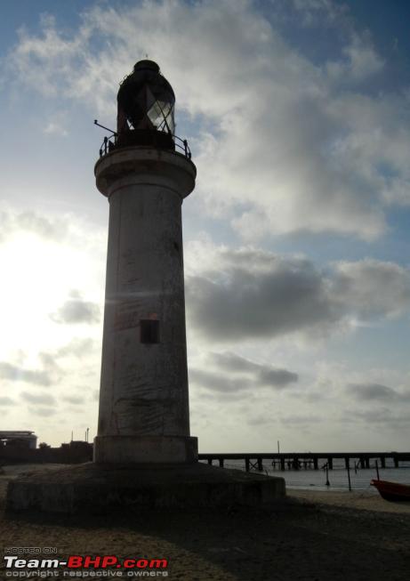
  Lighthouse at Talaimannar, the geographically closest point to India and the other end of Rama Setu. They have some boating with glass houses around here. Mannar has some really good food and bird watchers will love it here beacuse of the Giant's tank but very poor accommodation choices.
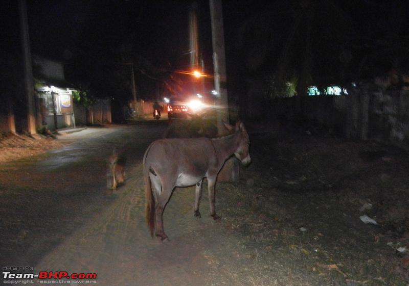
  There were several wild donkeys in Mannar (this was roaming in the town). In the past some merchants from Arabia thought that it would be a good idea to introduce donkeys and Baobabs in Sri Lanka.
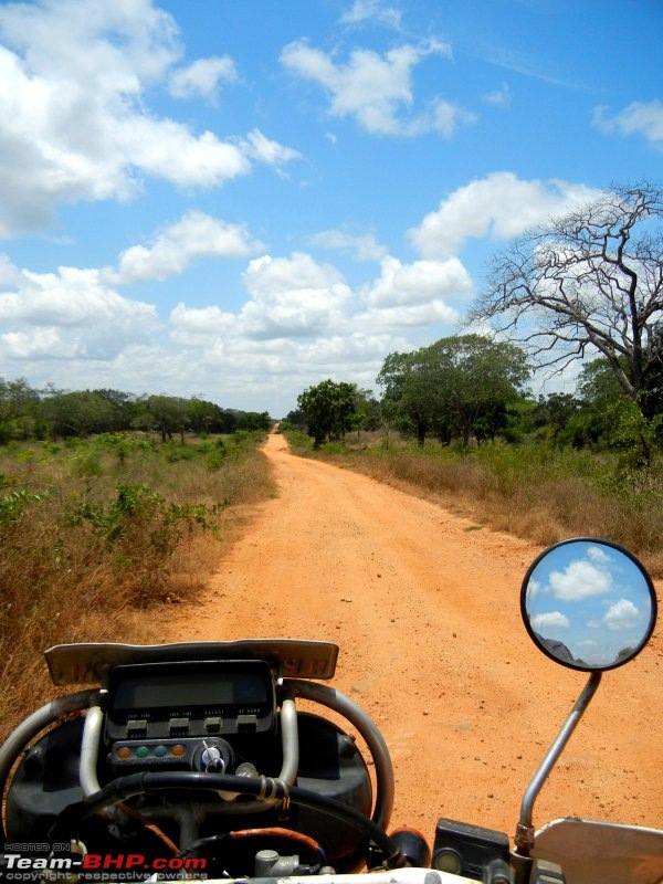
Day 3 –Mannar to Anuradhapura. Via Madhu Road Sanctuary, Silavatturai, and Wilpattu.
Distance – 100 Kms
Road conditions – Poor. Significant part of it is a dirt road which was pretty bad even in the dry season.
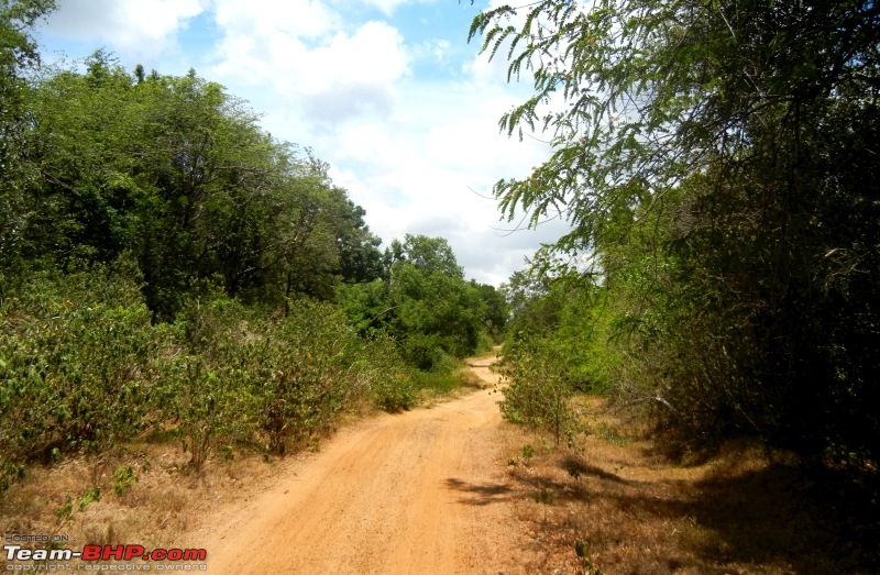
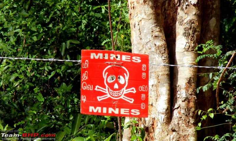 The road through Madhu Road Sanctuary was almost exclusively a dirt track and was a fun drive until this sign after which people start shitting bricks at every loud noise the bikes made.
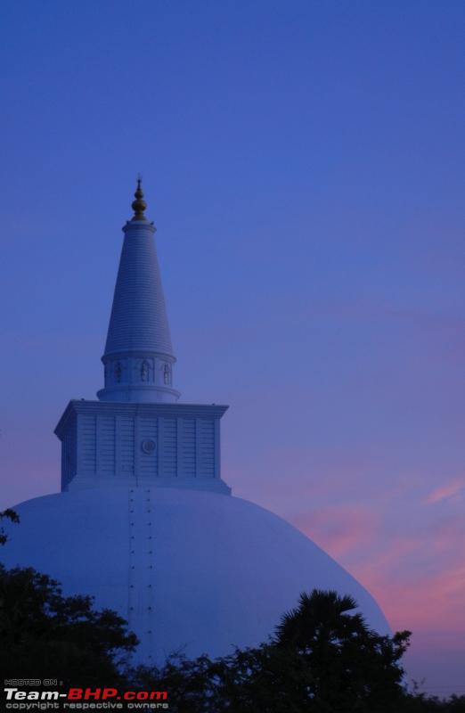
 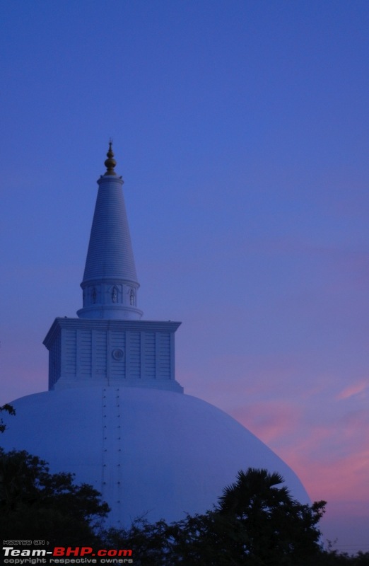 Arrived in Anuradhapura to see this sight of the sunset over the Ruwanweliseya Dagoba
Day 4 – Went around Anuradhapura which was a UNESCO World Heritage Site. Sites to visit include Sri Maha Bodhi (Sacred Bo Tree), the Ruwanweliseya Dagoba, Atamasthana (Eight Great Places of Veneration), and the remnants of the ancient city of Anuradhapura.
Road conditions – Good.
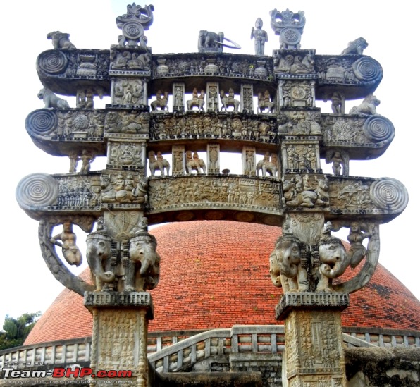
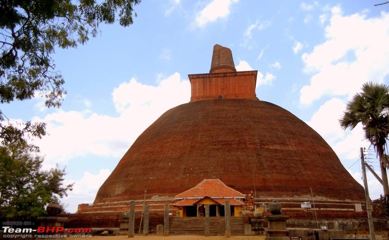
 Jetewanarama Dagoba. The Dagobas are Buddhist shrines which have remains of monks and offerings of gold, precious stones and jewels encased in them. Each of them has a unique story/legend associated with them.
Day 5 – Anuradhapura to Trincomalee via Mihintale.
Distance – 100 Kms
Road conditions – Average. There were a few stretches of road with a lot of potholes.
 Ancient monuments on the Road to Trincomalee about 10 Kms outside Anuradhapura.
 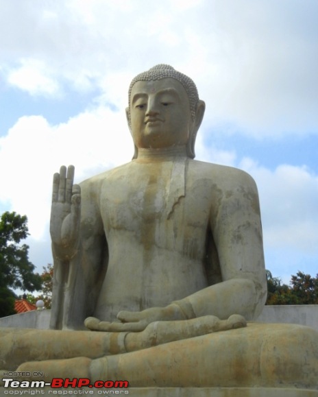 Ancient statue of the Buddha near Mihintale. Nearly in all of the heritage sites, there are statues of the Buddha in various positions.
 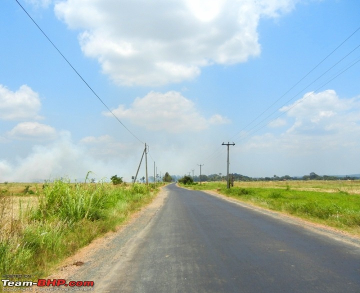 Road to Trincomalee. A pleasant drive for the most part. Met several people along the way all of whom wanted to talk cricket and invited home after finding out we were from India. This was the case all over Sri Lanka.
  Finally at Trincomalee! Apart from the beaches it also has the Koneswaram Kovil - a Maha Shakti Peetha. This temple is also referred to as Dakshina Kailasam (Kailash of the south), as it is located on the exact longitude as Mount Kailash (home of Lord Shiva). According to the Ramayana this is one of the three sites that Lord Ram performed Puja to get rid of the ‘Brahmana Dosham’.
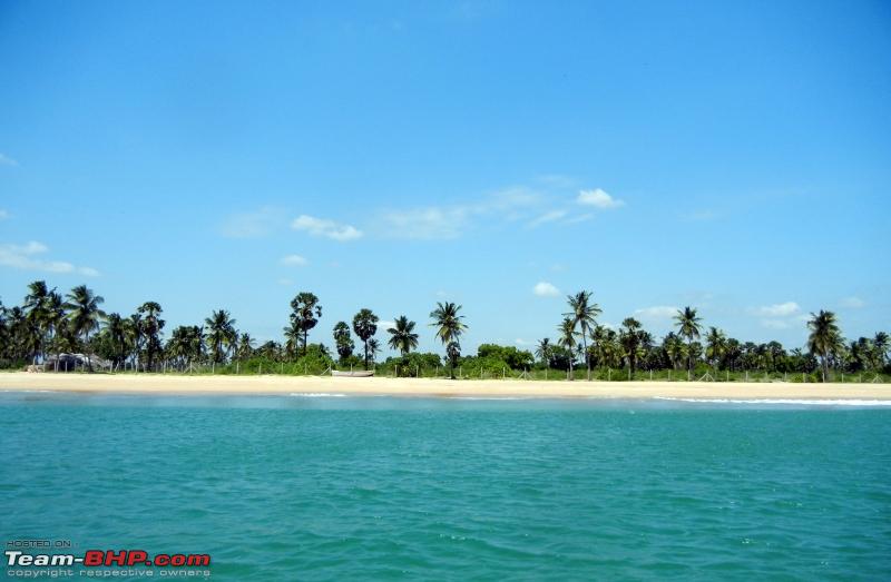
Day 6 – Scuba diving at Pigeon Island and side trip to Tiriyaya and back
Distance – 90 Kms
Road conditions – Average. Few stretches with potholes.
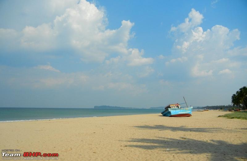
 On the way to Pigeon Island- gets its name from the thousands of Rock Pigeons on it
Day 7 – Trincomalee to Minneriya via Medirgiriya.
Distance – 100 Kms (30 Kms of dirt roads)
Road conditions – Good highway. Average on the dirt road; there were no signs so getting lost is very easy.
 Headed towards Watadageya (also called Medirigiriya) on a dirt road through a jungle and passed Kantale Wewa (huge and beautiful lake). After getting lost a couple of times, a few near wipe-outs and a few land mine scares, eventually made it.
 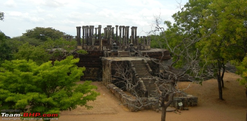 The Medirigiriya Vatadage – a shrine built on an elevated platform with a circular protective wall around it. The steps leading up to the shrine were carved out beautifully and in detail. There were three sets of pillars in concentric circles and the top of each pillar was intricately carved. The shrine itself consisted of the stupa and four statues of the Buddha in various postures around it.
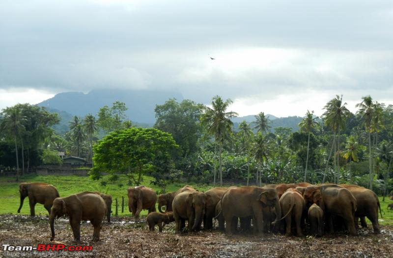
 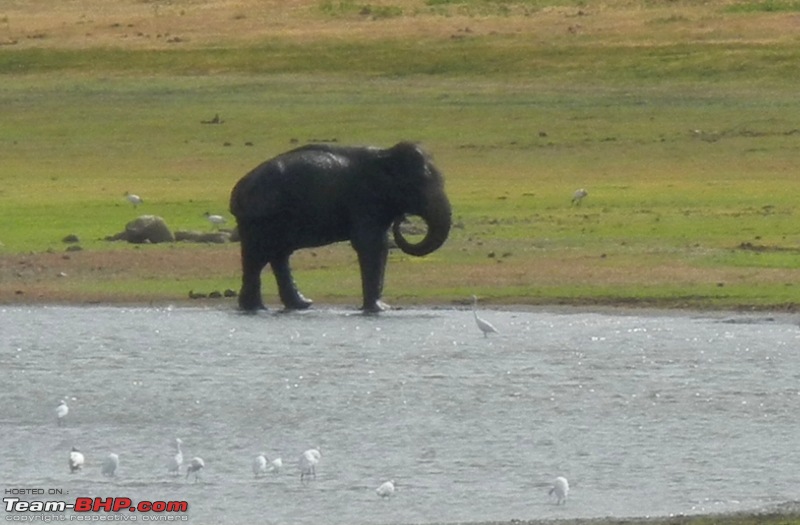 Wanted to see ‘The Gathering’ (during the dry season hundreds of elephants from across Sri Lanka gather at Minneriya to feast on the grass, mate, play, and interact with each other). Near the Minneriya lake spotted this lone elephant, so parked off the road and sat under a tree, watching it eat and drink.
Day 8 – Polonarruwa
Road conditions – Good.
“Polonnaruwa was the second ancient capital of Sri Lanka and a World Heritage site. If you had time to visit only one place in the Cultural Triangle, then this should be it. There is so much to see – huge statues, palaces, frescos, Viharas (monastery), Guardstones, Moonstones, Vatadages, baths, tanks, cave art, and several other relics.”
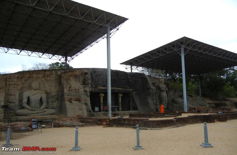
 The Gal Vihara in Polonnaruwa – The huge statues (15 - 50 feet) of the Buddha here seemed to be a key draw and there were plenty of people here as opposed to the rest of the place. There were 3 huge statues of the Buddha carved out of stone (granite) in different poses (Seated - left, standing – middle, recumbent – extreme right || thanks Captain Obvious) and an additional statue in the cave. Interestingly the recumbent Buddha is supposed to be the pose in which he passed away. Our guide explained that the various signs of his passing were his half-closed eyes, the position of his head and hand on the pillow, the fact that his top leg was moved forward slightly.
Day 9 – Polonnaruwa to Sigiriya.
Distance – 80 Kms
Road conditions – Good to Average depending on the route chosen.
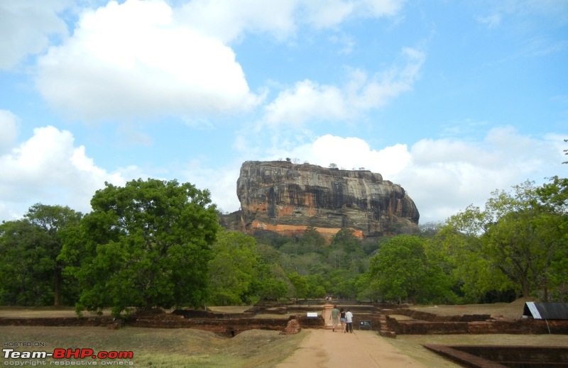 Sigiriya (Lion’s Rock) is a World Heritage site and ancient capital of Sri Lanka. It certainly is unique, thanks to its location – it is built on a huge rock, 180 metres high. There were several things to see like the Royal Gardens, the Mirror wall, Lion staircase, and the Sigiriya Frescos – paintings of Apsaras (celestial nymphs).
 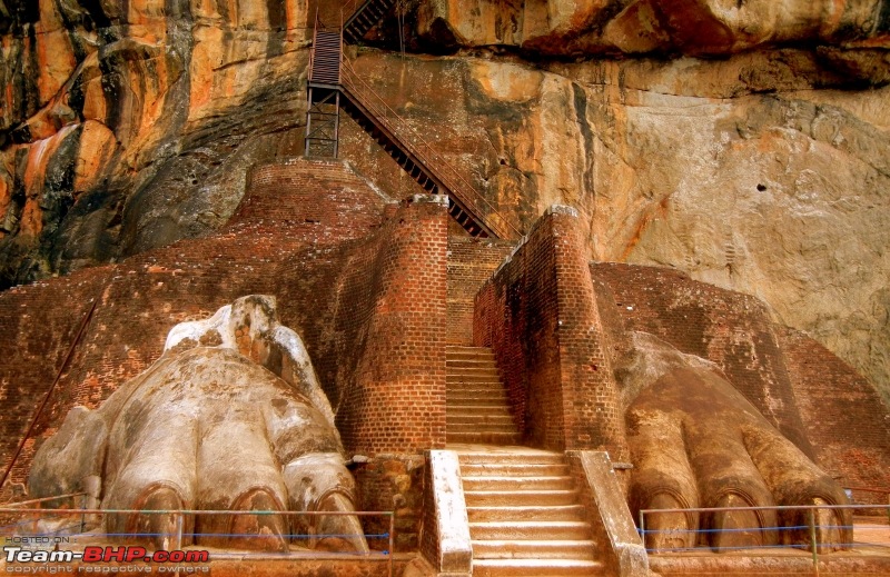 Lion's paws at Sigiriya. Originally there was a full Lion structure here and visitors to the palace entered through the Lion's mouth. Time certainly took its toll.
Day 10 – Sigiriya to Kandy with visits to Dambulla, Nalanda and Aluvihara along the way.
Distance 90 Kms
Road conditions – Average. Plenty of traffic along this route.
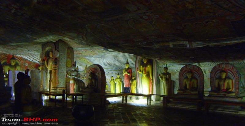
 The Dambulla Rock temple is one of the oldest Buddhist temples in Sri Lanka and a World Heritage site. It was built by King Abhaya in 1st century BCE and consisted of more than 80 caves. Five of these caves are famous for their paintings and 157 statues of the Buddha and other important figures of Buddhism.
Day 11 - Kandy and the The ‘Sri Dalada Maligawa’ or the Temple of the Tooth. It holds a tooth (canine) of the Buddha and is the most visited place in Sri Lanka. The sacred tooth cannot be seen directly as it is generally placed inside seven golden caskets which are adorned with precious gems.
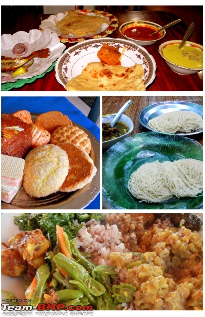 Some of the amazing food we had along the way.
Day 12 – Kandy to Nallitanniya after visiting Pinnawala Elephant Orphanage, Aluthnuwara Dewalaya and Ramboda.
Distance – 150 Kms
Road conditions – Average from Kandy to Pinnawala. Horrible from Pinnawala to Ramboda. Average from Ramboda to Nallitanniya.
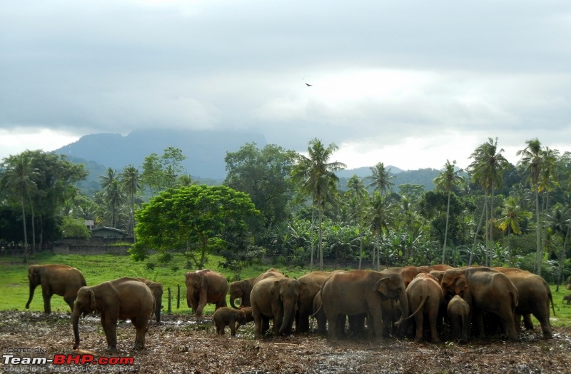 The elephant orphanage at Pinnawala
“The elephant orphanage at Pinnawala is located 30 kilometers from Kandy on the road to Colombo. Around 90 elephants including calves are present at the orphanage, a lot of which have sad stories. One of the saddest stories was that of a poor three legged elephant – Sama, who had lost her leg due to the civil war. The sight of it trying to walk along on three legs would move the hardest hearts but then who was responsible for it but the most savage of all animals - Man. This place was iffy and depressing.
The road to Ramboda was atrocious. It couldn’t possibly be even called a road. It wasn’t a road with potholes; it was potholes with a road. After a long 2 hours, finally through and butt cheeks could finally relax.
Our next objective was to trek up Sri Pada aka Adam’s peak, for which the town of Nallitanniya served as the base camp. Reached there at around midnight.
Day 13 – Trekked up Adam’s peak and moved to Nuwara Eliya.
Distance – 75 Kms
Road conditions – Average.
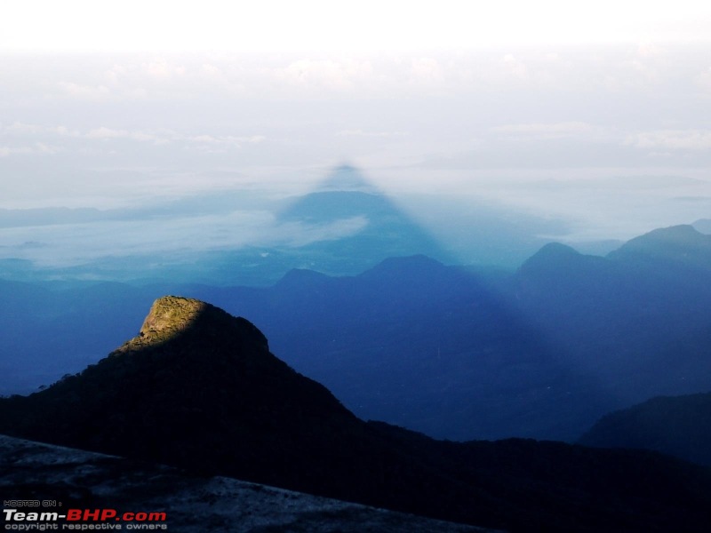 What was supposed to be seen ideally – a perfect shadow of Adam’s peak at sunrise. What was actually seen was a white out. Wrong season so it was covered with clouds and mist.
  Just added this picture from google as a reference.
Day 14 – Visited Horton’s Plains National Park to see World’s End (Patal Lok as per the Ramayana), Mini World’s End, Baker Falls and a few other sights. Also visited the Hakgala Gardens or Ashoka Vatika as per the Ramayana. This was the place where Ravana kept Sita Devi prisoner, as Queen Mandodari would not allow her to be brought into the royal palace. This was also the place where Lord Hanuman first met Sita Devi and passed to her Lord Ram’s ring.
Distance covered – 50 to 60 Kms
Road conditions – Good.
Day 15 – Nuwara Eliya to Arugam bay, visiting other tourist spots and some caving along the way.
Distance – 180 Kms
Road conditions – Amazing. Wide, beautiful roads with curves and no traffic made this a dream stretch.
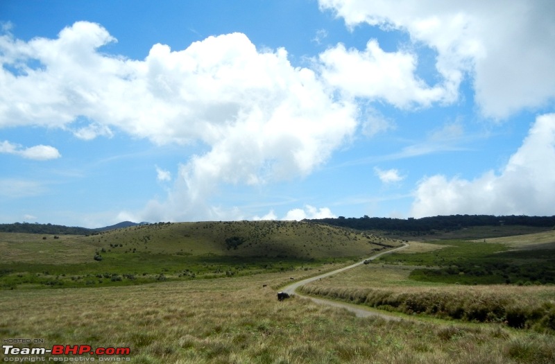 Amazing roads and weather
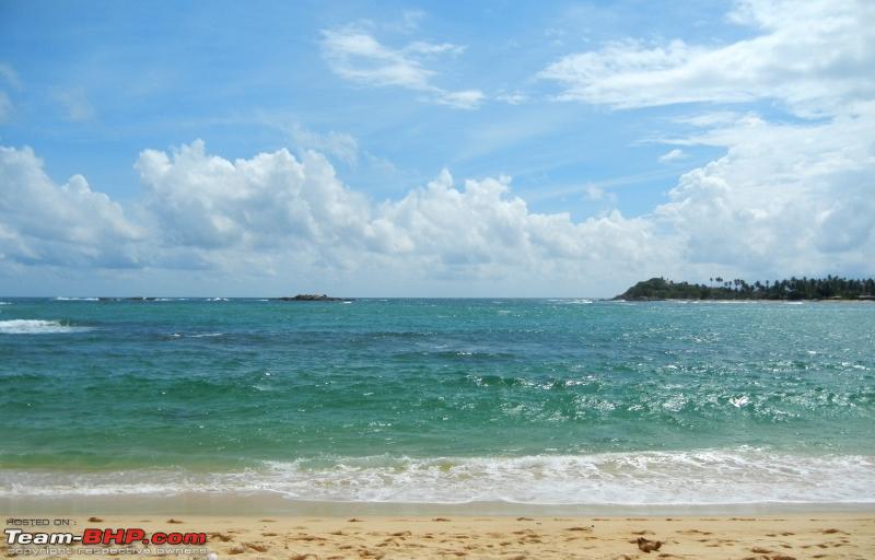
Day 16 – Surfing at Arugum Bay and drive to Galle visiting Katragama, Yala National park and Mirissa along the way. Was running out of time here so had to push through faster.
Distance – 300 Kms
Road conditions – Good for the most part. A few stretches had potholes. Since this passes through a national park, watch out for the elephant crossings.
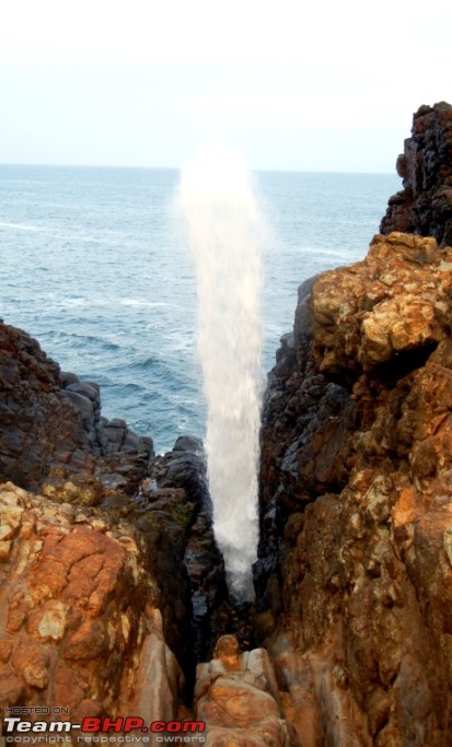 Blowhole at Hummanaya - the only known blowhole in Sri Lanka and possibly the second largest blowhole in the world.
Day 17 – Galle Fort and drive to Colombo on the beach road.
Distance 160 Kms
Road conditions – Good.
 “This is the end, beautiful friend. This is the end my only friend.
The end of our elaborate plans, the end. Of everything that stands the end.
No safety or surprise the end. I’ll never look into your eyes, again”


 11th November 2015, 14:27

 (37)
Thanks
(37)
Thanks


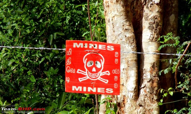


 . Any idea why the mines were there?


