Team-BHP
(
https://www.team-bhp.com/forum/)
-
Travelogues
(
https://www.team-bhp.com/forum/travelogues/)
Quote:
Originally Posted by laluks
(Post 2458824)
One query. Can you give some information on the stay options at Nako and Tabo
|
Nako:
Hotel Leo Purgil-+91-1785 236339 (Polular)
Kinner Camps-09650210909
Tabo:
Trojan Guest House -09418342999 (
Stay here, this is much cleaner and comfy)
Hotel Tiger Den (Dekit Norphel)-Vinit Rana-9418817761
Amazing pictures and travelogue. One question - would it have made any sense to attempt this in your Civic as a self drive or is a local Innova the only sensible option?
Quote:
Originally Posted by Hayek
(Post 2459268)
Amazing pictures and travelogue. One question - would it have made any sense to attempt this in your Civic as a self drive or is a local Innova the only sensible option?
|
I wouldn't take a civic here. However, innova's not the only option, regular hatchbacks with a decent GC would do this route without much fuss. I'd be taking my swift here and doing the entire circuit soon from Kinnaur side to Manali via Rohtang. However, lesser the GC, more careful one's gotta be.
(Cont.. Day 5)
We stop at Pooh for a while. There is a provision store on the highway which stocks biscuits, real juice and other food items. We rest for a while, my daughter seems to be in better shape-must have been tiredness.
From hereon the hue slowly changes from intolerable grey to more pleasant brown.
Soon we could see Khab at a distance.
Khab bridge is at confluence of Sutlaj and Spiti river. I get down the vehicle and walk alone towards the bridge... quite a serene atmosphere..

New truss bridge in nearing completion.. it may open to the traffic this year itself.

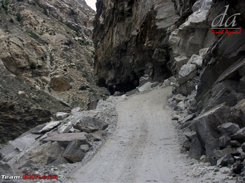
road beyond the bridge..
Two welders were working on the new bridge.. I approached them and asked them if this road was Namgia-Shipki La road on old Hindustan Tibet road. They had no knowledge. The road didn't look fit for vehicle but there were tyre marks.
The NH22 bifurcates somewhere here near Khab from the Hindustan Tibet road. NH22 meanders towards Kaurik and Hindustan Tibet road enters Tibet from Shipki La.

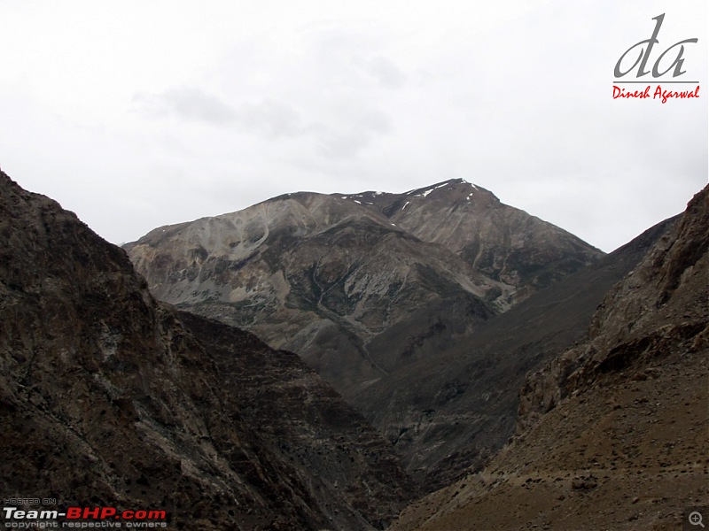
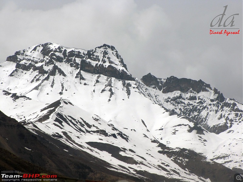
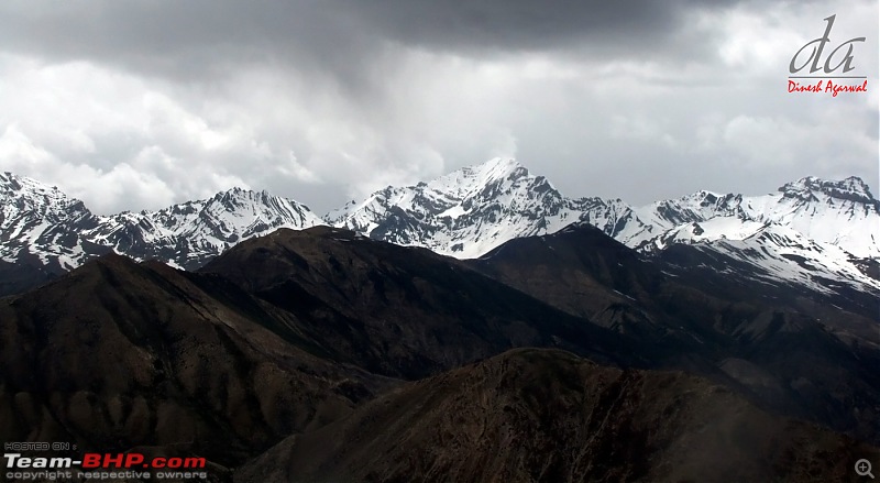
View of Reo (Leo) Purgil, (Elev 6816 meters) on the Indo-tibet boarder. Highest peak in Himachal.
Reo Purgil peak?.. isn't the view majestic..

We cross the Khab bridge..

and enter Hangrang valley (second largest valley in Himachal)..
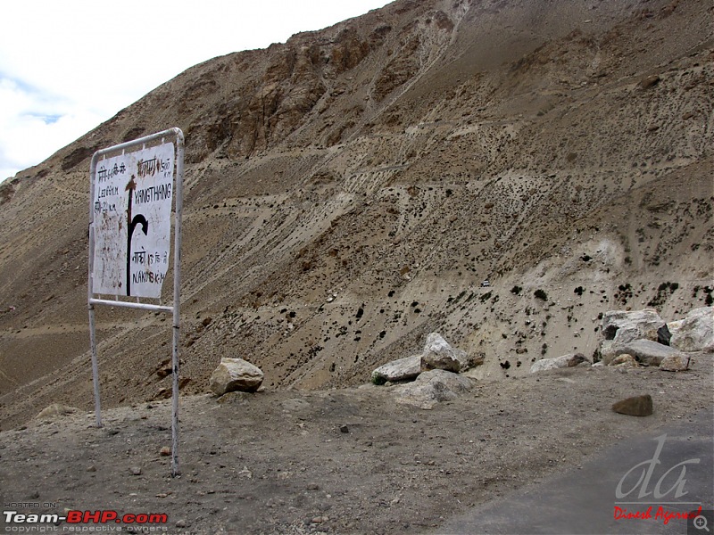
towads the "Kee loop" on way to Nako..
(Cont.. Day 5)
Quote:
Originally Posted by Hayek
(Post 2459268)
Amazing pictures and travelogue. One question - would it have made any sense to attempt this in your Civic as a self drive or is a local Innova the only sensible option?
|
Quote:
Originally Posted by fine69
(Post 2459364)
I wouldn't take a civic here. However, innova's not the only option, regular hatchbacks with a decent GC would do this route without much fuss. I'd be taking my swift here and doing the entire circuit soon from Kinnaur side to Manali via Rohtang. However, lesser the GC, more careful one's gotta be.
|
Thanks for the appreciation.
I wanted to take my Swift or Verna but was advised that it would be too risky for Kaza-Manali stretch (in case the route opened).. specially since I would have been the first few to cross the stretch at the beginning of the season..
(Cont.. Day 5)
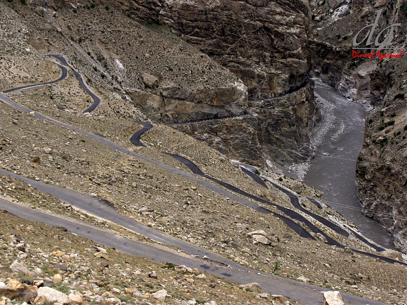
kee Loops- we begin the steep ascend
BRO's Project Deepak insignia on of the boulders

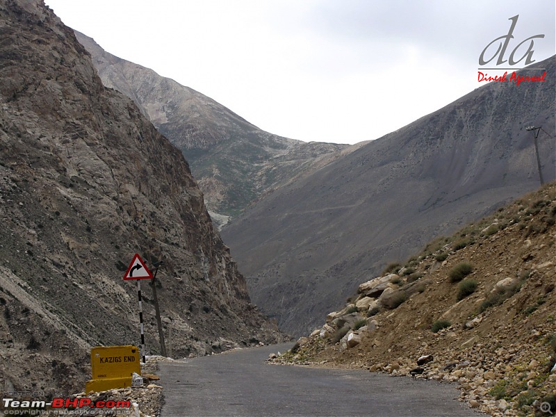
Kazigs Ends=Loops ends
..
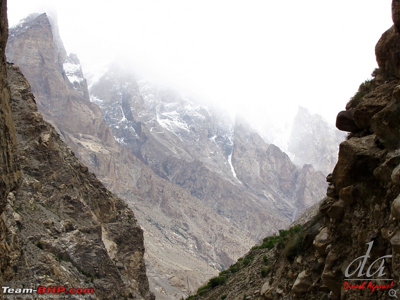
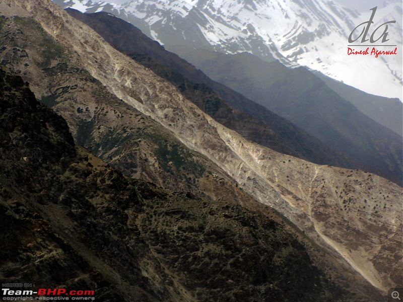
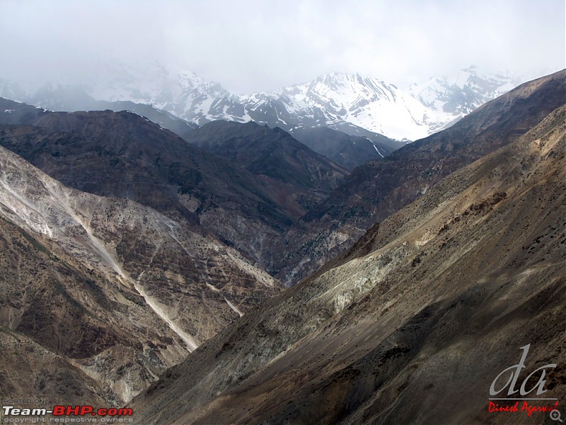
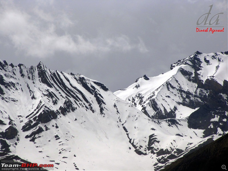
The view becomes mesmerising
view from the road
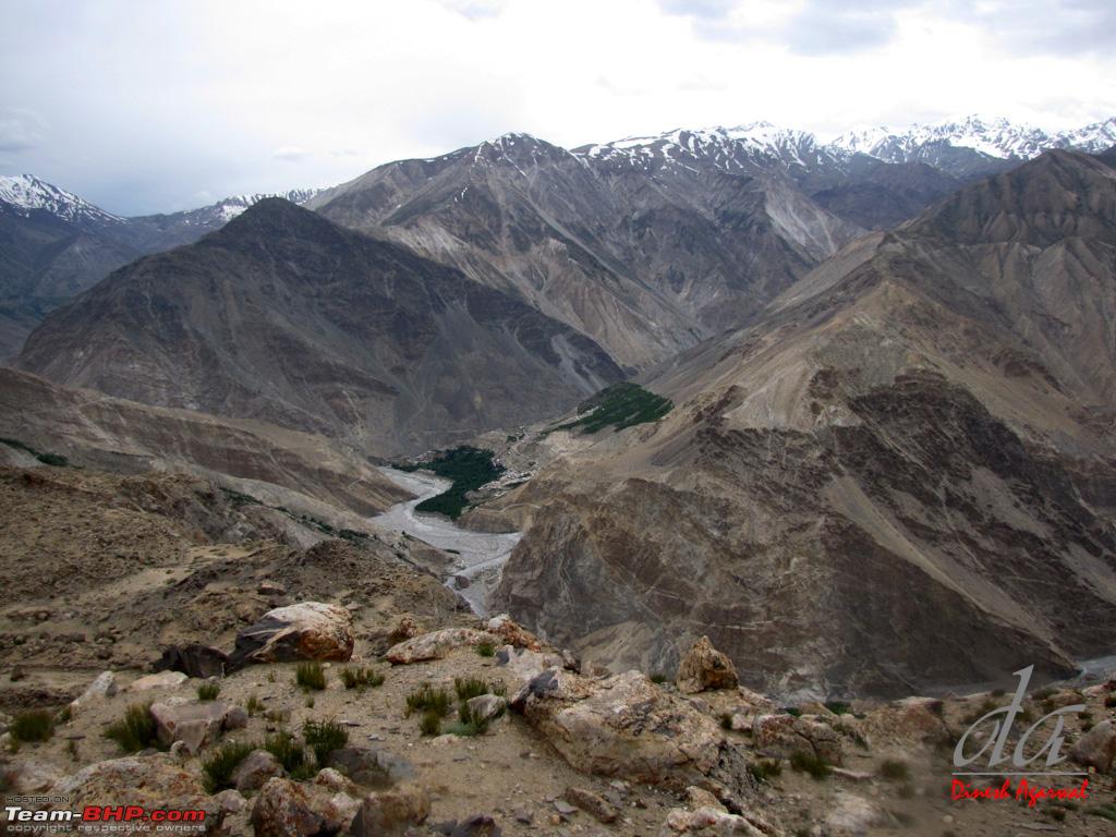
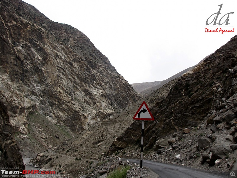
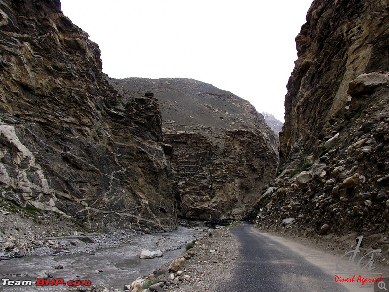
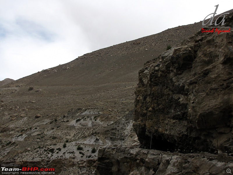
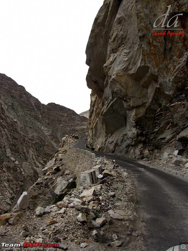
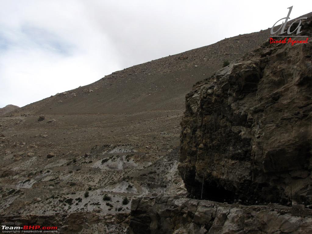
we continue our climb. Road between Khab and Nako is in good shape
Spiti River flowing through the Valley

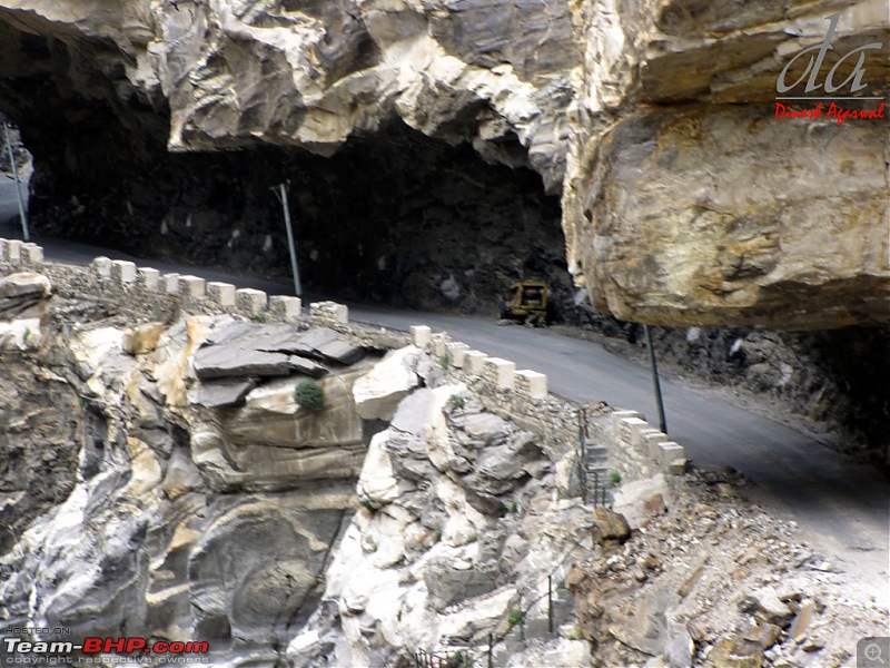
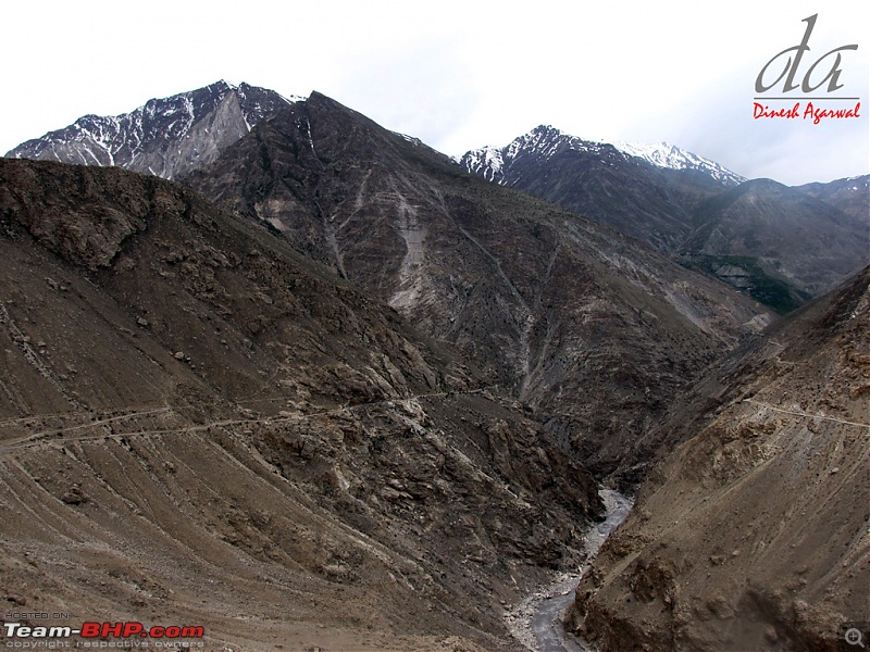
The old Malling alignment. This road has been abandoned due to long (3 Km) landslide stretch. This route now goes to Yangthang across the Spiti river. The old NH22 bypassed Nako. Now the new road ascends to Nako and crosses the Malling nallah near summit entailing very small landslide prone stretch.
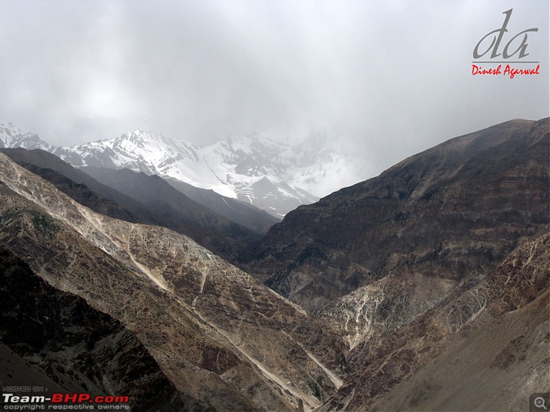
Hangrang valley: must have been har-rang valley originally :D

because it offers full range in the color palette.
(Cont.. Day 5)
(Cont .. Day 5)
The ascend continues..
and we cross one kazig after another..

nearing Nako now..
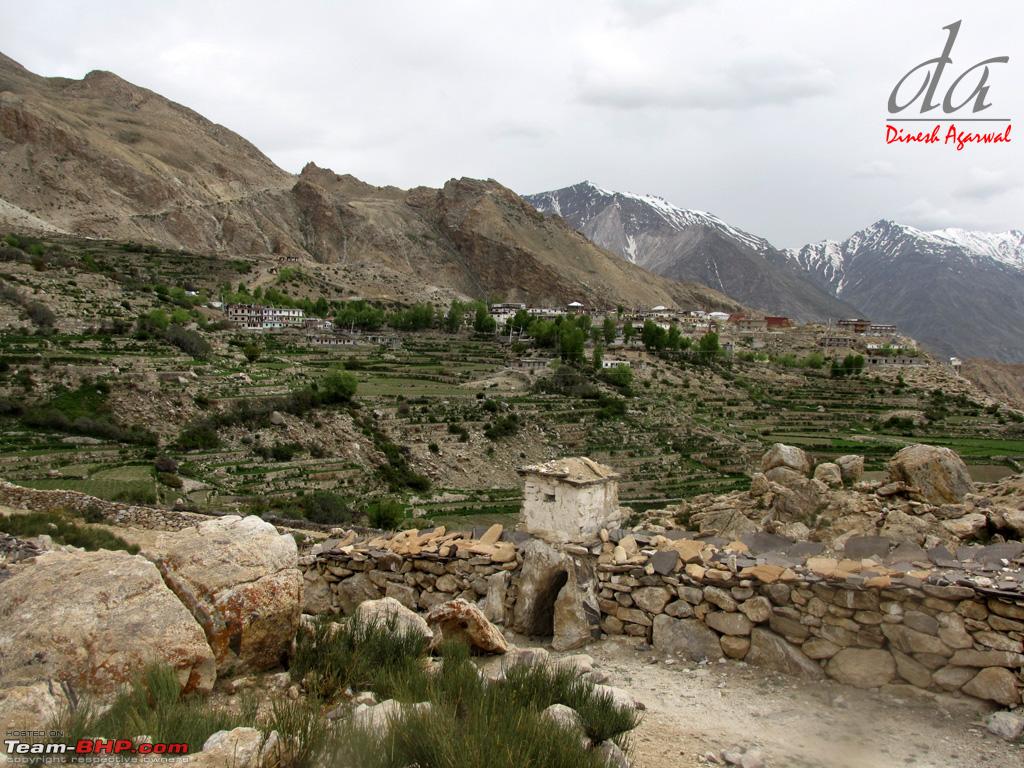
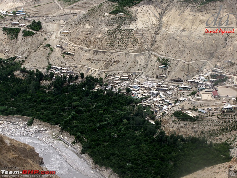
View of Yangthang acorss Spiti river. People here in barren lands in Kinnaur and Spiti are real hardworking. People in the towns and villages has maintained greenery and grows Peas and Potatoes in their field.
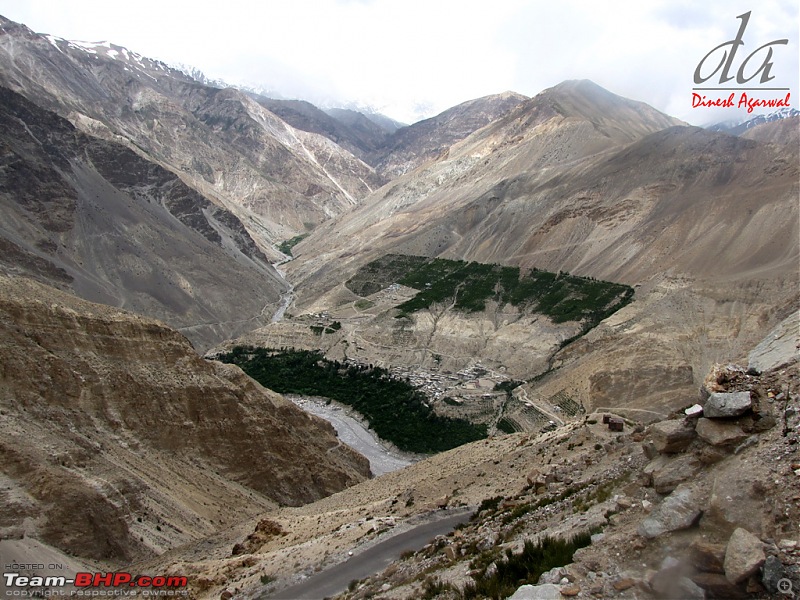
Close-up of Yangthang
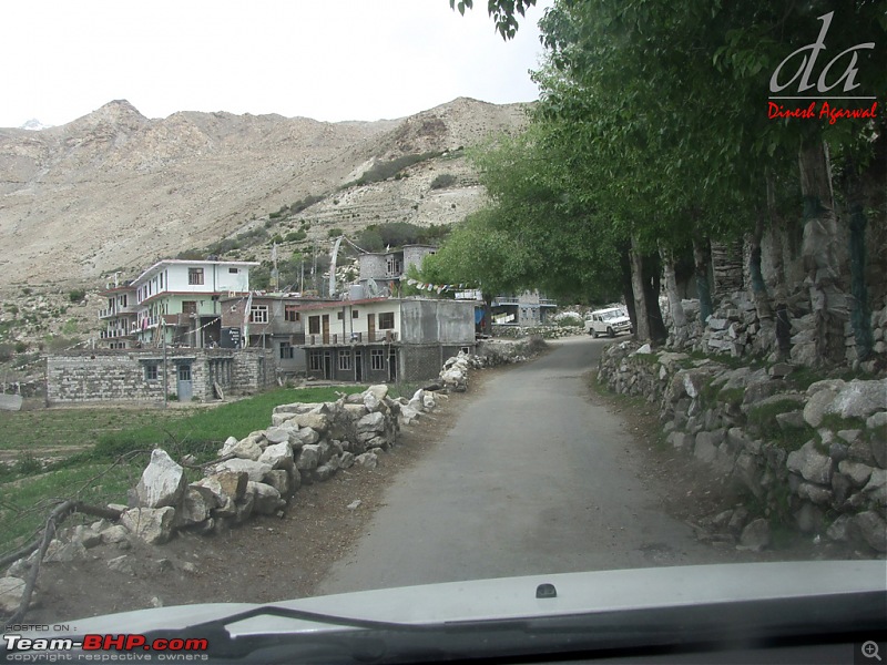
We reach nako at about 1:00PM.
Nako is located at an elevation of about 3800 meters about 1000 meters above Khab (2800 meters).. It is quite an elevation gain within a short span. Vinkal complains that the vehicle is finding it difficult to breath.
In fact I had made a couple in Kalpa who has spent a night in Nako as well as Losar (Elev 4200 meters). They told me that that they had difficult sleeping in Nako because of altitude sickness whereas they were fine at Losar and other places enroute Manai-Tabo. I was surprised hereing this however near Nako my wife also started showing the effects of high altitude..she had pain on the back of the skull and was slightly out of breath. My kids were fine.
The problem in Nako viz-a-viz other places may be because Nako is situated on top of the mountains where the air may be thinner compare to other higher altitude places which are located at Valley and river banks providing thicker air because of barrier effects from the mountains.. just my theory
View from Nako
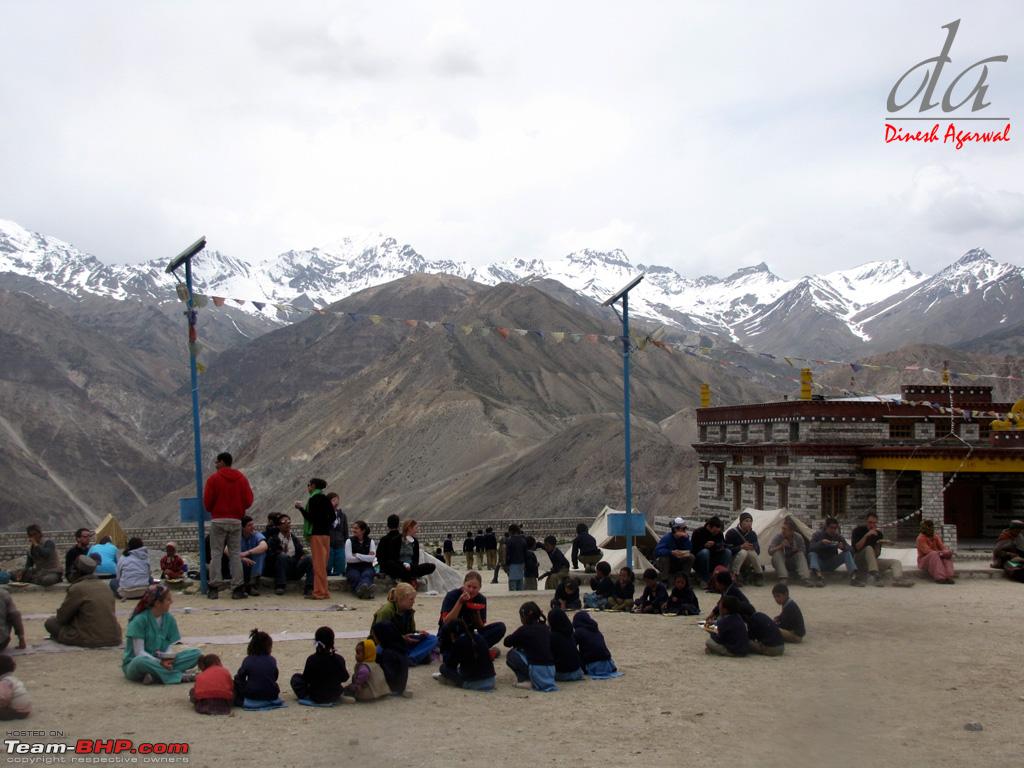
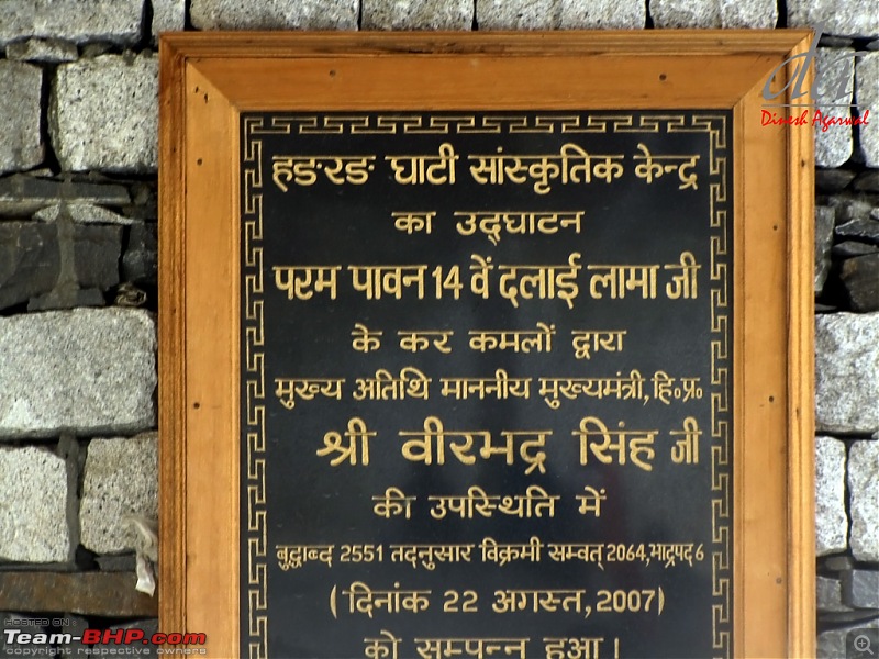
Nako Monastery..
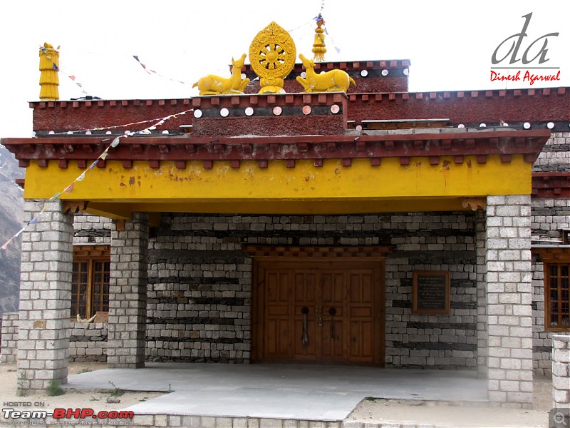
Inaugurated by H.H. Dalai Lama
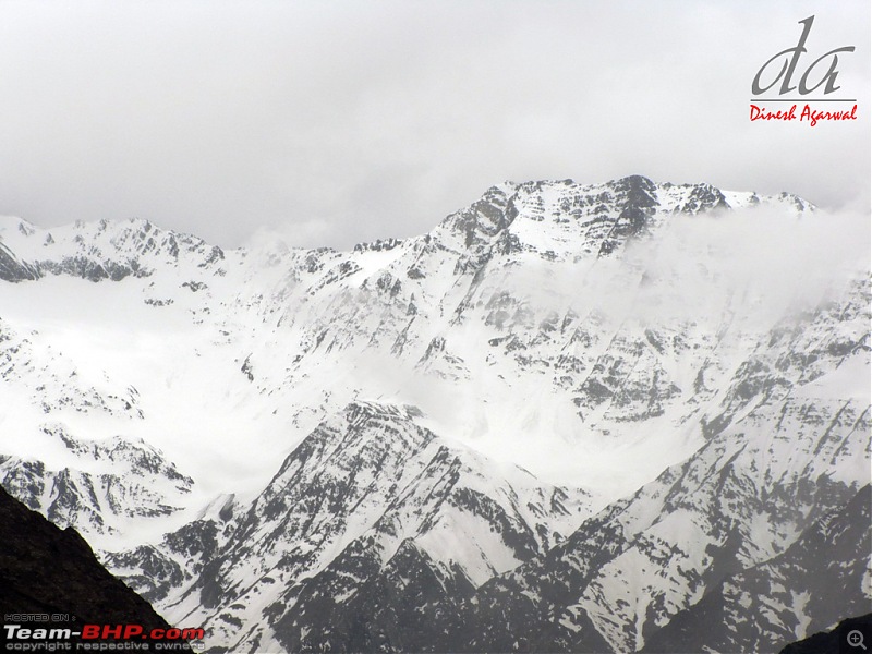
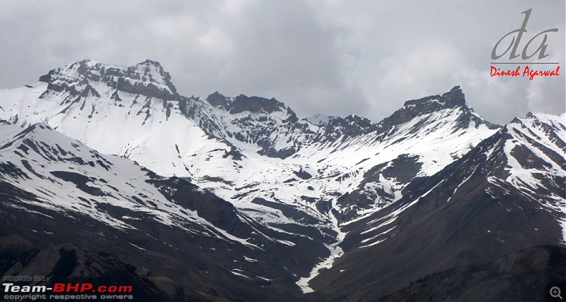
Is that Reo Purgil?

My daughter loves the trip and the view. My son inquires when will we reach the hotel. He wants to watch some cartoon. I promise him soon. :eek:
Meanwhile we enjoy the view of mountains around Yangthang..

(Cont .. Day 5)
(Cont.. Day 5)
Sand Stupas in a row at Nako Monastery

Some close-ups
one more
An international medical group consisting of doctors and health specialists were camping at Nako and they have set-up medical camp at the monastery compound..
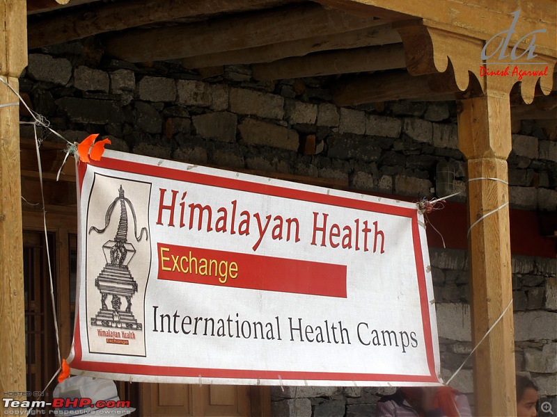
Every there doctors for the various countries volunteers and comes to Spiti- Lohaul and onwards to Leh Ladhak for about 2 months in mid-june. They stay at a place for few days and provide free and comprehensive medical facilities to local population. We met a fairly young doctor from US, he was mesmerized by the place and wanted to return to India for a longer duration.

It was lunch time at camp so we were invited for the lunch. We had delicious meal comprising of rice, razma and potato sabzi. Thank god for the meal otherwise it would have been thukpa and momos for the kids at Leo Purgils.

One of the local guy was distributing "Golden apples" to the camp staff and we were also offered one of each. Although preserved from the previous season they were very delicious and juicy. I have heard about them but have never seen or tasted before.

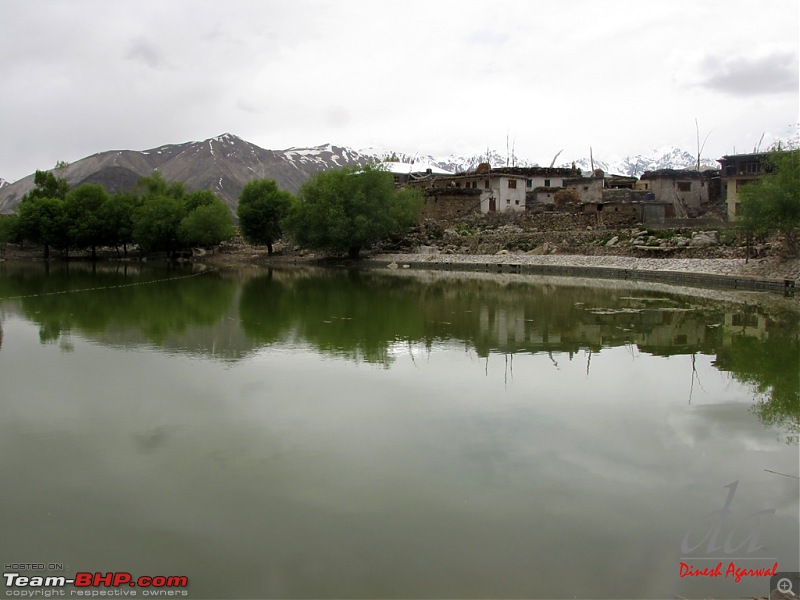
Nako village: towards Nako lake
Nako lake. This lake is located about 150 meters from the road. There are no pathways or walkways to the lake. The small descent is quite slippery and full of stones causing injury hazards.

One of the few places (I feel) which looks better in pictures..
view of Nako from NH22

..after a longish break of about an hour and half we proceed ahead..
(Cont.. Day 5)
I guess you still have to climb towards malling nala and cross it to avoid the landslides. How was malling this time? We were waiting before malling in 2009 for almost 1 hour for the landslides to be cleared by the bulldozers. They just take the mud and put down the slopes - it was horrifying to see the mud rushing down.
Quote:
Originally Posted by laluks
(Post 2461220)
I guess you still have to climb towards malling nala and cross it to avoid the landslides. How was malling this time? We were waiting before malling in 2009 for almost 1 hour for the landslides to be cleared by the bulldozers. They just take the mud and put down the slopes - it was horrifying to see the mud rushing down.
|
No probelm at Malling Nallah. Road was clear.
During the return journey we had to wait a little while as a semi-loaded truck from the opposite side was finding it very difficult to breath. The truck would climb a little (about 2-3 ft.) and then engine would choke out. The Khalasi then would place the boulders behind the rear tyres. The whole sequence was repeated until the truck cleared the ascend at Malling Nallah.
The Old Hindustan Road leaves NH22 from near kaurik and not Khab. The road that you saw near to Khab is a local BRO made road for replenishing some out posts. The route to Shpkila is also from Kaurik though civillian vehicles are not allowed.
Quote:
Originally Posted by wanderernomad
(Post 2463452)
The Old Hindustan Road leaves NH22 from near kaurik and not Khab. The road that you saw near to Khab is a local BRO made road for replenishing some out posts. The route to Shpkila is also from Kaurik though civillian vehicles are not allowed.
|
"Old" Hindustan-Tibet Road does not go past Khab but branches off from NH22 at about half a KM before Khab bridge.
In fact NH22 does not follow "Old" Hindustan-Tibet Road alignment at all places. At certain places the alignment varies by wide margin. The original alignment of old HTR basically a Mule Trek is something like:
Rampur-Gaura-Sarahan-Nichar-Wangtu-Tapri-Urni-Roghi-Kalpa-Pangi-Jangi-Labrang-Puh-Khab-Namgya-Shipki La.
This road enters Tibet at Shipki la onto Shipki village-first chinese village falling on old HT road.
The road that I saw on the bank of Sutlaj past khab is a foot trail to reach Namgya village. The motorable approach road to Khab village and Namgya Village forks out from this road (old HT road). RAP is needed to go beyond to Chuppan and Shipki La.
One cannot drive to Shipki la from Kaurik. Kaurik (Parachhu valley) connects Lepcha post and few other outpost.
Post 83 above: 4th, 5th and last picture is wrongly referred as Yungthang Village, the picture is of Leo village..
Mod: Please edit the above post.
Thanks
(Cont.. Day 5)
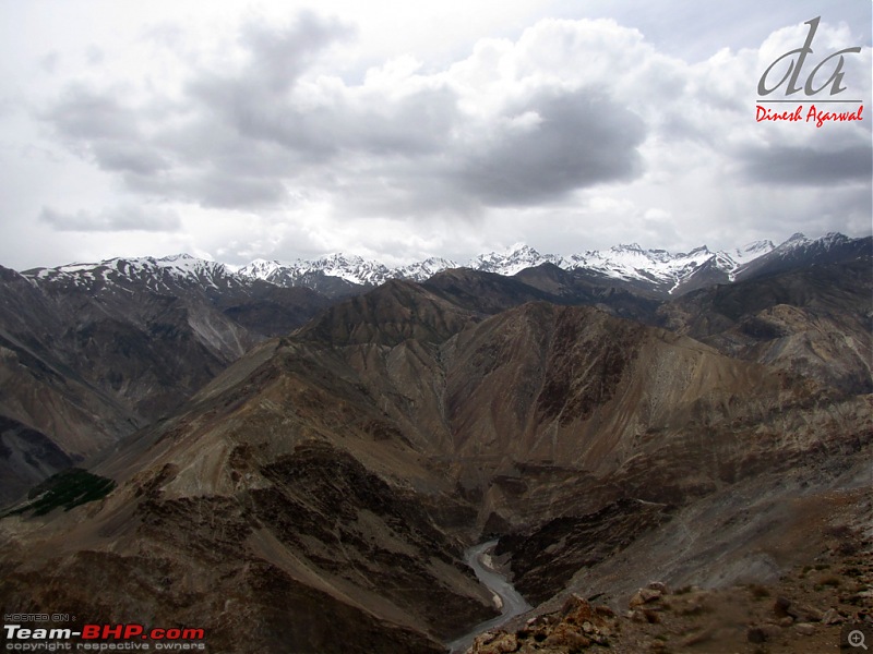
Nako village provides excellent vantage point for enjoying the snow capped mountains. A number of short trek starts from here. One of them is Tashigang Summer Village about 5 hours level trak. The winter Tashigang sattlement is about 600-700 meters below near the banks of Sutlaj on opposite side of Namgiya.
We started towards dreaded Malling Nallah but before existing the Nako village I asked Vinal to again stop for a while for few parting shots.
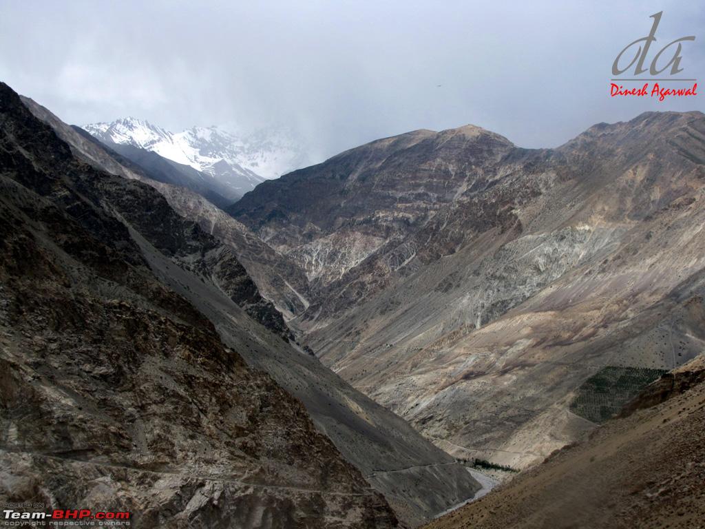
valley overlooking Leo Village

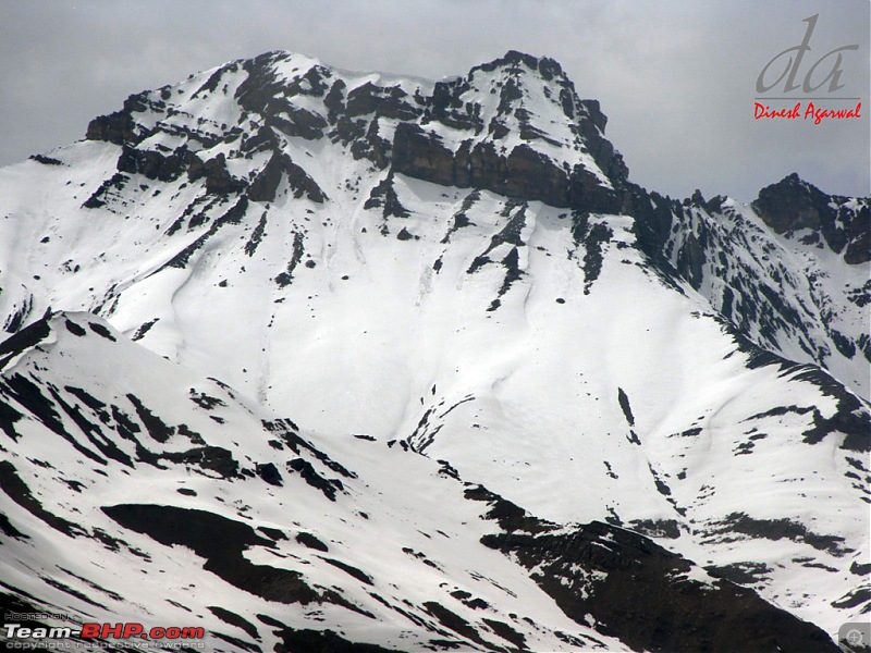
Is that Singekang Range
Close-up
Spiti River down below..
(Cont .. Day 5)
(Cont.. Day 5)
One of my favorite picture of the day..view from Nako
(Cont.. Day 5)
| All times are GMT +5.5. The time now is 20:12. | |


 ..
..