Team-BHP
(
https://www.team-bhp.com/forum/)
here is another one to compare
Mio with MMI maps
Mio - Day Mode

Mio - Night Mode

Polnav 5.8 using Navteq q1.2008 map
Polnav - Day mode

Polnav - Night mode

Quote:
Originally Posted by wildon
(Post 1556293)
|
v 6.0 is also available which is far different from 5 series. lots of changes in terms of gui. but maps r still older 2008 Q1, no updates available form polnav for india.
TTS is only available in 5.8 but voices are clutter where as 6.0 no tts edition is out there as of now.
Quote:
Originally Posted by akshay_b
(Post 1555860)
Yea, I thought what could one do with my postal address? Send me more GPSes? lol:
|
OT - what will someone do with your HKPost tracking number? lol:
A naive question for the Gurus
What is the level of standardisation in the data formats and interoperability. On one end I see things like MRI/CT where the data / image file from any system can be viewed and analysed on any other system. The data formats are fully standardized.
I guess the situation in GPS will be nowhere as good. Also, how will the Google system fit into the frame of things?
sgiitk, there is some data interoperability.
For example if you have image based maps(jpg + coordinate file), you can convert it to garmin format, + many other formats.
However, otherwise, all propreitery data formats are more or less non convertible.
Every mfr uses own database.
However maps come from primary two sources
1. Google
2. Navteq
The free source is openstreetmap, but we have not reached a point where routing is viable commercial via openstreetmap.
There are some software problems in progress, but nothing very usable.
From a mapping standpoint, some India cities like Chennai and BLR are very well mapped, and europe is almost 100% mapped on OSM.
However, software which can compete with likes of garmin mobile XT etc., is still far away.
Now coming to your second point, google does two things
1. Mapping - They have cartographers driving around, + people looking at satellite imagery to refine and update maps continuously.
2. Software - google is expected to release their mapping software(routing capable) first on Android platform.
Like Windows (devices version) come in 2 flavors(Windows mobile and CE), similarly Android, which is currently a mobile OS, may also start coming in a PDA flavor.
So give or take 2-3 years I expect 100$ made in china units running android instead of Windows CE
Quote:
Originally Posted by sgiitk
(Post 1556662)
What is the level of standardisation in the data formats and interoperability. On one end I see things like MRI/CT where the data / image file from any system can be viewed and analysed on any other system. The data formats are fully standardized.
I guess the situation in GPS will be nowhere as good. Also, how will the Google system fit into the frame of things?
|
This question needs to be divided in two categories:
1. End User formats (E.g. Garmin / Nokia Maps / Mio maps)
2. Developer / Enterprise formats (ArcSoft / Auocad / Oracle GIS ....)
End User formats
NO interoperability. Not required anyways.
You can't take Garmin maps and use (or even view) them in Nokia Maps. Same for Tomtom / MAPMyIndia / Satguide
Developer / Enterprise formats:
Near Complete interoperability.
You can take any Enterprise system and export to ArcSoft format. Any Enterprise system would accept ArcSoft.
Even Google data can be exported to pretty much any format since it is vector. Note that this is not just satellite images. I am talking about map data.
But that facility is not available to google maps users. You need to work directly with Google and sort out licnesing to access use created content.
E.g. Garmin accesses user created content on google maps. Google supplies data in basically any Enterprise format.
Example :
Satguide would have GIS data in Enterprise format. Based on need it would sell that in any consumer format.
It sells the same data in Garmin fomat as well as Destinator format.
Open Source:
Goes without saying that Open source formats like Open Street maps, OpenGIS can be consumed anywhere as far as there is money or willingness to develop converters.
Guess someone has installed MGMaps on these DX devices. Do we know if we have tiles downloaded and stored somewhere. It will save downloading from google again.
Quote:
Originally Posted by indie
(Post 1556362)
v 6.0 is also available which is far different from 5 series. lots of changes in terms of gui. but maps r still older 2008 Q1, no updates available form polnav for india.
TTS is only available in 5.8 but voices are clutter where as 6.0 no tts edition is out there as of now.
|
I think its not released yet officially. They are having a Beta Evaluation copy. Looks cool will try it and update you.
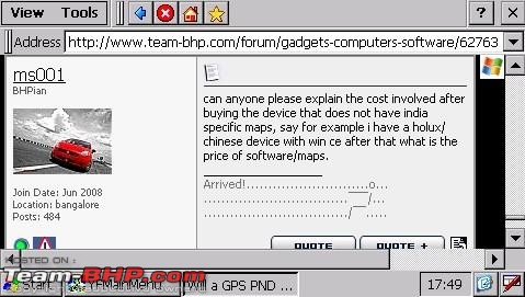
can anyone please explain the cost involved after buying the device that does not have india specific maps, say for example i have a holux/chinese device with win ce after that what is the price of software/maps.
1. First you have to unlock the device to use to its potential. Chinese device which we have bought can be unlocked easily.
2. buy software/map from MMI or Satguide. Its 7k and 2k respectively.
other option is get a Garmin device and put the Garmin MMI for 7k i think.
Also Dx once unlocked you can use it as normal comp to check mails too
:thumbs up
Quote:
Originally Posted by wildon
(Post 1557571)
other option is get a Garmin device and put the Garmin MMI for 7k i think.
|
or 2k Garmin maps from Satguide.
Quote:
Originally Posted by wildon
(Post 1557571)
1. First you have to unlock the device to use to its potential. Chinese device which we have bought can be unlocked easily.
2. buy software/map from MMI or Satguide. Its 7k and 2k respectively.
other option is get a Garmin device and put the Garmin MMI for 7k i think.
Also Dx once unlocked you can use it as normal comp to check mails too Attachment 218423
:thumbs up
|
lovely , does it have bluetooth too? for call answering
Are garmin maps from satguide good? they update it regularly?
Its having an inbuilt Bluetooth feature , i'm using this for my phone at present.voice is smooth with NO disturbance, also it have FM transmitter so your GPS voice commands can be heard through HU.
Opt for MMI Maps its better.
Update:-
I have done a Con call through my phone/DX few min back , wow its loud and clear in our conference hall .
is MMI worth paying 5k premium for?
| All times are GMT +5.5. The time now is 02:56. | |


